Quick links
16597 products
-
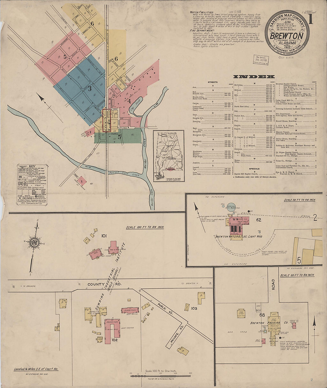 Brewton, Escambia County, Alabama 1922 (Sheet 1 of 6)Brewton, Escambia County, Alabama 1922 (Sheet 1 of 6)
- Regular price
-
$49.95 $83.95 - Regular price
-
$34.95 - Sale price
-
$49.95 $83.95
-
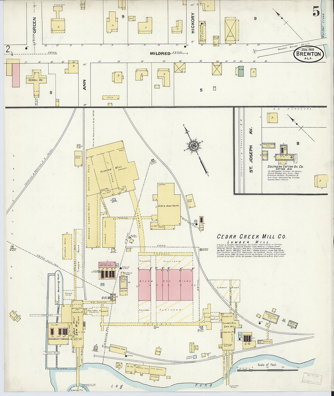 Brewton, Escambia County, Alabama 1910 (Sheet 5 of 5)Brewton, Escambia County, Alabama 1910 (Sheet 5 of 5)
- Regular price
-
$49.95 $83.95 - Regular price
-
$34.95 - Sale price
-
$49.95 $83.95
-
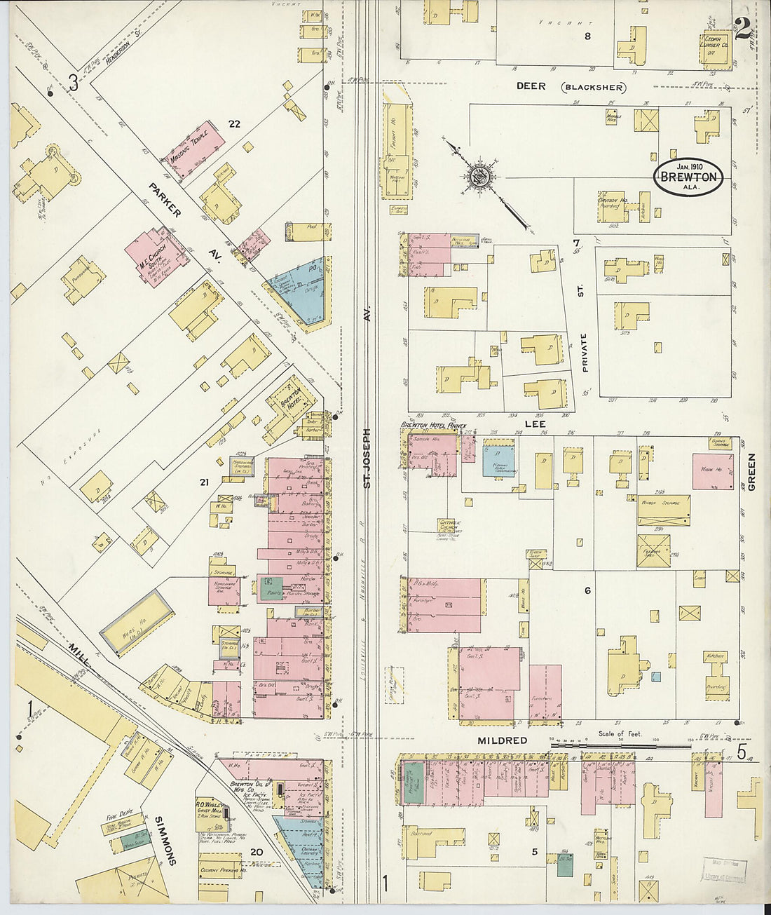
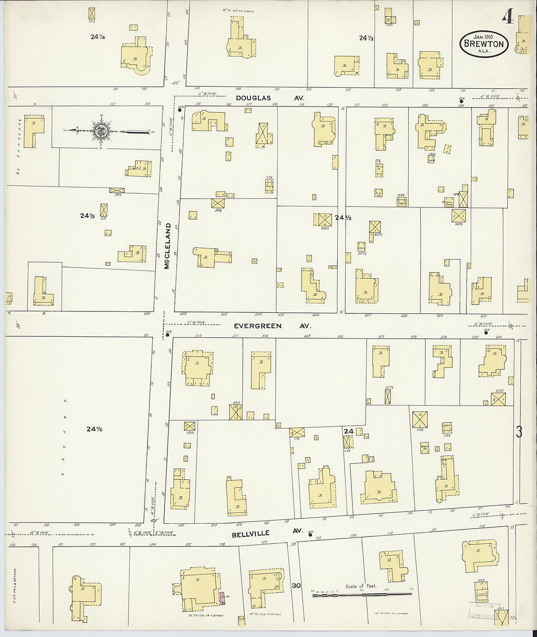 Brewton, Escambia County, Alabama 1910 (Sheet 4 of 5)Brewton, Escambia County, Alabama 1910 (Sheet 4 of 5)
- Regular price
-
$49.95 $83.95 - Regular price
-
$34.95 - Sale price
-
$49.95 $83.95
-
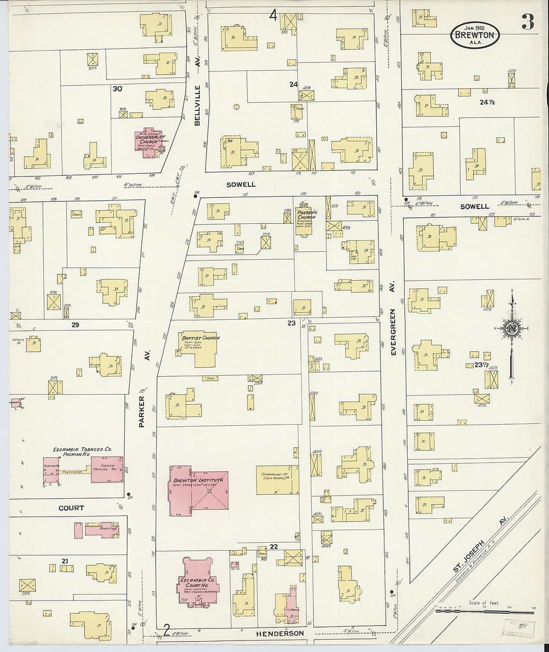 Brewton, Escambia County, Alabama 1910 (Sheet 3 of 5)Brewton, Escambia County, Alabama 1910 (Sheet 3 of 5)
- Regular price
-
$49.95 $83.95 - Regular price
-
$34.95 - Sale price
-
$49.95 $83.95
-
 Brewton, Escambia County, Alabama 1910 (Sheet 2 of 5)Brewton, Escambia County, Alabama 1910 (Sheet 2 of 5)
- Regular price
-
$49.95 $83.95 - Regular price
-
$34.95 - Sale price
-
$49.95 $83.95
-
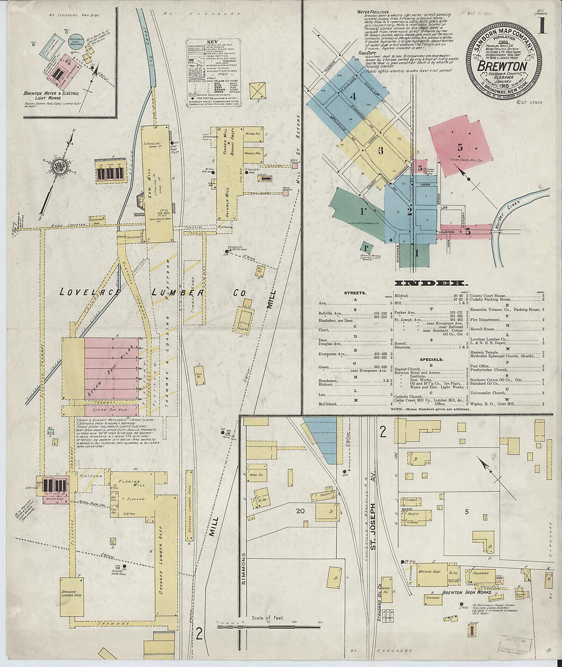 Brewton, Escambia County, Alabama 1910 (Sheet 1 of 5)Brewton, Escambia County, Alabama 1910 (Sheet 1 of 5)
- Regular price
-
$49.95 $83.95 - Regular price
-
$34.95 - Sale price
-
$49.95 $83.95
-
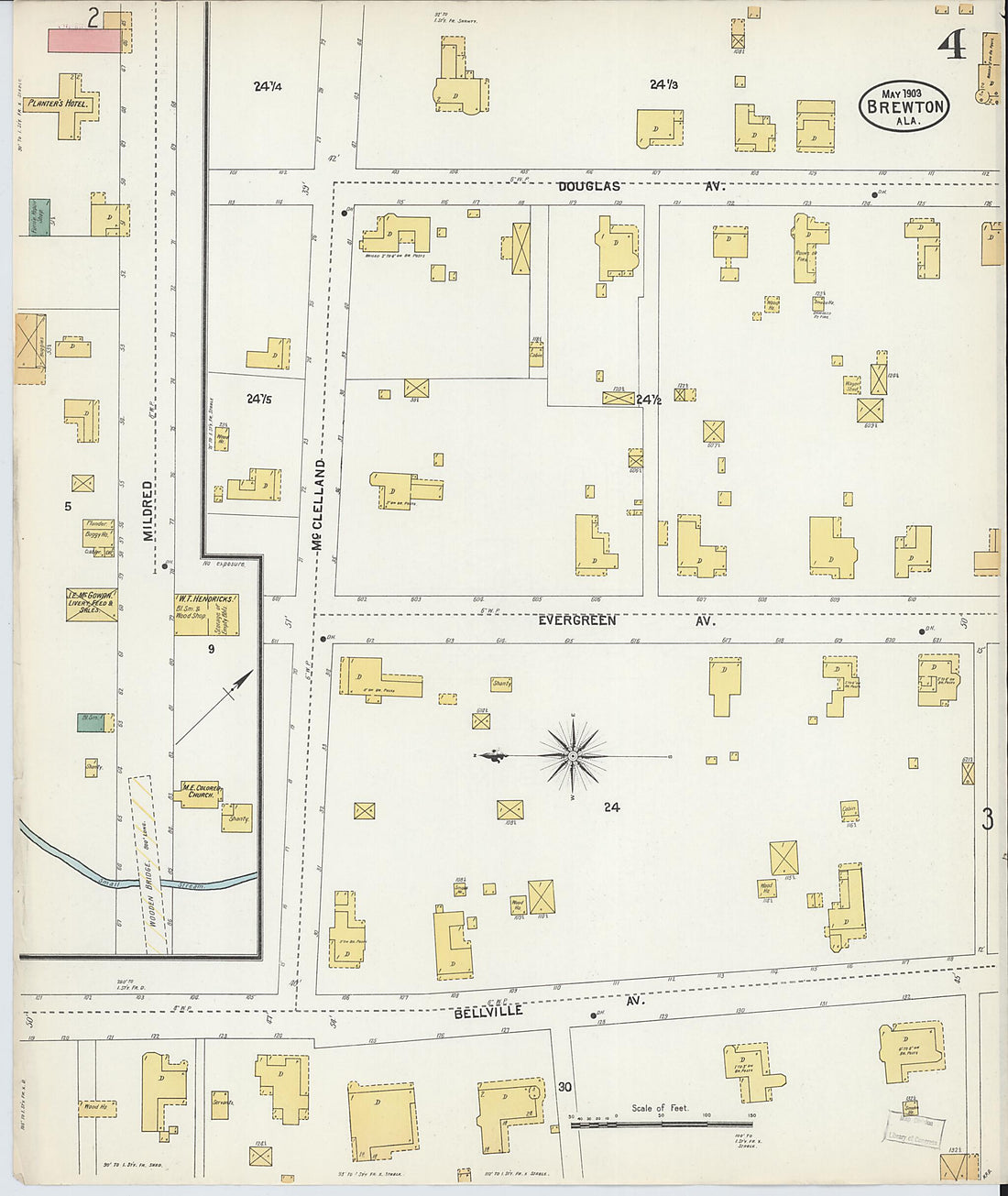 Brewton, Escambia County, Alabama 1903 (Sheet 4 of 4)Brewton, Escambia County, Alabama 1903 (Sheet 4 of 4)
- Regular price
-
$49.95 $83.95 - Regular price
-
$34.95 - Sale price
-
$49.95 $83.95
-
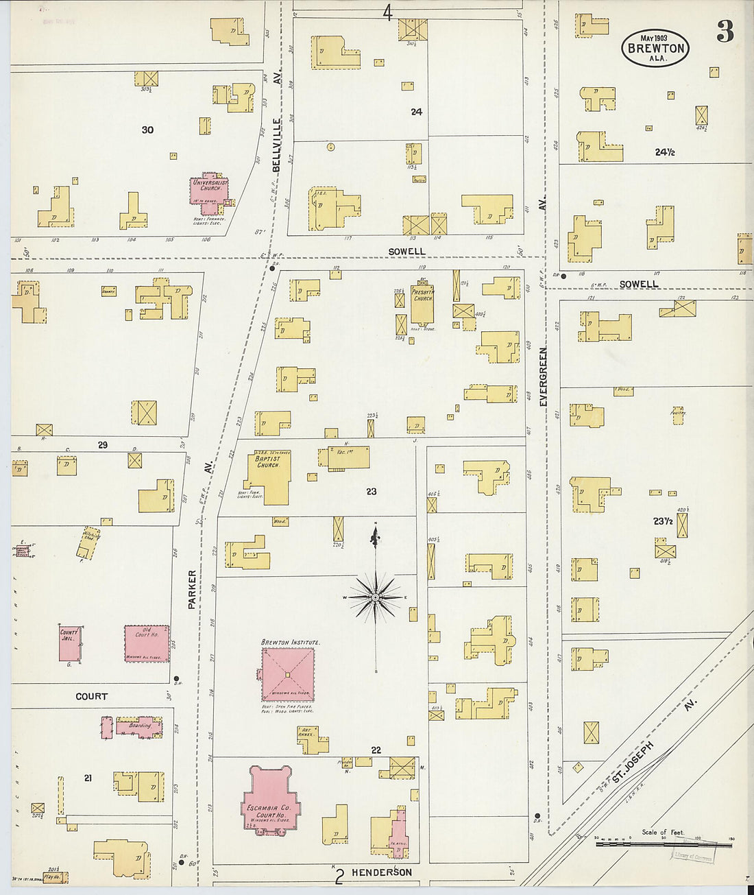 Brewton, Escambia County, Alabama 1903 (Sheet 3 of 4)Brewton, Escambia County, Alabama 1903 (Sheet 3 of 4)
- Regular price
-
$49.95 $83.95 - Regular price
-
$34.95 - Sale price
-
$49.95 $83.95
-
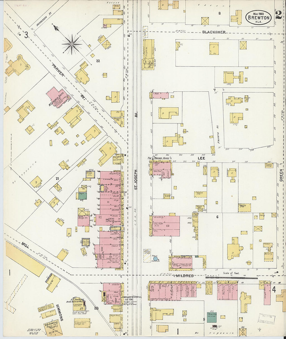 Brewton, Escambia County, Alabama 1903 (Sheet 2 of 4)Brewton, Escambia County, Alabama 1903 (Sheet 2 of 4)
- Regular price
-
$49.95 $83.95 - Regular price
-
$34.95 - Sale price
-
$49.95 $83.95
-
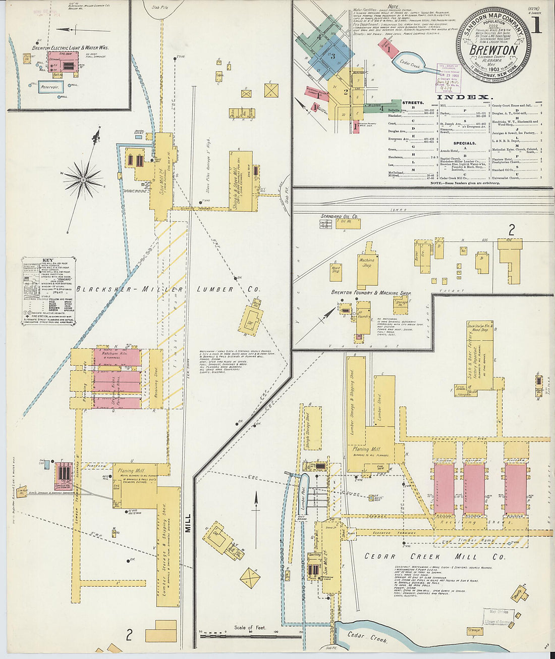 Brewton, Escambia County, Alabama 1903 (Sheet 1 of 4)Brewton, Escambia County, Alabama 1903 (Sheet 1 of 4)
- Regular price
-
$49.95 $83.95 - Regular price
-
$34.95 - Sale price
-
$49.95 $83.95
-
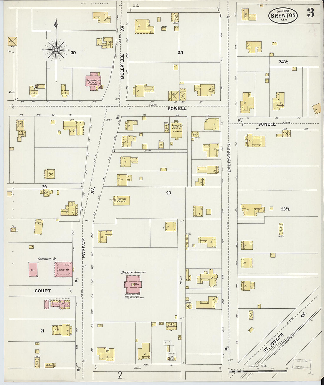 Brewton, Escambia County, Alabama 1898 (Sheet 3 of 3)Brewton, Escambia County, Alabama 1898 (Sheet 3 of 3)
- Regular price
-
$49.95 $83.95 - Regular price
-
$34.95 - Sale price
-
$49.95 $83.95
-
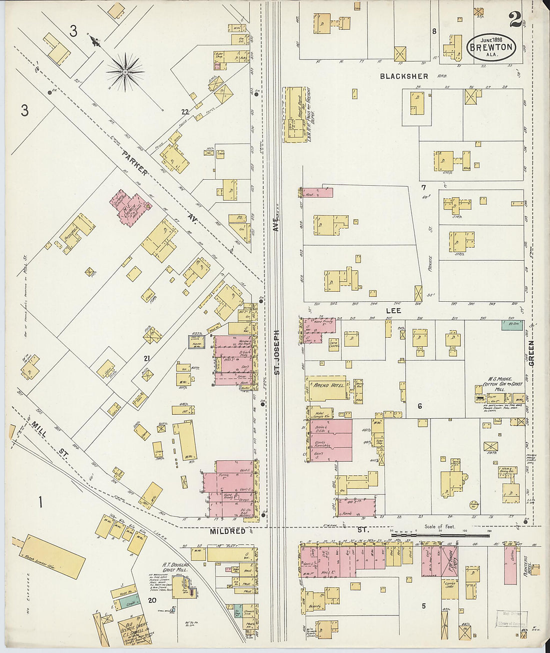 Brewton, Escambia County, Alabama 1898 (Sheet 2 of 3)Brewton, Escambia County, Alabama 1898 (Sheet 2 of 3)
- Regular price
-
$49.95 $83.95 - Regular price
-
$34.95 - Sale price
-
$49.95 $83.95


