221 products
-
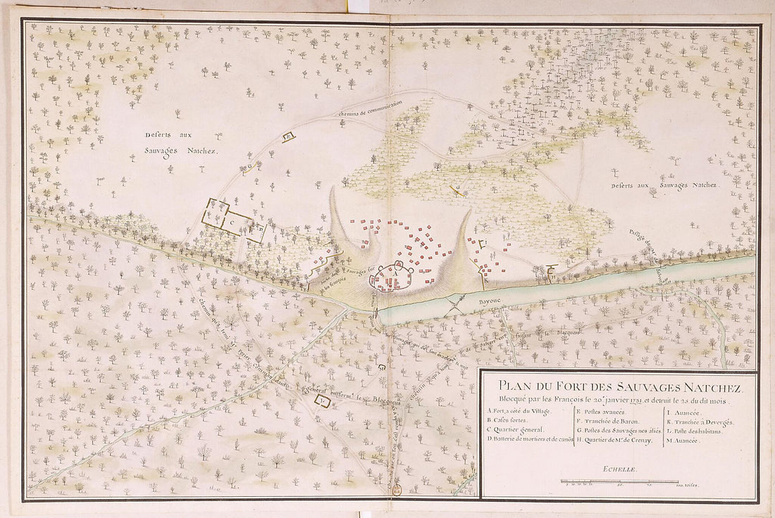 Plan of the Natchez Fort, Blockaded by the French On January 20, 1731, and Destroyed On the 25th of Said Month. (Plan Du Fort Des Sauvages Natchez Blocqué Par Les François Le 20e Janvier 1731 Et Détruit Le 25 Du Dit Mois)Plan of the Natchez Fort, Blockaded by the French On January 20, 1731, and Destroyed On the 25th of Said Month. (Plan Du Fort Des Sauvages Natchez Blocqué Par Les François Le 20e Janvier 1731 Et Détruit Le 25 Du Dit Mois)
- Regular price
-
$49.95 $99.95 - Regular price
-
$34.95 - Sale price
-
$49.95 $99.95
-
 Sketch of an Attack Made by Majr. Genl. Jackson On a Division of the British Army Commanded by Majr. Genl. Kean On the Evening of the 23 Decr. 1814Sketch of an Attack Made by Majr. Genl. Jackson On a Division of the British Army Commanded by Majr. Genl. Kean On the Evening of the 23 Decr. 1814
- Regular price
-
$49.95 $83.95 - Regular price
-
$34.95 - Sale price
-
$49.95 $83.95
-
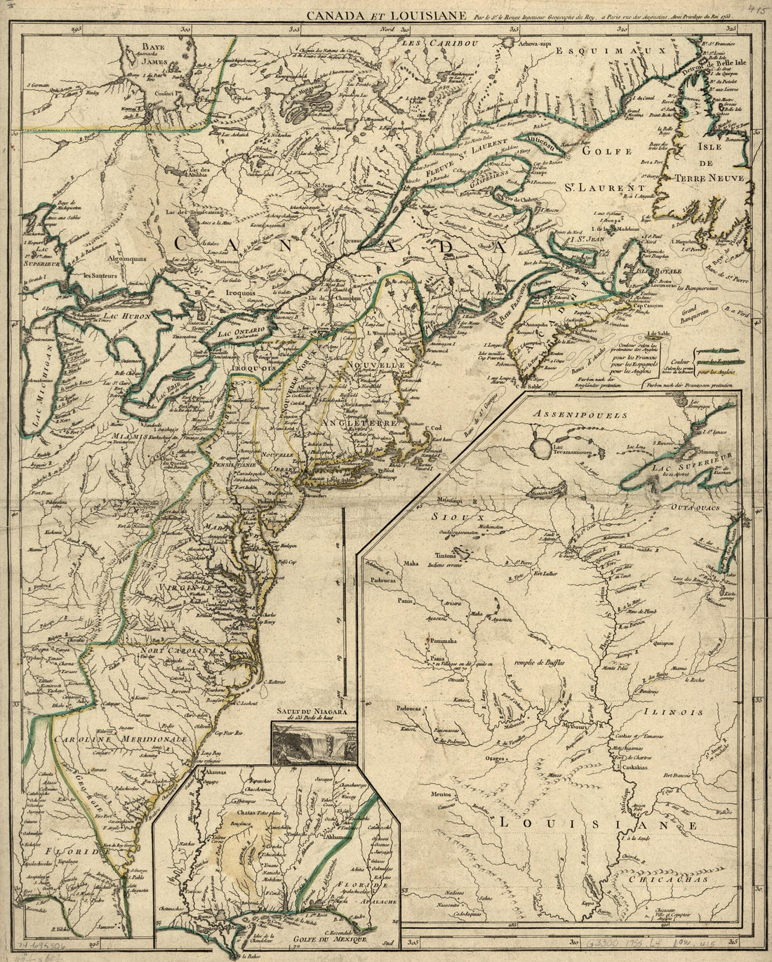 Canada Et Louisiane 1755Canada Et Louisiane 1755
- Regular price
-
$54.95 $83.95 - Regular price
-
$38.95 - Sale price
-
$54.95 $83.95
-
 A Map of the Seat of War at New Orleans 1815A Map of the Seat of War at New Orleans 1815
- Regular price
-
$49.95 $88.95 - Regular price
-
$29.95 - Sale price
-
$49.95 $88.95
-
 Louisiana from the Campaign Atlas, for 1861 : United StatesLouisiana from the Campaign Atlas, for 1861 : United States
- Regular price
-
$49.95 $88.95 - Regular price
-
$9.95 - Sale price
-
$49.95 $88.95
-
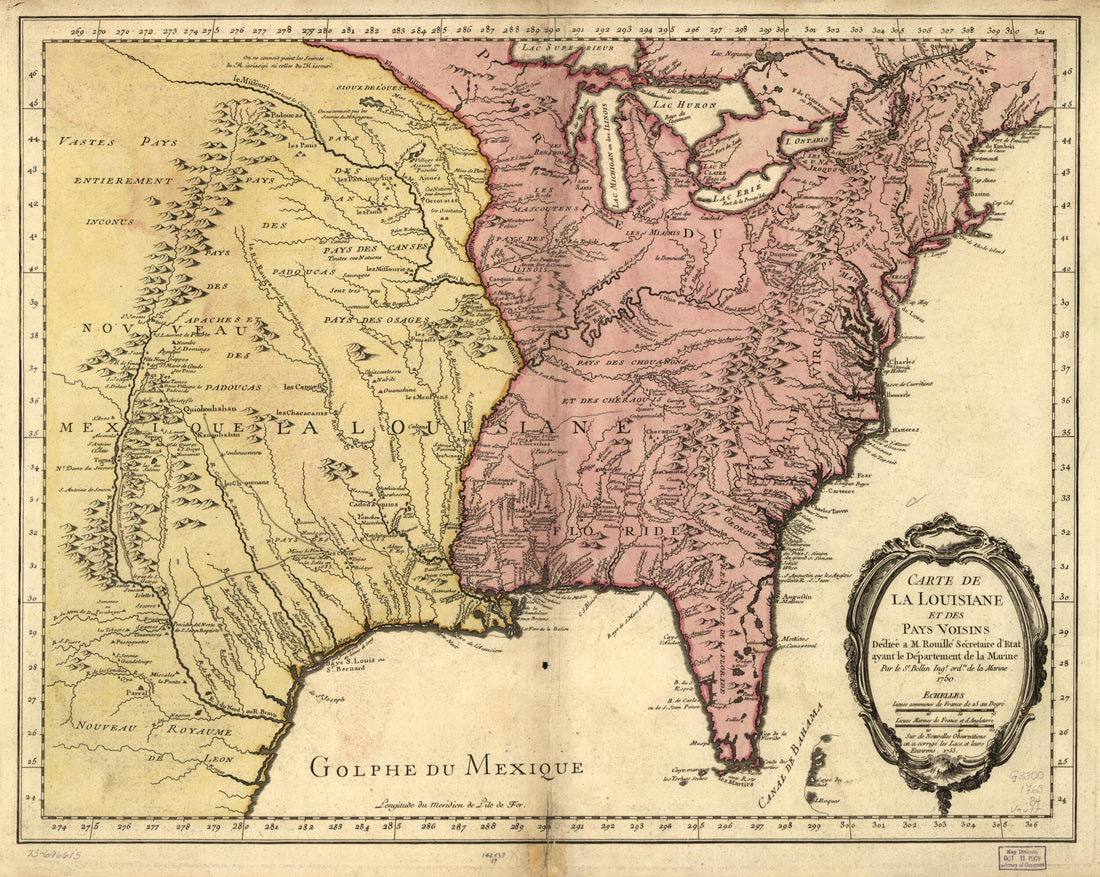 Carte De La Louisiane Et Des Pays Voisins 1763Carte De La Louisiane Et Des Pays Voisins 1763
- Regular price
-
$54.95 $83.95 - Regular price
-
$38.95 - Sale price
-
$54.95 $83.95
-
 Norman's Plan of New Orleans & Environs, 1845Norman's Plan of New Orleans & Environs, 1845
- Regular price
-
$51.95 $88.95 - Regular price
-
$32.95 - Sale price
-
$51.95 $88.95
-
 Map of an Area Along Bayou Bogue Chitto, Spanish West Florida 1805Map of an Area Along Bayou Bogue Chitto, Spanish West Florida 1805
- Regular price
-
$49.95 $83.95 - Regular price
-
$33.95 - Sale price
-
$49.95 $83.95
-
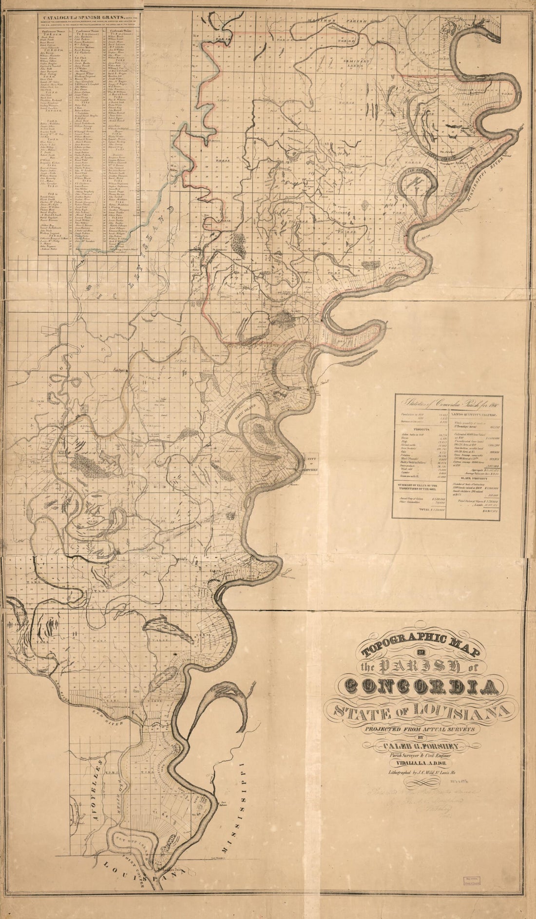 Topographic Map of the Parish of Concordia, State of Louisiana 1841Topographic Map of the Parish of Concordia, State of Louisiana 1841
- Regular price
-
$58.95 $210.95 - Regular price
-
$41.95 - Sale price
-
$58.95 $210.95
-
 Carte D'une Partie Des Côtes De La Floride Et De La Louisiane, Contenant Le Cours Du Mississipi, Depuis Ses Embouchures Jusqu'à La Rivière Rouge, L'entrée De La Mobile Et Les Baies De Pensacola, De Ste. Rose Et De S. Joseph 1778Carte D'une Partie Des Côtes De La Floride Et De La Louisiane, Contenant Le Cours Du Mississipi, Depuis Ses Embouchures Jusqu'à La Rivière Rouge, L'entrée De La Mobile Et Les Baies De Pensacola, De Ste. Rose Et De S. Joseph 1778
- Regular price
-
$51.95 $90.95 - Regular price
-
$32.95 - Sale price
-
$51.95 $90.95
-
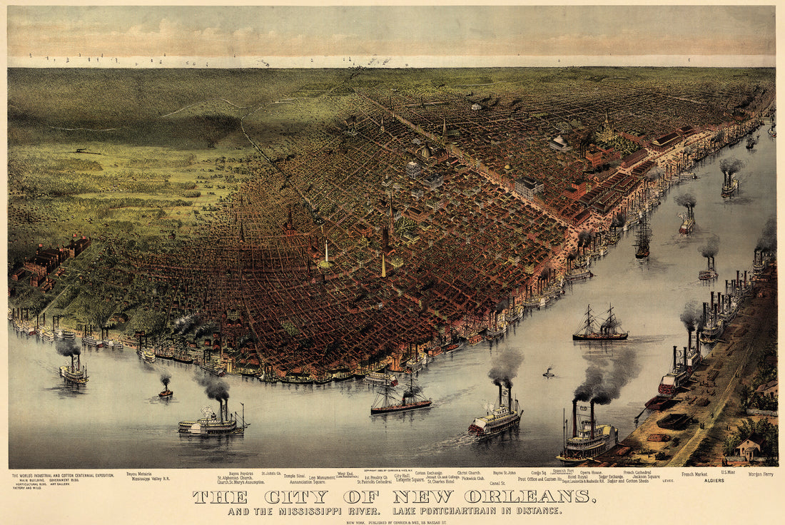 The City of New Orleans, and the Mississippi River Lake Pontchartrain In Distance 1885The City of New Orleans, and the Mississippi River Lake Pontchartrain In Distance 1885
- Regular price
-
$58.95 $99.95 - Regular price
-
$41.95 - Sale price
-
$58.95 $99.95
-
 Louisiana from a New and Elegant General Atlas, Containing Maps of Each of the United States 1817Louisiana from a New and Elegant General Atlas, Containing Maps of Each of the United States 1817
- Regular price
-
$49.95 $99.95 - Regular price
-
$36.95 - Sale price
-
$49.95 $99.95


