181 products
-
 Sketch Showing the Position of the Attacking and Defending Forces at the Siege of Washington, N.C., March 29 to April 16, 1863 1866Sketch Showing the Position of the Attacking and Defending Forces at the Siege of Washington, N.C., March 29 to April 16, 1863 1866
- Regular price
-
$51.95 $88.95 - Regular price
-
$32.95 - Sale price
-
$51.95 $88.95
-
 Coast of North Carolina & Virginia 1863Coast of North Carolina & Virginia 1863
- Regular price
-
$58.95 $126.95 - Regular price
-
$41.95 - Sale price
-
$58.95 $126.95
-
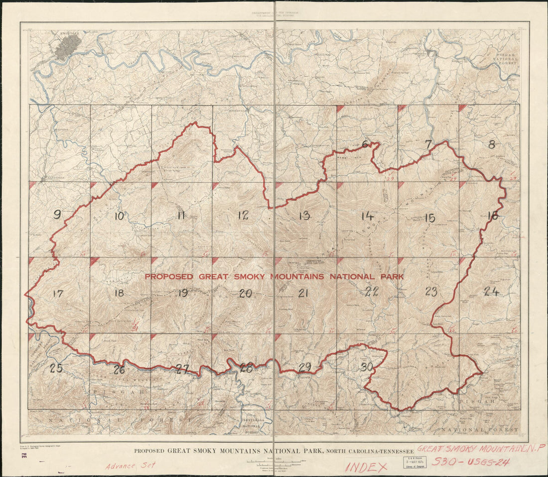 Proposed Great Smoky Mountains National Park 1928Proposed Great Smoky Mountains National Park 1928
- Regular price
-
$54.95 $92.95 - Regular price
-
$38.95 - Sale price
-
$54.95 $92.95
-
 Johnson's North and South Carolina 1861Johnson's North and South Carolina 1861
- Regular price
-
$50.95 $99.95 - Regular price
-
$32.95 - Sale price
-
$50.95 $99.95
-
 North Carolina from Atlas of Doniphan County, Kansas : Containing Maps of Townships of the County, Maps of State, United States and World : Farmers Directory, Analysis of the System of U.S. Land Surveys 1927North Carolina from Atlas of Doniphan County, Kansas : Containing Maps of Townships of the County, Maps of State, United States and World : Farmers Directory, Analysis of the System of U.S. Land Surveys 1927
- Regular price
-
$49.95 $88.95 - Regular price
-
$7.95 - Sale price
-
$49.95 $88.95
-
 North Carolina from a New and Elegant General Atlas, Containing Maps of Each of the United States 1817North Carolina from a New and Elegant General Atlas, Containing Maps of Each of the United States 1817
- Regular price
-
$49.95 $92.95 - Regular price
-
$36.95 - Sale price
-
$49.95 $92.95
-
 North Carolina from Morse's North American Atlas 1842North Carolina from Morse's North American Atlas 1842
- Regular price
-
$49.95 $92.95 - Regular price
-
$36.95 - Sale price
-
$49.95 $92.95
-
 North Carolina from the Campaign Atlas, for 1861 : United StatesNorth Carolina from the Campaign Atlas, for 1861 : United States
- Regular price
-
$49.95 $83.95 - Regular price
-
$9.95 - Sale price
-
$49.95 $83.95
-
 North Carolina from Atlas of Plymouth County, Iowa : Containing Maps of Townships of the County, Maps of State, United States and World : Farmers Directory 1921North Carolina from Atlas of Plymouth County, Iowa : Containing Maps of Townships of the County, Maps of State, United States and World : Farmers Directory 1921
- Regular price
-
$49.95 $88.95 - Regular price
-
$7.95 - Sale price
-
$49.95 $88.95
-
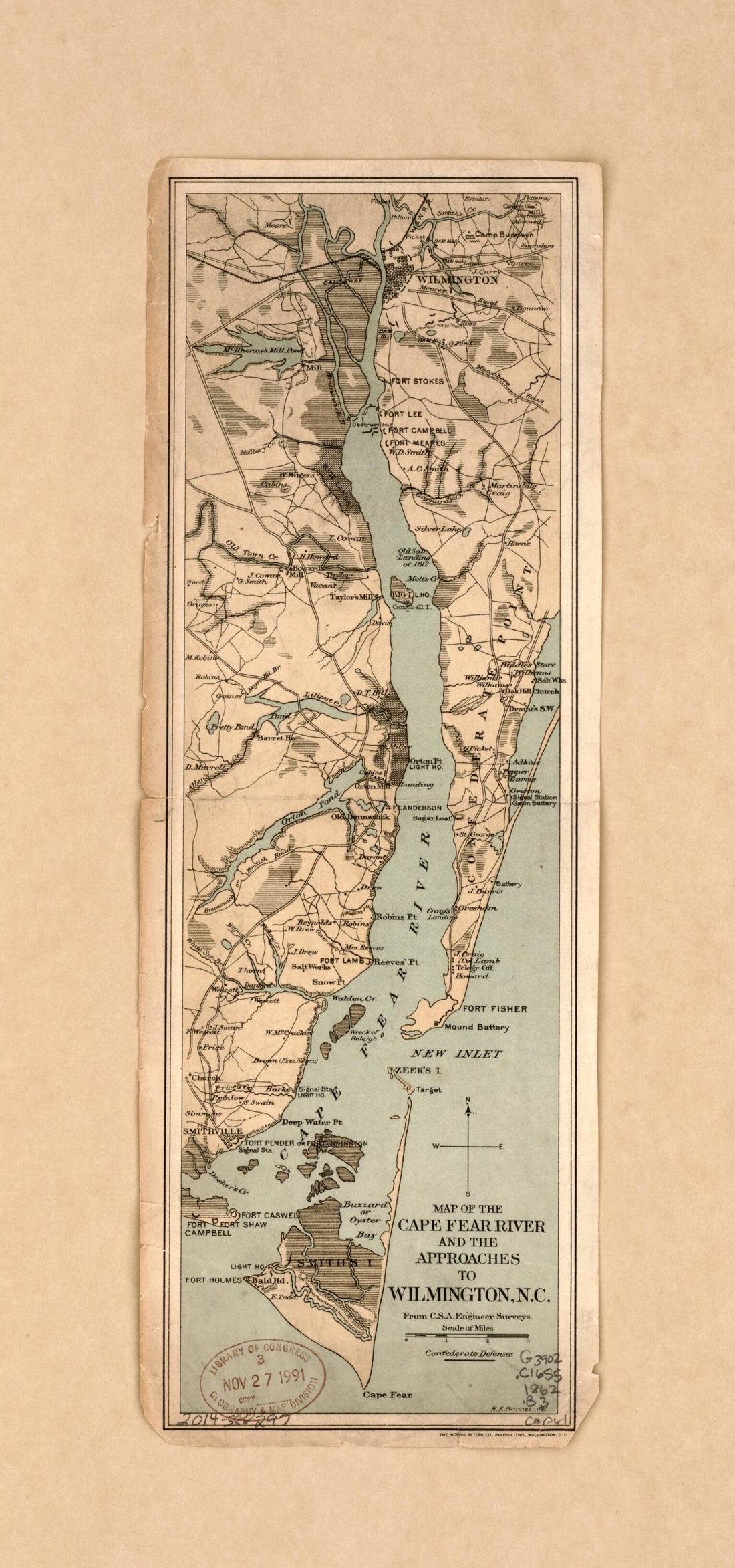 Map of the Cape Fear River and the Approaches to Wilmington, N.C. : From C.S.A. Engineer Surveys in 1862Map of the Cape Fear River and the Approaches to Wilmington, N.C. : From C.S.A. Engineer Surveys in 1862
- Regular price
-
$49.95 $99.95 - Regular price
-
$34.95 - Sale price
-
$49.95 $99.95
-
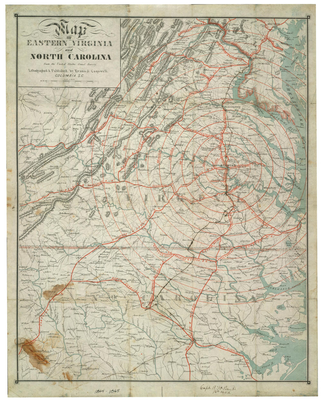 Map of Eastern Virginia and North Carolina from the United States Coast Survey 1864Map of Eastern Virginia and North Carolina from the United States Coast Survey 1864
- Regular price
-
$54.95 $83.95 - Regular price
-
$38.95 - Sale price
-
$54.95 $83.95
-
 A New and Accurate Map of North Carolina In North America 1779A New and Accurate Map of North Carolina In North America 1779
- Regular price
-
$49.95 $83.95 - Regular price
-
$34.95 - Sale price
-
$49.95 $83.95


