28 products
-
 Post Route Map of the Territory of Dakota With Adjacent Parts of Montana, Wyoming, Nebraska, Iowa and Minnesota, and Portions of the Dominion of Canada in 1881Post Route Map of the Territory of Dakota With Adjacent Parts of Montana, Wyoming, Nebraska, Iowa and Minnesota, and Portions of the Dominion of Canada in 1881
- Regular price
-
$58.95 $202.95 - Regular price
-
$41.95 - Sale price
-
$58.95 $202.95
-
 Map of the Rocky Mountain Highway. (Map of the Rocky Mountain Highway: Showing Every City, Town, Village and Hamlet Throughout Its Entire Length) 1915Map of the Rocky Mountain Highway. (Map of the Rocky Mountain Highway: Showing Every City, Town, Village and Hamlet Throughout Its Entire Length) 1915
- Regular price
-
$49.95 $99.95 - Regular price
-
$34.95 - Sale price
-
$49.95 $99.95
-
 Montana from Atlas of Doniphan County, Kansas : Containing Maps of Townships of the County, Maps of State, United States and World : Farmers Directory, Analysis of the System of U.S. Land Surveys 1927Montana from Atlas of Doniphan County, Kansas : Containing Maps of Townships of the County, Maps of State, United States and World : Farmers Directory, Analysis of the System of U.S. Land Surveys 1927
- Regular price
-
$49.95 $88.95 - Regular price
-
$6.95 - Sale price
-
$49.95 $88.95
-
 Montana from Riddell's Greene County Atlas, 1896Montana from Riddell's Greene County Atlas, 1896
- Regular price
-
$49.95 $92.95 - Regular price
-
$36.95 - Sale price
-
$49.95 $92.95
-
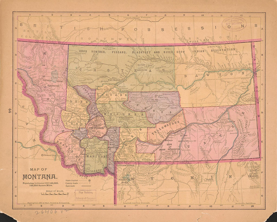 Map of Montana : Population (estimated 1890) 130,000. 145,310 Square MilesMap of Montana : Population (estimated 1890) 130,000. 145,310 Square Miles
- Regular price
-
$49.95 $83.95 - Regular price
-
$34.95 - Sale price
-
$49.95 $83.95
-
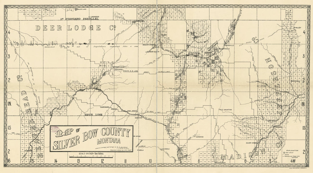 Map of Silver Bow County, Montana 1890Map of Silver Bow County, Montana 1890
- Regular price
-
$58.95 $99.95 - Regular price
-
$41.95 - Sale price
-
$58.95 $99.95
-
 Administrative Map of Glacier National Park, Montana (Glacier National Park, Montana) 1915Administrative Map of Glacier National Park, Montana (Glacier National Park, Montana) 1915
- Regular price
-
$54.95 $211.95 - Regular price
-
$38.95 - Sale price
-
$54.95 $211.95
-
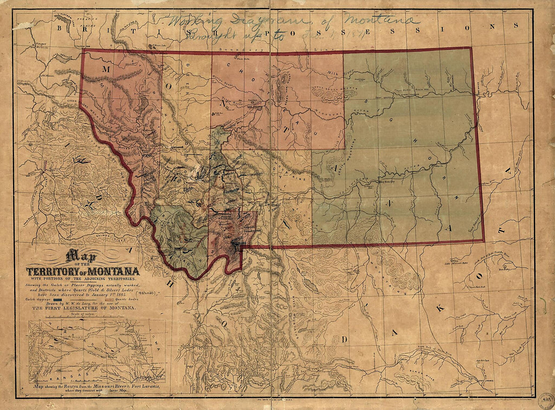 Map of the Territory of Montana With Portions of the Adjoining Territories : Showing the Gulch Or Placer Diggings Actually Worked and Districts Where Quartz (gold & Silver) Lodes Have Been Discovered to January 1st 1865Map of the Territory of Montana With Portions of the Adjoining Territories : Showing the Gulch Or Placer Diggings Actually Worked and Districts Where Quartz (gold & Silver) Lodes Have Been Discovered to January 1st 1865
- Regular price
-
$51.95 $175.95 - Regular price
-
$38.95 - Sale price
-
$51.95 $175.95
-
 Indexed County Map of Montana With a New and Original Compilation and Index, Designating All Post Office Towns and Railroad Stations 1881Indexed County Map of Montana With a New and Original Compilation and Index, Designating All Post Office Towns and Railroad Stations 1881
- Regular price
-
$54.95 $99.95 - Regular price
-
$30.95 - Sale price
-
$54.95 $99.95
-
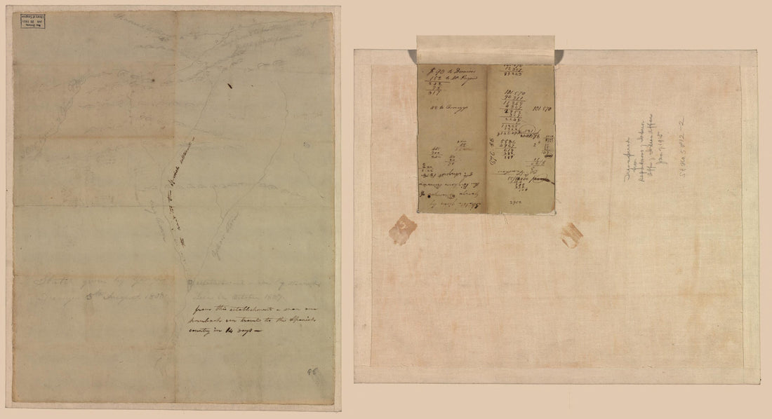 Sketch Given by George Drewyer, 5th August 1808 : Bighorn River, Wyoming and Montana. (Sketch Given by George Drewyer of the Bighorn River, 5th August 1808)Sketch Given by George Drewyer, 5th August 1808 : Bighorn River, Wyoming and Montana. (Sketch Given by George Drewyer of the Bighorn River, 5th August 1808)
- Regular price
-
$58.95 $99.95 - Regular price
-
$41.95 - Sale price
-
$58.95 $99.95
-
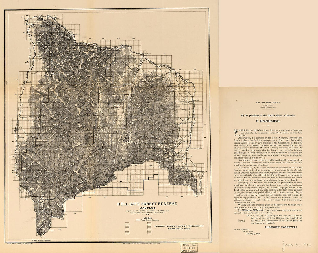 Hell Gate Forest Reserve 1906Hell Gate Forest Reserve 1906
- Regular price
-
$49.95 $114.95 - Regular price
-
$34.95 - Sale price
-
$49.95 $114.95
-
 Topographical Map of Lewis and Clarke County, Montana, in 1890Topographical Map of Lewis and Clarke County, Montana, in 1890
- Regular price
-
$49.95 $158.95 - Regular price
-
$34.95 - Sale price
-
$49.95 $158.95


