39 products
-
 Potomac River from Washington to Chesapeake Bay 1887Potomac River from Washington to Chesapeake Bay 1887
- Regular price
-
$49.95 $99.95 - Regular price
-
$29.95 - Sale price
-
$49.95 $99.95
-
 The Potomac River from Great Falls to Point Lookout 1878The Potomac River from Great Falls to Point Lookout 1878
- Regular price
-
$49.95 $83.95 - Regular price
-
$29.95 - Sale price
-
$49.95 $83.95
-
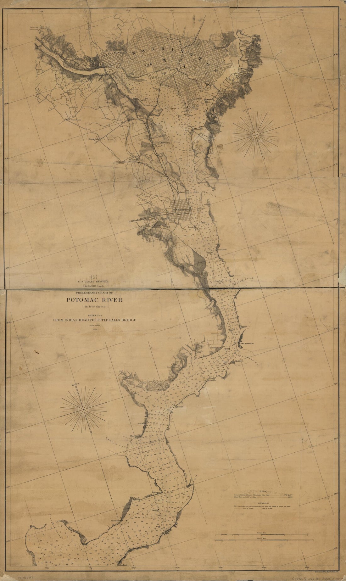
 Map of the Potomac River 1861Map of the Potomac River 1861
- Regular price
-
$49.95 $88.95 - Regular price
-
$29.95 - Sale price
-
$49.95 $88.95
-
 Hammond's 8 X 11 Map of Pennsylvania in 1903Hammond's 8 X 11 Map of Pennsylvania in 1903
- Regular price
-
$58.95 $99.95 - Regular price
-
$41.95 - Sale price
-
$58.95 $99.95
-
 Chart of the Head of Navigation of the Potomac River Shewing the Route of the Alexandria Canal : Made In Pursuance of a Resolution of the Alex'a Canal Company Oct. 1838Chart of the Head of Navigation of the Potomac River Shewing the Route of the Alexandria Canal : Made In Pursuance of a Resolution of the Alex'a Canal Company Oct. 1838
- Regular price
-
$58.95 $99.95 - Regular price
-
$41.95 - Sale price
-
$58.95 $99.95
-
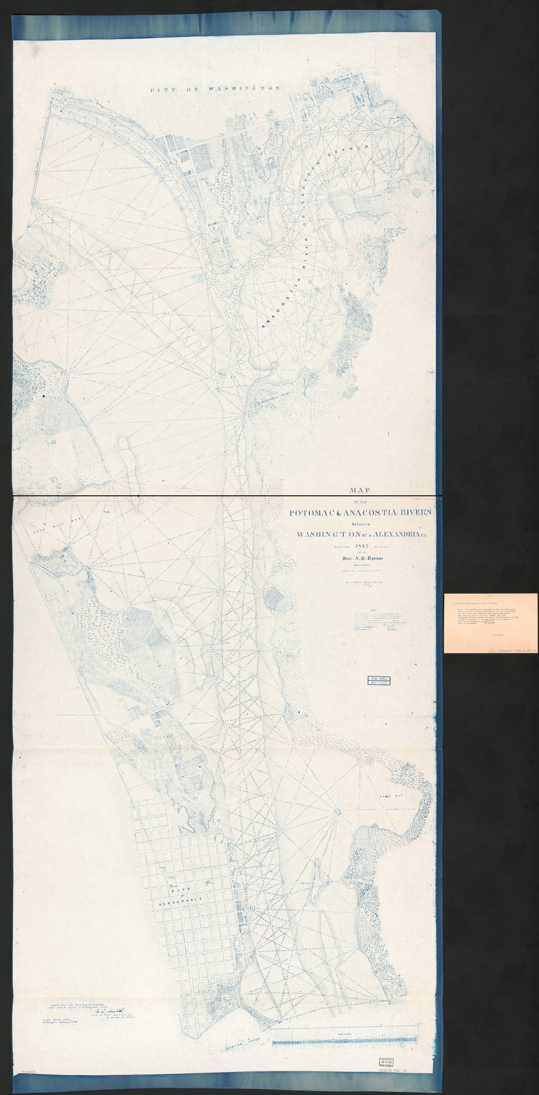 Map of the Potomac & Anacostia Rivers Between Washington D.C. & Alexandria Va in 1842Map of the Potomac & Anacostia Rivers Between Washington D.C. & Alexandria Va in 1842
- Regular price
-
$58.95 $319.95 - Regular price
-
$41.95 - Sale price
-
$58.95 $319.95
-
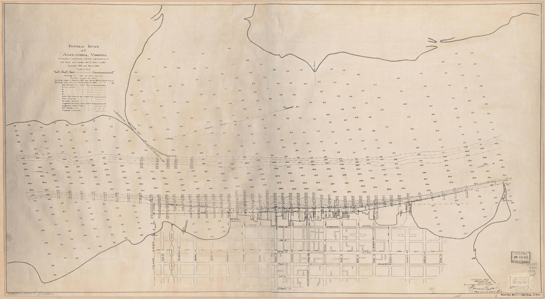 Potomac River at Alexandria, Virginia : Surveyed In Compliance With the Requirements of the River and Harbor Act of March 2, 1907, November 1907 and March 1908Potomac River at Alexandria, Virginia : Surveyed In Compliance With the Requirements of the River and Harbor Act of March 2, 1907, November 1907 and March 1908
- Regular price
-
$58.95 $117.95 - Regular price
-
$41.95 - Sale price
-
$58.95 $117.95
-
 Location Map of Kidwell's Meadows In the Potomac River Estuary, Washington D.C. 1880Location Map of Kidwell's Meadows In the Potomac River Estuary, Washington D.C. 1880
- Regular price
-
$49.95 $83.95 - Regular price
-
$34.95 - Sale price
-
$49.95 $83.95
-
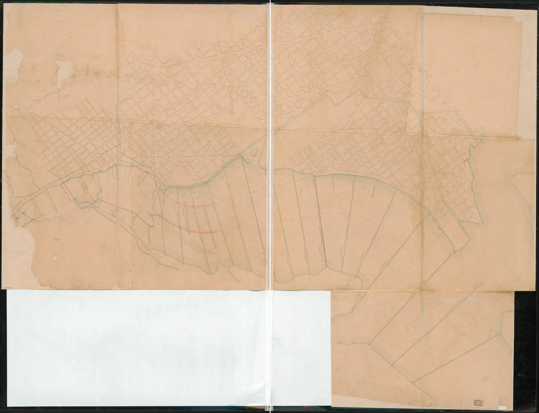 Map of the Potomac River Estuary From the Three Sisters to Giesboro Point D.C. in 1857Map of the Potomac River Estuary From the Three Sisters to Giesboro Point D.C. in 1857
- Regular price
-
$51.95 $231.95 - Regular price
-
$38.95 - Sale price
-
$51.95 $231.95
-
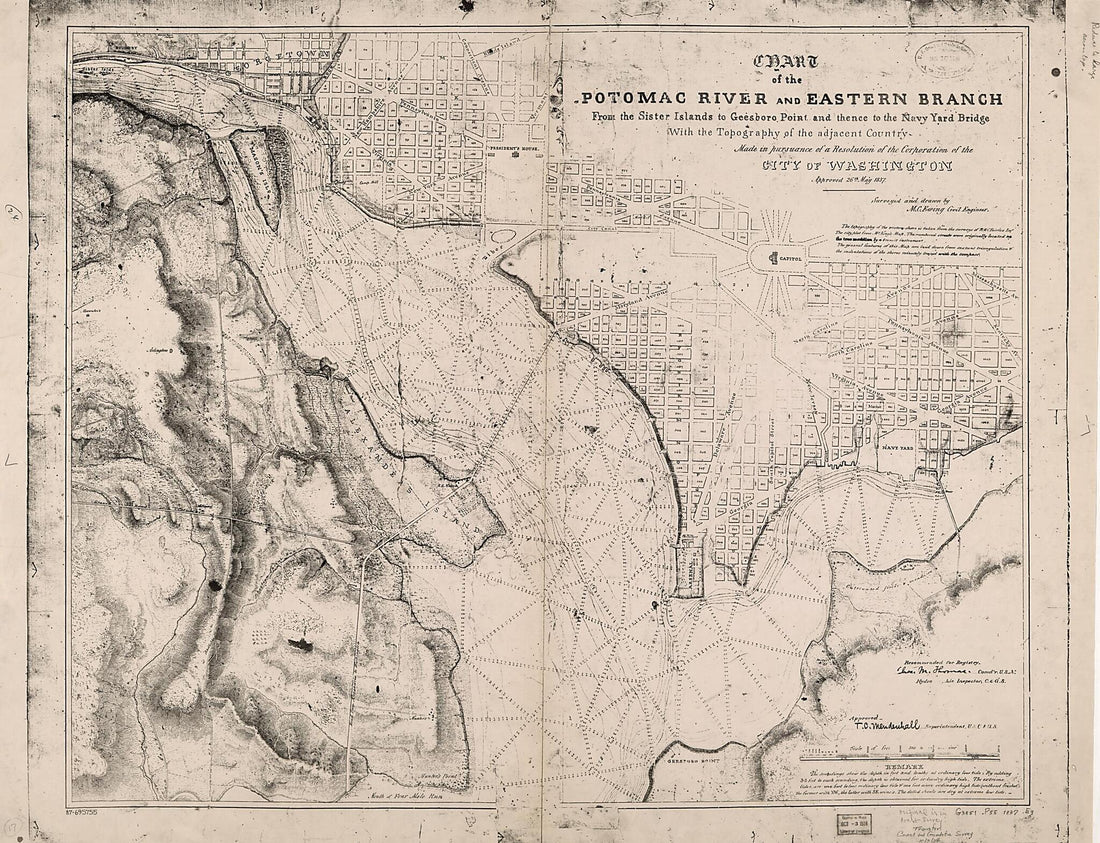 Chart of the Potomac River and Eastern Branch from the Sister Islands to Geesboro Point and Thence to the Navy Yard Bridge : With the Topography of the Adjacent Country : Made In Pursuance of a Resolution of the Corporation of the City of Washington, ...Chart of the Potomac River and Eastern Branch from the Sister Islands to Geesboro Point and Thence to the Navy Yard Bridge : With the Topography of the Adjacent Country : Made In Pursuance of a Resolution of the Corporation of the City of Washington, ...
- Regular price
-
$51.95 $222.95 - Regular price
-
$38.95 - Sale price
-
$51.95 $222.95
-
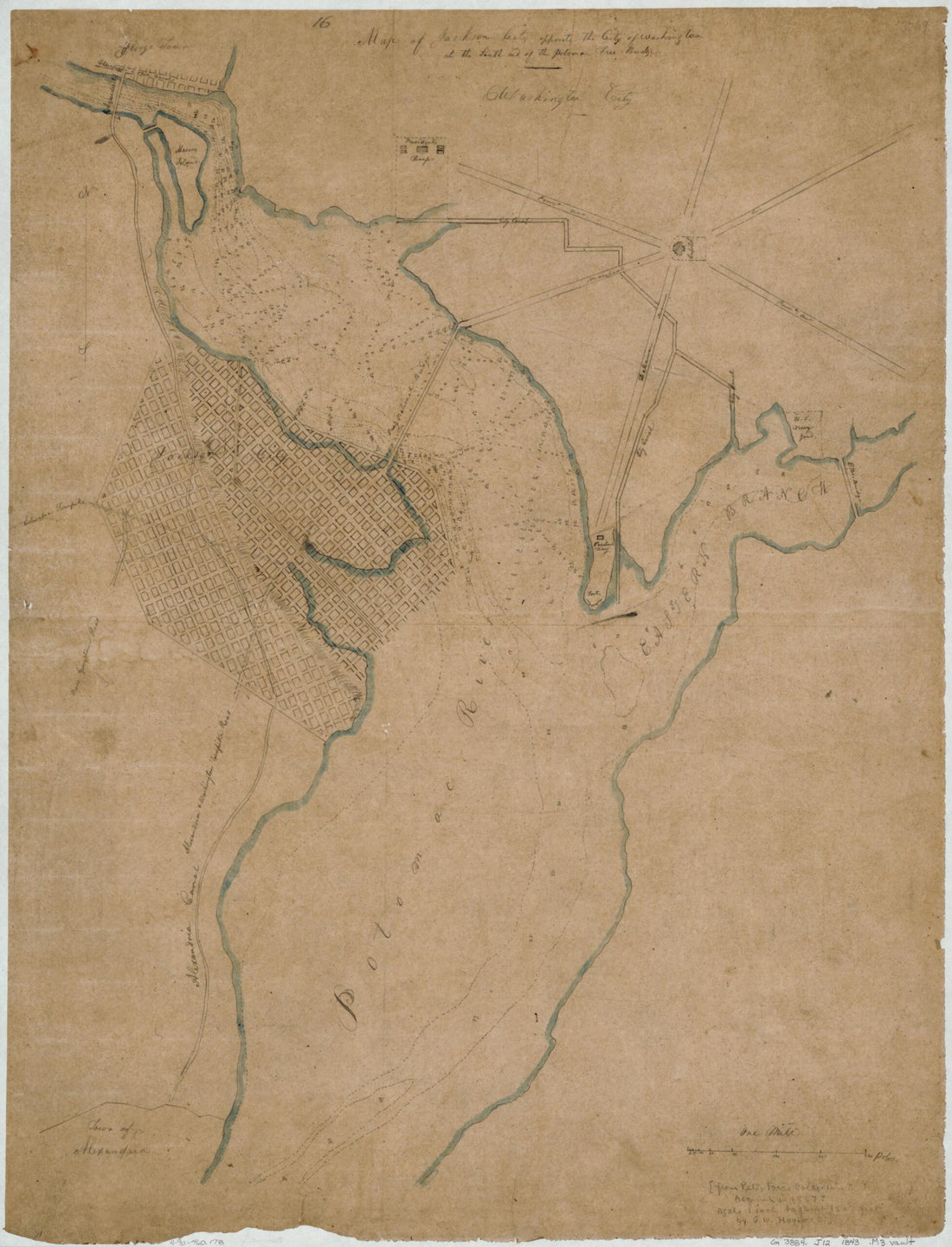 Map of Jackson City Opposite the City of Washington at the South End of the Potomac Free Bridge in 1843Map of Jackson City Opposite the City of Washington at the South End of the Potomac Free Bridge in 1843
- Regular price
-
$51.95 $88.95 - Regular price
-
$38.95 - Sale price
-
$51.95 $88.95
-
 Chart of the Head of Navigation of the Potomac River Shewing the Route of the Alexandria Canal : Made In Pursuance of a Resolution of the Alex'a Canal Company Oct. 1838Chart of the Head of Navigation of the Potomac River Shewing the Route of the Alexandria Canal : Made In Pursuance of a Resolution of the Alex'a Canal Company Oct. 1838
- Regular price
-
$58.95 $173.95 - Regular price
-
$41.95 - Sale price
-
$58.95 $173.95


