4782 products
-
 Map Showing the Distribution of the Slave Population of the Southern States of the United States. Compiled from the Census of 1860 1861Map Showing the Distribution of the Slave Population of the Southern States of the United States. Compiled from the Census of 1860 1861
- Regular price
-
$49.95 $201.95 - Regular price
-
$34.95 - Sale price
-
$49.95 $201.95
-
 Map of the United States, Showing the Territory In Possession of the Federal Union, January, 1864Map of the United States, Showing the Territory In Possession of the Federal Union, January, 1864
- Regular price
-
$58.95 $99.95 - Regular price
-
$41.95 - Sale price
-
$58.95 $99.95
-
 Reynolds's Political Map of the United States, Designed to Exhibit the Comparative Area of the Free and Slave States and the Territory Open to Slavery Or Freedom by the Repeal of the Missouri Compromise. (Political Map of the United States) 1856Reynolds's Political Map of the United States, Designed to Exhibit the Comparative Area of the Free and Slave States and the Territory Open to Slavery Or Freedom by the Repeal of the Missouri Compromise. (Political Map of the United States) 1856
- Regular price
-
$49.95 $83.95 - Regular price
-
$34.95 - Sale price
-
$49.95 $83.95
-
 United States of America 1818United States of America 1818
- Regular price
-
$49.95 $83.95 - Regular price
-
$31.95 - Sale price
-
$49.95 $83.95
-
 Hamburg from Standard Atlas of Livingston County, Michigan : Including a Plat Book of the Villages, Cities and Townships of the County, Map of the State, United States and World, Farmers Directory, Reference Business … 1895Hamburg from Standard Atlas of Livingston County, Michigan : Including a Plat Book of the Villages, Cities and Townships of the County, Map of the State, United States and World, Farmers Directory, Reference Business … 1895
- Regular price
-
$49.95 $83.95 - Regular price
-
$11.95 - Sale price
-
$49.95 $83.95
-
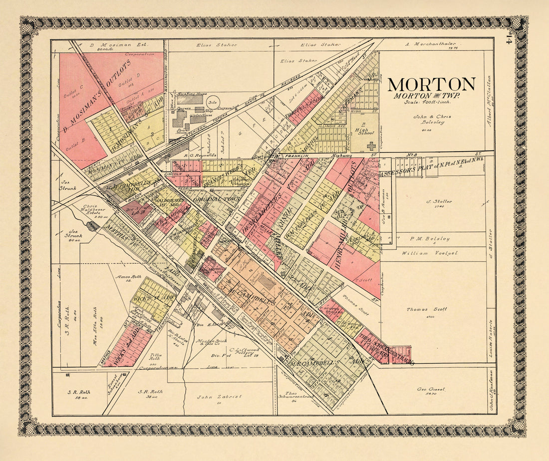 Morton from Standard Atlas of Tazewell County, Illinois : Including a Plat Book of the Villages, Cities and Townships of the County, Map of the State, United States and World : Patrons Directory, Reference … 1929Morton from Standard Atlas of Tazewell County, Illinois : Including a Plat Book of the Villages, Cities and Townships of the County, Map of the State, United States and World : Patrons Directory, Reference … 1929
- Regular price
-
$49.95 $83.95 - Regular price
-
$10.95 - Sale price
-
$49.95 $83.95
-
 Almira from Atlas of Benzie County, Michigan : With Maps of Michigan, United States and the World, Alaska, Cuba, Porto Rico, Hawaii and the Philippines : Also a Complete Mailing List of All Resident … 1901Almira from Atlas of Benzie County, Michigan : With Maps of Michigan, United States and the World, Alaska, Cuba, Porto Rico, Hawaii and the Philippines : Also a Complete Mailing List of All Resident … 1901
- Regular price
-
$49.95 $83.95 - Regular price
-
$9.95 - Sale price
-
$49.95 $83.95
-
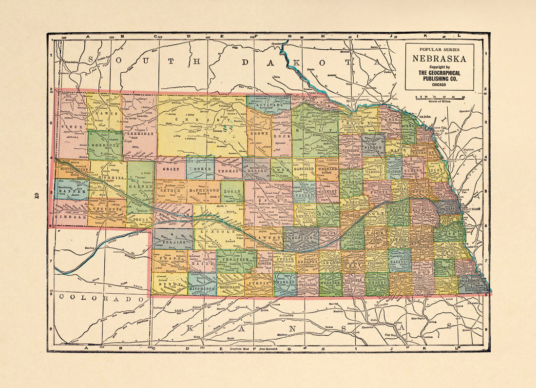 Nebraska from Atlas of Doniphan County, Kansas : Containing Maps of Townships of the County, Maps of State, United States and World : Farmers Directory, Analysis of the System of U.S. Land Surveys 1927Nebraska from Atlas of Doniphan County, Kansas : Containing Maps of Townships of the County, Maps of State, United States and World : Farmers Directory, Analysis of the System of U.S. Land Surveys 1927
- Regular price
-
$49.95 $88.95 - Regular price
-
$7.95 - Sale price
-
$49.95 $88.95
-
 Springwater from Atlas of Waushara County, Wisconsin : Containing Maps of Villages, Cities and Townships of the County, Maps of State and United States 1906Springwater from Atlas of Waushara County, Wisconsin : Containing Maps of Villages, Cities and Townships of the County, Maps of State and United States 1906
- Regular price
-
$49.95 $83.95 - Regular price
-
$10.95 - Sale price
-
$49.95 $83.95
-
 Saxeville from Atlas of Waushara County, Wisconsin : Containing Maps of Villages, Cities and Townships of the County, Maps of State and United States 1906Saxeville from Atlas of Waushara County, Wisconsin : Containing Maps of Villages, Cities and Townships of the County, Maps of State and United States 1906
- Regular price
-
$49.95 $83.95 - Regular price
-
$10.95 - Sale price
-
$49.95 $83.95
-
 Louisiana from the Campaign Atlas, for 1861 : United StatesLouisiana from the Campaign Atlas, for 1861 : United States
- Regular price
-
$49.95 $88.95 - Regular price
-
$9.95 - Sale price
-
$49.95 $88.95
-
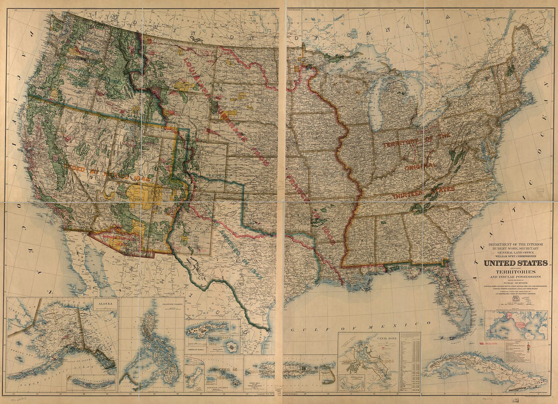 United States Including Territories and Insular Possessions : Showing the Extent of Public Surveys, National Parks and Monuments, Indian, Military, Bird and Game Reservations, National Forests, Railroads, Canals and Other Details 1923United States Including Territories and Insular Possessions : Showing the Extent of Public Surveys, National Parks and Monuments, Indian, Military, Bird and Game Reservations, National Forests, Railroads, Canals and Other Details 1923
- Regular price
-
$51.95 $244.95 - Regular price
-
$32.95 - Sale price
-
$51.95 $244.95


