Quick links
5181 products
-
Map of the State of Indiana Compiled from the United States Surveys by S. D. King, Washington City; Exhibiting the Sections & Fractional Sections; the Situation & Boundaries of Counties; the Location of Cities Villages & Post Offices Canals, Rail Road...
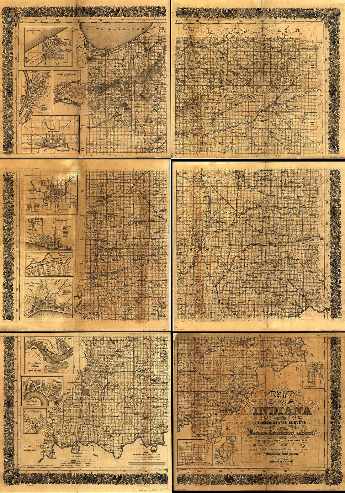 Map of the State of Indiana Compiled from the United States Surveys by S. D. King, Washington City; Exhibiting the Sections & Fractional Sections; the Situation & Boundaries of Counties; the Location of Cities Villages & Post Offices Canals, Rail Road...
- Regular price
-
$41.95 $330.95 - Regular price
-
$41.95 - Sale price
-
$41.95 $330.95
-
Indiana Fort Wayne : Ms. Map of Fort Wayne Said to Have Been Made On July 18, 1795, for General Anthony Wayne
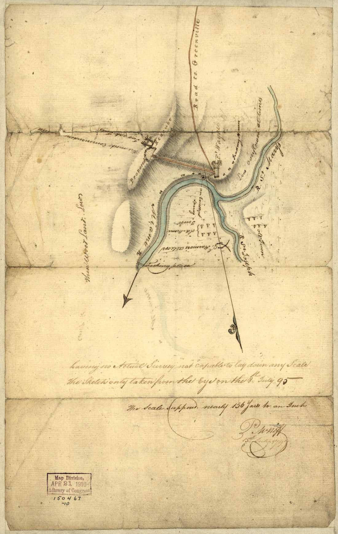 Indiana Fort Wayne : Ms. Map of Fort Wayne Said to Have Been Made On July 18, 1795, for General Anthony Wayne
- Regular price
-
$29.95 $94.95 - Regular price
-
$29.95 - Sale price
-
$29.95 $94.95
-
Galbraith's Railway Mail Service Maps, Indiana in 1897
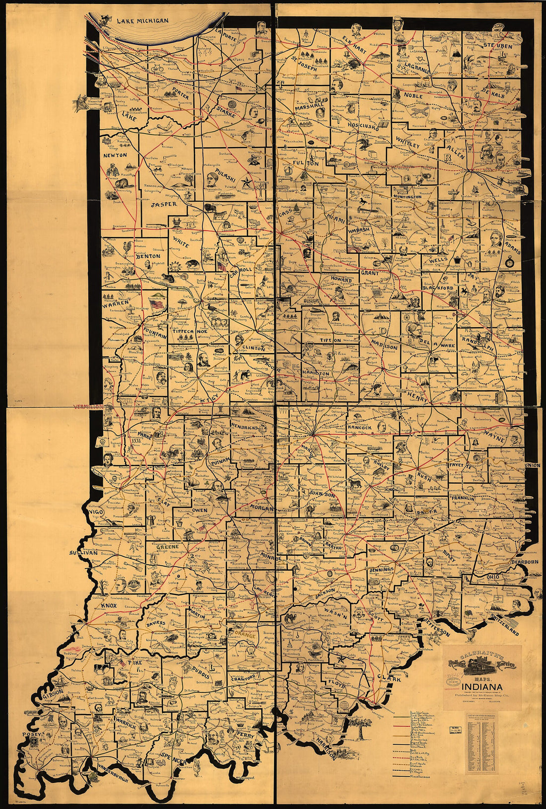 Galbraith's Railway Mail Service Maps, Indiana in 1897
- Regular price
-
$41.95 $342.95 - Regular price
-
$41.95 - Sale price
-
$41.95 $342.95
-
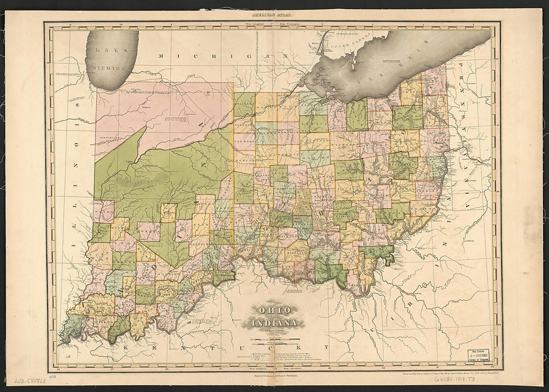
Ohio and Indiana 1819
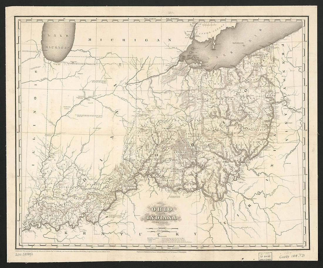 Ohio and Indiana 1819
- Regular price
-
$34.95 $151.95 - Regular price
-
$34.95 - Sale price
-
$34.95 $151.95
-
Map of Floyd County, Indiana : Showing Townships, Ranges, Sections & Farm Lines With the Owners Names and Number of Acres in 1882
 Map of Floyd County, Indiana : Showing Townships, Ranges, Sections & Farm Lines With the Owners Names and Number of Acres in 1882
- Regular price
-
$34.95 $250.95 - Regular price
-
$34.95 - Sale price
-
$34.95 $250.95
-
Cram's Township and Rail Road Map of Indiana 1888
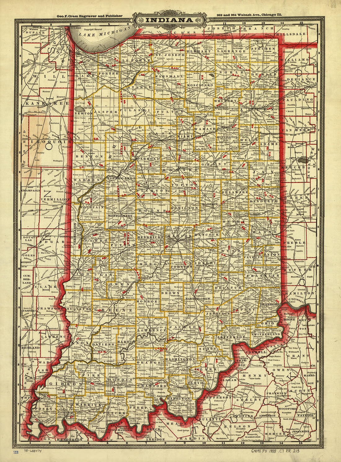 Cram's Township and Rail Road Map of Indiana 1888
- Regular price
-
$32.95 $83.95 - Regular price
-
$32.95 - Sale price
-
$32.95 $83.95
-
Railroad Map of Indiana, by Col. Thomas A. Morris, Civil Engineer 1850
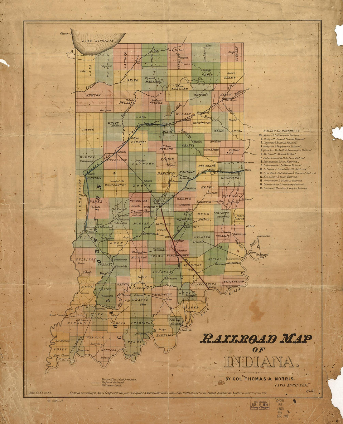 Railroad Map of Indiana, by Col. Thomas A. Morris, Civil Engineer 1850
- Regular price
-
$34.95 $78.95 - Regular price
-
$34.95 - Sale price
-
$34.95 $78.95
-
Map of the Camp of Lt. Col. John R. Campbell On the Bank of the Mississinewa River, December 18, 1812 With Details of Attack by Indians.
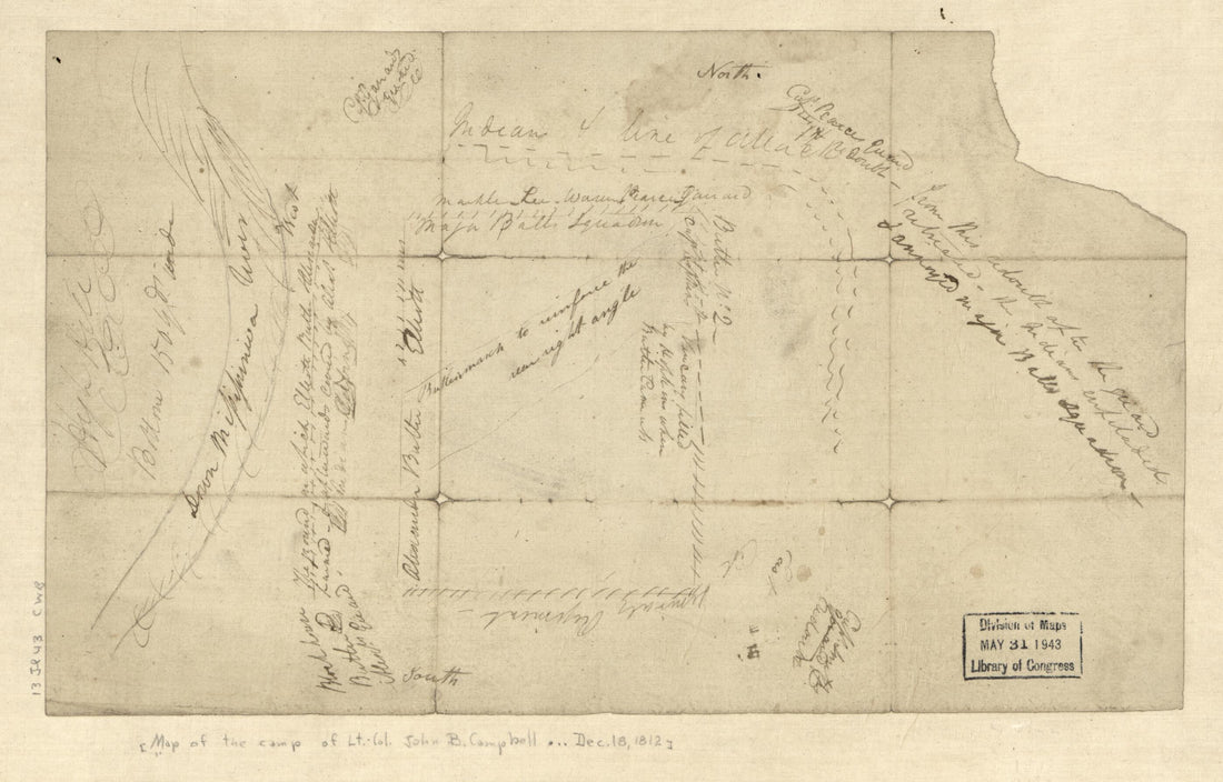 Map of the Camp of Lt. Col. John R. Campbell On the Bank of the Mississinewa River, December 18, 1812 With Details of Attack by Indians.
- Regular price
-
$29.95 $94.95 - Regular price
-
$29.95 - Sale price
-
$29.95 $94.95
-
W. W. Richie's Map of Morgan County, Indiana : From Official Records & Actual Surveys in 1875
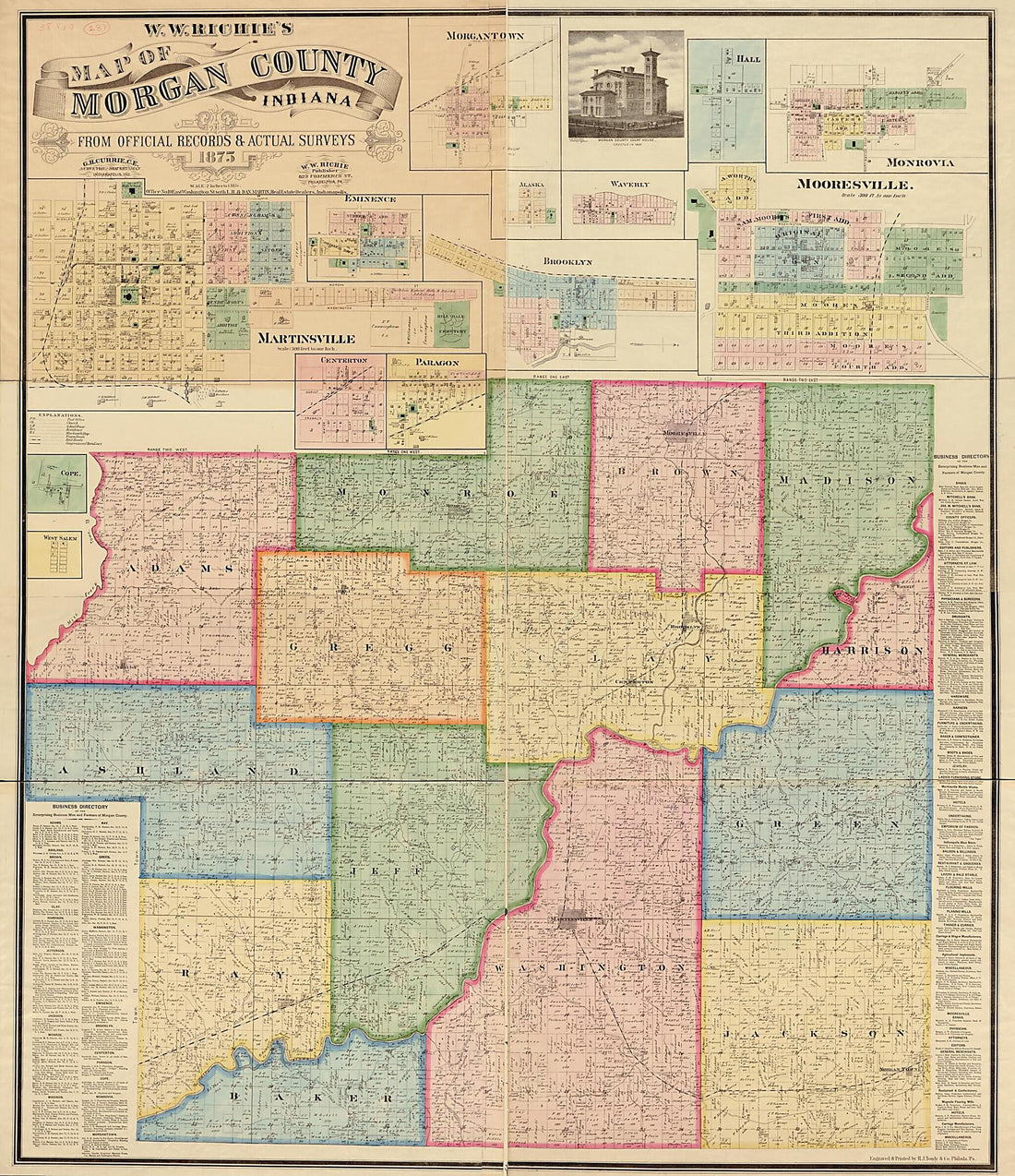 W. W. Richie's Map of Morgan County, Indiana : From Official Records & Actual Surveys in 1875
- Regular price
-
$34.95 $310.95 - Regular price
-
$34.95 - Sale price
-
$34.95 $310.95
-
Map Showing the Line of the Louisville, New Albany, and St. Louis Air Line Railroad and Its Connections 1872
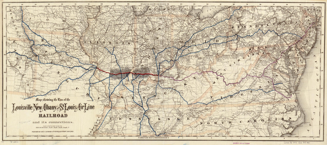 Map Showing the Line of the Louisville, New Albany, and St. Louis Air Line Railroad and Its Connections 1872
- Regular price
-
$41.95 $94.95 - Regular price
-
$41.95 - Sale price
-
$41.95 $94.95
-
A Map of the Western Parts of the Province of Pennsylvania, Virginia, &c 1753
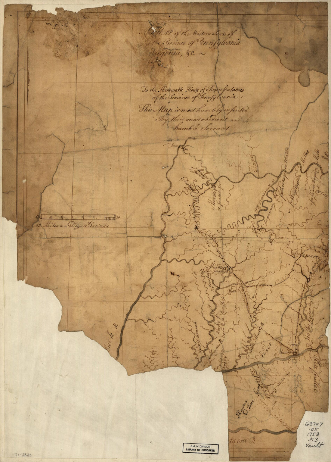 A Map of the Western Parts of the Province of Pennsylvania, Virginia, &c 1753
- Regular price
-
$32.95 $83.95 - Regular price
-
$32.95 - Sale price
-
$32.95 $83.95
-
Ohio and Indiana 1819
 Ohio and Indiana 1819
- Regular price
-
$32.95 $158.95 - Regular price
-
$32.95 - Sale price
-
$32.95 $158.95


