23 products
-
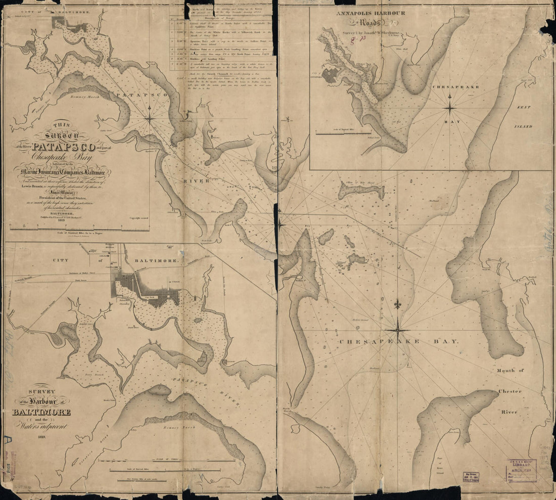
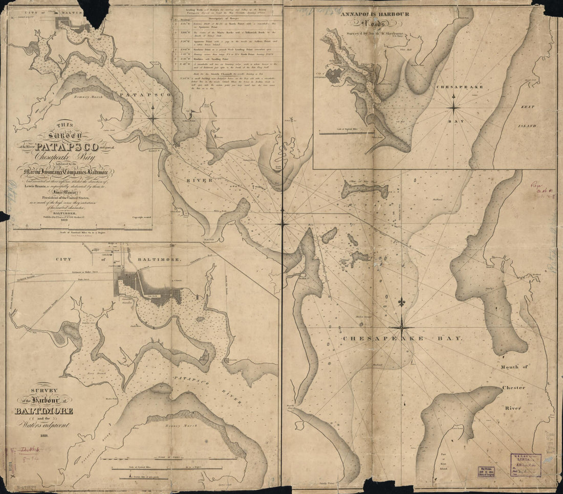 This Survey of the River Patapsco and Part of Chesapeake Bay 1819This Survey of the River Patapsco and Part of Chesapeake Bay 1819
- Regular price
-
$39.95 $118.95 - Regular price
-
$34.95 - Sale price
-
$39.95 $118.95
-
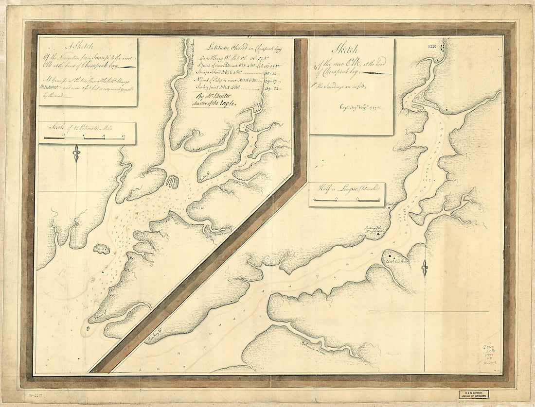 A Sketch of the Navigation from Swan Pt. to the River Elk at the Head of Chesapeak Bay. Sketch of the River Elk, at the Head of Chesapeak Bay 1777A Sketch of the Navigation from Swan Pt. to the River Elk at the Head of Chesapeak Bay. Sketch of the River Elk, at the Head of Chesapeak Bay 1777
- Regular price
-
$43.95 $156.95 - Regular price
-
$32.95 - Sale price
-
$43.95 $156.95
-
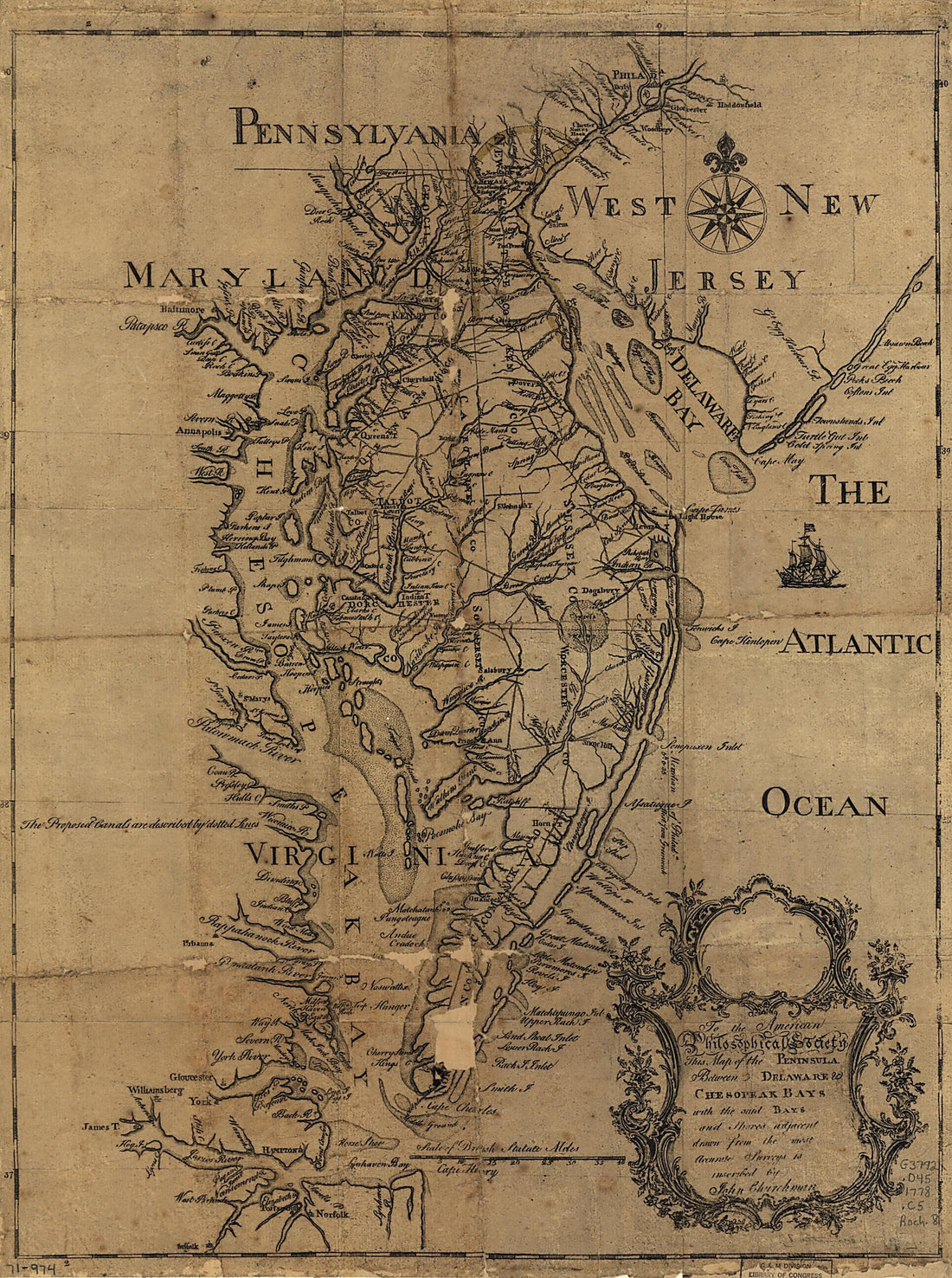
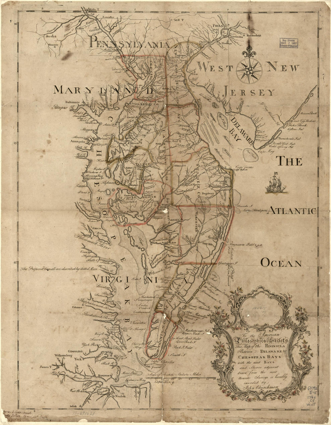 To the American Philosophical Society, This Map of the Peninsula Between Delaware & Chesopeak Bays, With the Said Bays and Shores Adjacent Drawn From the Most Accurate Surveys Is Humbly Inscribed by John Churchman in 1786To the American Philosophical Society, This Map of the Peninsula Between Delaware & Chesopeak Bays, With the Said Bays and Shores Adjacent Drawn From the Most Accurate Surveys Is Humbly Inscribed by John Churchman in 1786
- Regular price
-
$39.95 $83.95 - Regular price
-
$34.95 - Sale price
-
$39.95 $83.95
-
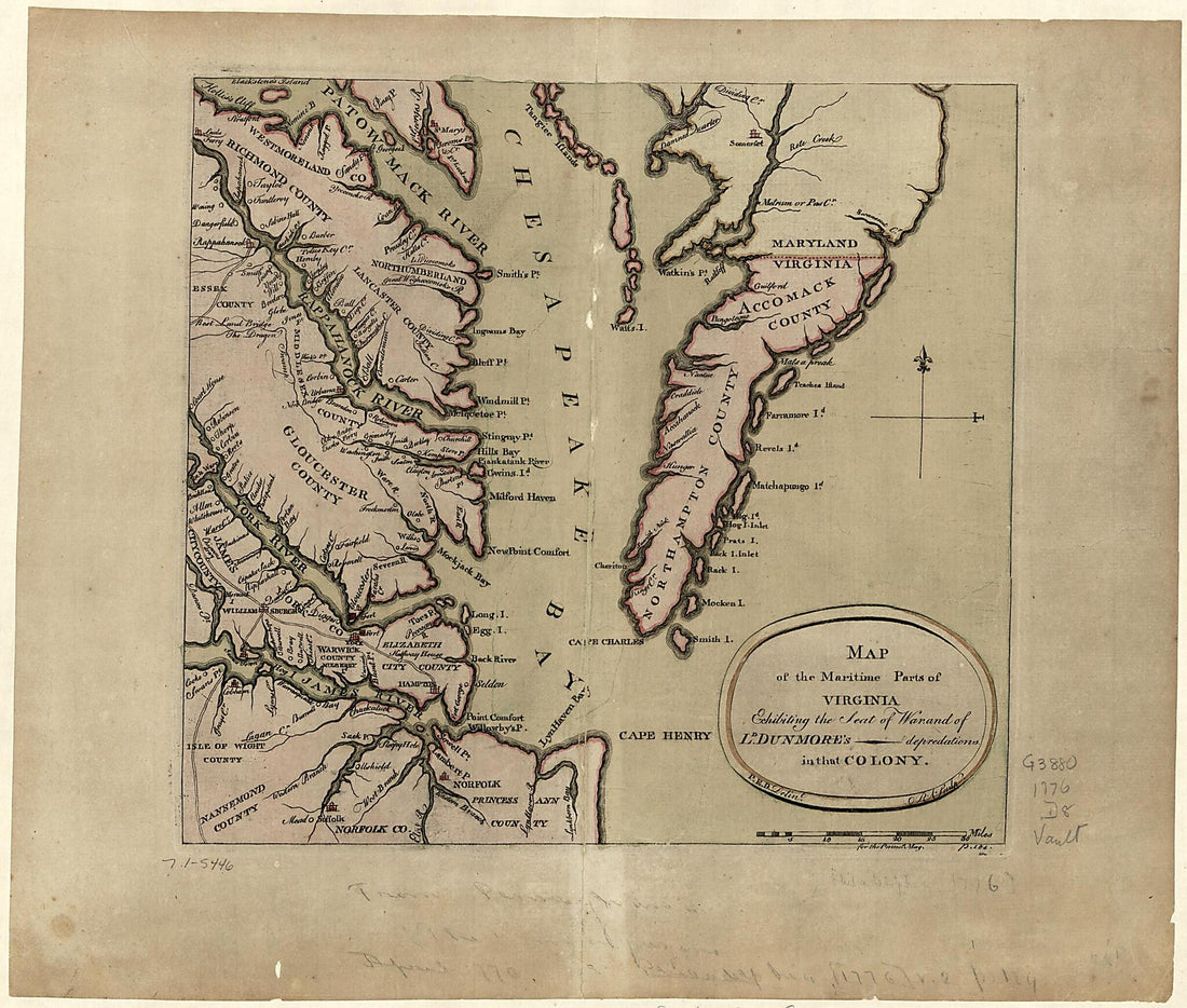 Map of the Maritime Parts of Virginia Exhibiting the Seat of War and of Ld. Dunmore's Depredations In That Colony 1776Map of the Maritime Parts of Virginia Exhibiting the Seat of War and of Ld. Dunmore's Depredations In That Colony 1776
- Regular price
-
$39.95 $83.95 - Regular price
-
$29.95 - Sale price
-
$39.95 $83.95
-
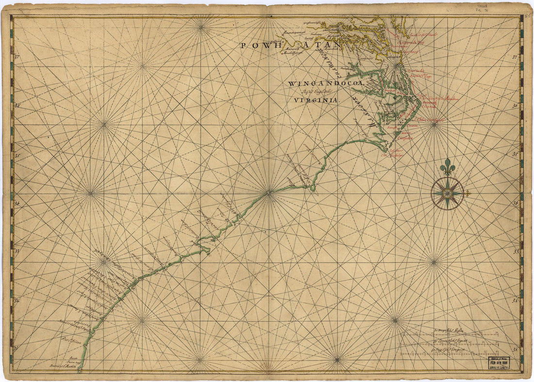 Map of Atlantic Coast of North America from the Chesapeake Bay to Florida 1639Map of Atlantic Coast of North America from the Chesapeake Bay to Florida 1639
- Regular price
-
$43.95 $88.95 - Regular price
-
$32.95 - Sale price
-
$43.95 $88.95
-
 This Map of the Peninsula Between Delaware & Chesopeak Bays, With the Said Bays and Shores Adjacent Drawn from the Most Accurate Surveys 1778This Map of the Peninsula Between Delaware & Chesopeak Bays, With the Said Bays and Shores Adjacent Drawn from the Most Accurate Surveys 1778
- Regular price
-
$43.95 $95.95 - Regular price
-
$32.95 - Sale price
-
$43.95 $95.95
-
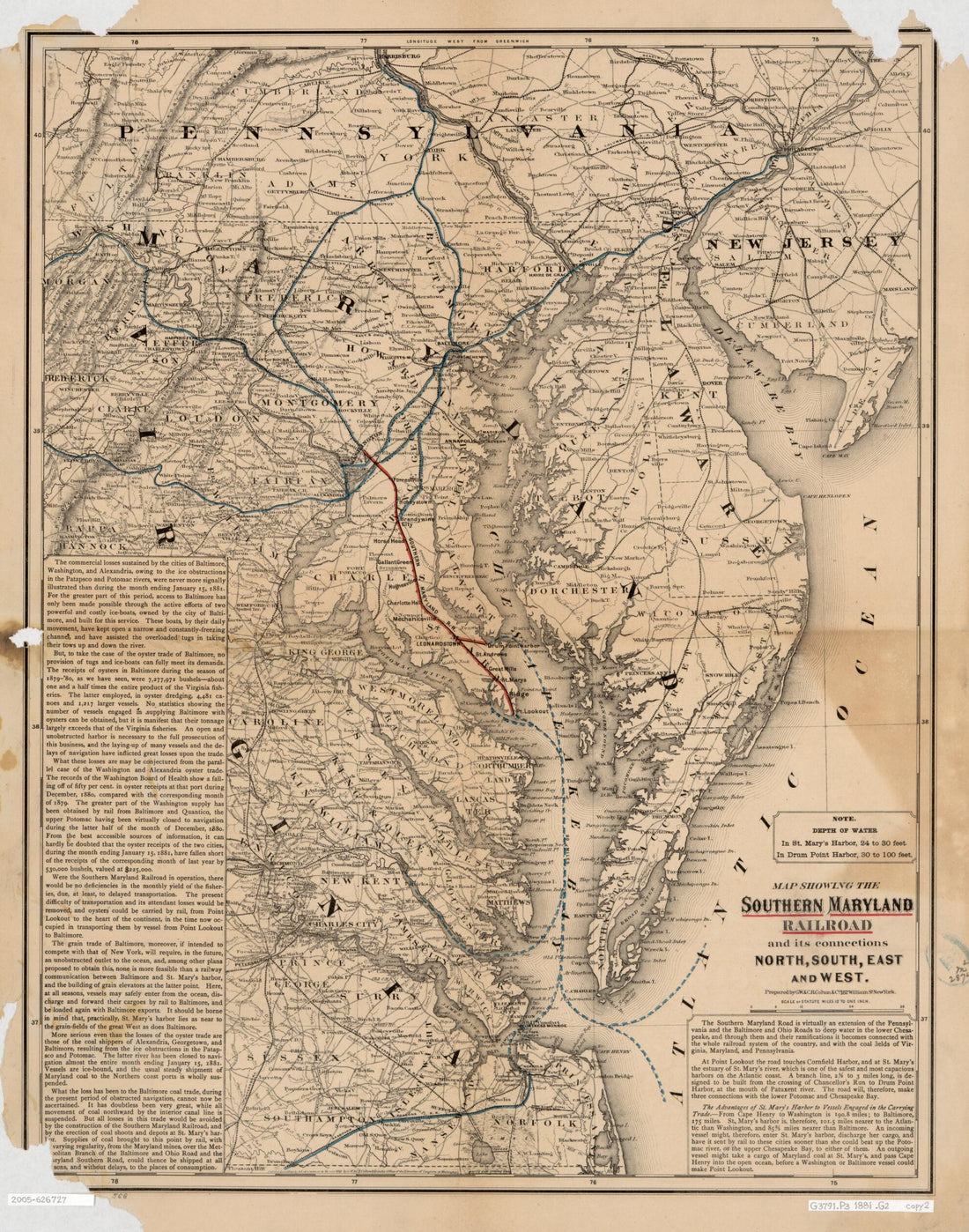 Map Showing the Southern Maryland Railroad and Its Connections : North, South, East, and West 1881Map Showing the Southern Maryland Railroad and Its Connections : North, South, East, and West 1881
- Regular price
-
$39.95 $83.95 - Regular price
-
$34.95 - Sale price
-
$39.95 $83.95
-
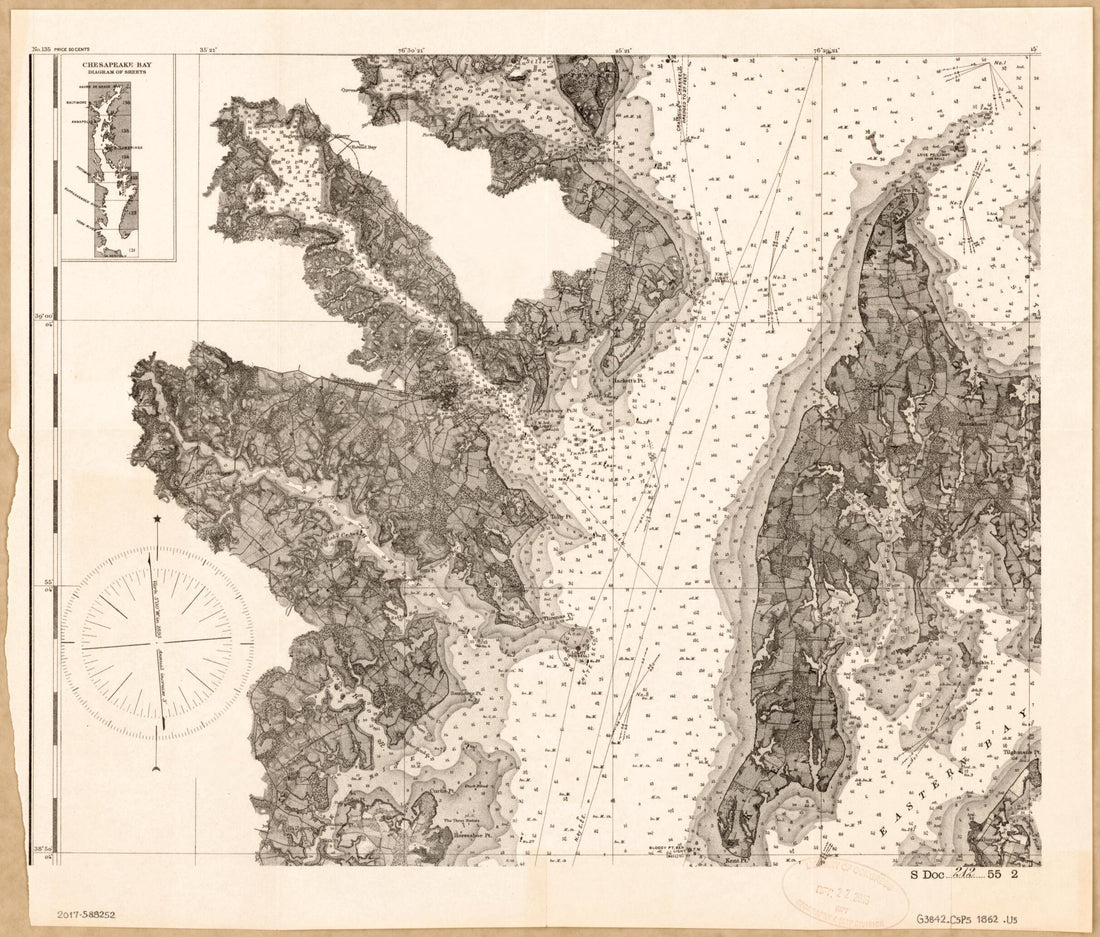
 Chesapeake Bay, Sheet No. 1, York River, Hampton Roads, Chesapeake Entrance 1863Chesapeake Bay, Sheet No. 1, York River, Hampton Roads, Chesapeake Entrance 1863
- Regular price
-
$46.95 $215.95 - Regular price
-
$41.95 - Sale price
-
$46.95 $215.95
-
 Chesapeake Bay 1862Chesapeake Bay 1862
- Regular price
-
$39.95 $83.95 - Regular price
-
$32.95 - Sale price
-
$39.95 $83.95
-
 Chart Showing the Depth of the James and York Rivers As They Enter Chesapeake Bay, With Towns Adjacent 1781Chart Showing the Depth of the James and York Rivers As They Enter Chesapeake Bay, With Towns Adjacent 1781
- Regular price
-
$39.95 $83.95 - Regular price
-
$29.95 - Sale price
-
$39.95 $83.95
-
 This Survey of the River Patapsco and Part of Chesapeake Bay in 1819This Survey of the River Patapsco and Part of Chesapeake Bay in 1819
- Regular price
-
$39.95 $117.95 - Regular price
-
$34.95 - Sale price
-
$39.95 $117.95


