174 products
-
 Plano Del Puerto De La Ysla De Roatán Cituado En La Parte Del S. Y E. De Ella, El Centro De Esta Ysla Se Halla En Lattd. N. 16 Gs. Y 24 Ms. Y En Longd. 289 Gs. 6 Ms., Meridiano De Thenerife, Siendo Su Extension De 14 Leguas, Havitada Por Los Basallos...Plano Del Puerto De La Ysla De Roatán Cituado En La Parte Del S. Y E. De Ella, El Centro De Esta Ysla Se Halla En Lattd. N. 16 Gs. Y 24 Ms. Y En Longd. 289 Gs. 6 Ms., Meridiano De Thenerife, Siendo Su Extension De 14 Leguas, Havitada Por Los Basallos...
- Regular price
-
$43.95 $99.95 - Regular price
-
$33.95 - Sale price
-
$43.95 $99.95
-
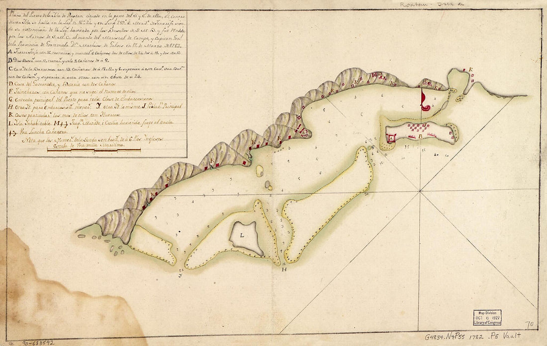 Plano Del Puerto De La Ysla De Roatán Cituado En La Parte Del S. Y E. De Ella, El Centro De Esta Ysla Se Halla En La Latd. N. 16⁰24ʹ Y En Longd. 289⁰6ʹ, Merido. De Tenerife, Siendo Su Extención De 14 Legs. Havitada Por Los Basallos De S.M.B. Y...Plano Del Puerto De La Ysla De Roatán Cituado En La Parte Del S. Y E. De Ella, El Centro De Esta Ysla Se Halla En La Latd. N. 16⁰24ʹ Y En Longd. 289⁰6ʹ, Merido. De Tenerife, Siendo Su Extención De 14 Legs. Havitada Por Los Basallos De S.M.B. Y...
- Regular price
-
$39.95 $99.95 - Regular price
-
$34.95 - Sale price
-
$39.95 $99.95
-
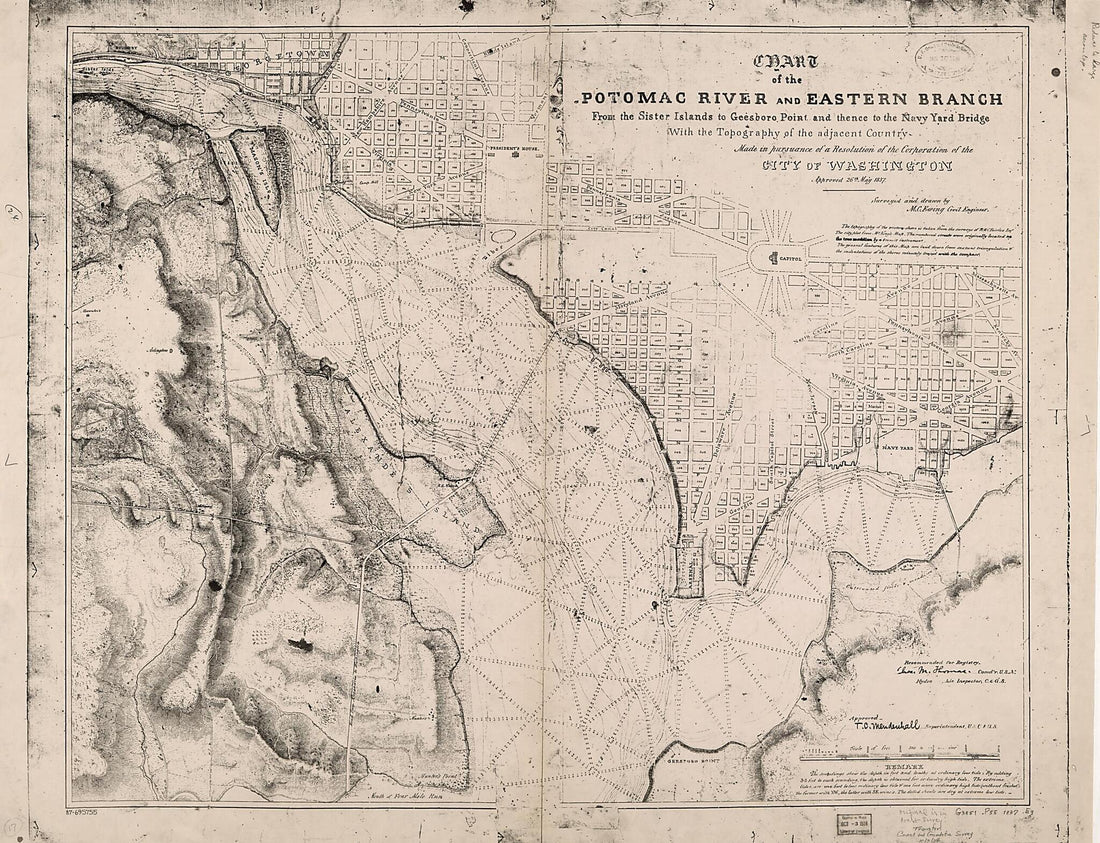 Chart of the Potomac River and Eastern Branch from the Sister Islands to Geesboro Point and Thence to the Navy Yard Bridge : With the Topography of the Adjacent Country : Made In Pursuance of a Resolution of the Corporation of the City of Washington, ...Chart of the Potomac River and Eastern Branch from the Sister Islands to Geesboro Point and Thence to the Navy Yard Bridge : With the Topography of the Adjacent Country : Made In Pursuance of a Resolution of the Corporation of the City of Washington, ...
- Regular price
-
$43.95 $222.95 - Regular price
-
$38.95 - Sale price
-
$43.95 $222.95
-
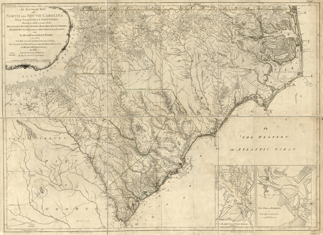 An Accurate Map of North and South Carolina With Their Indian Frontiers, Shewing In a Distinct Manner All the Mountains, Rivers, Swamps, Marshes, Bays, Creeks, Harbours, Sandbanks and Soundings On the Coasts; With the Roads and Indian Paths; As Well A...An Accurate Map of North and South Carolina With Their Indian Frontiers, Shewing In a Distinct Manner All the Mountains, Rivers, Swamps, Marshes, Bays, Creeks, Harbours, Sandbanks and Soundings On the Coasts; With the Roads and Indian Paths; As Well A...
- Regular price
-
$43.95 $204.95 - Regular price
-
$38.95 - Sale price
-
$43.95 $204.95
-
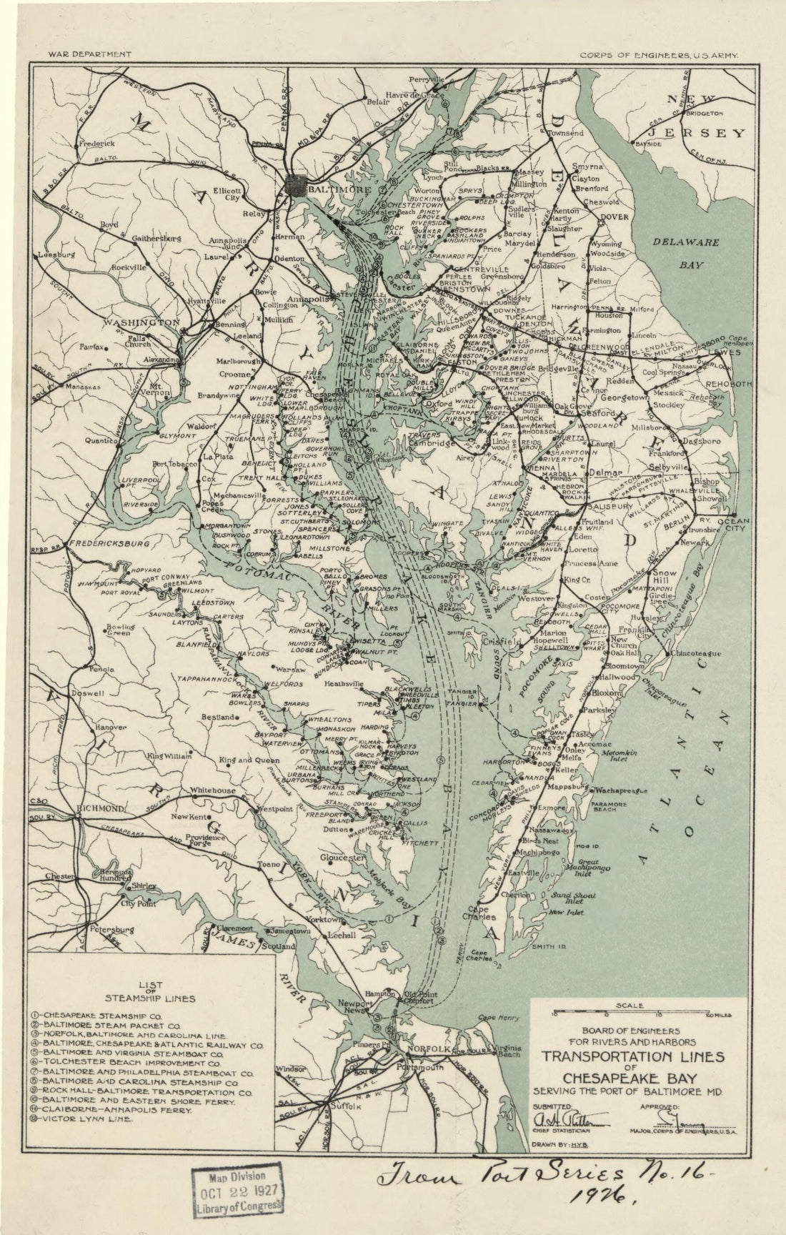 Transportation Lines of Chesapeake Bay Serving the Port of Baltimore MD in 1926Transportation Lines of Chesapeake Bay Serving the Port of Baltimore MD in 1926
- Regular price
-
$39.95 $99.95 - Regular price
-
$34.95 - Sale price
-
$39.95 $99.95
-
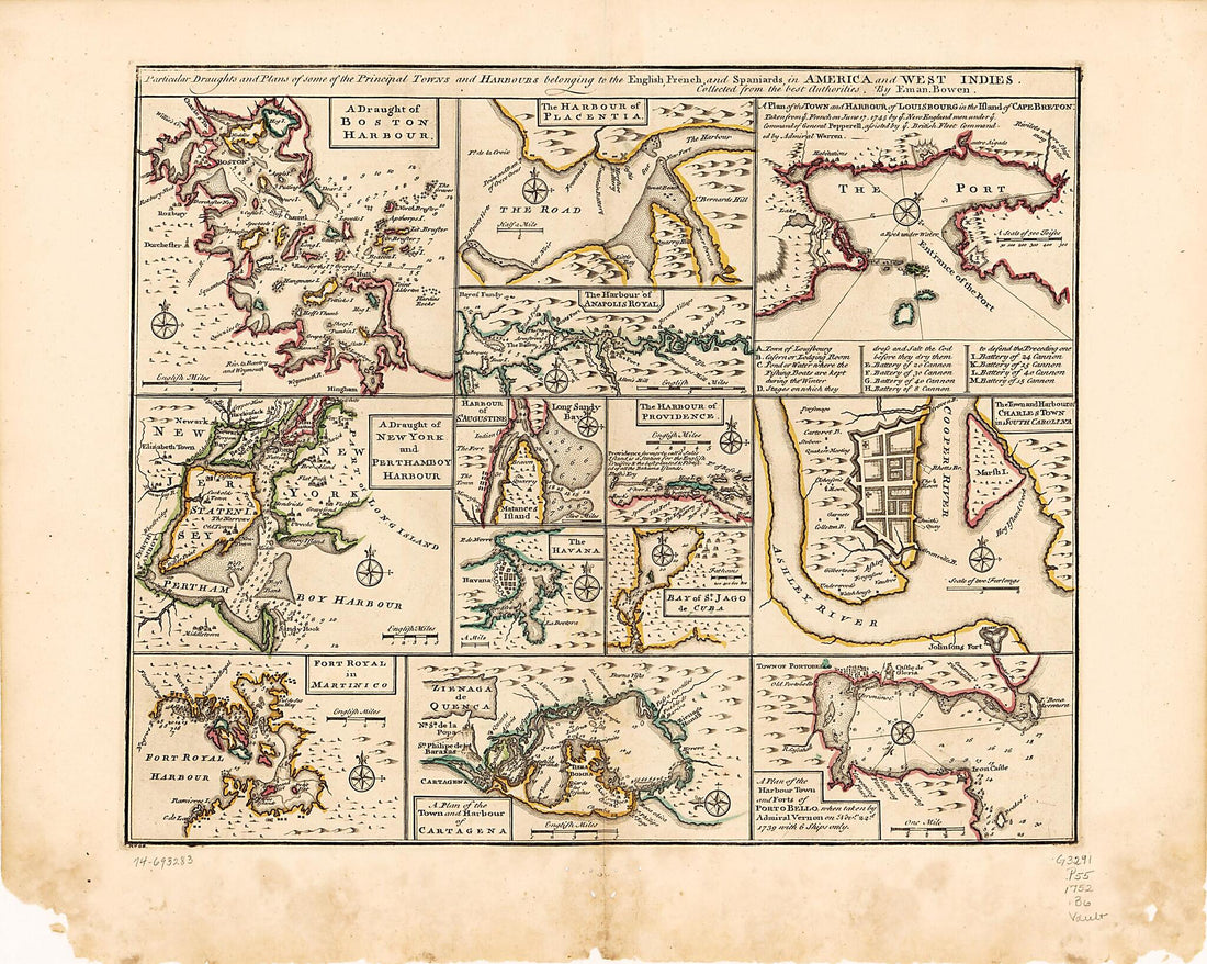 Particular Draughts and Plans of Some of the Principal Towns and Harbours Belonging to the English, French, and Spaniards, In America and West Indies 1752Particular Draughts and Plans of Some of the Principal Towns and Harbours Belonging to the English, French, and Spaniards, In America and West Indies 1752
- Regular price
-
$43.95 $88.95 - Regular price
-
$38.95 - Sale price
-
$43.95 $88.95
-
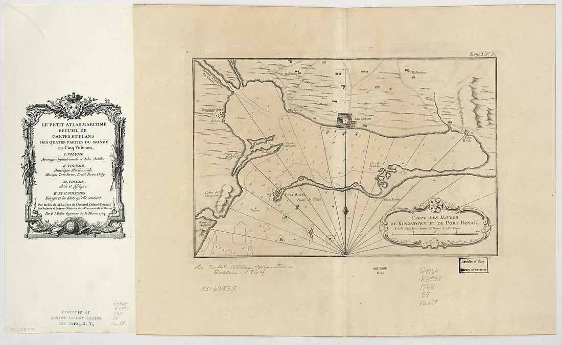 Carte Des Havres De Kingstown Et De Port Royal 1764Carte Des Havres De Kingstown Et De Port Royal 1764
- Regular price
-
$46.95 $119.95 - Regular price
-
$41.95 - Sale price
-
$46.95 $119.95
-
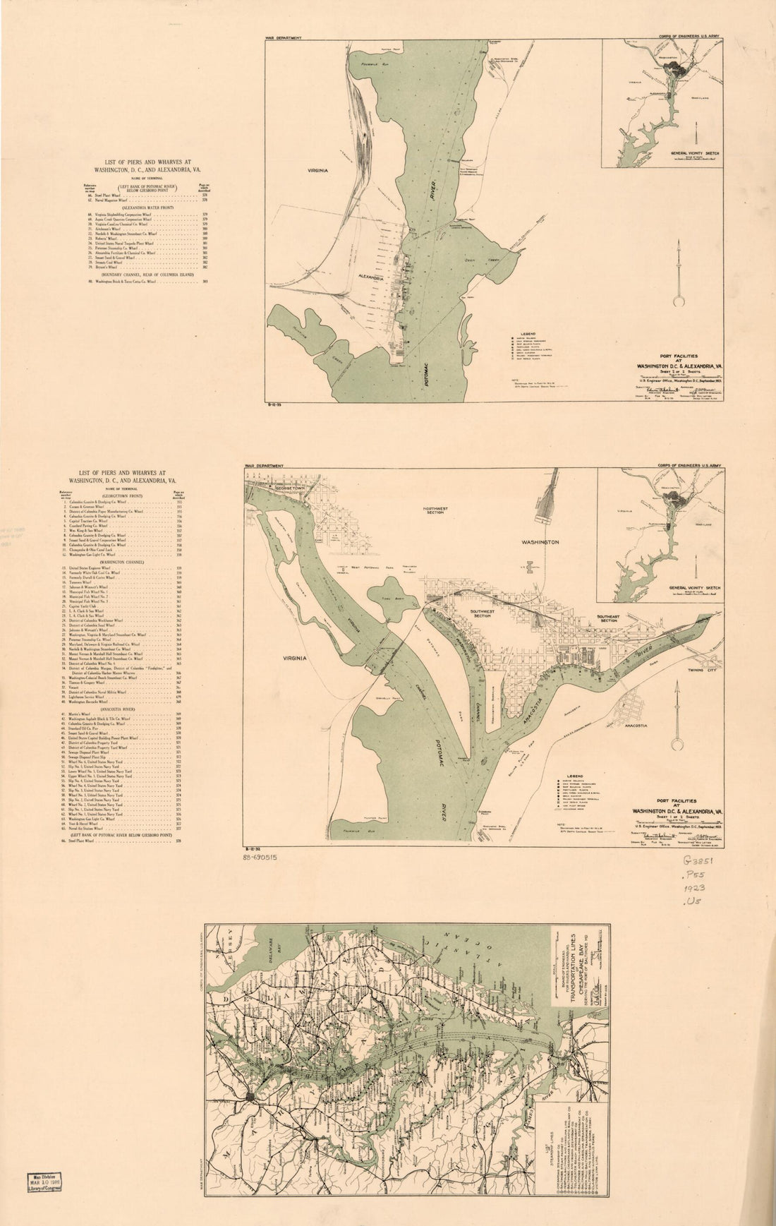 Port Facilities at Washington D.C. & Alexandria, Va in 1923Port Facilities at Washington D.C. & Alexandria, Va in 1923
- Regular price
-
$46.95 $99.95 - Regular price
-
$41.95 - Sale price
-
$46.95 $99.95
-
 Chart of the Head of Navigation of the Potomac River Shewing the Route of the Alexandria Canal : Made In Pursuance of a Resolution of the Alex'a Canal Company Oct. 1838Chart of the Head of Navigation of the Potomac River Shewing the Route of the Alexandria Canal : Made In Pursuance of a Resolution of the Alex'a Canal Company Oct. 1838
- Regular price
-
$46.95 $173.95 - Regular price
-
$41.95 - Sale price
-
$46.95 $173.95
-
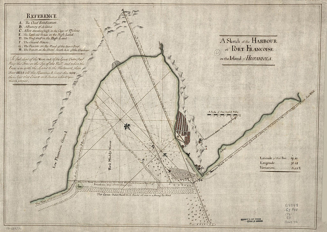 A Sketch of the Harbour of Port Francoise On the Island of Hispaniola 1760A Sketch of the Harbour of Port Francoise On the Island of Hispaniola 1760
- Regular price
-
$43.95 $150.95 - Regular price
-
$38.95 - Sale price
-
$43.95 $150.95
-
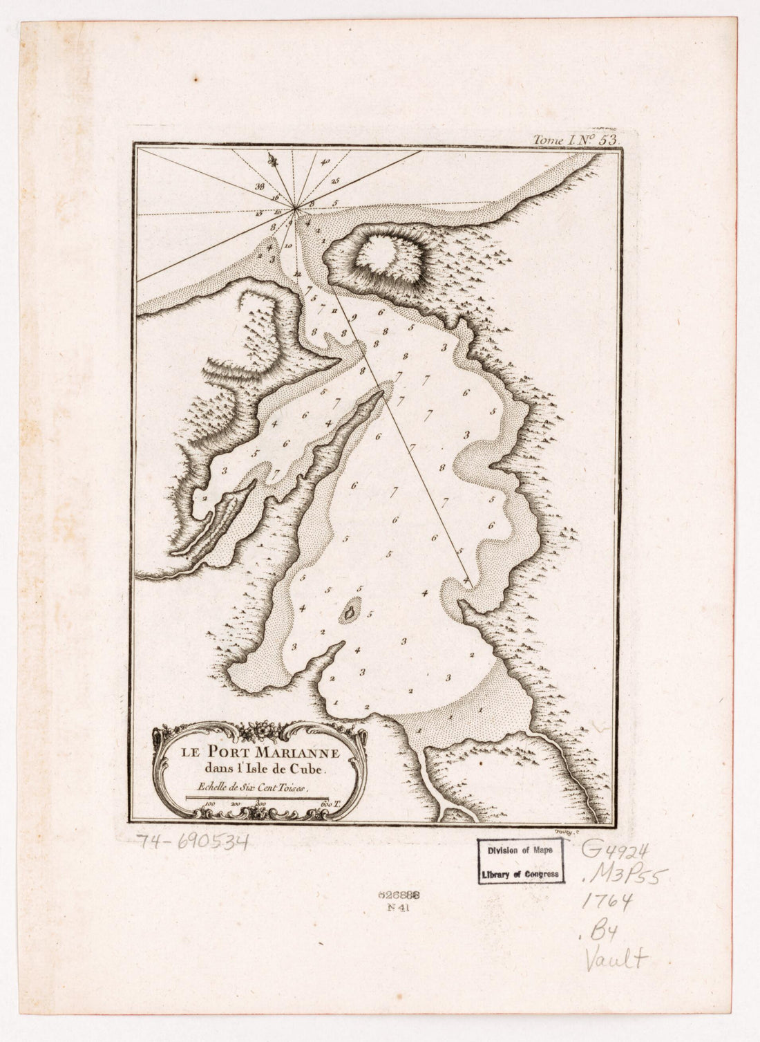 Le Port Marianne Dans L'isle De Cube in 1764Le Port Marianne Dans L'isle De Cube in 1764
- Regular price
-
$39.95 $88.95 - Regular price
-
$34.95 - Sale price
-
$39.95 $88.95
-
 Plano De La Ciudad Y Puerto De San Agustin De La Florida 1783Plano De La Ciudad Y Puerto De San Agustin De La Florida 1783
- Regular price
-
$39.95 $99.95 - Regular price
-
$34.95 - Sale price
-
$39.95 $99.95


