705 products
-
 Map of Harden County, Iowa from Plat Book of Hardin County, Iowa : Drawn from Actual Surveys & County Records 1892Map of Harden County, Iowa from Plat Book of Hardin County, Iowa : Drawn from Actual Surveys & County Records 1892
- Regular price
-
$39.95 $83.95 - Regular price
-
$10.95 - Sale price
-
$39.95 $83.95
-
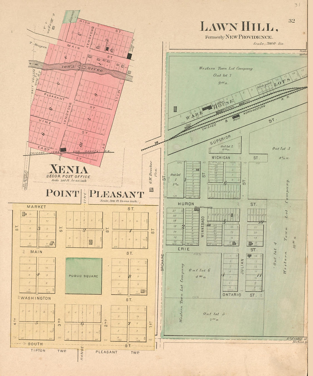 Lawn Hill; Xenia; Point Pleasant from Plat Book of Hardin County, Iowa : Drawn from Actual Surveys & County Records 1892Lawn Hill; Xenia; Point Pleasant from Plat Book of Hardin County, Iowa : Drawn from Actual Surveys & County Records 1892
- Regular price
-
$39.95 $83.95 - Regular price
-
$10.95 - Sale price
-
$39.95 $83.95
-
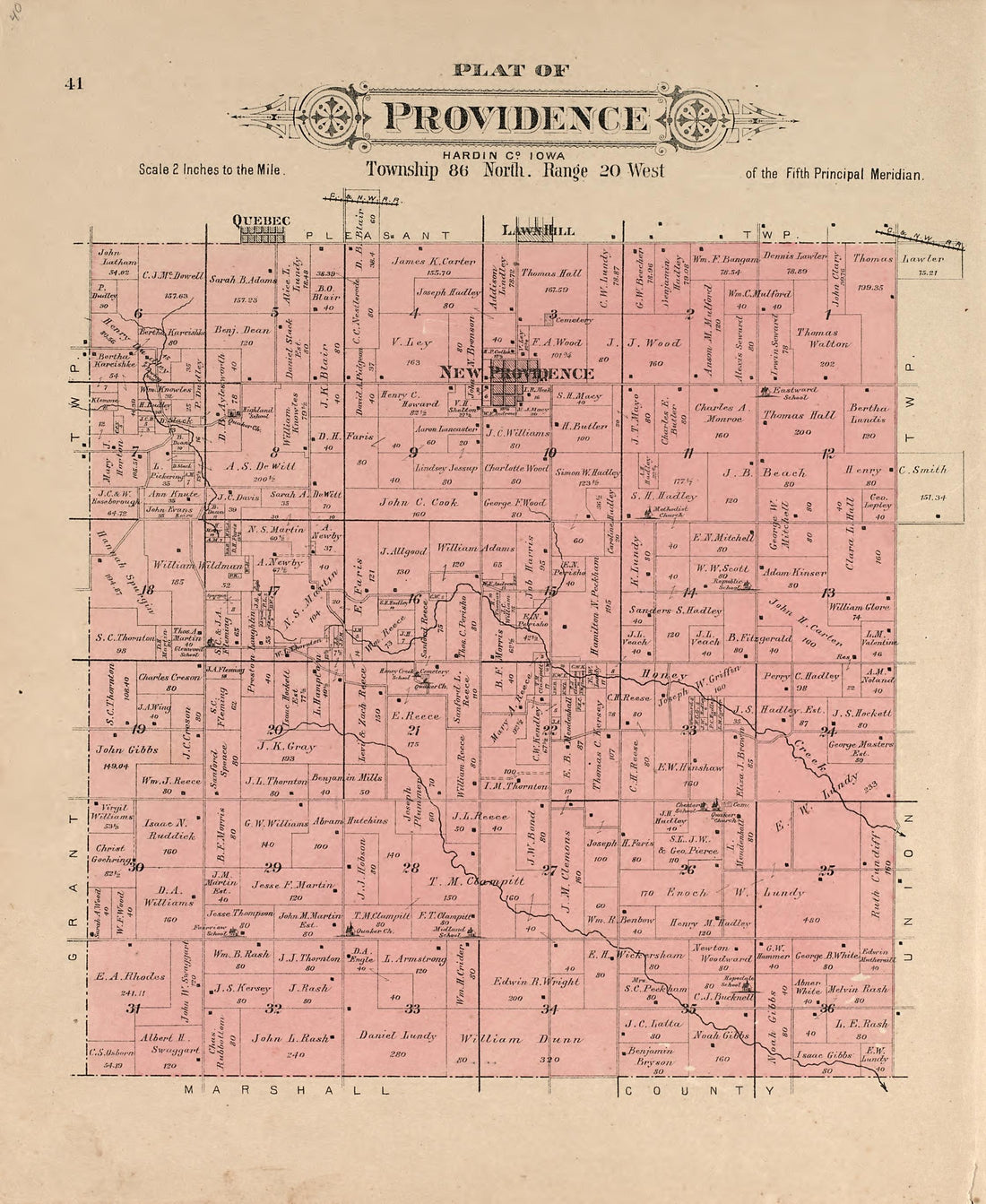 Plat of Providence from Plat Book of Hardin County, Iowa : Drawn from Actual Surveys & County Records 1892Plat of Providence from Plat Book of Hardin County, Iowa : Drawn from Actual Surveys & County Records 1892
- Regular price
-
$39.95 $83.95 - Regular price
-
$10.95 - Sale price
-
$39.95 $83.95
-
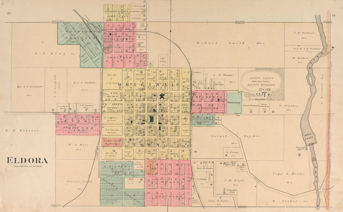 Eldora from Plat Book of Hardin County, Iowa : Drawn from Actual Surveys & County Records 1892Eldora from Plat Book of Hardin County, Iowa : Drawn from Actual Surveys & County Records 1892
- Regular price
-
$39.95 $99.95 - Regular price
-
$21.95 - Sale price
-
$39.95 $99.95
-
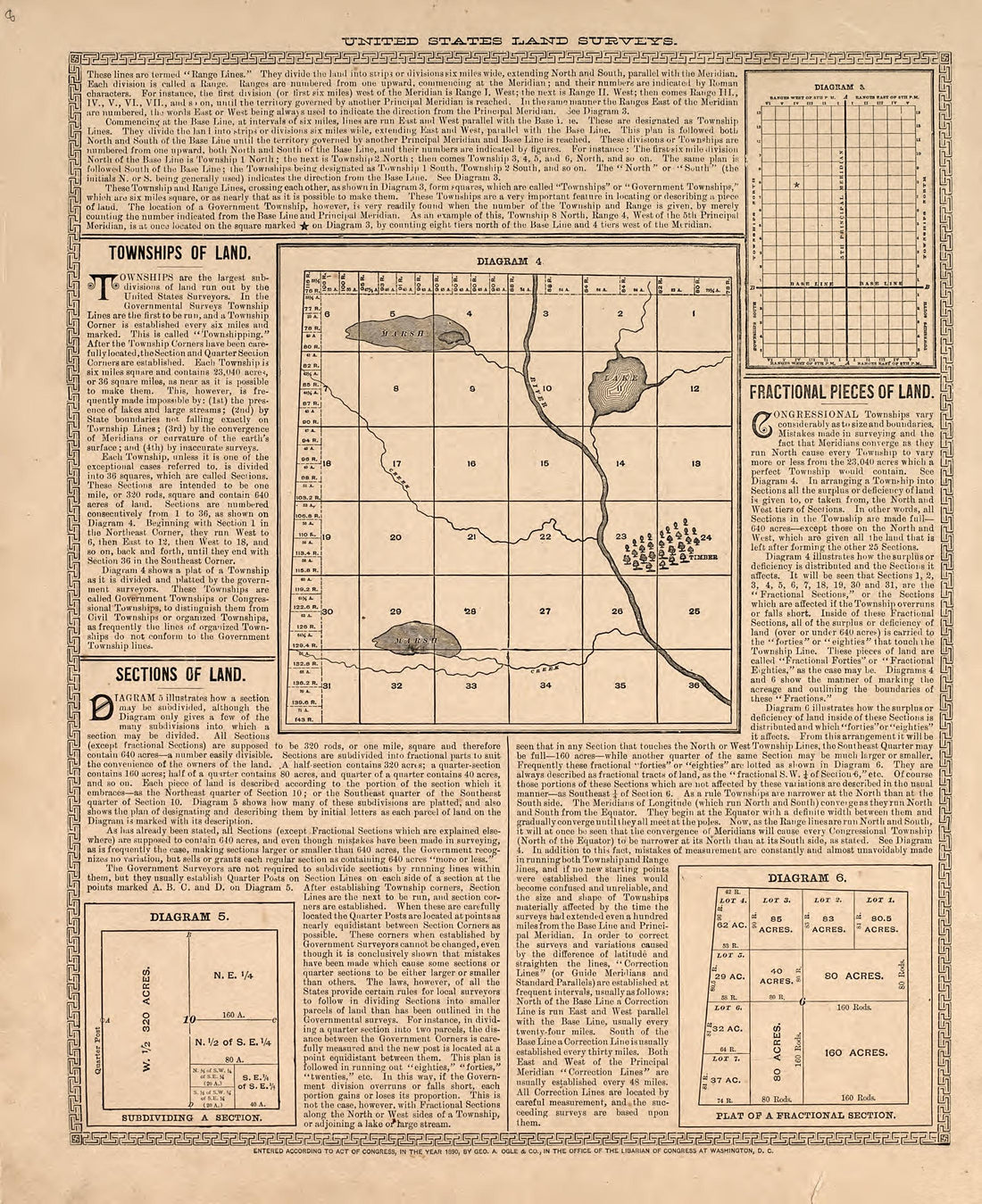 United States Land Surveys from Plat Book of Hardin County, Iowa : Drawn from Actual Surveys & County Records 1892United States Land Surveys from Plat Book of Hardin County, Iowa : Drawn from Actual Surveys & County Records 1892
- Regular price
-
$39.95 $83.95 - Regular price
-
$10.95 - Sale price
-
$39.95 $83.95
-
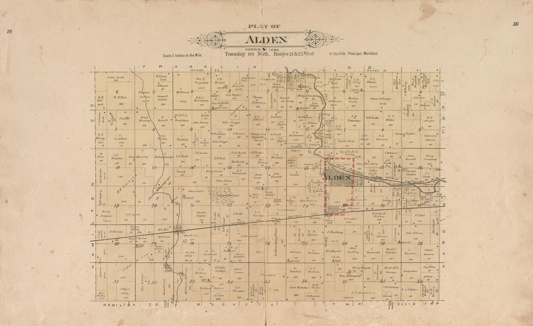 Plat of Alden from Plat Book of Hardin County, Iowa : Drawn from Actual Surveys & County Records 1892Plat of Alden from Plat Book of Hardin County, Iowa : Drawn from Actual Surveys & County Records 1892
- Regular price
-
$39.95 $99.95 - Regular price
-
$21.95 - Sale price
-
$39.95 $99.95
-
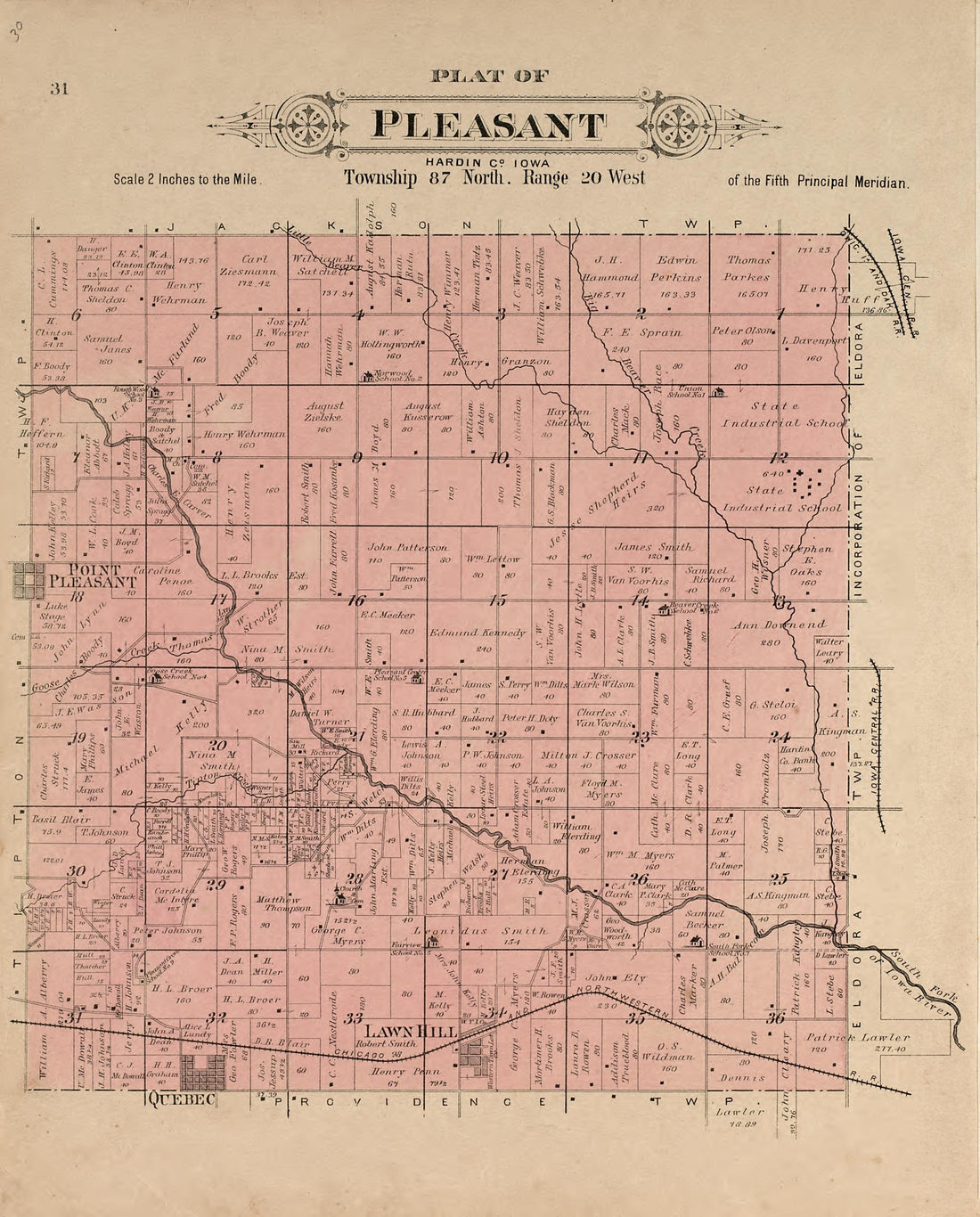 Plat of Pleasant from Plat Book of Hardin County, Iowa : Drawn from Actual Surveys & County Records 1892Plat of Pleasant from Plat Book of Hardin County, Iowa : Drawn from Actual Surveys & County Records 1892
- Regular price
-
$39.95 $83.95 - Regular price
-
$10.95 - Sale price
-
$39.95 $83.95
-
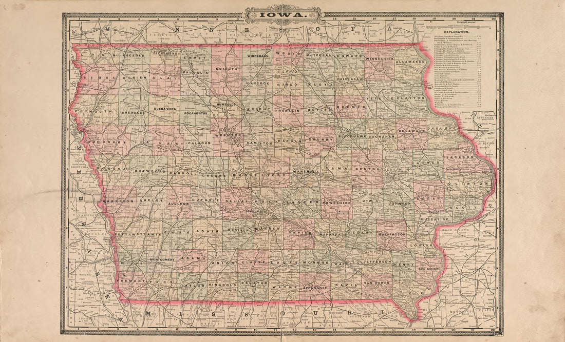 Iowa from Plat Book of Hardin County, Iowa : Drawn from Actual Surveys & County Records 1892Iowa from Plat Book of Hardin County, Iowa : Drawn from Actual Surveys & County Records 1892
- Regular price
-
$39.95 $99.95 - Regular price
-
$22.95 - Sale price
-
$39.95 $99.95
-
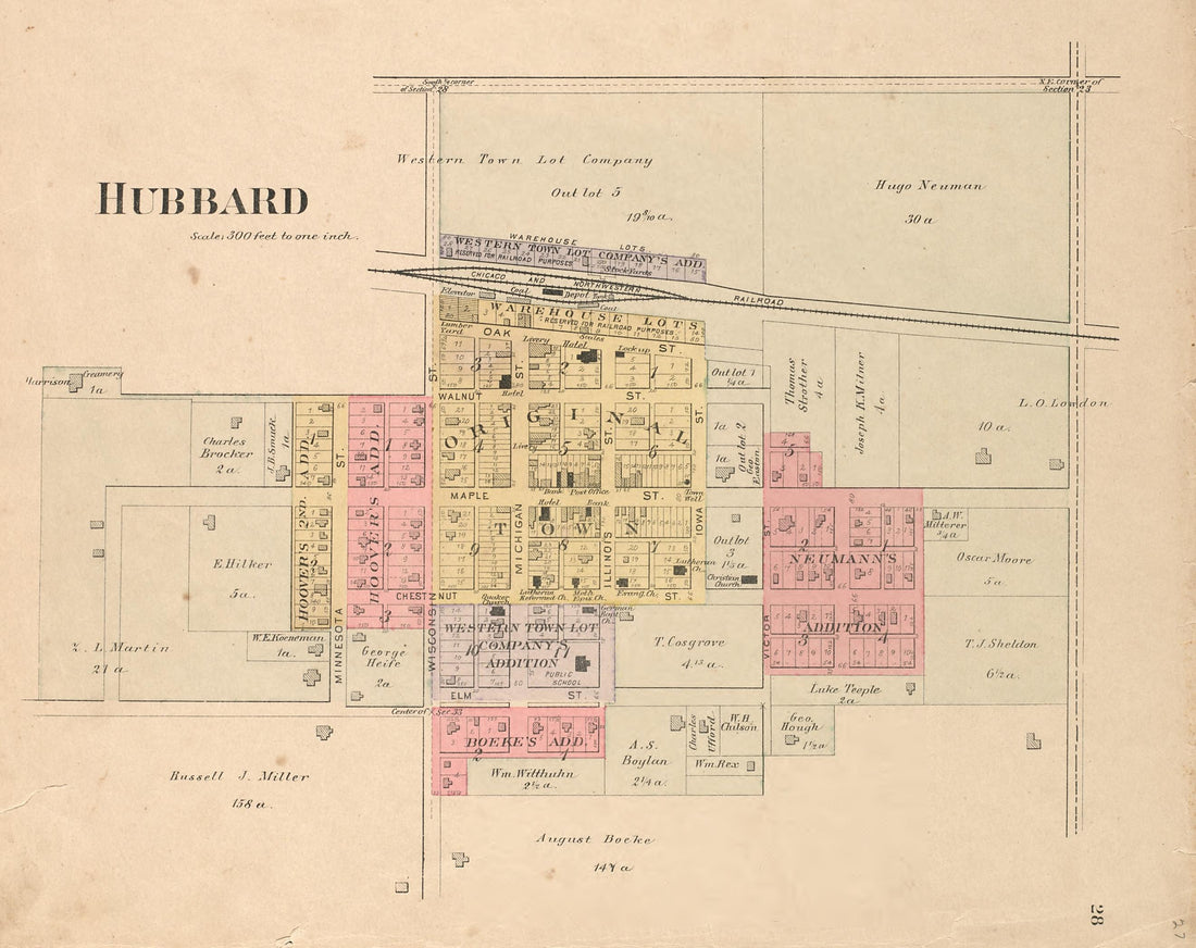 Hubbard from Plat Book of Hardin County, Iowa : Drawn from Actual Surveys & County Records 1892Hubbard from Plat Book of Hardin County, Iowa : Drawn from Actual Surveys & County Records 1892
- Regular price
-
$39.95 $83.95 - Regular price
-
$9.95 - Sale price
-
$39.95 $83.95
-
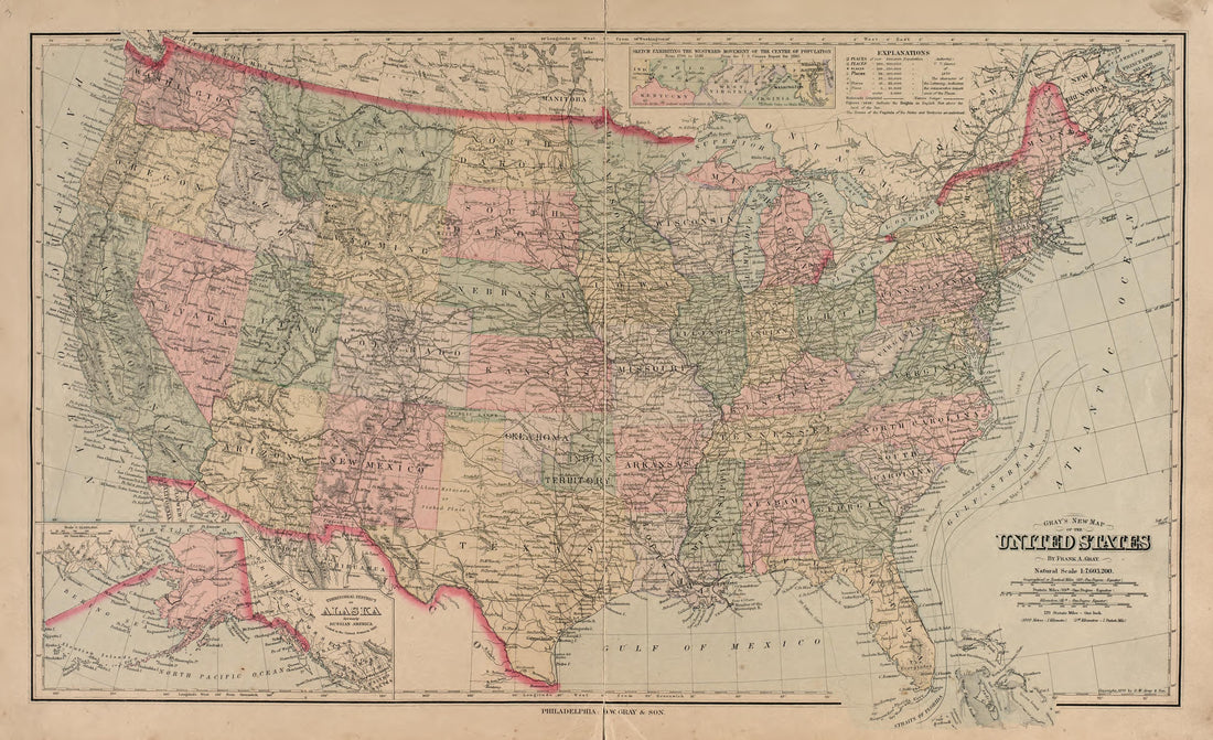 Gray's New Map of the United States from Plat Book of Hardin County, Iowa : Drawn from Actual Surveys & County Records 1892Gray's New Map of the United States from Plat Book of Hardin County, Iowa : Drawn from Actual Surveys & County Records 1892
- Regular price
-
$39.95 $99.95 - Regular price
-
$22.95 - Sale price
-
$39.95 $99.95
-
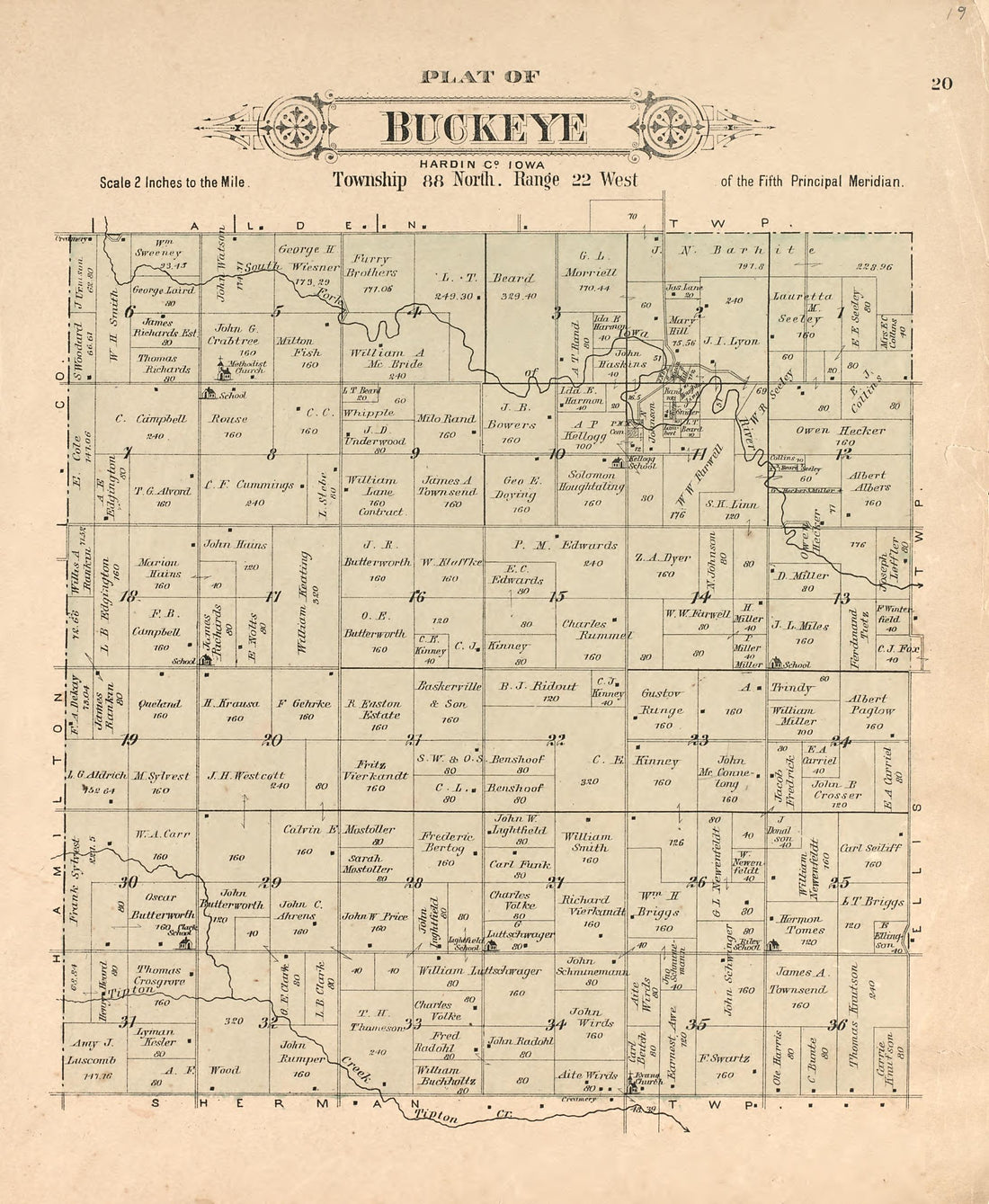 Plat of Buckeye from Plat Book of Hardin County, Iowa : Drawn from Actual Surveys & County Records 1892Plat of Buckeye from Plat Book of Hardin County, Iowa : Drawn from Actual Surveys & County Records 1892
- Regular price
-
$39.95 $83.95 - Regular price
-
$10.95 - Sale price
-
$39.95 $83.95
-
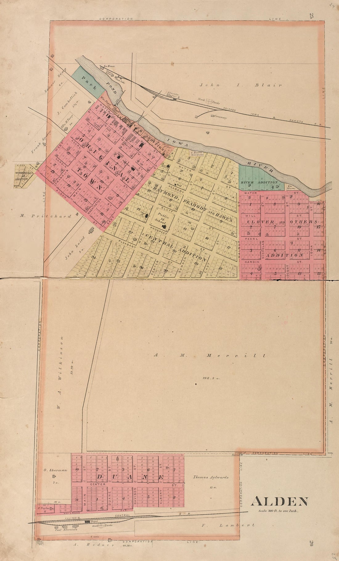 Alden from Plat Book of Hardin County, Iowa : Drawn from Actual Surveys & County Records 1892Alden from Plat Book of Hardin County, Iowa : Drawn from Actual Surveys & County Records 1892
- Regular price
-
$39.95 $99.95 - Regular price
-
$21.95 - Sale price
-
$39.95 $99.95


