963 products
-
 Image 21 of General Official Atlas of Wayne County, Michigan : Containing General Maps of Wayne County and City of Detroit, General Township Maps ... from General Official Atlas of Wayne County, Michigan : Containing General Maps of Wayne County and C...Image 21 of General Official Atlas of Wayne County, Michigan : Containing General Maps of Wayne County and City of Detroit, General Township Maps ... from General Official Atlas of Wayne County, Michigan : Containing General Maps of Wayne County and C...
- Regular price
-
$49.95 $83.95 - Regular price
-
$36.95 - Sale price
-
$49.95 $83.95
-
 Image 40 of General Official Atlas of Wayne County, Michigan : Containing General Maps of Wayne County and City of Detroit, General Township Maps ... from General Official Atlas of Wayne County, Michigan : Containing General Maps of Wayne County and C...Image 40 of General Official Atlas of Wayne County, Michigan : Containing General Maps of Wayne County and City of Detroit, General Township Maps ... from General Official Atlas of Wayne County, Michigan : Containing General Maps of Wayne County and C...
- Regular price
-
$49.95 $99.95 - Regular price
-
$36.95 - Sale price
-
$49.95 $99.95
-
 Image 20 of General Official Atlas of Wayne County, Michigan : Containing General Maps of Wayne County and City of Detroit, General Township Maps ... from General Official Atlas of Wayne County, Michigan : Containing General Maps of Wayne County and C...Image 20 of General Official Atlas of Wayne County, Michigan : Containing General Maps of Wayne County and City of Detroit, General Township Maps ... from General Official Atlas of Wayne County, Michigan : Containing General Maps of Wayne County and C...
- Regular price
-
$49.95 $83.95 - Regular price
-
$36.95 - Sale price
-
$49.95 $83.95
-
 Image 8 of General Official Atlas of Wayne County, Michigan : Containing General Maps of Wayne County and City of Detroit, General Township Maps ... from General Official Atlas of Wayne County, Michigan : Containing General Maps of Wayne County and Ci...Image 8 of General Official Atlas of Wayne County, Michigan : Containing General Maps of Wayne County and City of Detroit, General Township Maps ... from General Official Atlas of Wayne County, Michigan : Containing General Maps of Wayne County and Ci...
- Regular price
-
$49.95 $83.95 - Regular price
-
$36.95 - Sale price
-
$49.95 $83.95
-
 Image 32 of General Official Atlas of Wayne County, Michigan : Containing General Maps of Wayne County and City of Detroit, General Township Maps ... from General Official Atlas of Wayne County, Michigan : Containing General Maps of Wayne County and C...Image 32 of General Official Atlas of Wayne County, Michigan : Containing General Maps of Wayne County and City of Detroit, General Township Maps ... from General Official Atlas of Wayne County, Michigan : Containing General Maps of Wayne County and C...
- Regular price
-
$49.95 $83.95 - Regular price
-
$36.95 - Sale price
-
$49.95 $83.95
-
 Image 16 of General Official Atlas of Wayne County, Michigan : Containing General Maps of Wayne County and City of Detroit, General Township Maps ... from General Official Atlas of Wayne County, Michigan : Containing General Maps of Wayne County and C...Image 16 of General Official Atlas of Wayne County, Michigan : Containing General Maps of Wayne County and City of Detroit, General Township Maps ... from General Official Atlas of Wayne County, Michigan : Containing General Maps of Wayne County and C...
- Regular price
-
$49.95 $99.95 - Regular price
-
$37.95 - Sale price
-
$49.95 $99.95
-
 Image 19 of General Official Atlas of Wayne County, Michigan : Containing General Maps of Wayne County and City of Detroit, General Township Maps ... from General Official Atlas of Wayne County, Michigan : Containing General Maps of Wayne County and C...Image 19 of General Official Atlas of Wayne County, Michigan : Containing General Maps of Wayne County and City of Detroit, General Township Maps ... from General Official Atlas of Wayne County, Michigan : Containing General Maps of Wayne County and C...
- Regular price
-
$49.95 $83.95 - Regular price
-
$36.95 - Sale price
-
$49.95 $83.95
-
 Image 34 of General Official Atlas of Wayne County, Michigan : Containing General Maps of Wayne County and City of Detroit, General Township Maps ... from General Official Atlas of Wayne County, Michigan : Containing General Maps of Wayne County and C...Image 34 of General Official Atlas of Wayne County, Michigan : Containing General Maps of Wayne County and City of Detroit, General Township Maps ... from General Official Atlas of Wayne County, Michigan : Containing General Maps of Wayne County and C...
- Regular price
-
$49.95 $99.95 - Regular price
-
$36.95 - Sale price
-
$49.95 $99.95
-
 Image 31 of General Official Atlas of Wayne County, Michigan : Containing General Maps of Wayne County and City of Detroit, General Township Maps ... from General Official Atlas of Wayne County, Michigan : Containing General Maps of Wayne County and C...Image 31 of General Official Atlas of Wayne County, Michigan : Containing General Maps of Wayne County and City of Detroit, General Township Maps ... from General Official Atlas of Wayne County, Michigan : Containing General Maps of Wayne County and C...
- Regular price
-
$49.95 $83.95 - Regular price
-
$36.95 - Sale price
-
$49.95 $83.95
-
 Image 35 of General Official Atlas of Wayne County, Michigan : Containing General Maps of Wayne County and City of Detroit, General Township Maps ... from General Official Atlas of Wayne County, Michigan : Containing General Maps of Wayne County and C...Image 35 of General Official Atlas of Wayne County, Michigan : Containing General Maps of Wayne County and City of Detroit, General Township Maps ... from General Official Atlas of Wayne County, Michigan : Containing General Maps of Wayne County and C...
- Regular price
-
$49.95 $99.95 - Regular price
-
$36.95 - Sale price
-
$49.95 $99.95
-
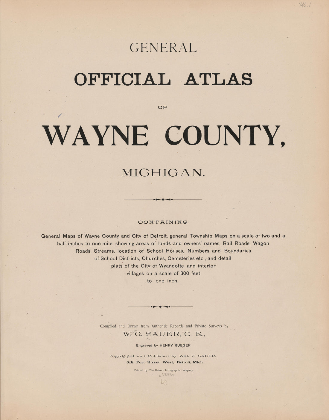 Image 1 of General Official Atlas of Wayne County, Michigan : Containing General Maps of Wayne County and City of Detroit, General Township Maps ... from General Official Atlas of Wayne County, Michigan : Containing General Maps of Wayne County and Ci...Image 1 of General Official Atlas of Wayne County, Michigan : Containing General Maps of Wayne County and City of Detroit, General Township Maps ... from General Official Atlas of Wayne County, Michigan : Containing General Maps of Wayne County and Ci...
- Regular price
-
$49.95 $83.95 - Regular price
-
$36.95 - Sale price
-
$49.95 $83.95
-
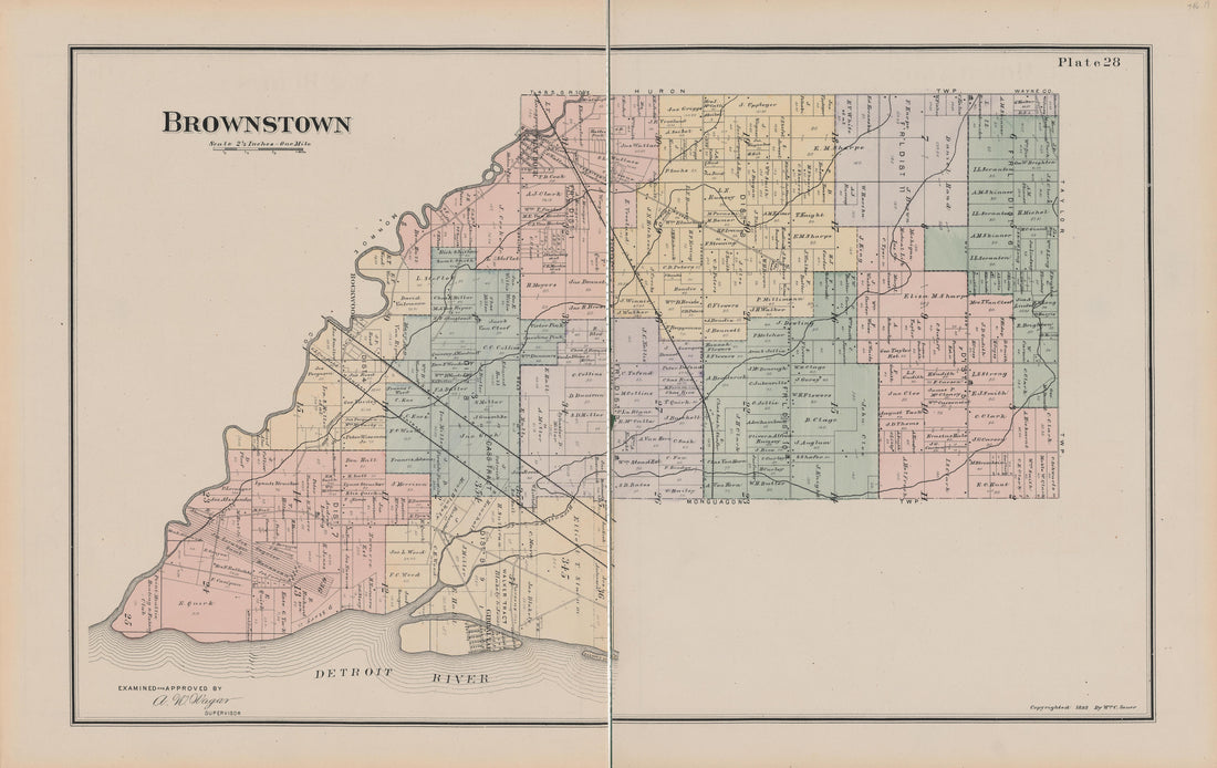 Image 30 of General Official Atlas of Wayne County, Michigan : Containing General Maps of Wayne County and City of Detroit, General Township Maps ... from General Official Atlas of Wayne County, Michigan : Containing General Maps of Wayne County and C...Image 30 of General Official Atlas of Wayne County, Michigan : Containing General Maps of Wayne County and City of Detroit, General Township Maps ... from General Official Atlas of Wayne County, Michigan : Containing General Maps of Wayne County and C...
- Regular price
-
$49.95 $99.95 - Regular price
-
$36.95 - Sale price
-
$49.95 $99.95


