2057 products
-
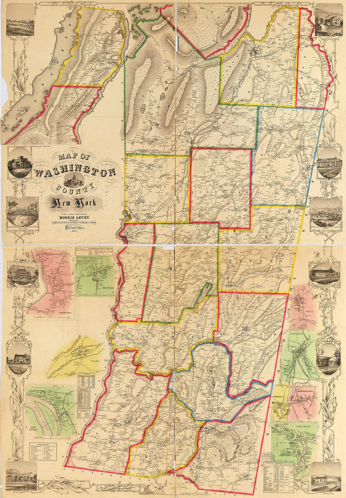 Map of Washington County, New York in 1853Map of Washington County, New York in 1853
- Regular price
-
$46.95 $200.95 - Regular price
-
$41.95 - Sale price
-
$46.95 $200.95
-
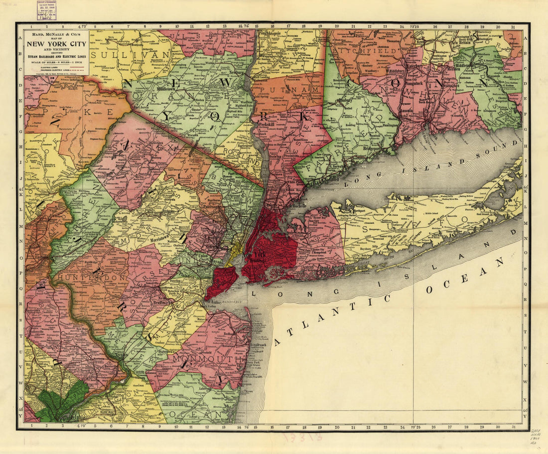 Rand, McNally & Co.'s Map of New York City and Vicinity Showing Steam Railroads and Electric Lines 1908Rand, McNally & Co.'s Map of New York City and Vicinity Showing Steam Railroads and Electric Lines 1908
- Regular price
-
$43.95 $83.95 - Regular price
-
$38.95 - Sale price
-
$43.95 $83.95
-
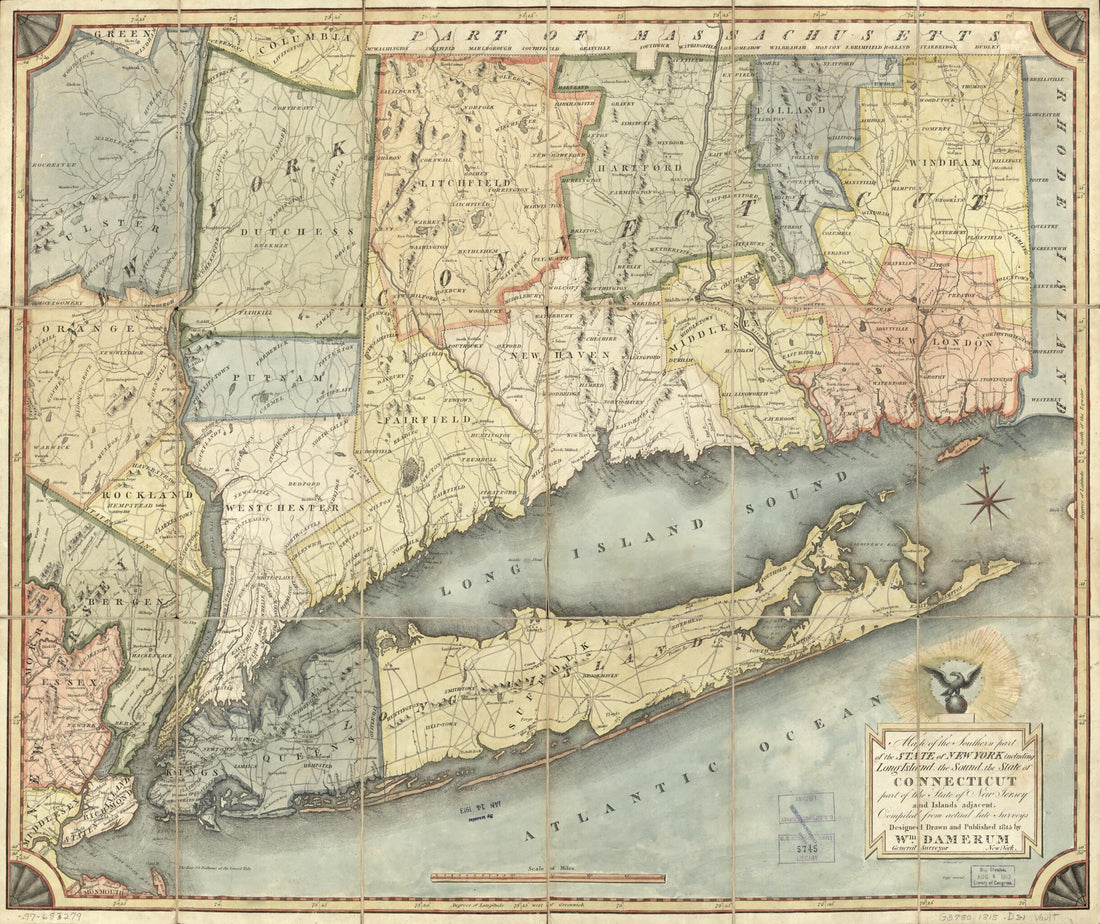 Map of the Southern Part of the State of New York Including Long Island, the Sound, the State of Connecticut, Part of the State of New Jersey, and Islands Adjacent : Compiled from Actual Late Surveys 1815Map of the Southern Part of the State of New York Including Long Island, the Sound, the State of Connecticut, Part of the State of New Jersey, and Islands Adjacent : Compiled from Actual Late Surveys 1815
- Regular price
-
$43.95 $83.95 - Regular price
-
$38.95 - Sale price
-
$43.95 $83.95
-
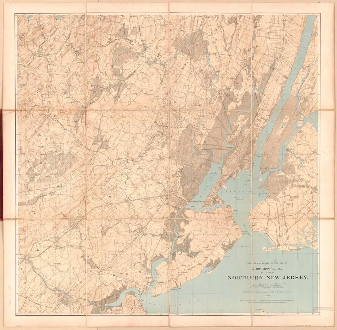 A Topographical Map of a Part of Northern New Jersey (Northern New Jersey, Map of Northern N.J.) 1882A Topographical Map of a Part of Northern New Jersey (Northern New Jersey, Map of Northern N.J.) 1882
- Regular price
-
$43.95 $156.95 - Regular price
-
$38.95 - Sale price
-
$43.95 $156.95
-
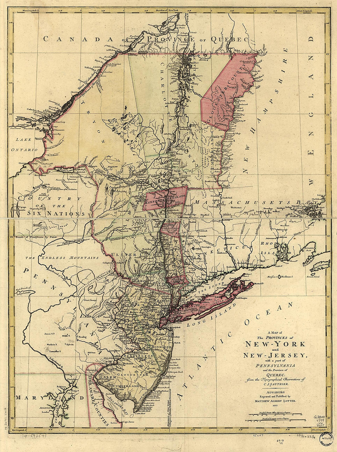 York and New Jersey, With a Part of Pennsylvania and the Province of Quebec 1777York and New Jersey, With a Part of Pennsylvania and the Province of Quebec 1777
- Regular price
-
$43.95 $119.95 - Regular price
-
$38.95 - Sale price
-
$43.95 $119.95
-
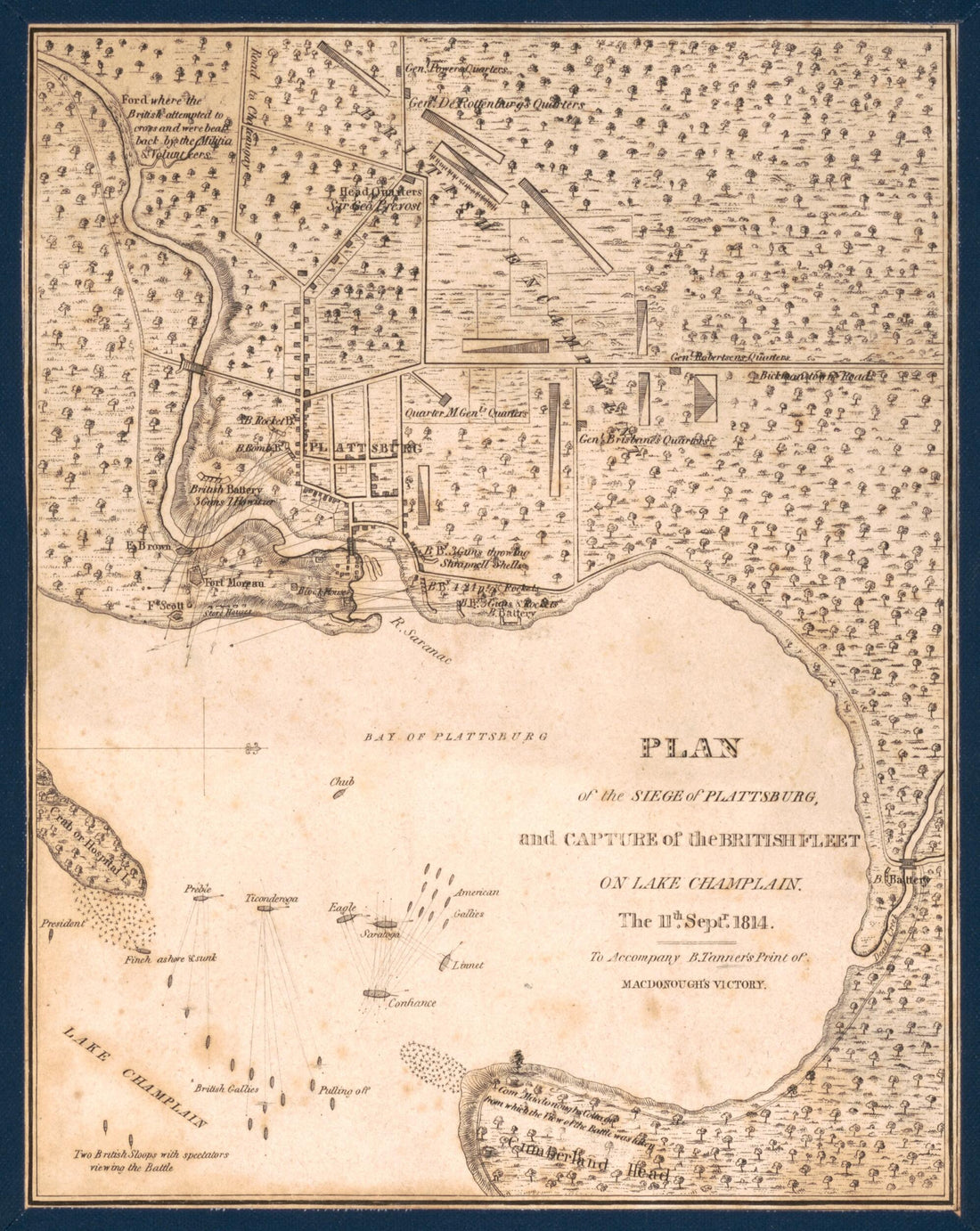 Plan of the Siege of Plattsburg and Capture of the British Fleet On Lake Champlain the 11th Sptr. 1814 : to Accompany B. Tanner's Print of Macdonough's VictoryPlan of the Siege of Plattsburg and Capture of the British Fleet On Lake Champlain the 11th Sptr. 1814 : to Accompany B. Tanner's Print of Macdonough's Victory
- Regular price
-
$39.95 $83.95 - Regular price
-
$34.95 - Sale price
-
$39.95 $83.95
-
 This Colour'd Map Exhibits a General View of the Economical Geology of New York and Part of the Adjoining States 1830This Colour'd Map Exhibits a General View of the Economical Geology of New York and Part of the Adjoining States 1830
- Regular price
-
$44.95 $99.95 - Regular price
-
$39.95 - Sale price
-
$44.95 $99.95
-
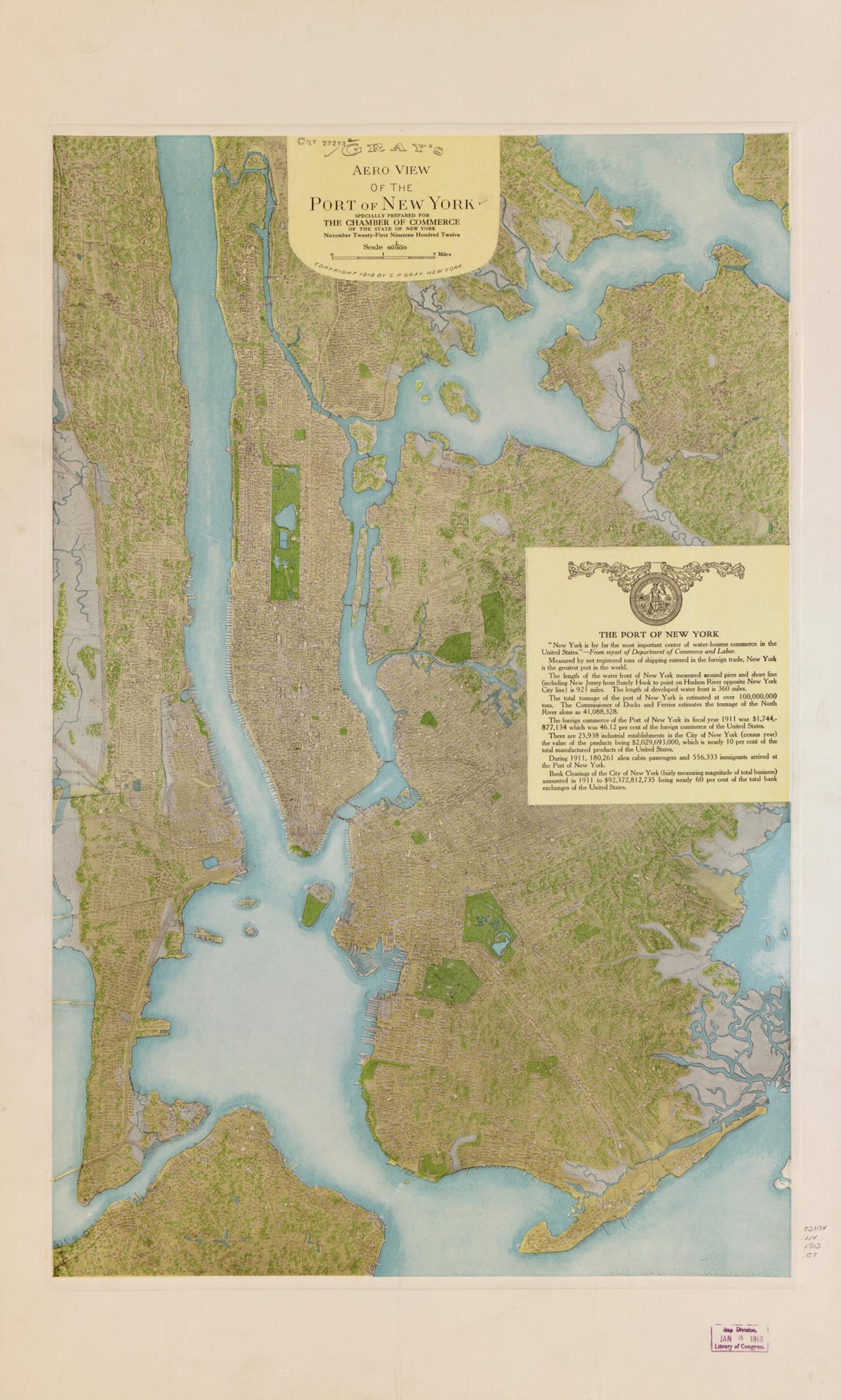 Gray's Aero View of the Port of New York 1913Gray's Aero View of the Port of New York 1913
- Regular price
-
$46.95 $99.95 - Regular price
-
$41.95 - Sale price
-
$46.95 $99.95
-
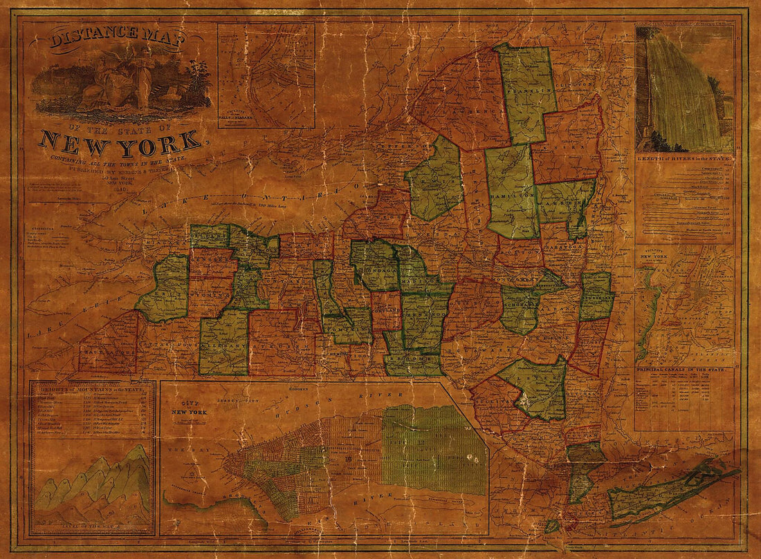 Distance Map of the State of New York : Containing All the Towns In the State 1849Distance Map of the State of New York : Containing All the Towns In the State 1849
- Regular price
-
$43.95 $150.95 - Regular price
-
$38.95 - Sale price
-
$43.95 $150.95
-
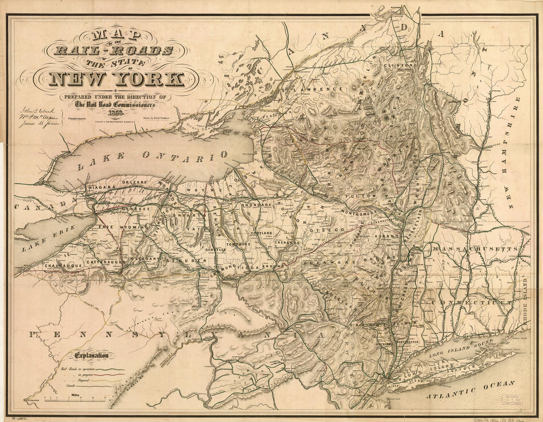 Roads of the State of New York Prepared Under the Direction of the Rail Road Commissioners, John S. Clark, William J. McAlpine, James B. Swain 1856Roads of the State of New York Prepared Under the Direction of the Rail Road Commissioners, John S. Clark, William J. McAlpine, James B. Swain 1856
- Regular price
-
$43.95 $83.95 - Regular price
-
$38.95 - Sale price
-
$43.95 $83.95
-
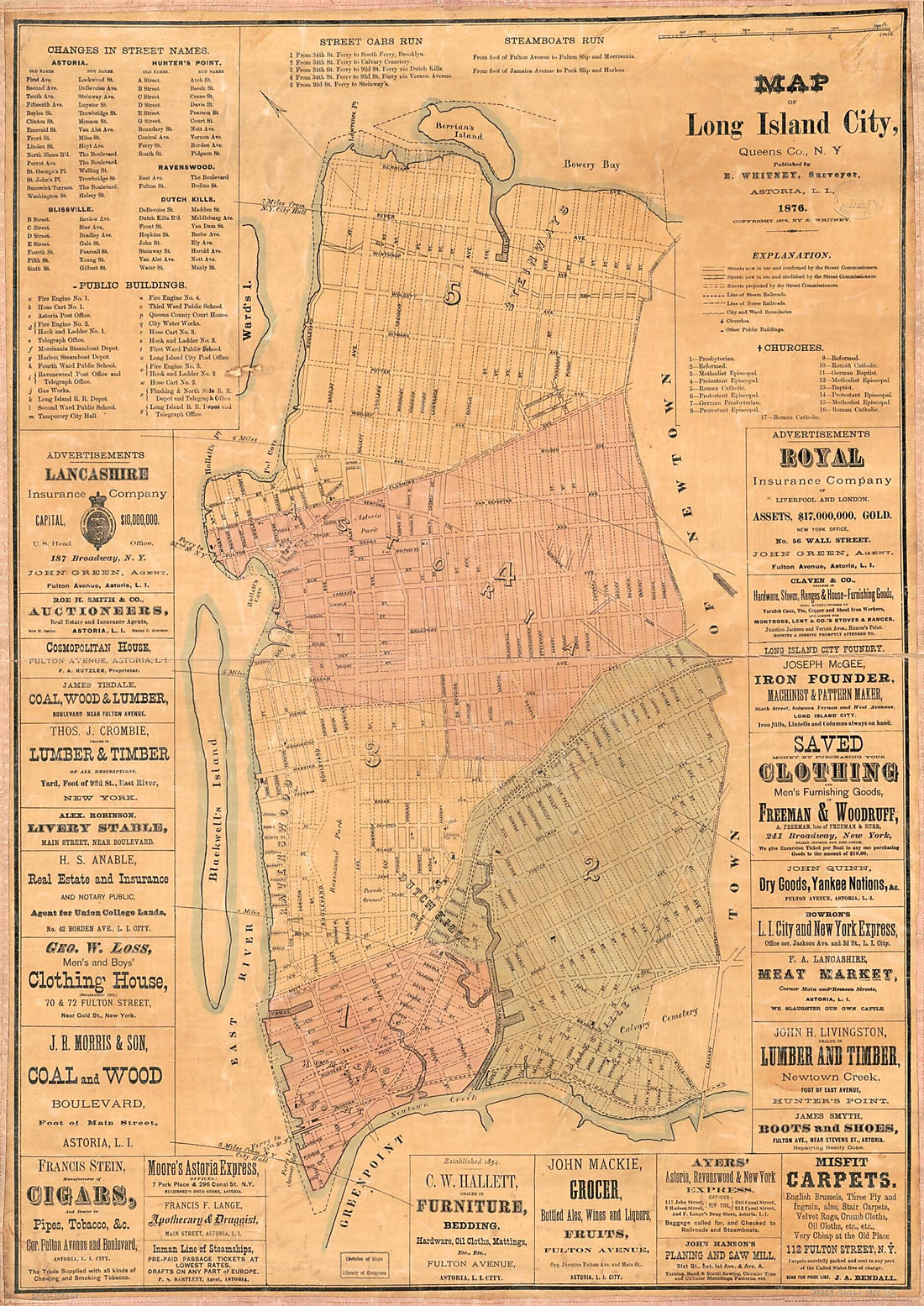 Map of Long Island City, Queens County, New York 1876Map of Long Island City, Queens County, New York 1876
- Regular price
-
$46.95 $143.95 - Regular price
-
$41.95 - Sale price
-
$46.95 $143.95
-
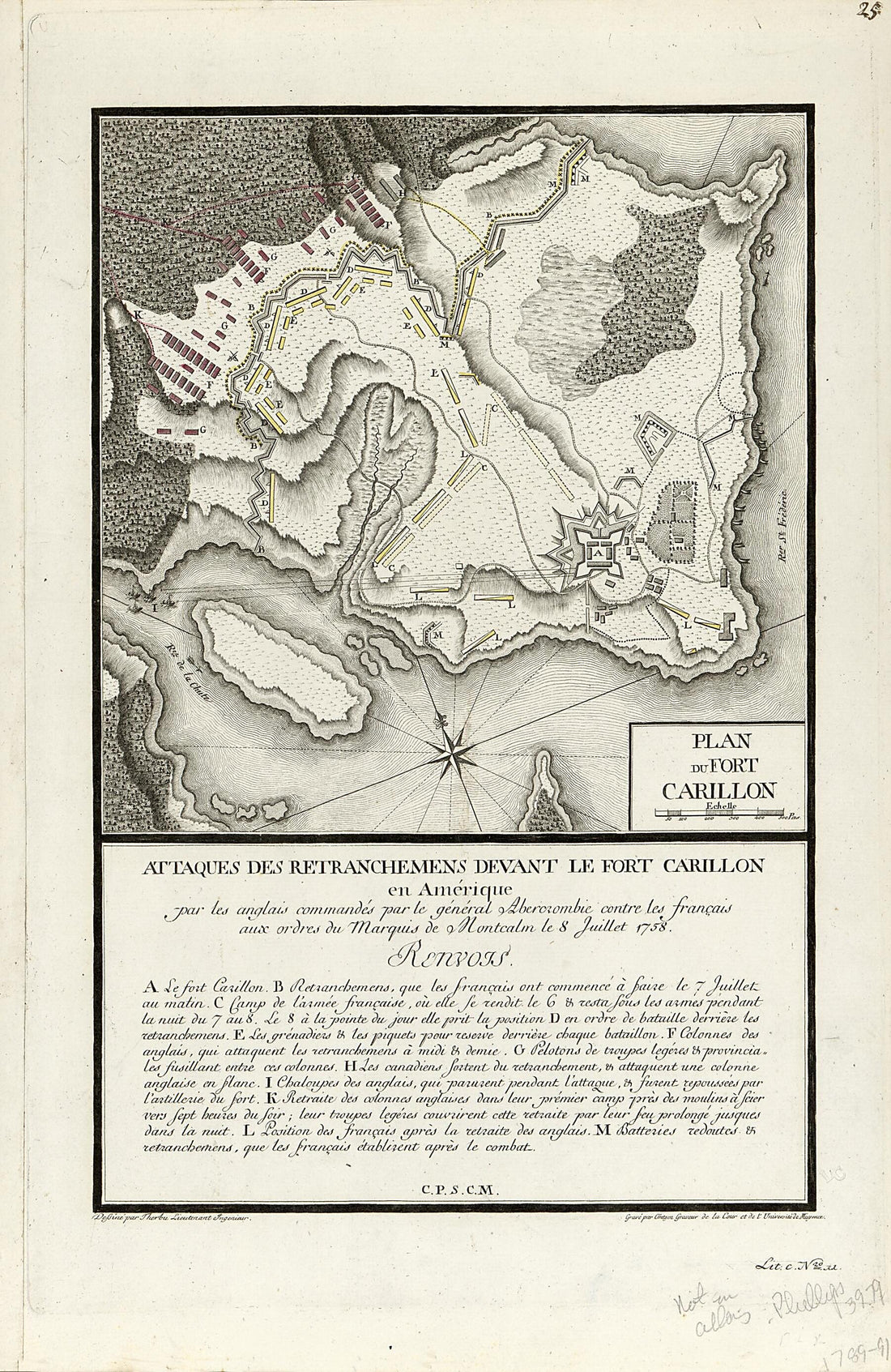 Attaques Des Retranchemens sic Devant Le Fort Carillon En Amérique : Par Les Anglais Commandés Par Le Général Abercrombie Contre Les Français Aux Ordres Du Marquis De Montcalm Le 8 Juillet 1758Attaques Des Retranchemens sic Devant Le Fort Carillon En Amérique : Par Les Anglais Commandés Par Le Général Abercrombie Contre Les Français Aux Ordres Du Marquis De Montcalm Le 8 Juillet 1758
- Regular price
-
$39.95 $99.95 - Regular price
-
$34.95 - Sale price
-
$39.95 $99.95


