707 products
-
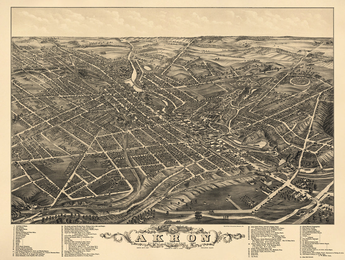 Panoramic View of the City of Akron, Summit County, Ohio 1882Panoramic View of the City of Akron, Summit County, Ohio 1882
- Regular price
-
$51.95 $165.95 - Regular price
-
$32.95 - Sale price
-
$51.95 $165.95
-
 Sugar Valley, New Westville from Plat Book of Preble County, Ohio : Compiled from County Records and Actual Surveys 1912Sugar Valley, New Westville from Plat Book of Preble County, Ohio : Compiled from County Records and Actual Surveys 1912
- Regular price
-
$49.95 $83.95 - Regular price
-
$11.95 - Sale price
-
$49.95 $83.95
-
 West Elkton from Plat Book of Preble County, Ohio : Compiled from County Records and Actual Surveys 1912West Elkton from Plat Book of Preble County, Ohio : Compiled from County Records and Actual Surveys 1912
- Regular price
-
$49.95 $83.95 - Regular price
-
$11.95 - Sale price
-
$49.95 $83.95
-
 Western, Eastern Hemisphere from Plat Book of Preble County, Ohio : Compiled from County Records and Actual Surveys 1912Western, Eastern Hemisphere from Plat Book of Preble County, Ohio : Compiled from County Records and Actual Surveys 1912
- Regular price
-
$49.95 $99.95 - Regular price
-
$24.95 - Sale price
-
$49.95 $99.95
-
 West Alexandria from Plat Book of Preble County, Ohio : Compiled from County Records and Actual Surveys 1912West Alexandria from Plat Book of Preble County, Ohio : Compiled from County Records and Actual Surveys 1912
- Regular price
-
$49.95 $83.95 - Regular price
-
$11.95 - Sale price
-
$49.95 $83.95
-
 Verona, West Sonora from Plat Book of Preble County, Ohio : Compiled from County Records and Actual Surveys 1912Verona, West Sonora from Plat Book of Preble County, Ohio : Compiled from County Records and Actual Surveys 1912
- Regular price
-
$49.95 $83.95 - Regular price
-
$12.95 - Sale price
-
$49.95 $83.95
-
 Principal Meridans and Base Lines from Plat Book of Preble County, Ohio : Compiled from County Records and Actual Surveys 1912Principal Meridans and Base Lines from Plat Book of Preble County, Ohio : Compiled from County Records and Actual Surveys 1912
- Regular price
-
$49.95 $99.95 - Regular price
-
$24.95 - Sale price
-
$49.95 $99.95
-
 Euphemia, Lewisburg from Plat Book of Preble County, Ohio : Compiled from County Records and Actual Surveys 1912Euphemia, Lewisburg from Plat Book of Preble County, Ohio : Compiled from County Records and Actual Surveys 1912
- Regular price
-
$49.95 $83.95 - Regular price
-
$11.95 - Sale price
-
$49.95 $83.95
-
 Gratis from Plat Book of Preble County, Ohio : Compiled from County Records and Actual Surveys 1912Gratis from Plat Book of Preble County, Ohio : Compiled from County Records and Actual Surveys 1912
- Regular price
-
$49.95 $99.95 - Regular price
-
$23.95 - Sale price
-
$49.95 $99.95
-
 Lanier from Plat Book of Preble County, Ohio : Compiled from County Records and Actual Surveys 1912Lanier from Plat Book of Preble County, Ohio : Compiled from County Records and Actual Surveys 1912
- Regular price
-
$49.95 $83.95 - Regular price
-
$12.95 - Sale price
-
$49.95 $83.95
-
 Camden from Plat Book of Preble County, Ohio : Compiled from County Records and Actual Surveys 1912Camden from Plat Book of Preble County, Ohio : Compiled from County Records and Actual Surveys 1912
- Regular price
-
$49.95 $99.95 - Regular price
-
$23.95 - Sale price
-
$49.95 $99.95
-
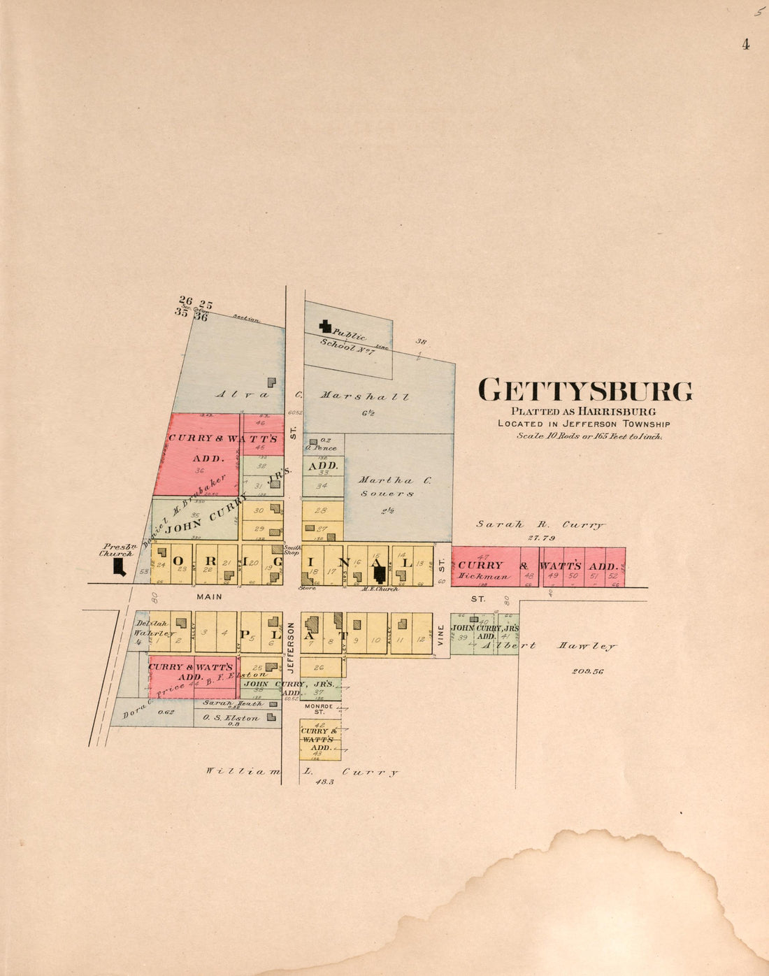 Gettysburg from Plat Book of Preble County, Ohio : Compiled from County Records and Actual Surveys 1912Gettysburg from Plat Book of Preble County, Ohio : Compiled from County Records and Actual Surveys 1912
- Regular price
-
$49.95 $83.95 - Regular price
-
$11.95 - Sale price
-
$49.95 $83.95


