707 products
-
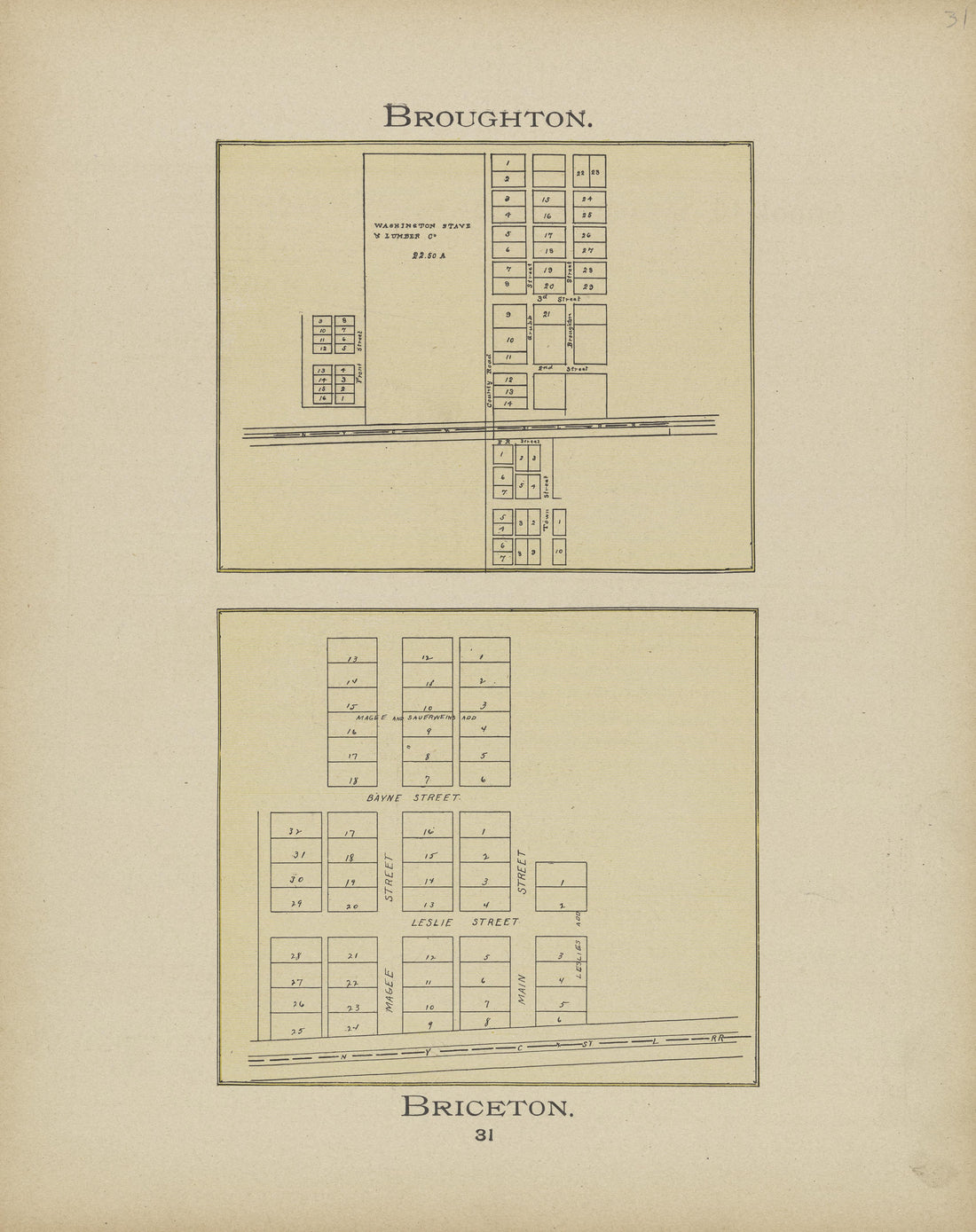 Broughton, Briceton from Atlas and Directory of Paulding County, Ohio : Containing Maps of Paulding County, Townships, and Incorporated Villages, Also Maps of the United States and State of Ohio : Together With an Outline … 1905Broughton, Briceton from Atlas and Directory of Paulding County, Ohio : Containing Maps of Paulding County, Townships, and Incorporated Villages, Also Maps of the United States and State of Ohio : Together With an Outline … 1905
- Regular price
-
$49.95 $83.95 - Regular price
-
$26.95 - Sale price
-
$49.95 $83.95
-
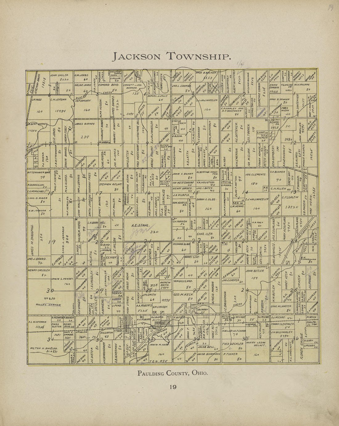 Jackson Township from Atlas and Directory of Paulding County, Ohio : Containing Maps of Paulding County, Townships, and Incorporated Villages, Also Maps of the United States and State of Ohio : Together With an Outline … 1905Jackson Township from Atlas and Directory of Paulding County, Ohio : Containing Maps of Paulding County, Townships, and Incorporated Villages, Also Maps of the United States and State of Ohio : Together With an Outline … 1905
- Regular price
-
$49.95 $83.95 - Regular price
-
$27.95 - Sale price
-
$49.95 $83.95
-
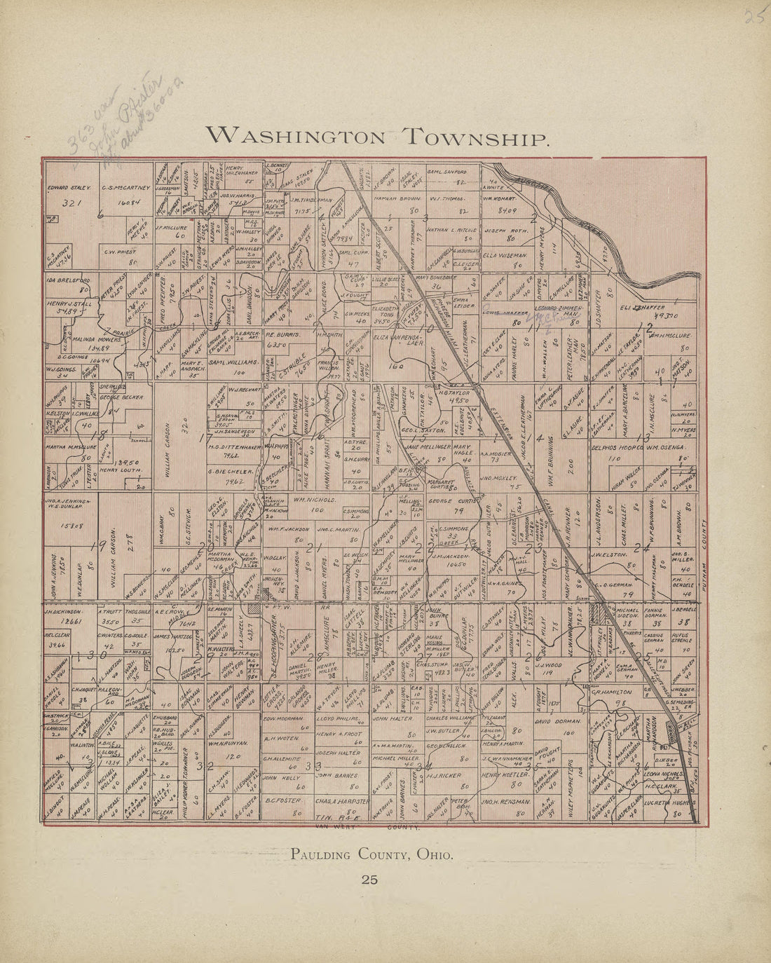 Washington Township from Atlas and Directory of Paulding County, Ohio : Containing Maps of Paulding County, Townships, and Incorporated Villages, Also Maps of the United States and State of Ohio : Together With an Outline … 1905Washington Township from Atlas and Directory of Paulding County, Ohio : Containing Maps of Paulding County, Townships, and Incorporated Villages, Also Maps of the United States and State of Ohio : Together With an Outline … 1905
- Regular price
-
$49.95 $83.95 - Regular price
-
$27.95 - Sale price
-
$49.95 $83.95
-
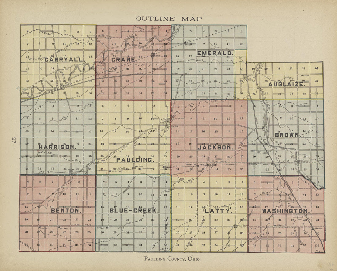 Outline Map from Atlas and Directory of Paulding County, Ohio : Containing Maps of Paulding County, Townships, and Incorporated Villages, Also Maps of the United States and State of Ohio : Together With an Outline … 1905Outline Map from Atlas and Directory of Paulding County, Ohio : Containing Maps of Paulding County, Townships, and Incorporated Villages, Also Maps of the United States and State of Ohio : Together With an Outline … 1905
- Regular price
-
$49.95 $83.95 - Regular price
-
$26.95 - Sale price
-
$49.95 $83.95
-
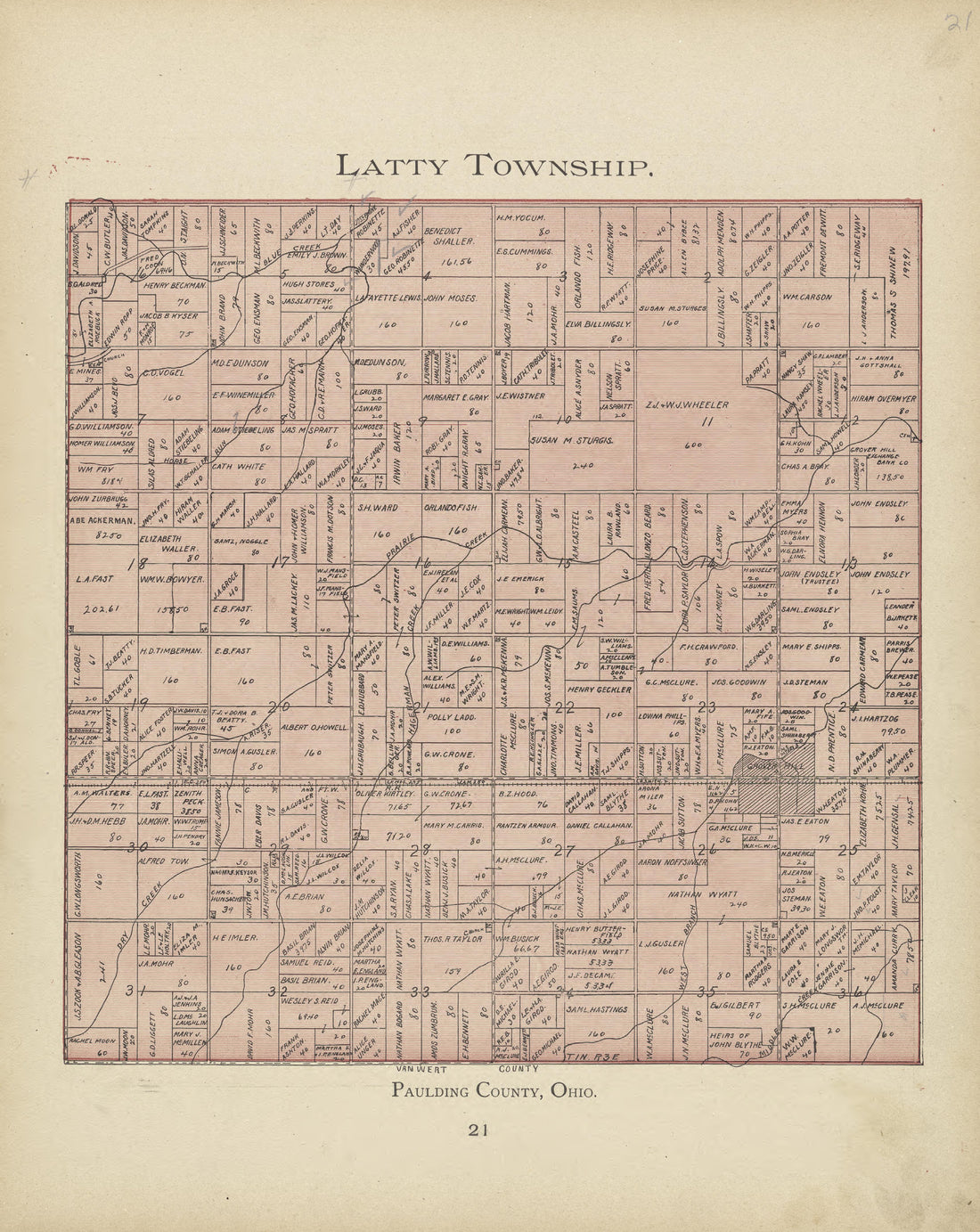 Latty Township from Atlas and Directory of Paulding County, Ohio : Containing Maps of Paulding County, Townships, and Incorporated Villages, Also Maps of the United States and State of Ohio : Together With an Outline … 1905Latty Township from Atlas and Directory of Paulding County, Ohio : Containing Maps of Paulding County, Townships, and Incorporated Villages, Also Maps of the United States and State of Ohio : Together With an Outline … 1905
- Regular price
-
$49.95 $83.95 - Regular price
-
$26.95 - Sale price
-
$49.95 $83.95
-
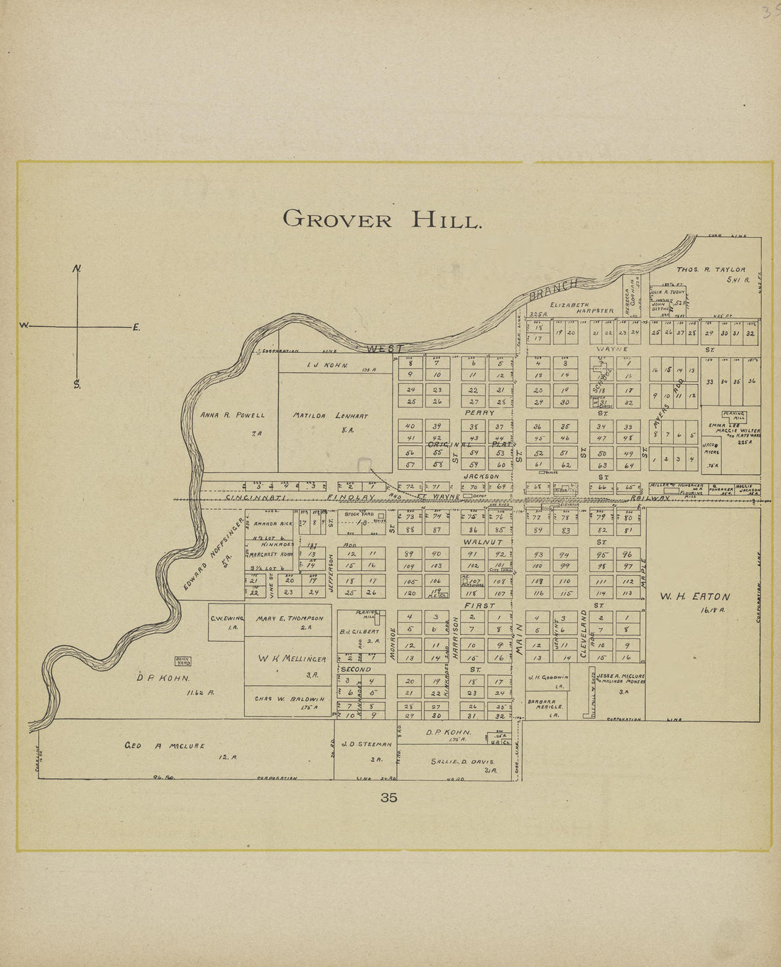 Grover Hill from Atlas and Directory of Paulding County, Ohio : Containing Maps of Paulding County, Townships, and Incorporated Villages, Also Maps of the United States and State of Ohio : Together With an Outline … 1905Grover Hill from Atlas and Directory of Paulding County, Ohio : Containing Maps of Paulding County, Townships, and Incorporated Villages, Also Maps of the United States and State of Ohio : Together With an Outline … 1905
- Regular price
-
$49.95 $83.95 - Regular price
-
$26.95 - Sale price
-
$49.95 $83.95
-
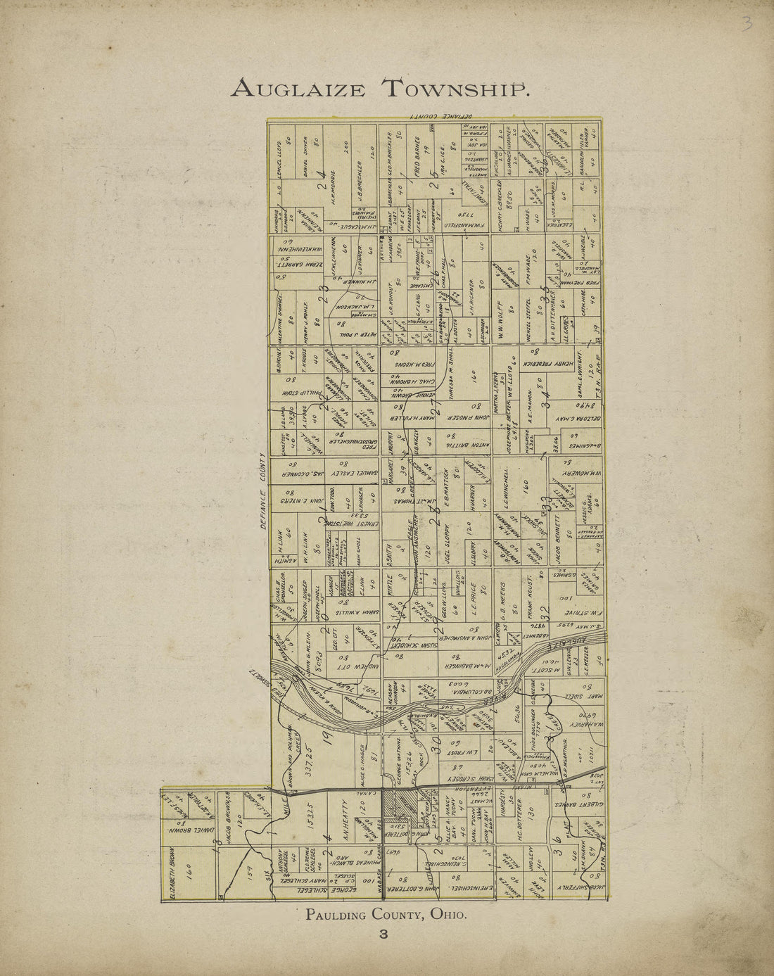 Auglaize Township from Atlas and Directory of Paulding County, Ohio : Containing Maps of Paulding County, Townships, and Incorporated Villages, Also Maps of the United States and State of Ohio : Together With an Outline … 1905Auglaize Township from Atlas and Directory of Paulding County, Ohio : Containing Maps of Paulding County, Townships, and Incorporated Villages, Also Maps of the United States and State of Ohio : Together With an Outline … 1905
- Regular price
-
$49.95 $83.95 - Regular price
-
$27.95 - Sale price
-
$49.95 $83.95
-
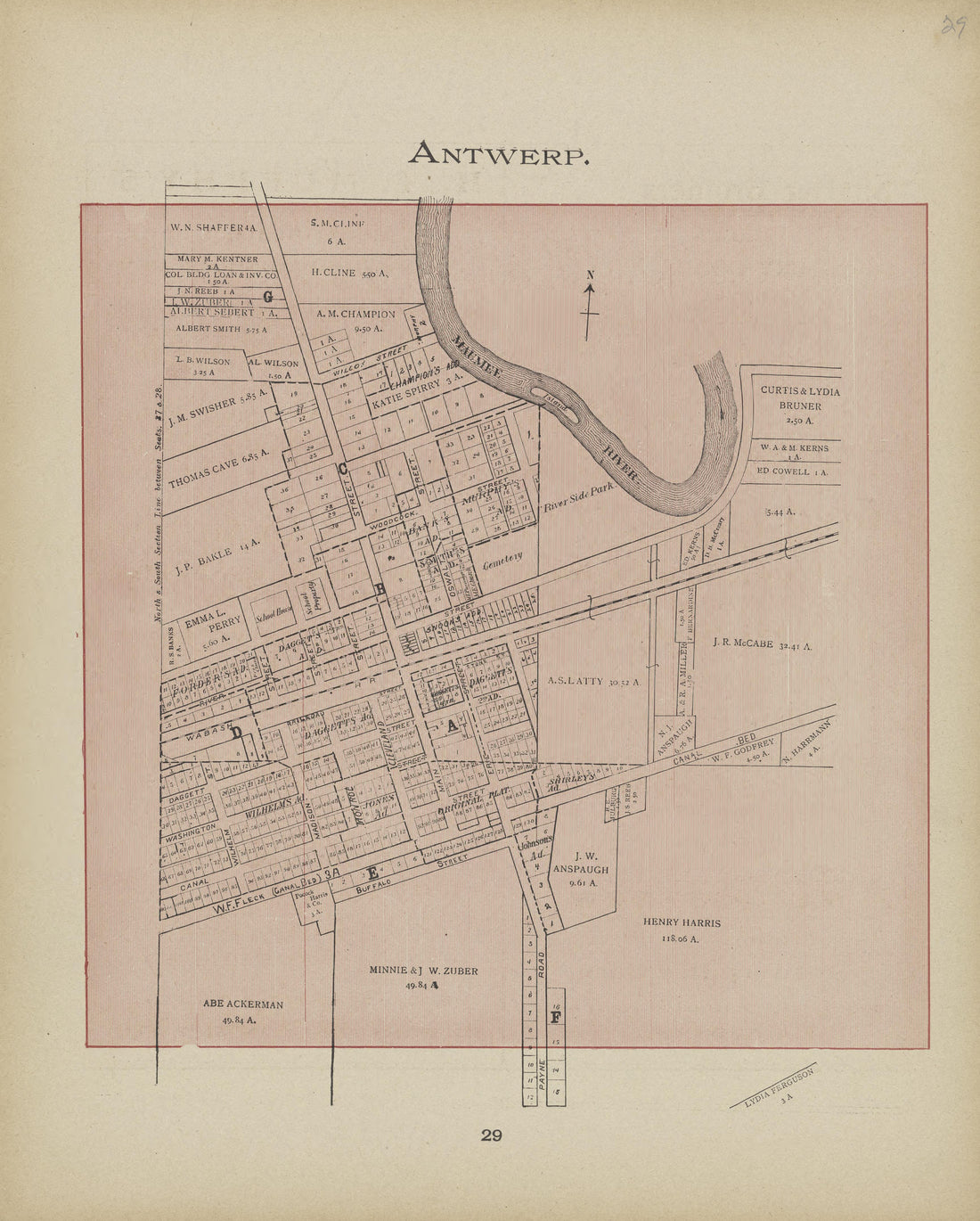 Antwerp from Atlas and Directory of Paulding County, Ohio : Containing Maps of Paulding County, Townships, and Incorporated Villages, Also Maps of the United States and State of Ohio : Together With an Outline … 1905Antwerp from Atlas and Directory of Paulding County, Ohio : Containing Maps of Paulding County, Townships, and Incorporated Villages, Also Maps of the United States and State of Ohio : Together With an Outline … 1905
- Regular price
-
$49.95 $83.95 - Regular price
-
$27.95 - Sale price
-
$49.95 $83.95
-
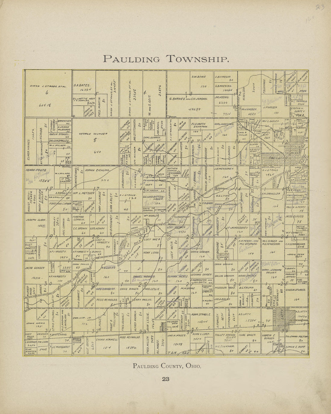 Paulding Township from Atlas and Directory of Paulding County, Ohio : Containing Maps of Paulding County, Townships, and Incorporated Villages, Also Maps of the United States and State of Ohio : Together With an Outline … 1905Paulding Township from Atlas and Directory of Paulding County, Ohio : Containing Maps of Paulding County, Townships, and Incorporated Villages, Also Maps of the United States and State of Ohio : Together With an Outline … 1905
- Regular price
-
$49.95 $83.95 - Regular price
-
$27.95 - Sale price
-
$49.95 $83.95
-
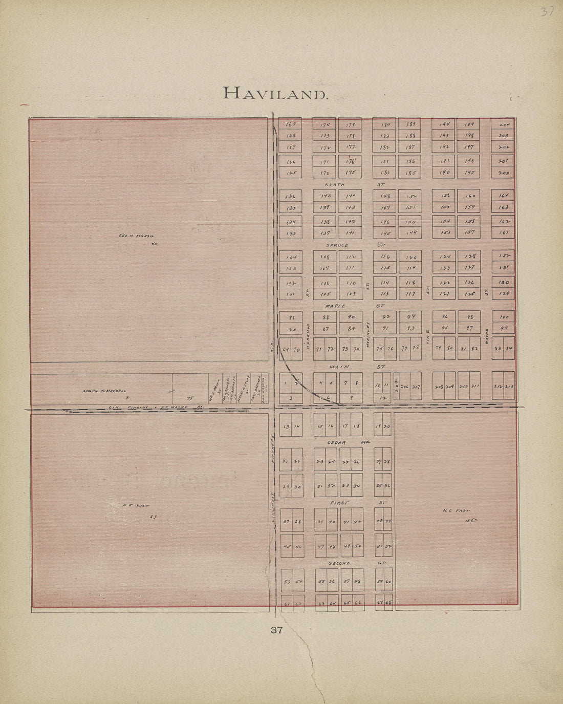 Haviland from Atlas and Directory of Paulding County, Ohio : Containing Maps of Paulding County, Townships, and Incorporated Villages, Also Maps of the United States and State of Ohio : Together With an Outline … 1905Haviland from Atlas and Directory of Paulding County, Ohio : Containing Maps of Paulding County, Townships, and Incorporated Villages, Also Maps of the United States and State of Ohio : Together With an Outline … 1905
- Regular price
-
$49.95 $83.95 - Regular price
-
$27.95 - Sale price
-
$49.95 $83.95
-
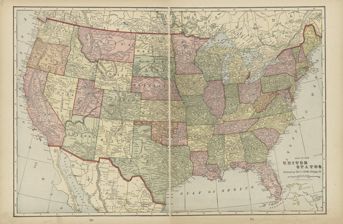 United States from Atlas and Directory of Paulding County, Ohio : Containing Maps of Paulding County, Townships, and Incorporated Villages, Also Maps of the United States and State of Ohio : Together With an Outline … 1905United States from Atlas and Directory of Paulding County, Ohio : Containing Maps of Paulding County, Townships, and Incorporated Villages, Also Maps of the United States and State of Ohio : Together With an Outline … 1905
- Regular price
-
$49.95 $99.95 - Regular price
-
$36.95 - Sale price
-
$49.95 $99.95
-
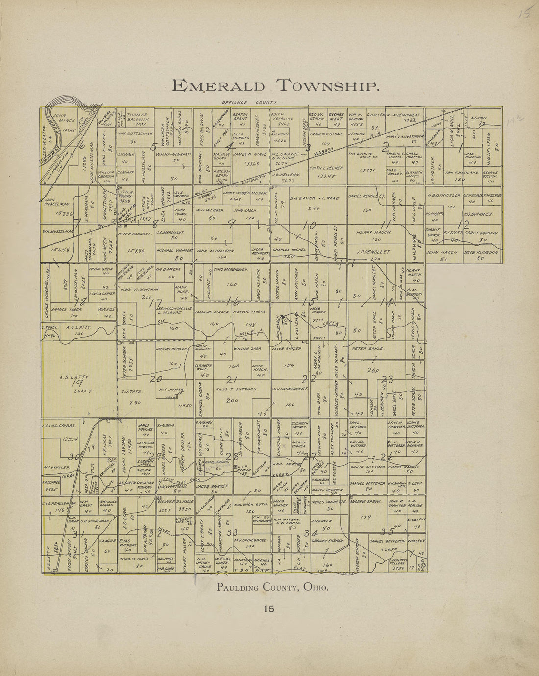 Emerald Township from Atlas and Directory of Paulding County, Ohio : Containing Maps of Paulding County, Townships, and Incorporated Villages, Also Maps of the United States and State of Ohio : Together With an Outline … 1905Emerald Township from Atlas and Directory of Paulding County, Ohio : Containing Maps of Paulding County, Townships, and Incorporated Villages, Also Maps of the United States and State of Ohio : Together With an Outline … 1905
- Regular price
-
$49.95 $83.95 - Regular price
-
$27.95 - Sale price
-
$49.95 $83.95


