90 products
-
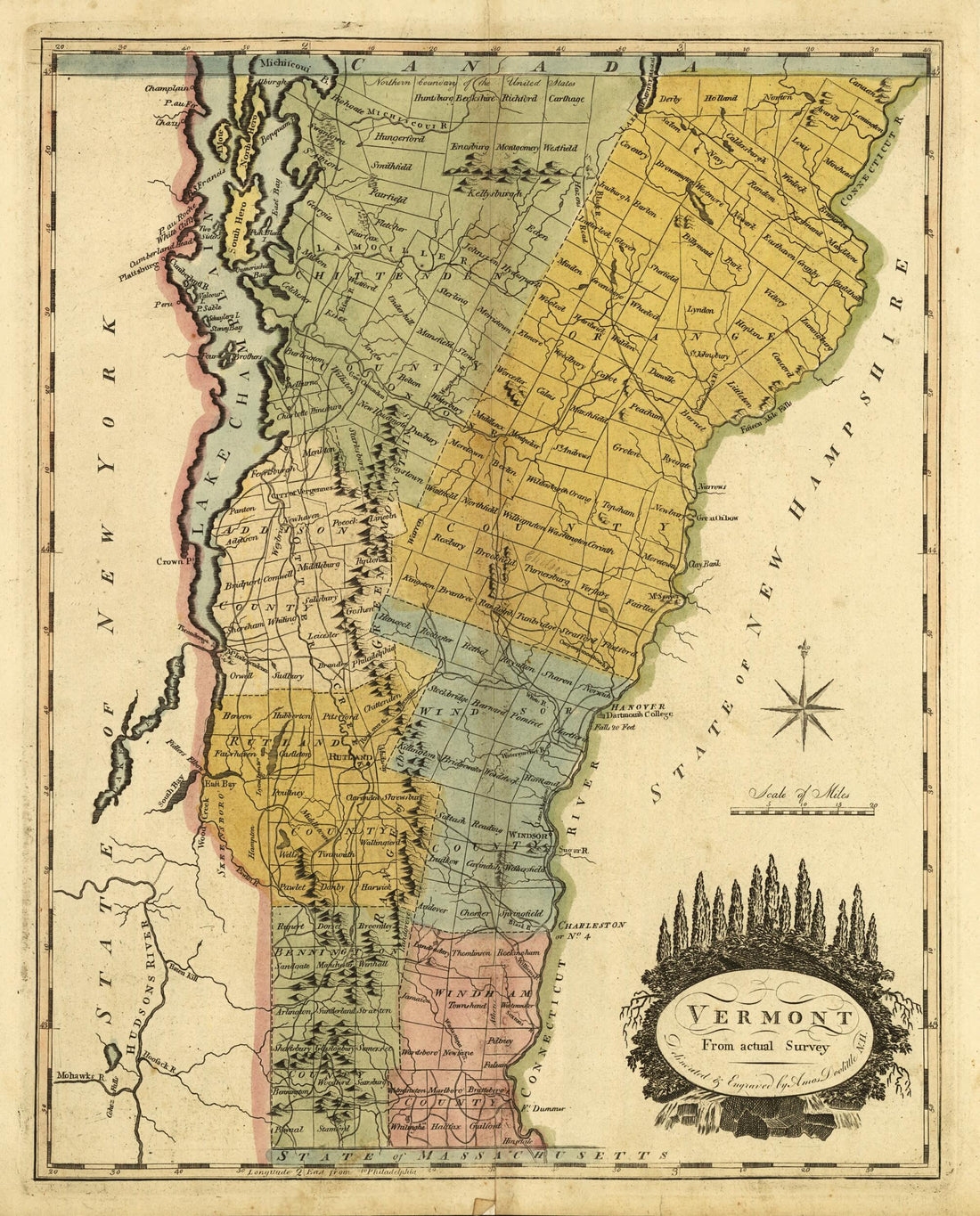 Vermont, from Actual Survey 1814Vermont, from Actual Survey 1814
- Regular price
-
$39.95 $83.95 - Regular price
-
$29.95 - Sale price
-
$39.95 $83.95
-
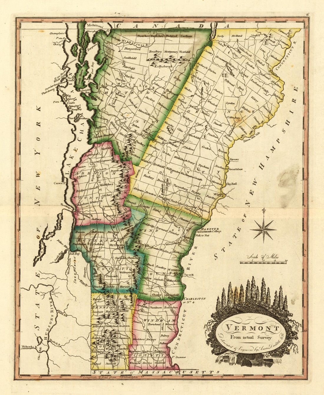 Vermont, from Actual Survey 1810Vermont, from Actual Survey 1810
- Regular price
-
$39.95 $83.95 - Regular price
-
$29.95 - Sale price
-
$39.95 $83.95
-
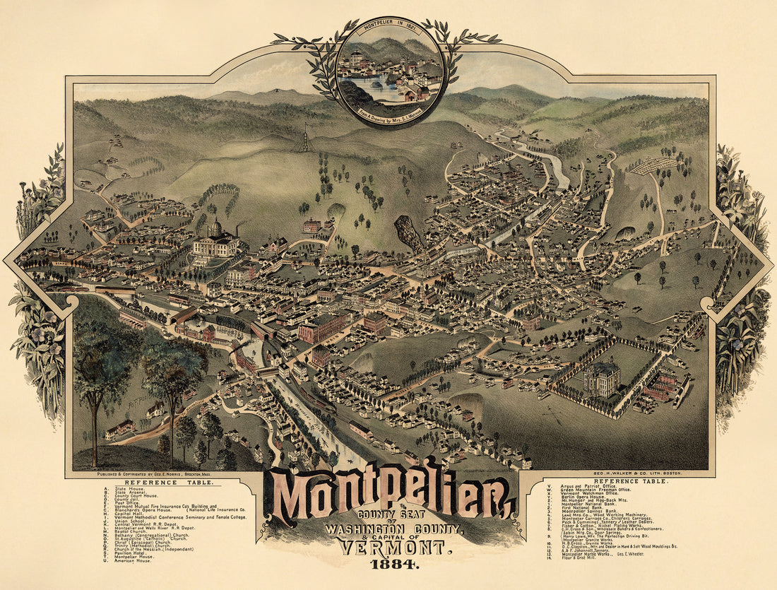 Montpelier, County Seat of Washington County & Capital of Vermont : 1884Montpelier, County Seat of Washington County & Capital of Vermont : 1884
- Regular price
-
$43.95 $235.95 - Regular price
-
$32.95 - Sale price
-
$43.95 $235.95
-
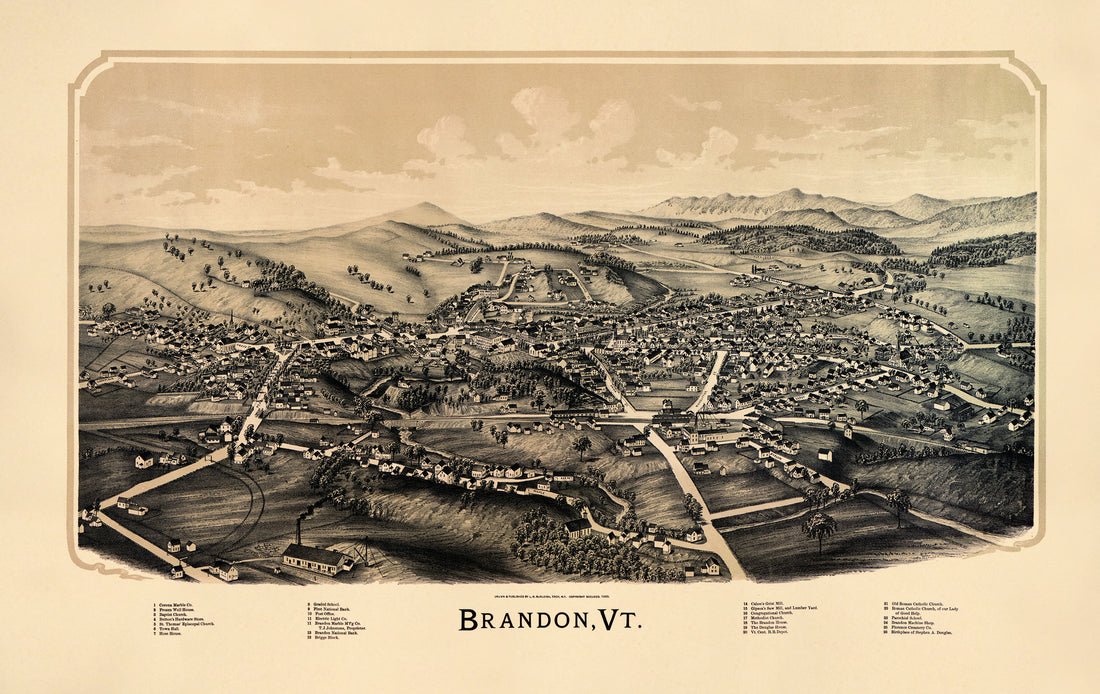 Brandon, Vermont (Brandon, Vermont) 1890Brandon, Vermont (Brandon, Vermont) 1890
- Regular price
-
$46.95 $154.95 - Regular price
-
$41.95 - Sale price
-
$46.95 $154.95
-
 Vermont from a New and Elegant General Atlas, Containing Maps of Each of the United States 1817Vermont from a New and Elegant General Atlas, Containing Maps of Each of the United States 1817
- Regular price
-
$39.95 $93.95 - Regular price
-
$36.95 - Sale price
-
$39.95 $93.95
-
 Vermont from Riddell's Greene County Atlas, 1896Vermont from Riddell's Greene County Atlas, 1896
- Regular price
-
$39.95 $93.95 - Regular price
-
$37.95 - Sale price
-
$39.95 $93.95
-
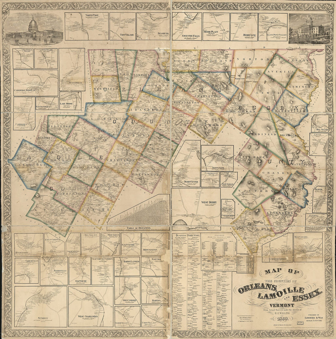 Map of the Counties of Orleans, Lamoille, and Essex, Vermont 1859Map of the Counties of Orleans, Lamoille, and Essex, Vermont 1859
- Regular price
-
$43.95 $198.95 - Regular price
-
$38.95 - Sale price
-
$43.95 $198.95
-
 Map of the County of Essex, Vermont 1878Map of the County of Essex, Vermont 1878
- Regular price
-
$43.95 $205.95 - Regular price
-
$38.95 - Sale price
-
$43.95 $205.95
-
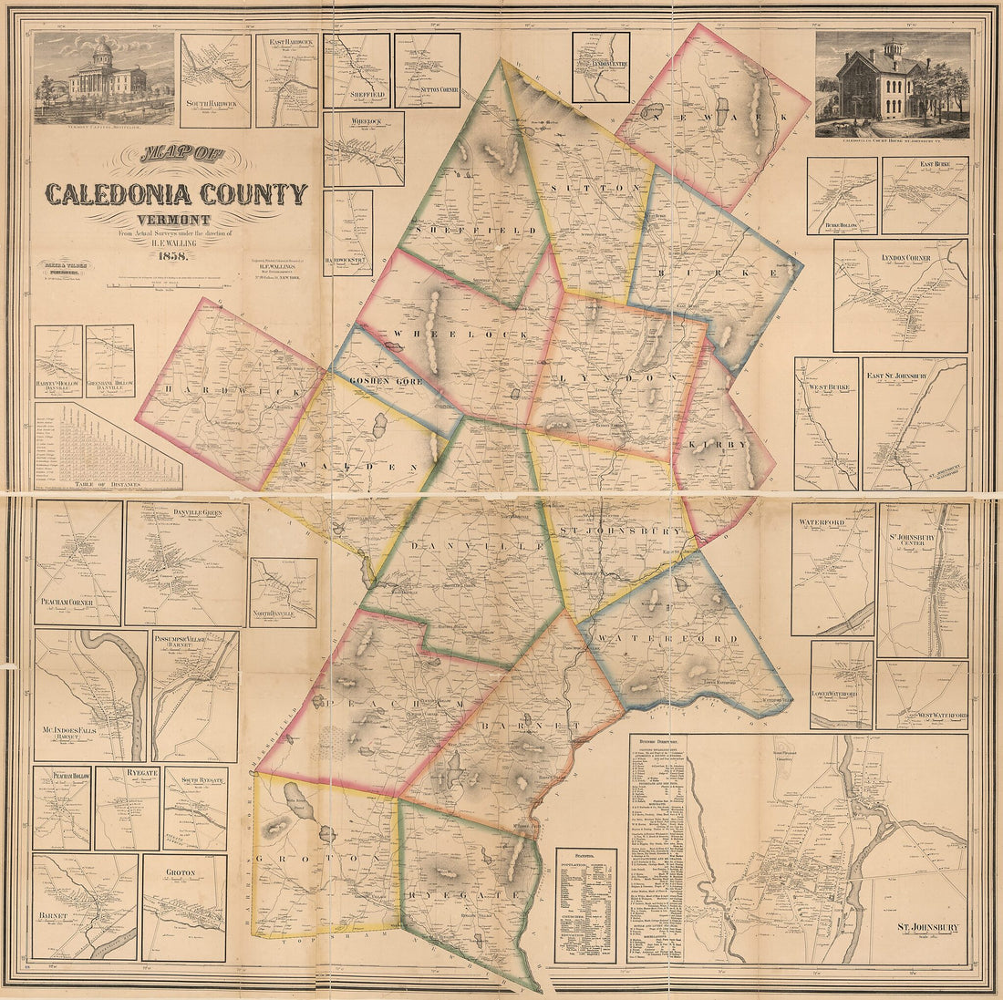 Map of Caledonia County, Vermont 1858Map of Caledonia County, Vermont 1858
- Regular price
-
$43.95 $198.95 - Regular price
-
$38.95 - Sale price
-
$43.95 $198.95
-
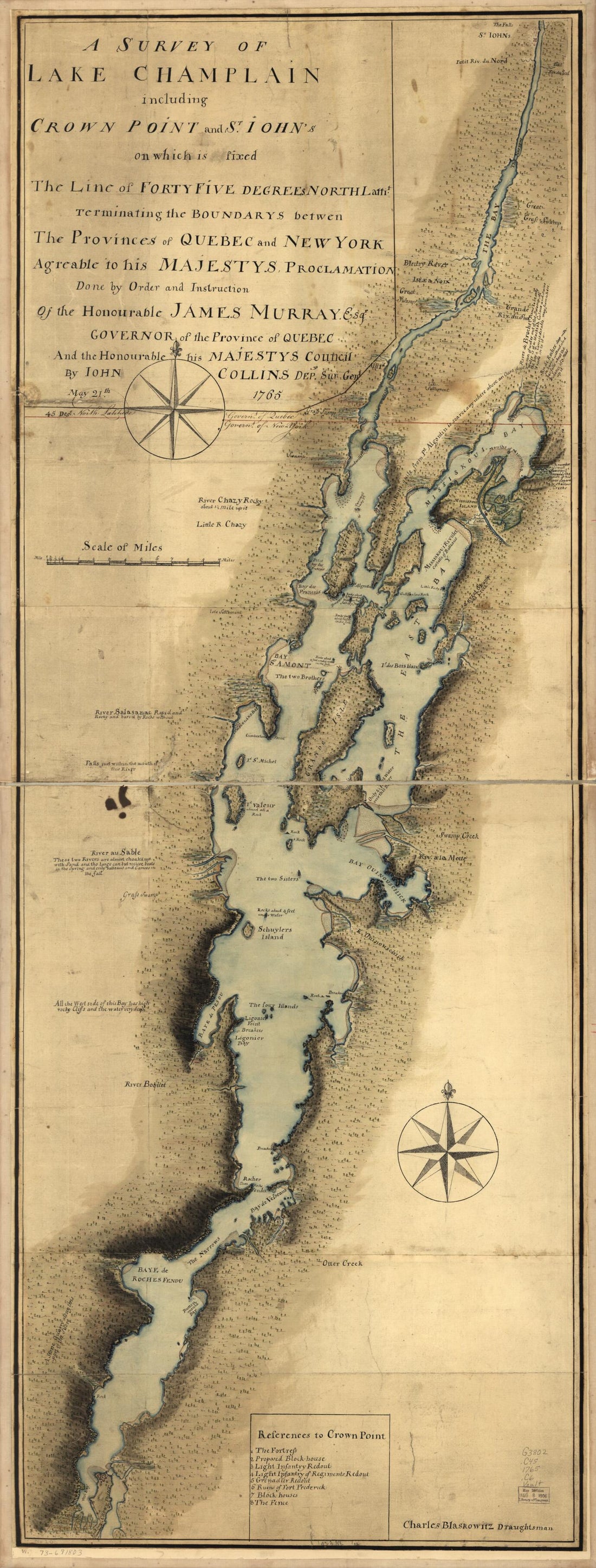 A Survey of Lake Champlain Including Crown Point and St. Iohn's On Which Is Fixed the Line of Forty Five Degrees North Lattit. Terminating the Boundarys Between the Provinces of Quebec and New York Agreeable to His Majesty's Proclamation Done by Order...A Survey of Lake Champlain Including Crown Point and St. Iohn's On Which Is Fixed the Line of Forty Five Degrees North Lattit. Terminating the Boundarys Between the Provinces of Quebec and New York Agreeable to His Majesty's Proclamation Done by Order...
- Regular price
-
$46.95 $101.95 - Regular price
-
$41.95 - Sale price
-
$46.95 $101.95
-
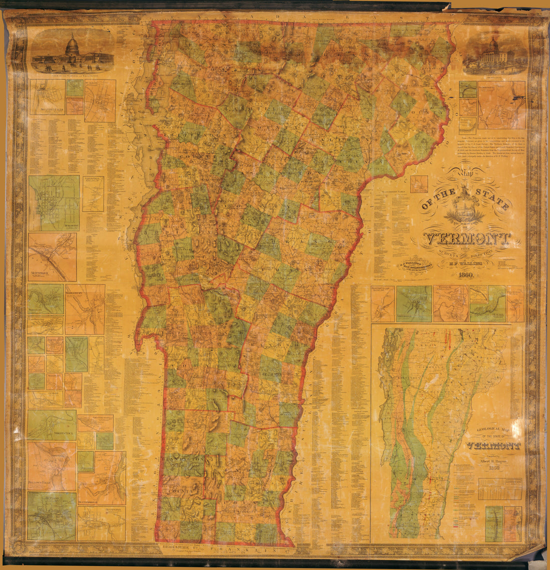 Map of the State of Vermont in 1860Map of the State of Vermont in 1860
- Regular price
-
$43.95 $204.95 - Regular price
-
$38.95 - Sale price
-
$43.95 $204.95
-
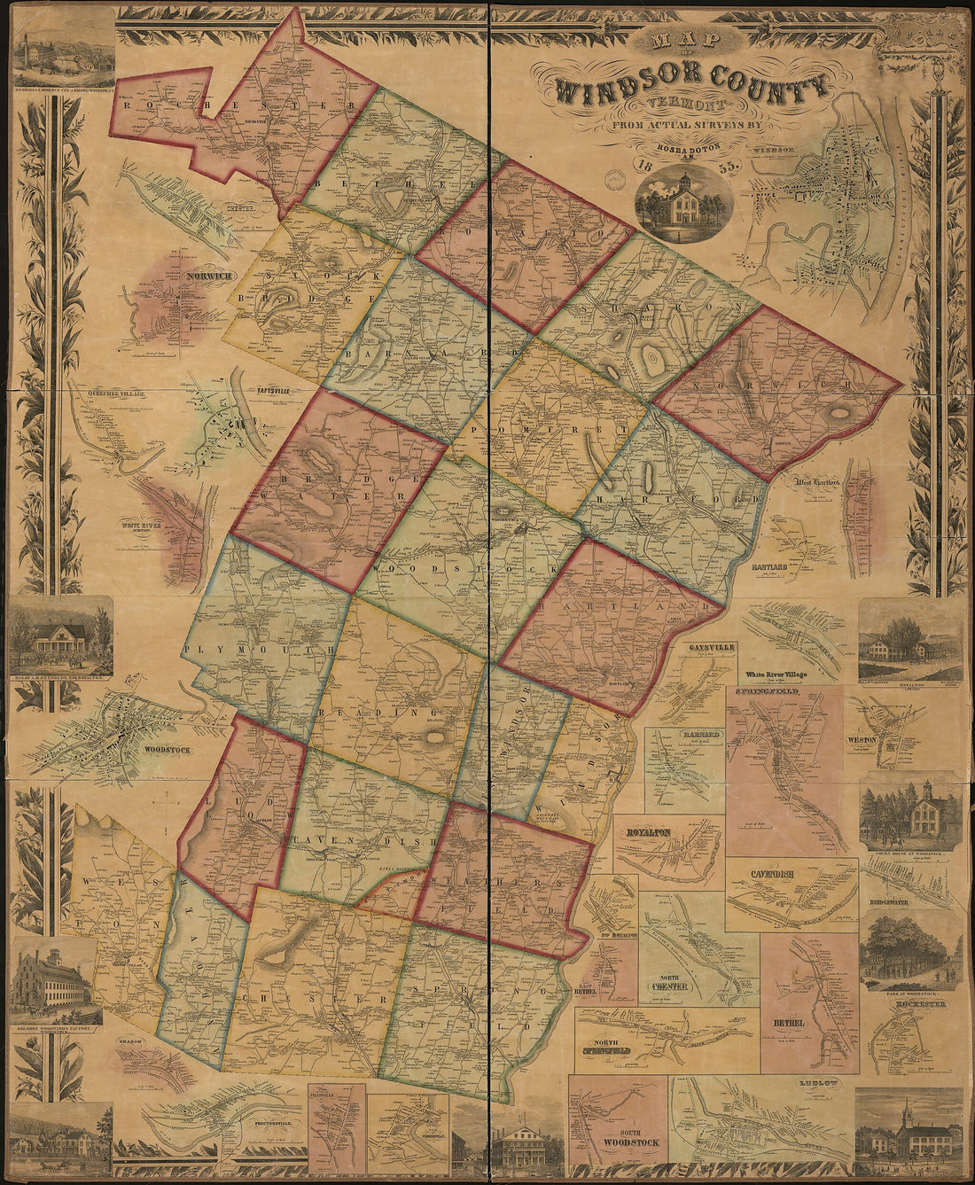 Map of Windsor County, Vermont in 1855Map of Windsor County, Vermont in 1855
- Regular price
-
$43.95 $215.95 - Regular price
-
$38.95 - Sale price
-
$43.95 $215.95


