428 products
-
 History of the United States Brought Down to July 1882 from Historical Hand-atlas, Illustrated, Containing Large Scale Copper Plate Maps of Each State and Territory of the United States, and the Provinces of Canada, Together With a Complete Reference ...History of the United States Brought Down to July 1882 from Historical Hand-atlas, Illustrated, Containing Large Scale Copper Plate Maps of Each State and Territory of the United States, and the Provinces of Canada, Together With a Complete Reference ...
- Regular price
-
$49.95 $88.95 - Regular price
-
$23.95 - Sale price
-
$49.95 $88.95
-
 Mississippi - Continued, Louisiana from Historical Hand-atlas, Illustrated, Containing Large Scale Copper Plate Maps of Each State and Territory of the United States, and the Provinces of Canada, Together With a Complete Reference Map of the World, �...Mississippi - Continued, Louisiana from Historical Hand-atlas, Illustrated, Containing Large Scale Copper Plate Maps of Each State and Territory of the United States, and the Provinces of Canada, Together With a Complete Reference Map of the World, �...
- Regular price
-
$49.95 $99.95 - Regular price
-
$21.95 - Sale price
-
$49.95 $99.95
-
 Personal History Department of Pleasants County from Historical Hand-atlas, Illustrated, Containing Large Scale Copper Plate Maps of Each State and Territory of the United States, and the Provinces of Canada, Together With a Complete Reference Map of ...Personal History Department of Pleasants County from Historical Hand-atlas, Illustrated, Containing Large Scale Copper Plate Maps of Each State and Territory of the United States, and the Provinces of Canada, Together With a Complete Reference Map of ...
- Regular price
-
$49.95 $88.95 - Regular price
-
$24.95 - Sale price
-
$49.95 $88.95
-
 Personal History Department of Pleasants County - Continued from Historical Hand-atlas, Illustrated, Containing Large Scale Copper Plate Maps of Each State and Territory of the United States, and the Provinces of Canada, Together With a Complete Refer...Personal History Department of Pleasants County - Continued from Historical Hand-atlas, Illustrated, Containing Large Scale Copper Plate Maps of Each State and Territory of the United States, and the Provinces of Canada, Together With a Complete Refer...
- Regular price
-
$49.95 $99.95 - Regular price
-
$21.95 - Sale price
-
$49.95 $99.95
-
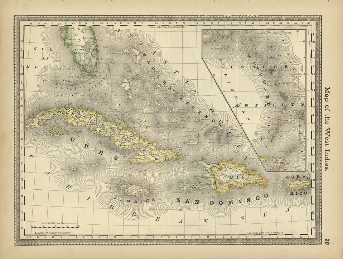 Map of the West Indies from Historical Hand-atlas, Illustrated, Containing Large Scale Copper Plate Maps of Each State and Territory of the United States, and the Provinces of Canada, Together With a Complete Reference Map of the World, … 1882Map of the West Indies from Historical Hand-atlas, Illustrated, Containing Large Scale Copper Plate Maps of Each State and Territory of the United States, and the Provinces of Canada, Together With a Complete Reference Map of the World, … 1882
- Regular price
-
$49.95 $88.95 - Regular price
-
$24.95 - Sale price
-
$49.95 $88.95
-
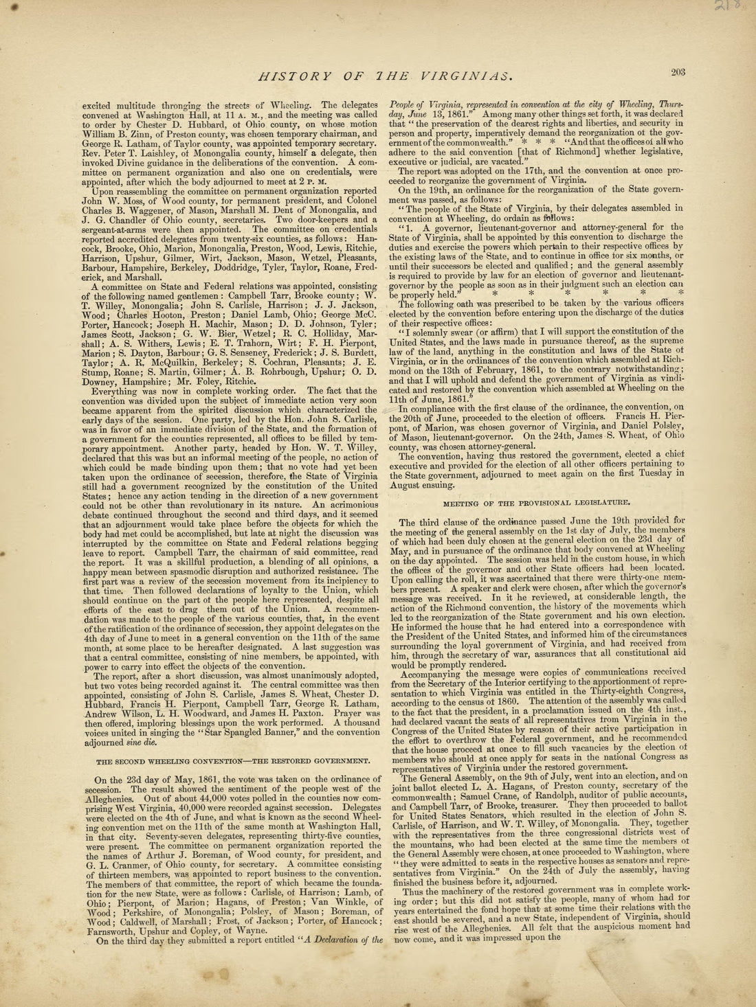 History of the Virginias - Continued from Historical Hand-atlas, Illustrated, Containing Large Scale Copper Plate Maps of Each State and Territory of the United States, and the Provinces of Canada, Together With a Complete Reference Map of the World, ...History of the Virginias - Continued from Historical Hand-atlas, Illustrated, Containing Large Scale Copper Plate Maps of Each State and Territory of the United States, and the Provinces of Canada, Together With a Complete Reference Map of the World, ...
- Regular price
-
$49.95 $88.95 - Regular price
-
$24.95 - Sale price
-
$49.95 $88.95
-
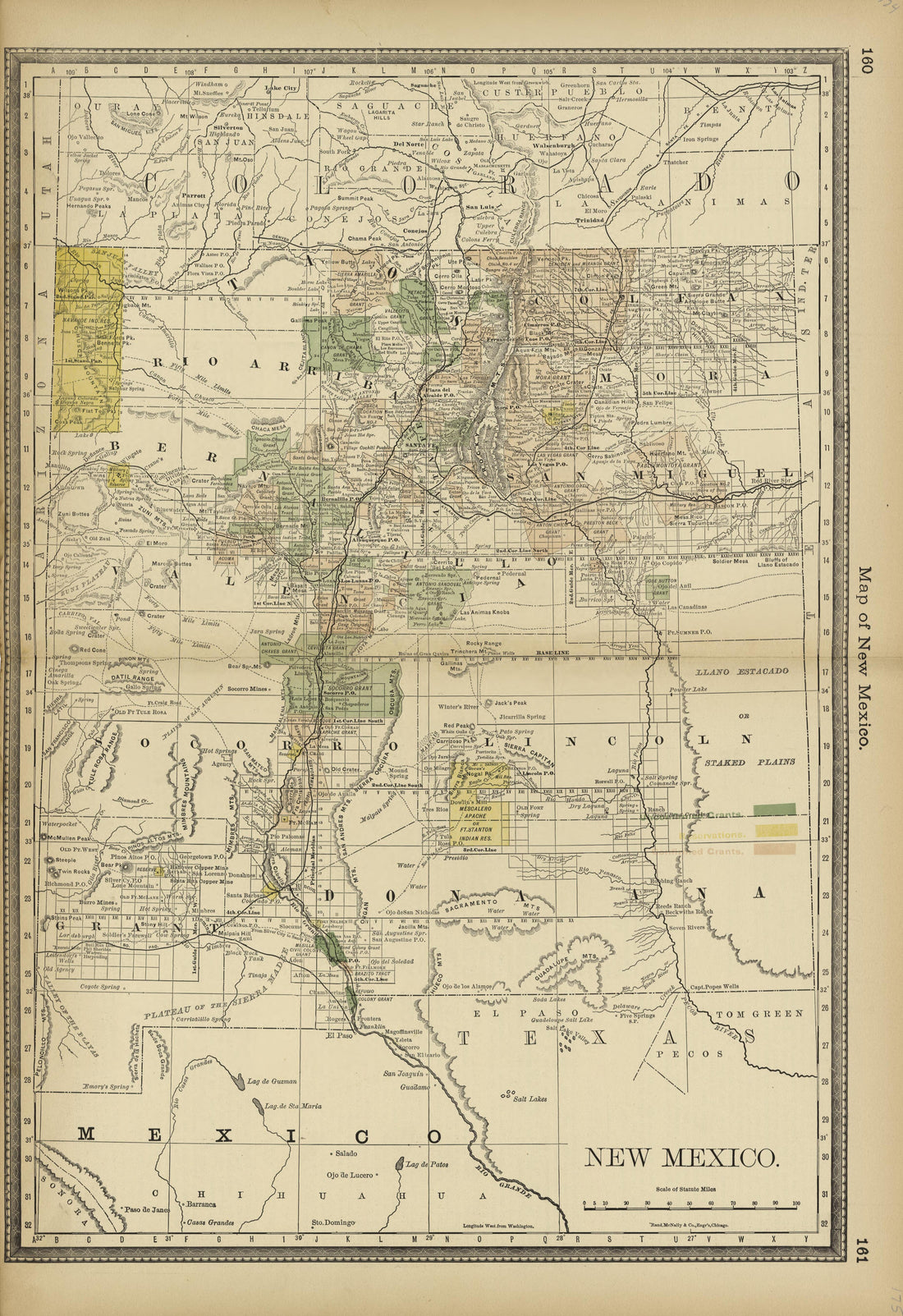 Map of New Mexico from Historical Hand-atlas, Illustrated, Containing Large Scale Copper Plate Maps of Each State and Territory of the United States, and the Provinces of Canada, Together With a Complete Reference Map of the World, … 1882Map of New Mexico from Historical Hand-atlas, Illustrated, Containing Large Scale Copper Plate Maps of Each State and Territory of the United States, and the Provinces of Canada, Together With a Complete Reference Map of the World, … 1882
- Regular price
-
$49.95 $99.95 - Regular price
-
$36.95 - Sale price
-
$49.95 $99.95
-
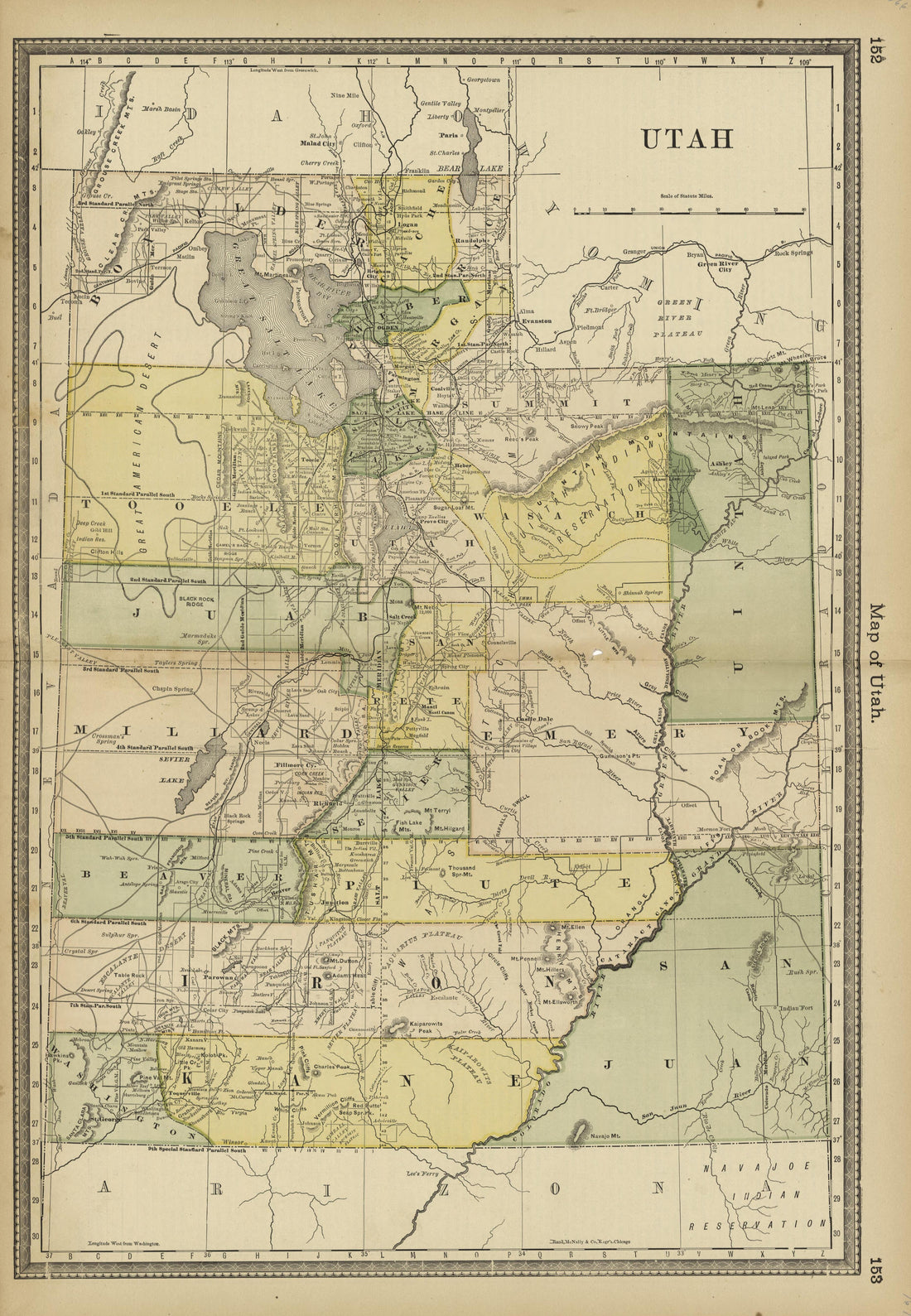 Map of Utah from Historical Hand-atlas, Illustrated, Containing Large Scale Copper Plate Maps of Each State and Territory of the United States, and the Provinces of Canada, Together With a Complete Reference Map of the World, … 1882Map of Utah from Historical Hand-atlas, Illustrated, Containing Large Scale Copper Plate Maps of Each State and Territory of the United States, and the Provinces of Canada, Together With a Complete Reference Map of the World, … 1882
- Regular price
-
$49.95 $99.95 - Regular price
-
$36.95 - Sale price
-
$49.95 $99.95
-
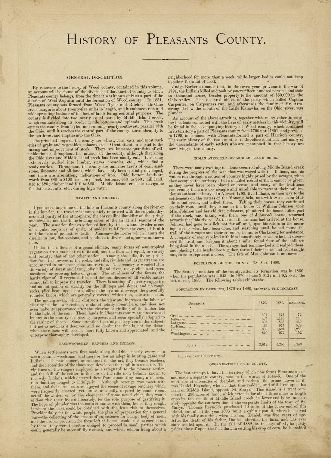 History of Pleasants County from Historical Hand-atlas, Illustrated, Containing Large Scale Copper Plate Maps of Each State and Territory of the United States, and the Provinces of Canada, Together With a Complete Reference Map of the World, … 1882History of Pleasants County from Historical Hand-atlas, Illustrated, Containing Large Scale Copper Plate Maps of Each State and Territory of the United States, and the Provinces of Canada, Together With a Complete Reference Map of the World, … 1882
- Regular price
-
$49.95 $88.95 - Regular price
-
$23.95 - Sale price
-
$49.95 $88.95
-
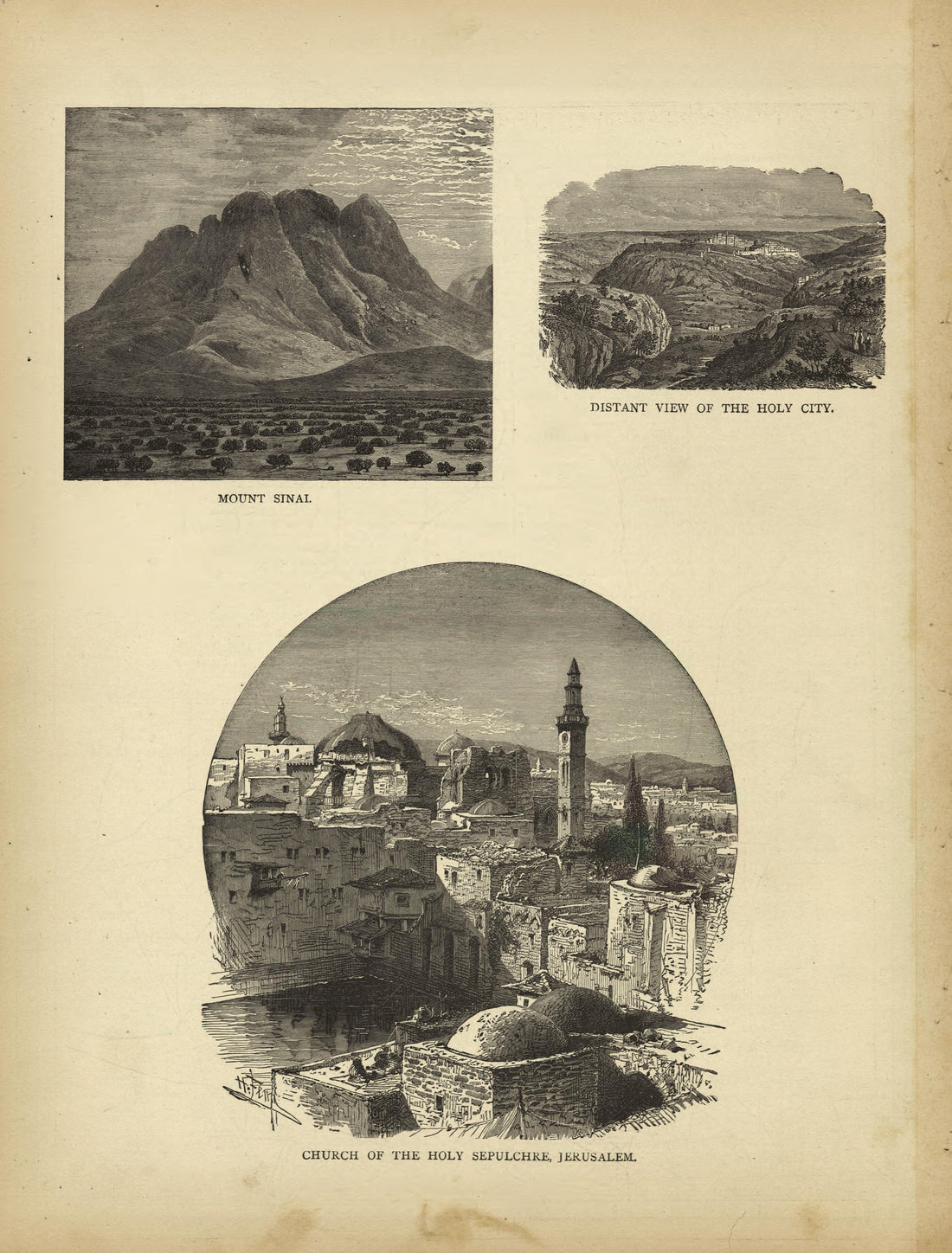 Mt Sinai, Distant View of the Holy City, Church of the Holy Sepulchre, Jerusalem from Historical Hand-atlas, Illustrated, Containing Large Scale Copper Plate Maps of Each State and Territory of the United States, and the Provinces of Canada, Together ...Mt Sinai, Distant View of the Holy City, Church of the Holy Sepulchre, Jerusalem from Historical Hand-atlas, Illustrated, Containing Large Scale Copper Plate Maps of Each State and Territory of the United States, and the Provinces of Canada, Together ...
- Regular price
-
$49.95 $88.95 - Regular price
-
$24.95 - Sale price
-
$49.95 $88.95
-
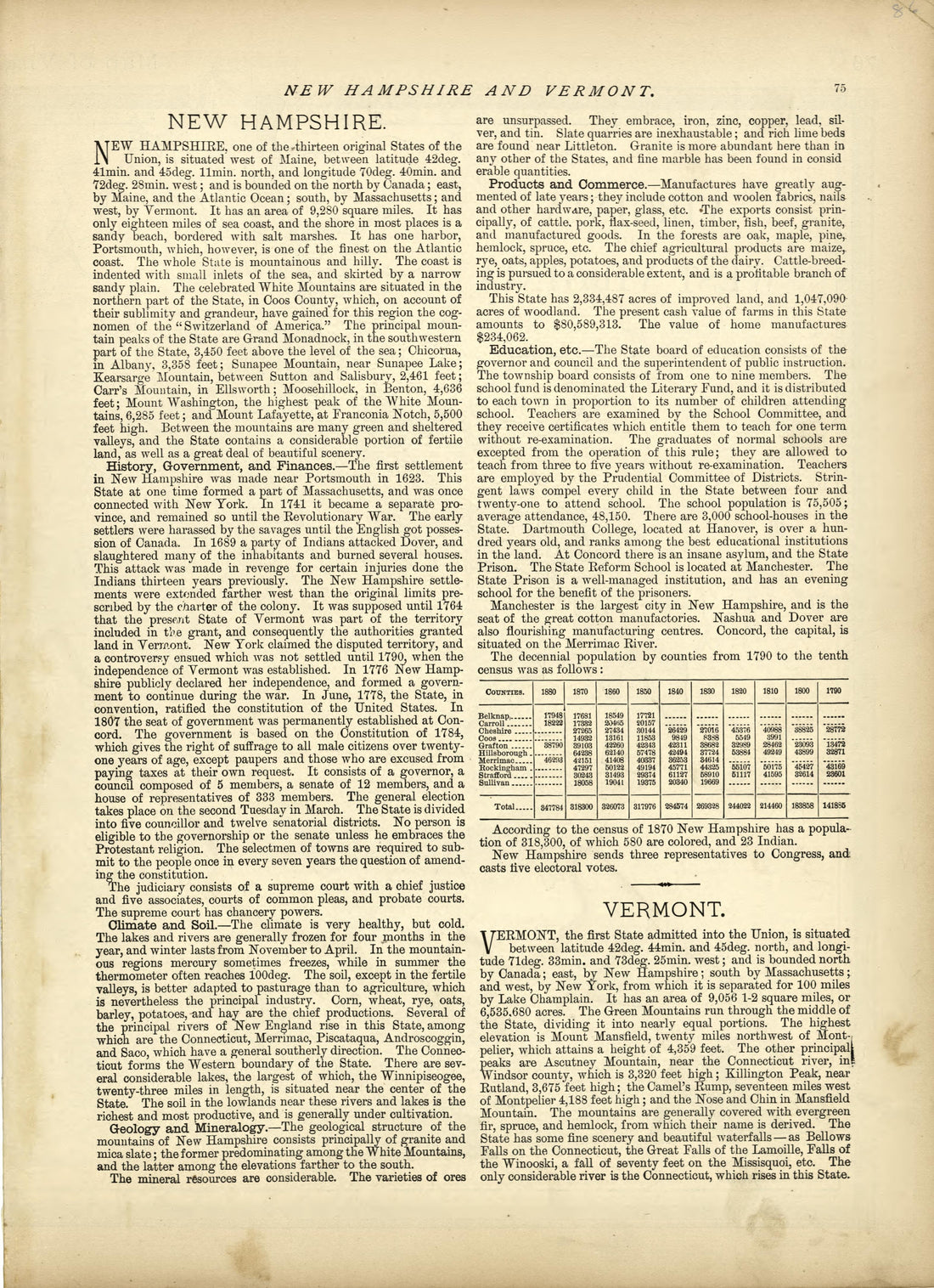 New Hampshire, Vermont from Historical Hand-atlas, Illustrated, Containing Large Scale Copper Plate Maps of Each State and Territory of the United States, and the Provinces of Canada, Together With a Complete Reference Map of the World, … 1882New Hampshire, Vermont from Historical Hand-atlas, Illustrated, Containing Large Scale Copper Plate Maps of Each State and Territory of the United States, and the Provinces of Canada, Together With a Complete Reference Map of the World, … 1882
- Regular price
-
$49.95 $88.95 - Regular price
-
$24.95 - Sale price
-
$49.95 $88.95
-
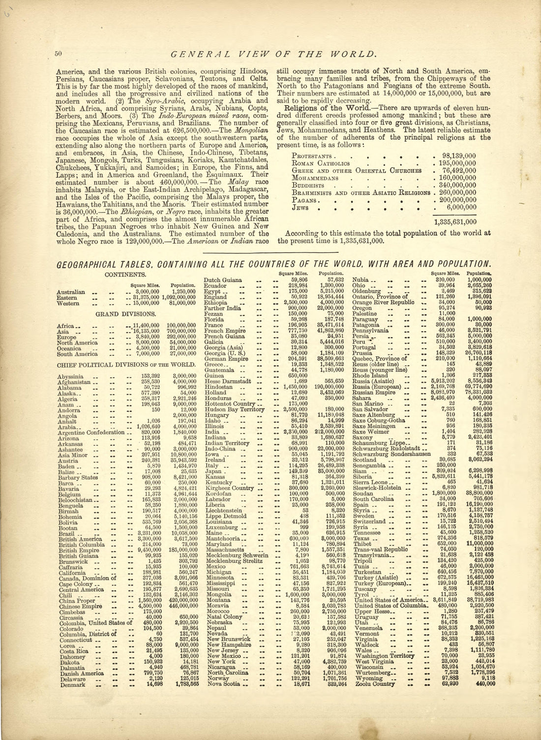 General View of the World - Continued from Historical Hand-atlas, Illustrated, Containing Large Scale Copper Plate Maps of Each State and Territory of the United States, and the Provinces of Canada, Together With a Complete Reference Map of the World,...General View of the World - Continued from Historical Hand-atlas, Illustrated, Containing Large Scale Copper Plate Maps of Each State and Territory of the United States, and the Provinces of Canada, Together With a Complete Reference Map of the World,...
- Regular price
-
$49.95 $88.95 - Regular price
-
$24.95 - Sale price
-
$49.95 $88.95


