Quick links
19716 products
-
Battle Fields of Fisher's Hill 22 Sept. 1864 and Cedar Creek 19 Oct. 1864, Virginia in 1873
 Battle Fields of Fisher's Hill 22 Sept. 1864 and Cedar Creek 19 Oct. 1864, Virginia in 1873
- Regular price
-
From
$34.95 - Regular price
-
$49.99 - Sale price
-
From
$34.95
-
Map of Walker's Mtn. Land (Map of Walker's Mountain Land) 1879
 Map of Walker's Mtn. Land (Map of Walker's Mountain Land) 1879
- Regular price
-
From
$41.95 - Regular price
-
$66.99 - Sale price
-
From
$41.95
-
Survey of the Property of George Poffenberger and Mrs. Nicodemus In Washington County, Md. 1883
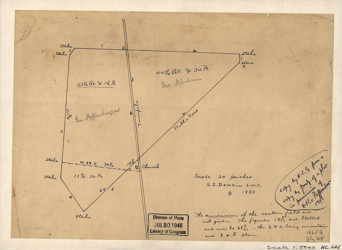 Survey of the Property of George Poffenberger and Mrs. Nicodemus In Washington County, Md. 1883
- Regular price
-
From
$19.95 - Regular price
-
$29.95 - Sale price
-
From
$19.95
-
Nouvelle Carte Qui Comprend Les Principaux Triangles Qui Servent De Fondement à La Description Géométrique De La France 1744
 Nouvelle Carte Qui Comprend Les Principaux Triangles Qui Servent De Fondement à La Description Géométrique De La France 1744
- Regular price
-
From
$41.95 - Regular price
-
$66.99 - Sale price
-
From
$41.95
-
Part of Map of Portions of the Mility. Dep'ts of Washington, Pennsylvania, Annapolis, and North Eastern Virginia. Compiled In the Bureau of Topographical Engr. War Department &c, July 1861. Washington, D.C., 1862. (Map of Portions of the Milit'y Dep't...
 Part of Map of Portions of the Mility. Dep'ts of Washington, Pennsylvania, Annapolis, and North Eastern Virginia. Compiled In the Bureau of Topographical Engr. War Department &c, July 1861. Washington, D.C., 1862. (Map of Portions of the Milit'y Dep't...
- Regular price
-
From
$41.95 - Regular price
-
$66.99 - Sale price
-
From
$41.95
-
Map of Part of South Eastern Virginia 1862
 Map of Part of South Eastern Virginia 1862
- Regular price
-
From
$34.95 - Regular price
-
$49.99 - Sale price
-
From
$34.95
-
View of the Panamint Range Mountains, Mines, Mills and Town Site ; Sherman Town, Property of the Panamint Mining & Concentration Works 1875
 View of the Panamint Range Mountains, Mines, Mills and Town Site ; Sherman Town, Property of the Panamint Mining & Concentration Works 1875
- Regular price
-
From
$41.95 - Regular price
-
$66.99 - Sale price
-
From
$41.95
-
Map Showing the Coal & Timber Lands of the Allegheny Rail Road & Coal Company With the Avenues to Market 1850
 Map Showing the Coal & Timber Lands of the Allegheny Rail Road & Coal Company With the Avenues to Market 1850
- Regular price
-
From
$31.95 - Regular price
-
$49.95 - Sale price
-
From
$31.95
-
Plano Del Puerte De Sta. Marta Situado En La Costa De Tierra Firme En 11 Gras. 16 Mtos. De Latitud Norte Y En La Longitud De 302 Gras. 23 Mtos. Segun El Meridiano De Thenerife 1755
 Plano Del Puerte De Sta. Marta Situado En La Costa De Tierra Firme En 11 Gras. 16 Mtos. De Latitud Norte Y En La Longitud De 302 Gras. 23 Mtos. Segun El Meridiano De Thenerife 1755
- Regular price
-
From
$30.95 - Regular price
-
$48.95 - Sale price
-
From
$30.95
-
Plan of the Bay, Town, Fortifications, and Environs, of St. Pierre, In the Island of Martinique 1763
 Plan of the Bay, Town, Fortifications, and Environs, of St. Pierre, In the Island of Martinique 1763
- Regular price
-
From
$41.95 - Regular price
-
$66.99 - Sale price
-
From
$41.95
-
A Plan of the Siege of the Havana. Drawn by an Officer.15th August 1762., Plan of the City and Harbour of Havanna 1763
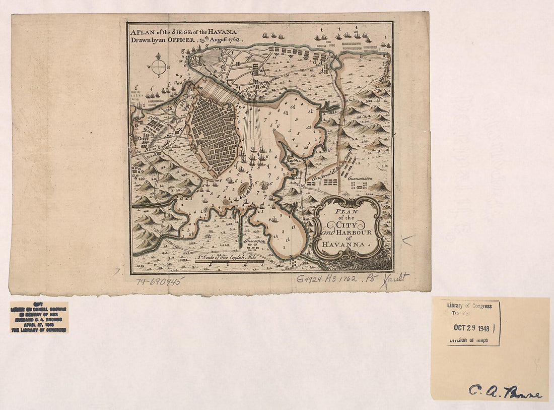 A Plan of the Siege of the Havana. Drawn by an Officer.15th August 1762., Plan of the City and Harbour of Havanna 1763
- Regular price
-
From
$32.95 - Regular price
-
$51.95 - Sale price
-
From
$32.95


