1131 products
-
 Delaware from a New and Elegant General Atlas, Containing Maps of Each of the United States 1817Delaware from a New and Elegant General Atlas, Containing Maps of Each of the United States 1817
- Regular price
-
$39.95 $93.95 - Regular price
-
$36.95 - Sale price
-
$39.95 $93.95
-
 Western Hemisphere from a New and Elegant General Atlas, Containing Maps of Each of the United States 1817Western Hemisphere from a New and Elegant General Atlas, Containing Maps of Each of the United States 1817
- Regular price
-
$39.95 $93.95 - Regular price
-
$36.95 - Sale price
-
$39.95 $93.95
-
 Louisiana from a New and Elegant General Atlas, Containing Maps of Each of the United States 1817Louisiana from a New and Elegant General Atlas, Containing Maps of Each of the United States 1817
- Regular price
-
$39.95 $99.95 - Regular price
-
$36.95 - Sale price
-
$39.95 $99.95
-
 United States from a New and Elegant General Atlas, Containing Maps of Each of the United States 1817United States from a New and Elegant General Atlas, Containing Maps of Each of the United States 1817
- Regular price
-
$39.95 $93.95 - Regular price
-
$36.95 - Sale price
-
$39.95 $93.95
-
 Virginia from a New and Elegant General Atlas, Containing Maps of Each of the United States 1817Virginia from a New and Elegant General Atlas, Containing Maps of Each of the United States 1817
- Regular price
-
$39.95 $99.95 - Regular price
-
$36.95 - Sale price
-
$39.95 $99.95
-
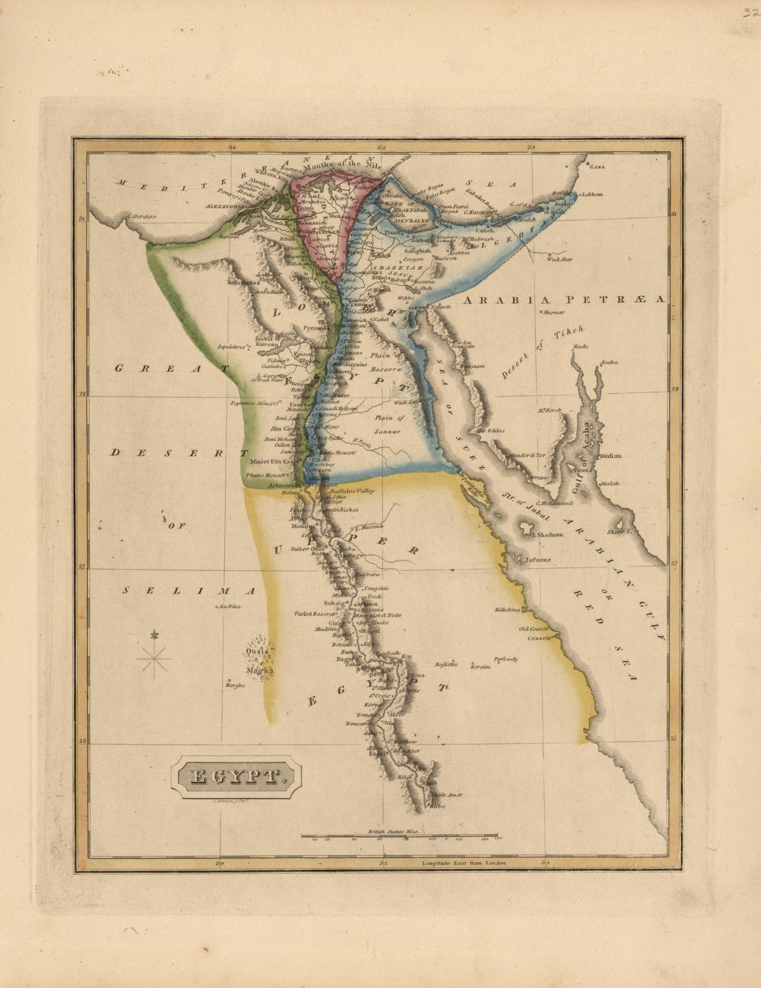 Egypt from a New and Elegant General Atlas, Containing Maps of Each of the United States 1817Egypt from a New and Elegant General Atlas, Containing Maps of Each of the United States 1817
- Regular price
-
$39.95 $93.95 - Regular price
-
$36.95 - Sale price
-
$39.95 $93.95
-
 Georgia from a New and Elegant General Atlas, Containing Maps of Each of the United States 1817Georgia from a New and Elegant General Atlas, Containing Maps of Each of the United States 1817
- Regular price
-
$39.95 $92.95 - Regular price
-
$36.95 - Sale price
-
$39.95 $92.95
-
 Hindoostan from a New and Elegant General Atlas, Containing Maps of Each of the United States 1817Hindoostan from a New and Elegant General Atlas, Containing Maps of Each of the United States 1817
- Regular price
-
$39.95 $92.95 - Regular price
-
$36.95 - Sale price
-
$39.95 $92.95
-
 Canada from a New and Elegant General Atlas, Containing Maps of Each of the United States 1817Canada from a New and Elegant General Atlas, Containing Maps of Each of the United States 1817
- Regular price
-
$39.95 $92.95 - Regular price
-
$36.95 - Sale price
-
$39.95 $92.95
-
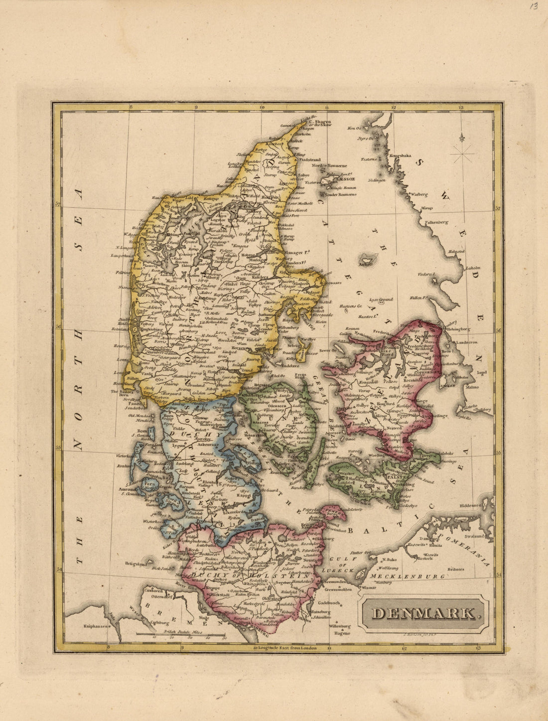 Denmark from a New and Elegant General Atlas, Containing Maps of Each of the United States 1817Denmark from a New and Elegant General Atlas, Containing Maps of Each of the United States 1817
- Regular price
-
$39.95 $92.95 - Regular price
-
$36.95 - Sale price
-
$39.95 $92.95
-
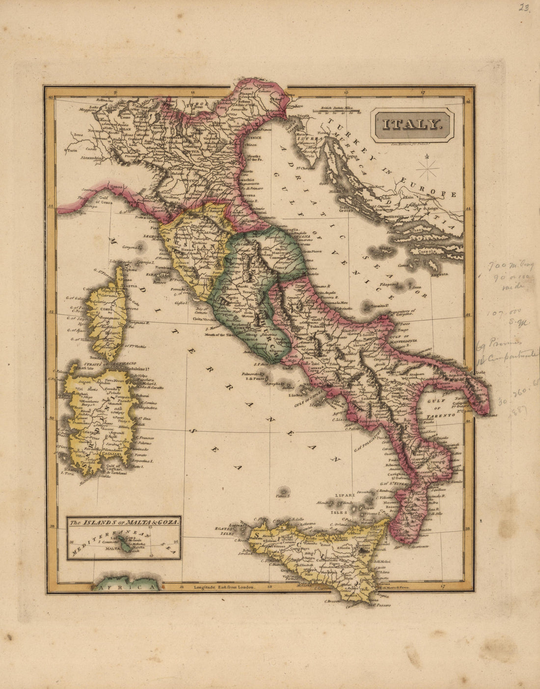 Italy from a New and Elegant General Atlas, Containing Maps of Each of the United States 1817Italy from a New and Elegant General Atlas, Containing Maps of Each of the United States 1817
- Regular price
-
$39.95 $92.95 - Regular price
-
$36.95 - Sale price
-
$39.95 $92.95
-
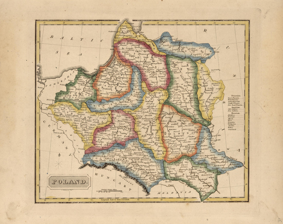 Poland from a New and Elegant General Atlas, Containing Maps of Each of the United States 1817Poland from a New and Elegant General Atlas, Containing Maps of Each of the United States 1817
- Regular price
-
$39.95 $93.95 - Regular price
-
$36.95 - Sale price
-
$39.95 $93.95


