949 products
-
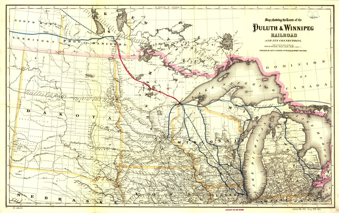 Map Showing the Route of the Duluth & Winnipeg Railroad and Its Connections in 1881Map Showing the Route of the Duluth & Winnipeg Railroad and Its Connections in 1881
- Regular price
-
$46.95 $99.95 - Regular price
-
$41.95 - Sale price
-
$46.95 $99.95
-
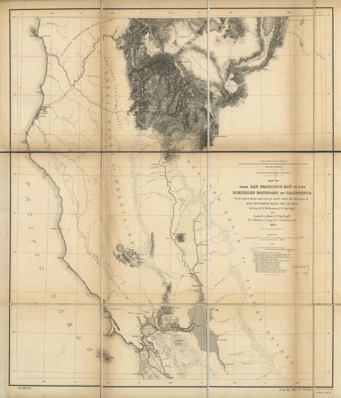 From San Francisco Bay to the Northern Boundary of California : From Explorations and Surveys in 1859From San Francisco Bay to the Northern Boundary of California : From Explorations and Surveys in 1859
- Regular price
-
$39.95 $84.95 - Regular price
-
$34.95 - Sale price
-
$39.95 $84.95
-
 Under a Black Cloud! in 1883Under a Black Cloud! in 1883
- Regular price
-
$46.95 $99.95 - Regular price
-
$41.95 - Sale price
-
$46.95 $99.95
-
 Indiana, Illinois, Missouri & Iowa With Parts of Adjoining States in 1858Indiana, Illinois, Missouri & Iowa With Parts of Adjoining States in 1858
- Regular price
-
$43.95 $88.95 - Regular price
-
$32.95 - Sale price
-
$43.95 $88.95
-
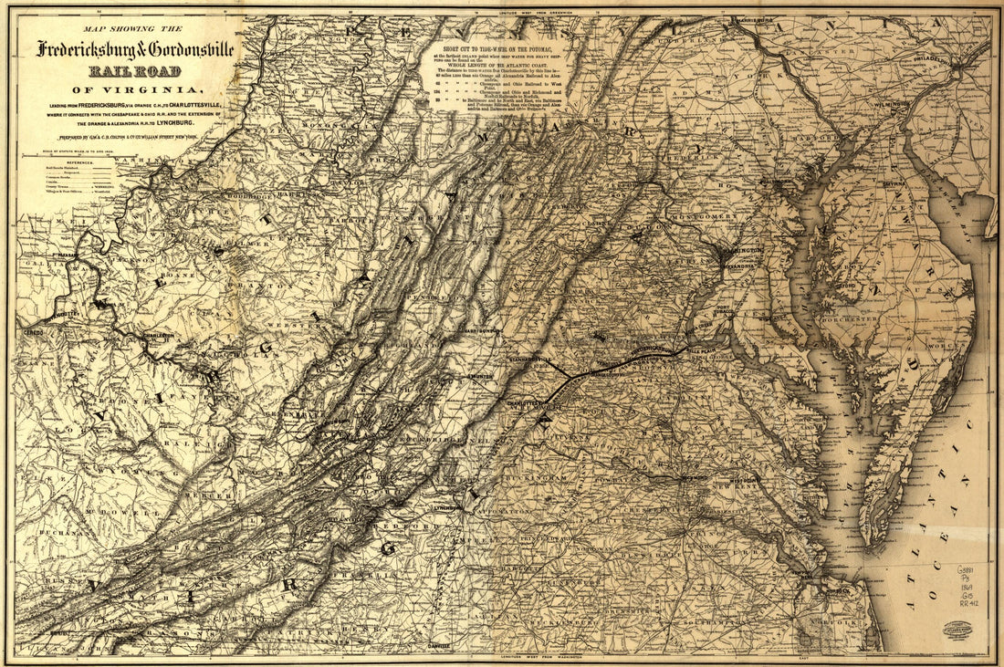 Map Showing the Fredericksburg & Gordonsville Rail Road of Virginia, Leading From Fredericksburg, Via Orange C.H., to Charlottesville, Where It Connects With the Chesapeake & Ohio R.R. and the Extension of the Orange & Alexandra R.R. to Lynchburg in 1869Map Showing the Fredericksburg & Gordonsville Rail Road of Virginia, Leading From Fredericksburg, Via Orange C.H., to Charlottesville, Where It Connects With the Chesapeake & Ohio R.R. and the Extension of the Orange & Alexandra R.R. to Lynchburg in 1869
- Regular price
-
$46.95 $99.95 - Regular price
-
$41.95 - Sale price
-
$46.95 $99.95
-
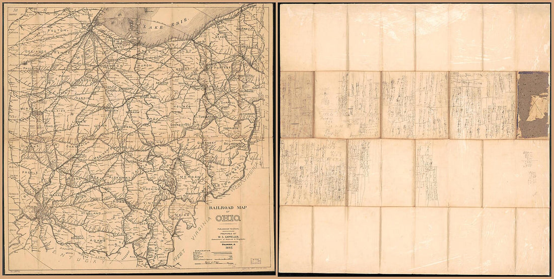 Railroad Map of Ohio Published by the State, Prepared by Commissioner of Railroads & Telegraphs 1887Railroad Map of Ohio Published by the State, Prepared by Commissioner of Railroads & Telegraphs 1887
- Regular price
-
$46.95 $323.95 - Regular price
-
$41.95 - Sale price
-
$46.95 $323.95
-
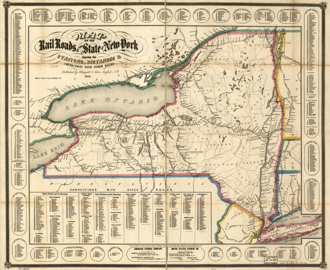 Map of the Rail Roads of the State of New York Showing the Stations, Distances & Connections With Other Roads; Thos. Pentingale, L.P. Behn in 1858Map of the Rail Roads of the State of New York Showing the Stations, Distances & Connections With Other Roads; Thos. Pentingale, L.P. Behn in 1858
- Regular price
-
$39.95 $83.95 - Regular price
-
$34.95 - Sale price
-
$39.95 $83.95
-
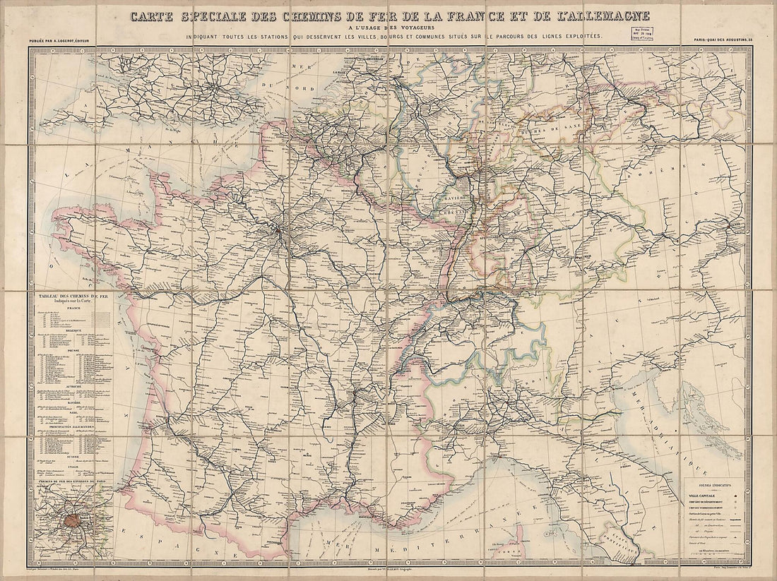 Carte Speciale Des Chemins De Fer De La France Et De L'Allemagne a L'usage Des Voyageurs Indiquant Toutes Les Stations Qui Desservent Les Villes, Bourgs Et Communes Situés Sûr Ile Parcours Des Lignes Exploitées (Routes De France) 1865Carte Speciale Des Chemins De Fer De La France Et De L'Allemagne a L'usage Des Voyageurs Indiquant Toutes Les Stations Qui Desservent Les Villes, Bourgs Et Communes Situés Sûr Ile Parcours Des Lignes Exploitées (Routes De France) 1865
- Regular price
-
$43.95 $206.95 - Regular price
-
$32.95 - Sale price
-
$43.95 $206.95
-
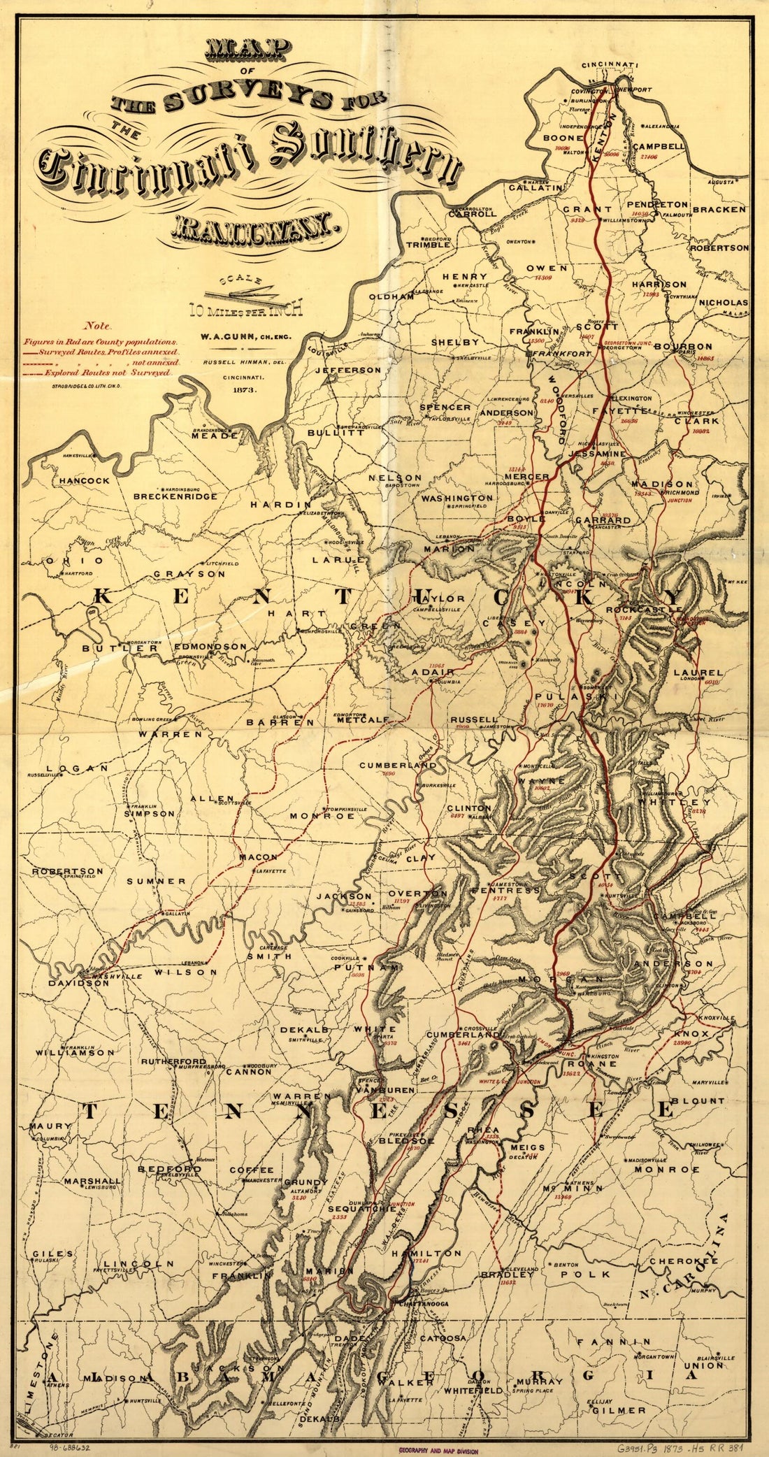 Map of the Surveys of the Cincinnati Railway, W.A. Gunn, Ch. Eng in 1873Map of the Surveys of the Cincinnati Railway, W.A. Gunn, Ch. Eng in 1873
- Regular price
-
$46.95 $99.95 - Regular price
-
$41.95 - Sale price
-
$46.95 $99.95
-
 Und Eisenbahn-Reisekarte--Deutschland, Holland, Die Schweiz, Italien Bis Neapel, Der Grösste Theil Von Frankreich, Ungarn, Polen Etc. : Mit Besonderer Rücksicht Auf Eisenbahnen U. Seedampfschiffahrt in 1856Und Eisenbahn-Reisekarte--Deutschland, Holland, Die Schweiz, Italien Bis Neapel, Der Grösste Theil Von Frankreich, Ungarn, Polen Etc. : Mit Besonderer Rücksicht Auf Eisenbahnen U. Seedampfschiffahrt in 1856
- Regular price
-
$39.95 $83.95 - Regular price
-
$34.95 - Sale price
-
$39.95 $83.95
-
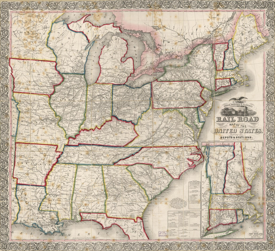 Ensign, Bridgman and Fanning's Railroad Map of the United States Showing the Depots & Stations, Rail Road Map of the United States in 1856Ensign, Bridgman and Fanning's Railroad Map of the United States Showing the Depots & Stations, Rail Road Map of the United States in 1856
- Regular price
-
$39.95 $113.95 - Regular price
-
$34.95 - Sale price
-
$39.95 $113.95
-
 Fitchburg Railroad With Its Branches and Connections 1880Fitchburg Railroad With Its Branches and Connections 1880
- Regular price
-
$39.95 $99.95 - Regular price
-
$29.95 - Sale price
-
$39.95 $99.95


