949 products
-
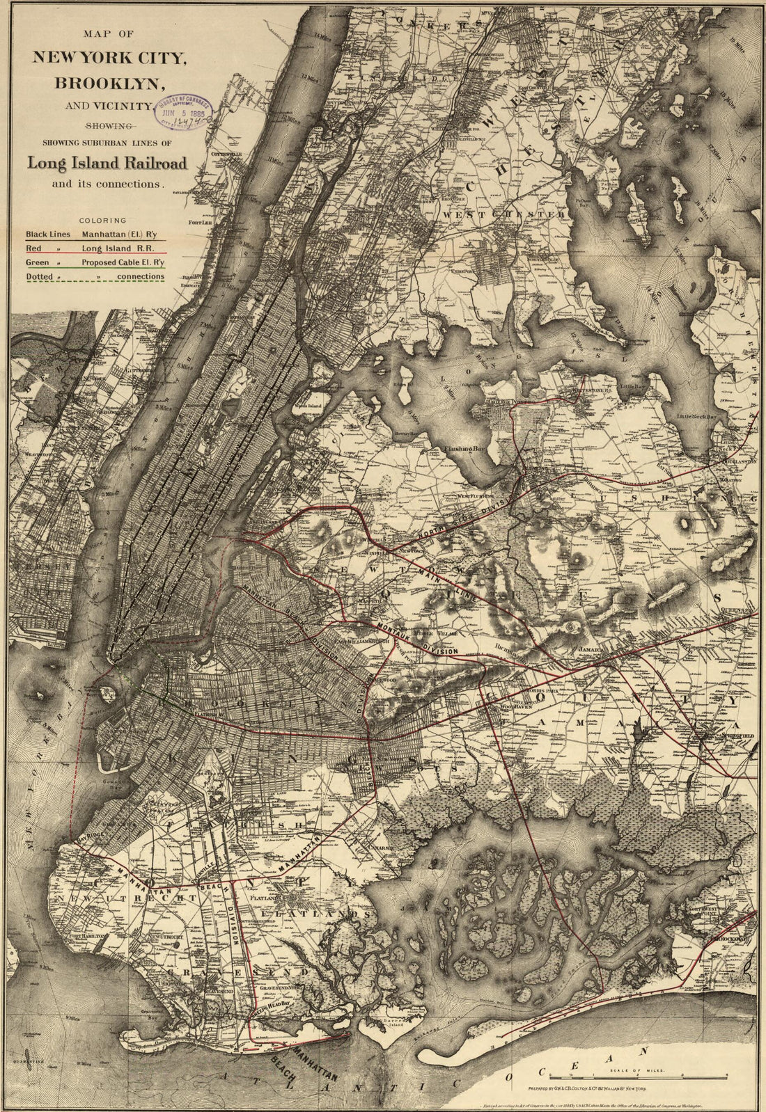 Map of New York City, Brooklyn, and Vicinity, Shewing sic Suburban Lines of Long Island Railroad and Its Connections 1885Map of New York City, Brooklyn, and Vicinity, Shewing sic Suburban Lines of Long Island Railroad and Its Connections 1885
- Regular price
-
$46.95 $99.95 - Regular price
-
$41.95 - Sale price
-
$46.95 $99.95
-
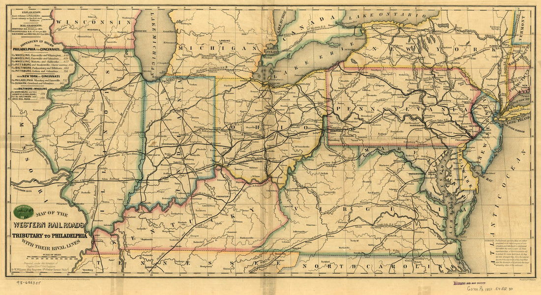 Map of the Western Railroads Tributary to Philadelphia, With Their Rival Lines; Prepared Under the Direction of Charles Ellet Jr., Civil Engineer 1851Map of the Western Railroads Tributary to Philadelphia, With Their Rival Lines; Prepared Under the Direction of Charles Ellet Jr., Civil Engineer 1851
- Regular price
-
$46.95 $99.95 - Regular price
-
$41.95 - Sale price
-
$46.95 $99.95
-
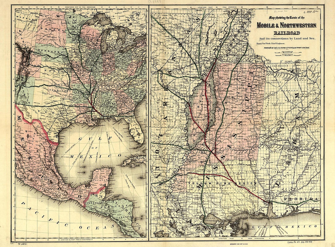 Map Showing the Route of the Mobile & North Western Railroad, and Its Connections by Land and Sea; Henry Van Vleck Chief Engineer 1871Map Showing the Route of the Mobile & North Western Railroad, and Its Connections by Land and Sea; Henry Van Vleck Chief Engineer 1871
- Regular price
-
$43.95 $207.95 - Regular price
-
$32.95 - Sale price
-
$43.95 $207.95
-
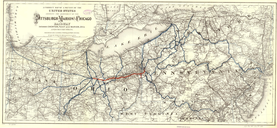 A Correct Map of a Section of the United States Showing the Allignment sic of the Pittsburgh, Marion, and Chicago Railway Between Chewton, Penna. and Marion, Ohio and Connections 1887A Correct Map of a Section of the United States Showing the Allignment sic of the Pittsburgh, Marion, and Chicago Railway Between Chewton, Penna. and Marion, Ohio and Connections 1887
- Regular price
-
$46.95 $99.95 - Regular price
-
$41.95 - Sale price
-
$46.95 $99.95
-
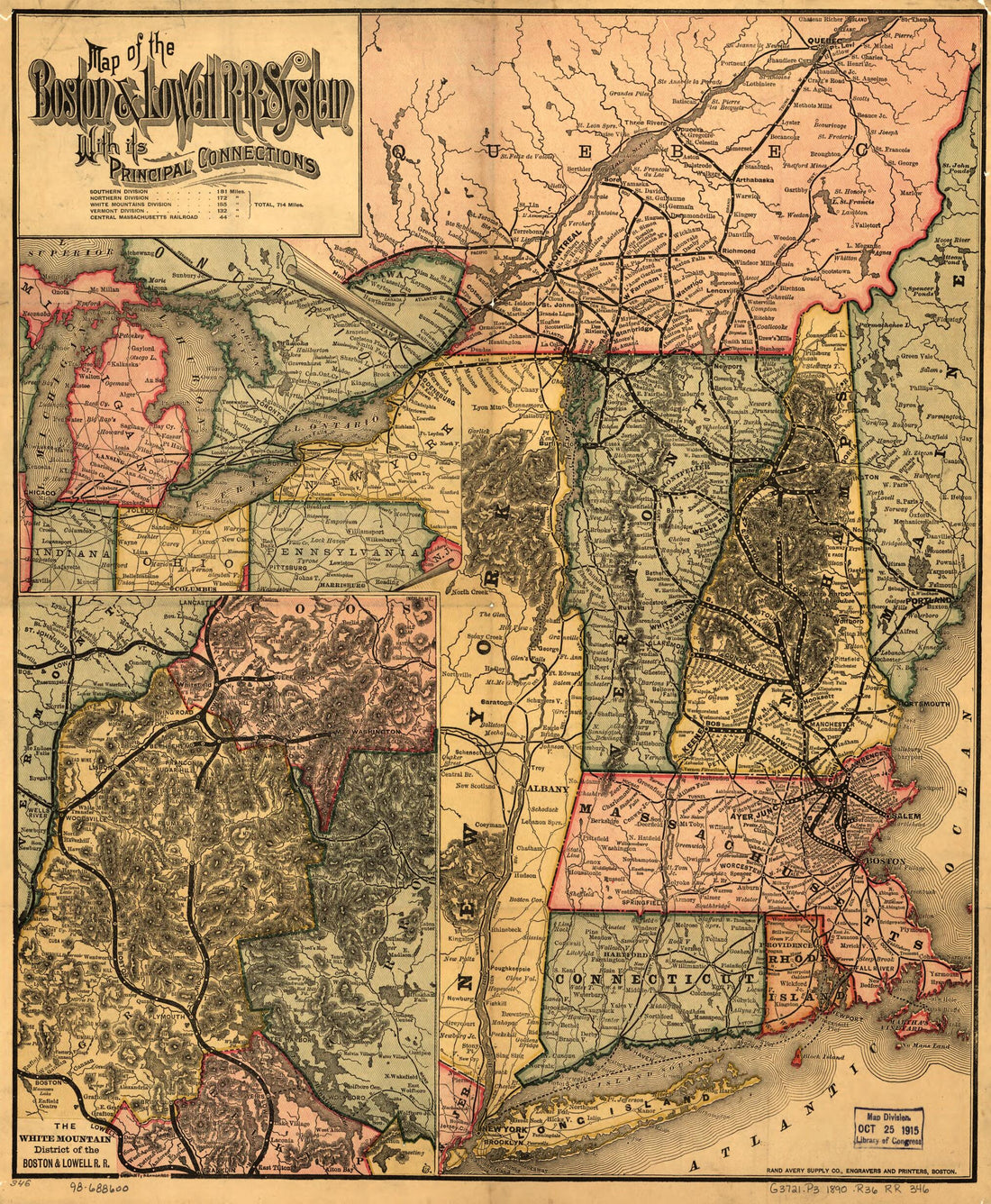 Map of the Boston & Lowell R.R. System With Its Principal Connections 1890Map of the Boston & Lowell R.R. System With Its Principal Connections 1890
- Regular price
-
$39.95 $83.95 - Regular price
-
$29.95 - Sale price
-
$39.95 $83.95
-
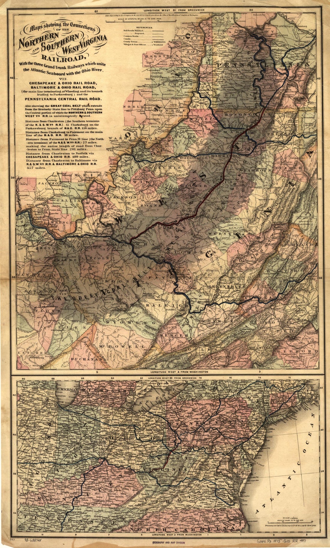 Maps Showing the Connections of the Northern and Southern West Virginia Railroad, With the Three Grand Trunk Railways Which Unite the Atlantic Seaboard With the Ohio River 1873Maps Showing the Connections of the Northern and Southern West Virginia Railroad, With the Three Grand Trunk Railways Which Unite the Atlantic Seaboard With the Ohio River 1873
- Regular price
-
$46.95 $99.95 - Regular price
-
$41.95 - Sale price
-
$46.95 $99.95
-
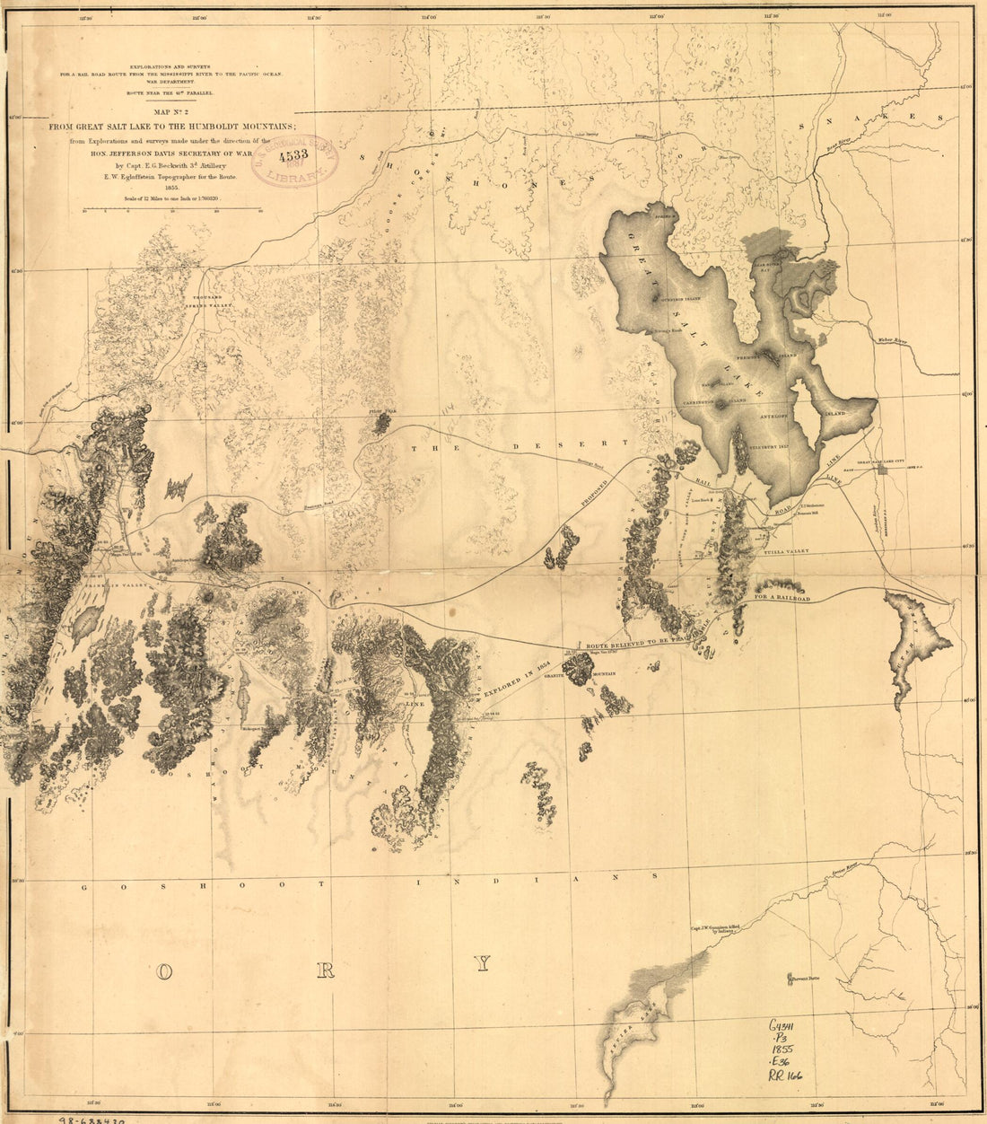 From Great Salt Lake to the Humboldt Mountains 1855From Great Salt Lake to the Humboldt Mountains 1855
- Regular price
-
$39.95 $83.95 - Regular price
-
$34.95 - Sale price
-
$39.95 $83.95
-
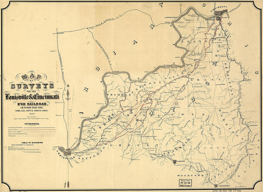 Map of Surveys for the Louisville & Cincinnati B'ch Railroad; I. M. St. John, Chief Eng', 1866Map of Surveys for the Louisville & Cincinnati B'ch Railroad; I. M. St. John, Chief Eng', 1866
- Regular price
-
$43.95 $100.95 - Regular price
-
$32.95 - Sale price
-
$43.95 $100.95
-
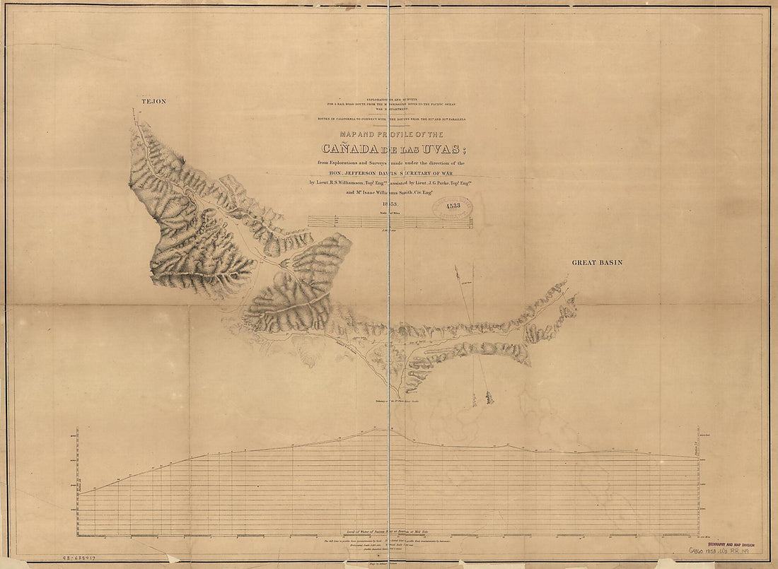 Map and Profile of the Cañada De Las Uvas : from Explorations and Surveys 1853Map and Profile of the Cañada De Las Uvas : from Explorations and Surveys 1853
- Regular price
-
$43.95 $159.95 - Regular price
-
$32.95 - Sale price
-
$43.95 $159.95
-
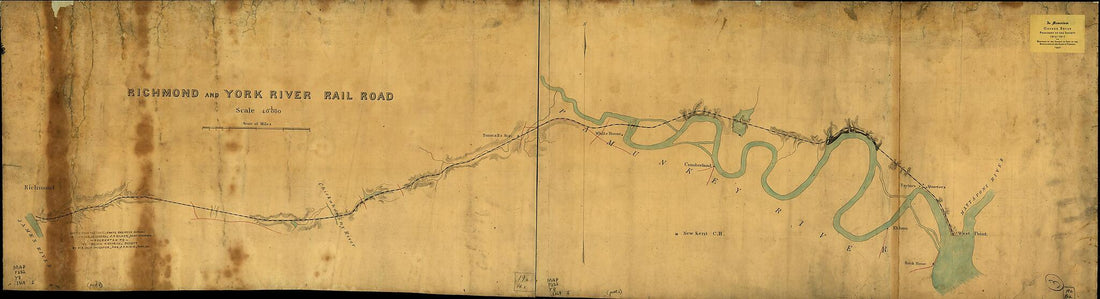 Richmond and York River Railroad 1864Richmond and York River Railroad 1864
- Regular price
-
$46.95 $238.95 - Regular price
-
$41.95 - Sale price
-
$46.95 $238.95
-
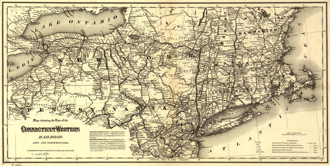 Map Showing the Line of the Connecticut & Western Railroad and Its Connections 1871Map Showing the Line of the Connecticut & Western Railroad and Its Connections 1871
- Regular price
-
$46.95 $99.95 - Regular price
-
$41.95 - Sale price
-
$46.95 $99.95
-
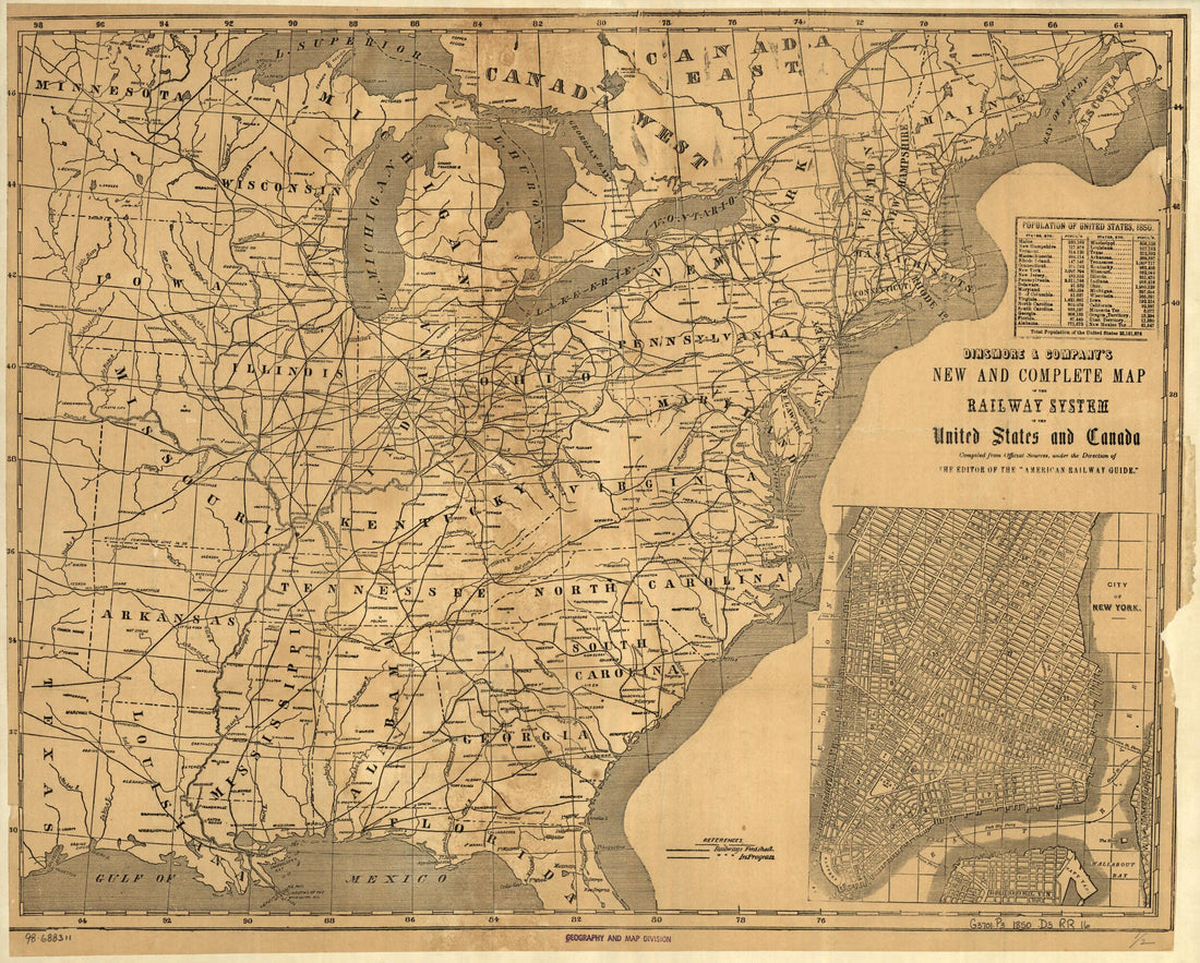 Dinsmore & Company's New and Complete Map of the Railway System of the United States and Canada; Compiled from Official Sources, Under the Direction of the Editor of the American Railway Guide. 1850Dinsmore & Company's New and Complete Map of the Railway System of the United States and Canada; Compiled from Official Sources, Under the Direction of the Editor of the American Railway Guide. 1850
- Regular price
-
$39.95 $83.95 - Regular price
-
$34.95 - Sale price
-
$39.95 $83.95


