125 products
-
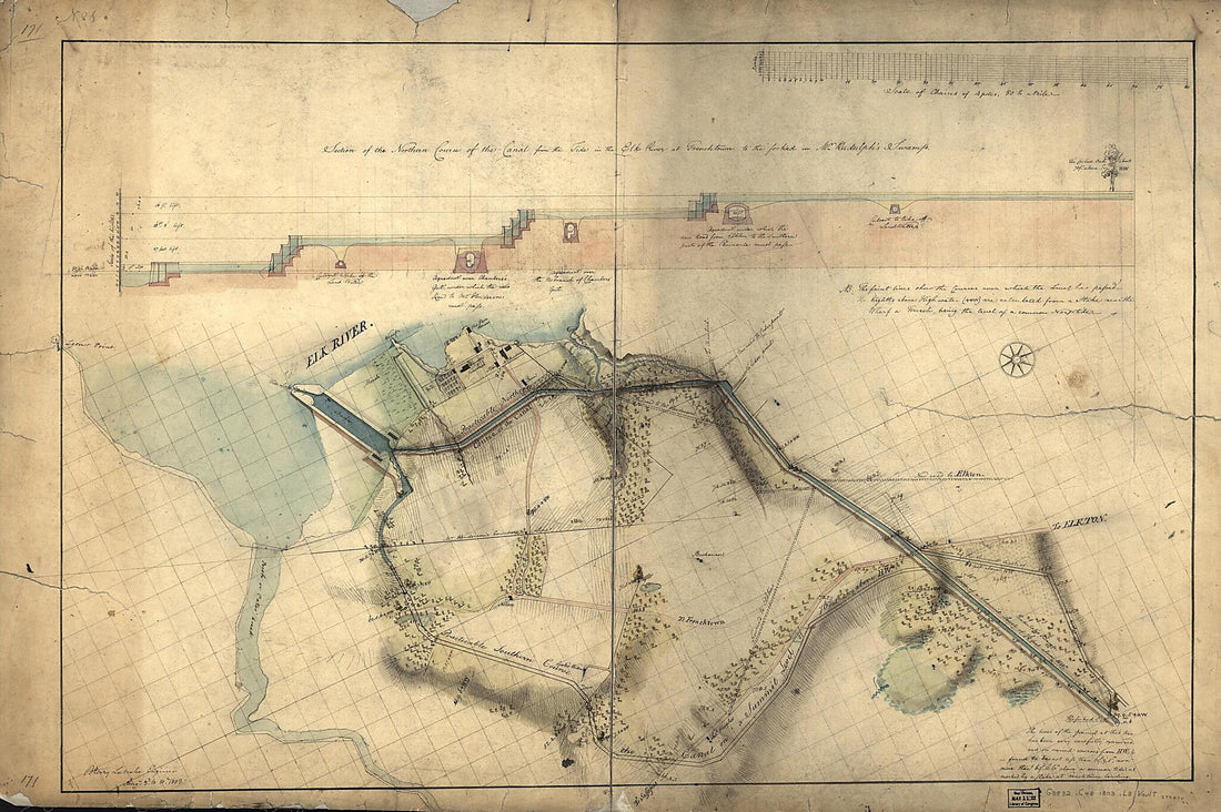 Section of the Northern Course of the Canal from the Tide In the Elk River at Frenchtown to the Forked oak In Mr. Rudulph's Swamp : Chesapeake and Delaware Canal, Maryland Portion 1803Section of the Northern Course of the Canal from the Tide In the Elk River at Frenchtown to the Forked oak In Mr. Rudulph's Swamp : Chesapeake and Delaware Canal, Maryland Portion 1803
- Regular price
-
$58.95 $163.95 - Regular price
-
$41.95 - Sale price
-
$58.95 $163.95
-
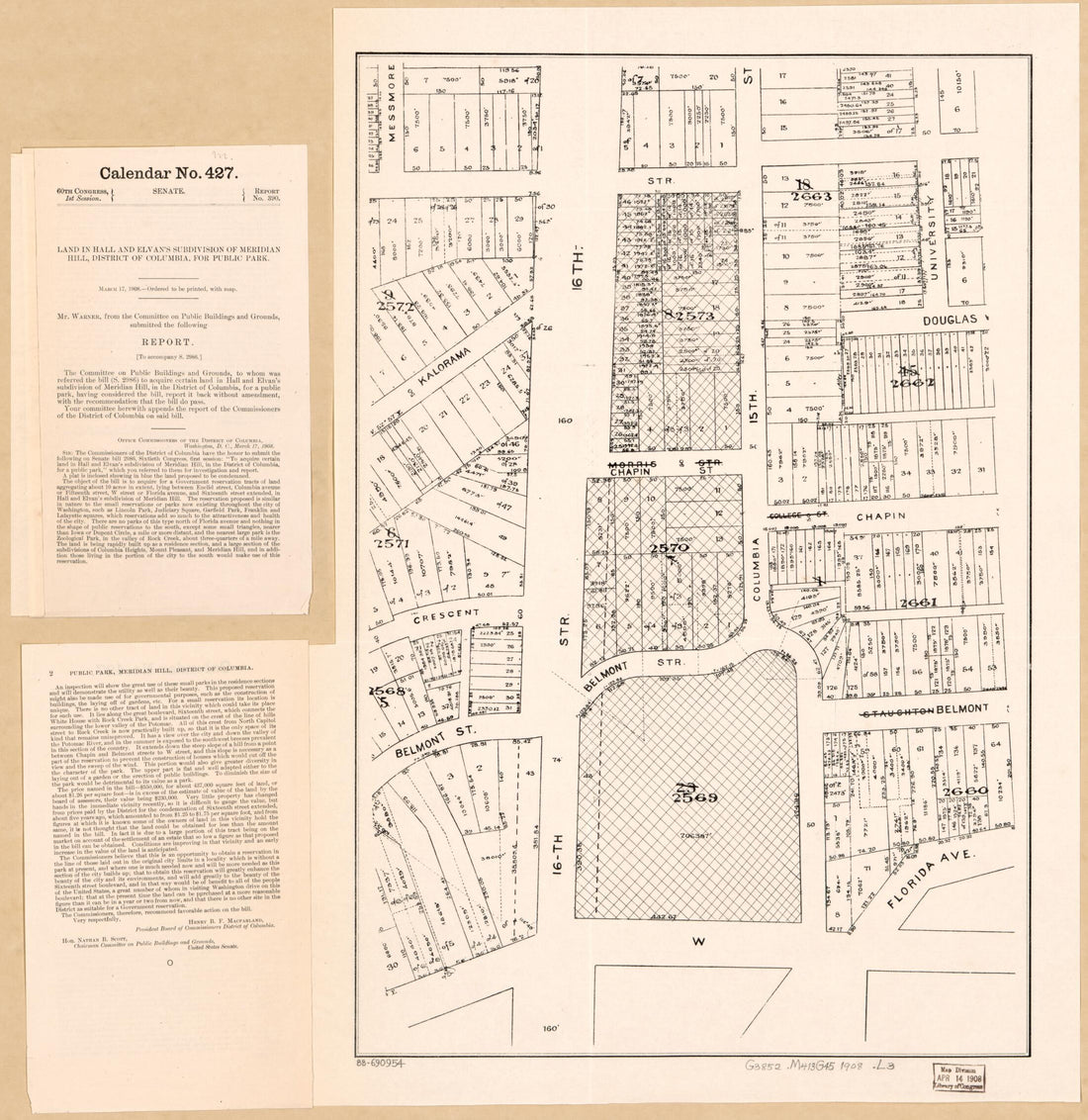 Land In Hall and Elvan's Subdivision of Meridian Hill, District of Columbia, for Public Park in 1908Land In Hall and Elvan's Subdivision of Meridian Hill, District of Columbia, for Public Park in 1908
- Regular price
-
$49.95 $83.95 - Regular price
-
$34.95 - Sale price
-
$49.95 $83.95
-
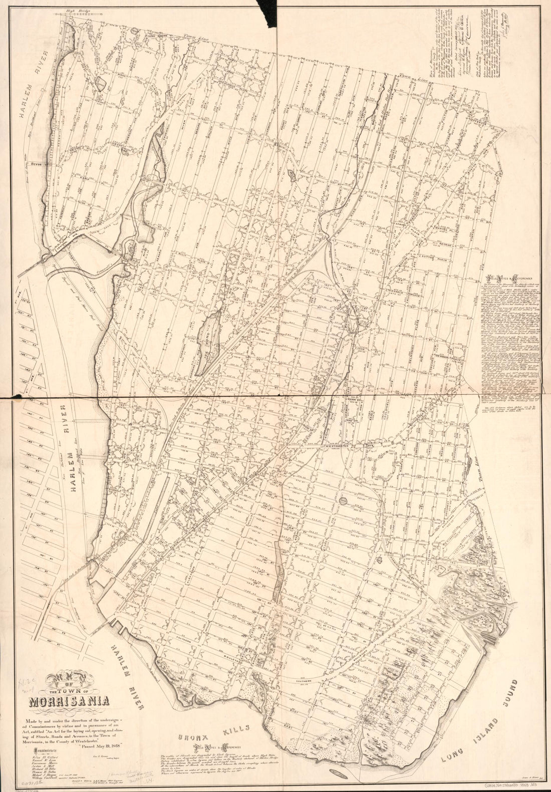 Map of the Town of Morrisania 1868Map of the Town of Morrisania 1868
- Regular price
-
$58.95 $120.95 - Regular price
-
$41.95 - Sale price
-
$58.95 $120.95
-
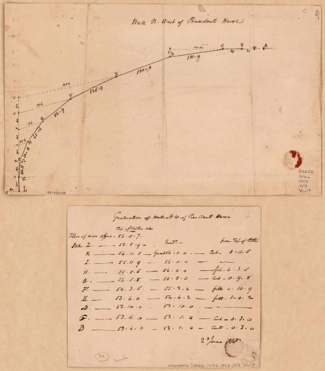 Wall N. West of Presidents House : Washington D.C. 1808Wall N. West of Presidents House : Washington D.C. 1808
- Regular price
-
$49.95 $83.95 - Regular price
-
$29.95 - Sale price
-
$49.95 $83.95
-
 Plat of Land Lying Between Road to Benning's Bridge & Cool Spring Road 1800Plat of Land Lying Between Road to Benning's Bridge & Cool Spring Road 1800
- Regular price
-
$49.95 $83.95 - Regular price
-
$29.95 - Sale price
-
$49.95 $83.95
-
 Frogland, Georgetown D.C. & H. Balls Lot, Viginia sic 1800Frogland, Georgetown D.C. & H. Balls Lot, Viginia sic 1800
- Regular price
-
$49.95 $92.95 - Regular price
-
$34.95 - Sale price
-
$49.95 $92.95
-
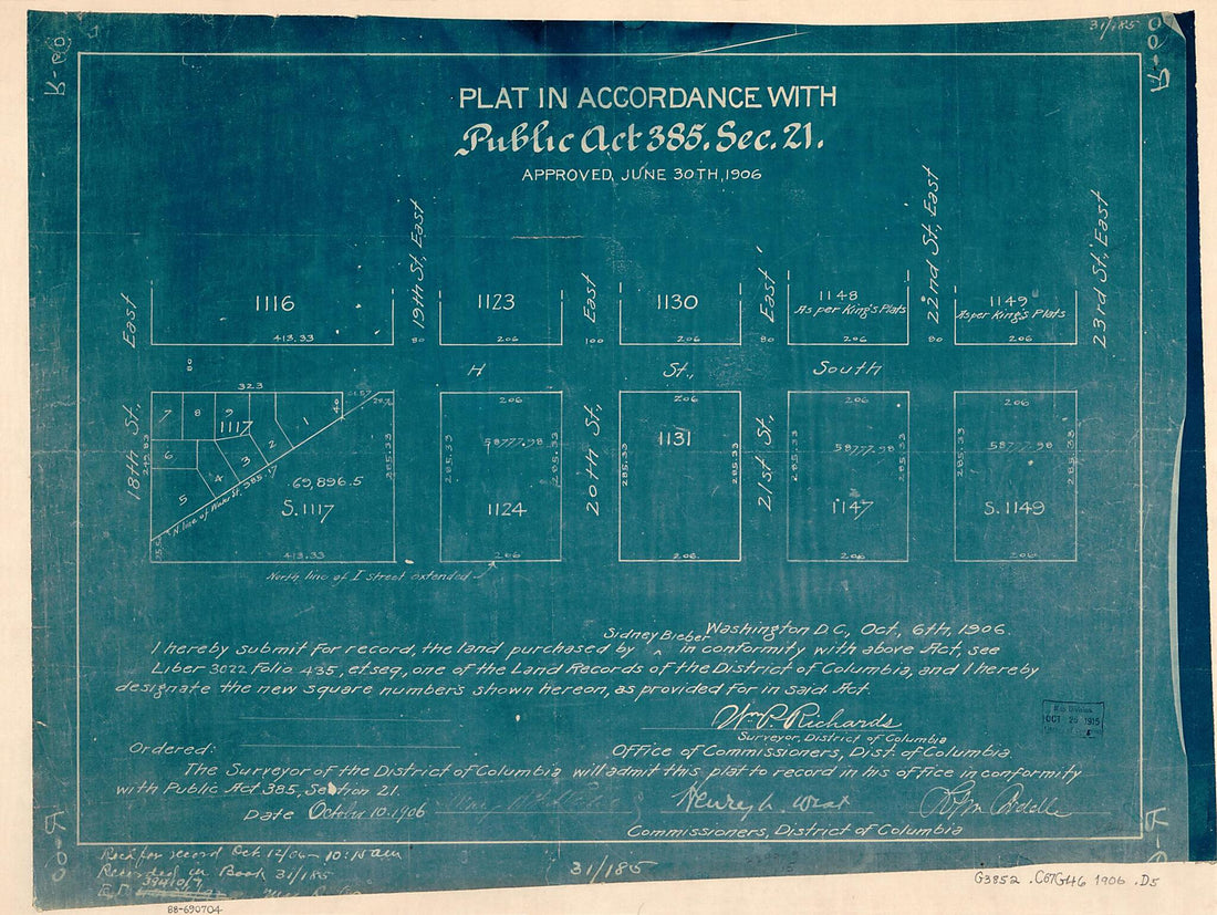 Plat In Accordance With Public Act 385, Sec. 21 : Approved June 30th 1906 : Washington D.C.Plat In Accordance With Public Act 385, Sec. 21 : Approved June 30th 1906 : Washington D.C.
- Regular price
-
$49.95 $88.95 - Regular price
-
$32.95 - Sale price
-
$49.95 $88.95
-
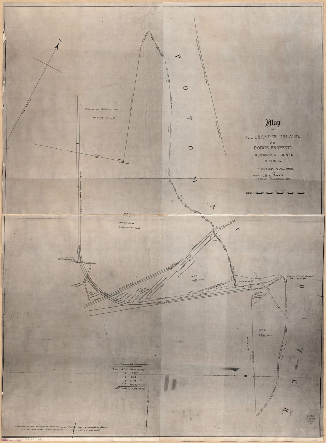 Map of Alexander Island Or Dodge Property, Alexandria County, Virginia in 1906Map of Alexander Island Or Dodge Property, Alexandria County, Virginia in 1906
- Regular price
-
$51.95 $217.95 - Regular price
-
$32.95 - Sale price
-
$51.95 $217.95
-
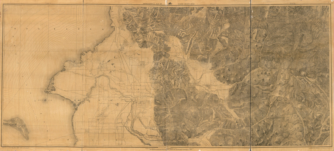 Topographical Map of Weber County, Utah : Surveys of 1884, 1885, 1886 & 1887 in 1888Topographical Map of Weber County, Utah : Surveys of 1884, 1885, 1886 & 1887 in 1888
- Regular price
-
$58.95 $263.95 - Regular price
-
$41.95 - Sale price
-
$58.95 $263.95
-
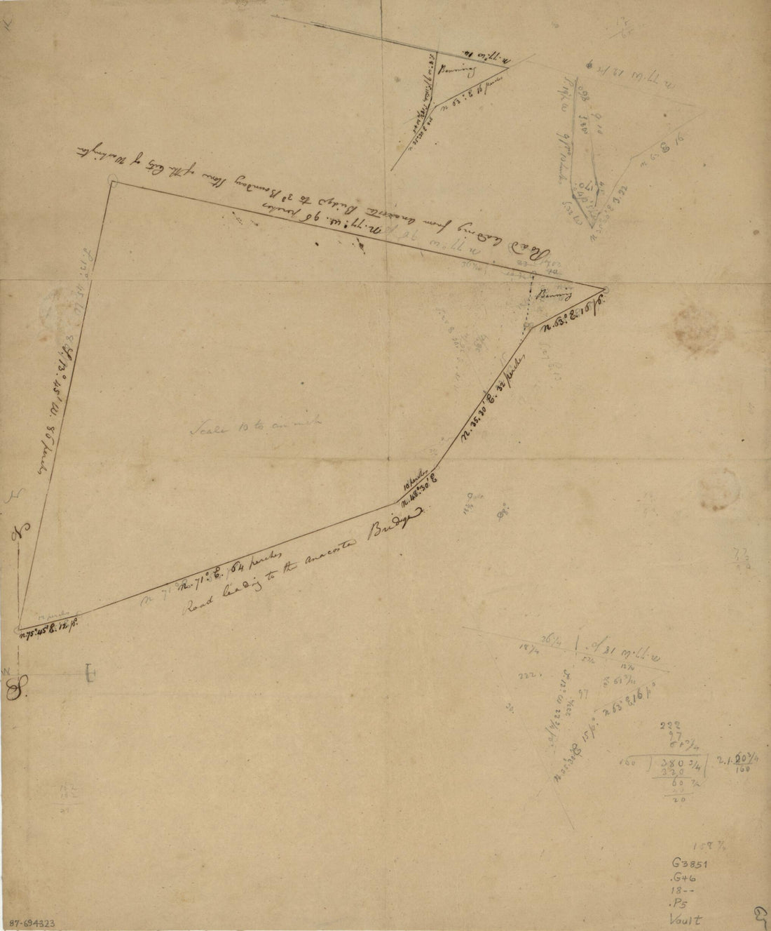
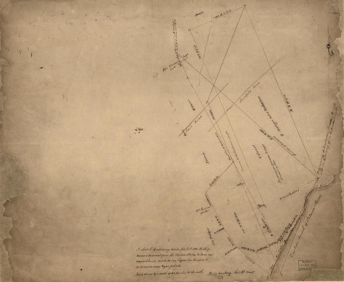 A Sketch of a Survey Made for Col. W'm Hickey, Under a Warrant from the United States, to Take Up Vacant Land : Made to Lay Before His Lawyers to Determine Some Legal Points : part of Washington D.C. Adjacent to the Anacostia River 1840A Sketch of a Survey Made for Col. W'm Hickey, Under a Warrant from the United States, to Take Up Vacant Land : Made to Lay Before His Lawyers to Determine Some Legal Points : part of Washington D.C. Adjacent to the Anacostia River 1840
- Regular price
-
$49.95 $101.95 - Regular price
-
$34.95 - Sale price
-
$49.95 $101.95
-
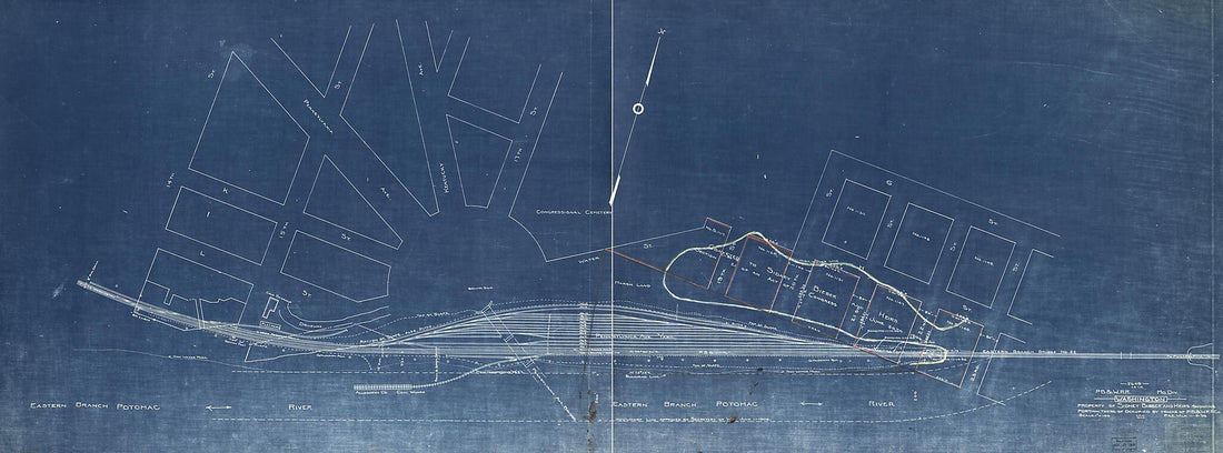 Washington, Property of Sidney Bieber and Heirs Showing Portion There of Occupied by Tracks of P.B & W.Railroad Co 1906Washington, Property of Sidney Bieber and Heirs Showing Portion There of Occupied by Tracks of P.B & W.Railroad Co 1906
- Regular price
-
$58.95 $213.95 - Regular price
-
$41.95 - Sale price
-
$58.95 $213.95
-
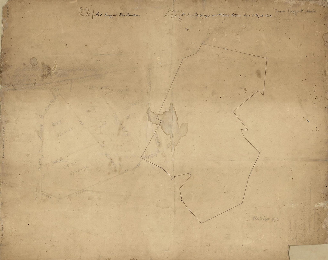 No. 1. Survey for John Davidson ; No. 2. Lots Surveyed On 1st Street Between Fred. & Fayette Streets : Georgetown, Washington D.C. 1843No. 1. Survey for John Davidson ; No. 2. Lots Surveyed On 1st Street Between Fred. & Fayette Streets : Georgetown, Washington D.C. 1843
- Regular price
-
$49.95 $90.95 - Regular price
-
$34.95 - Sale price
-
$49.95 $90.95


