598 products
-
Map of the City of Washington : Established As the Permanent Seat of the Government of the United States of America 1855
 Map of the City of Washington : Established As the Permanent Seat of the Government of the United States of America 1855
- Regular price
-
From
$34.95 - Regular price
-
$49.99 - Sale price
-
From
$34.95
-
Map of the Territory of the United States From the Mississippi to the Pacific Ocean; Ordered by Jeff'n Davis, Secretary of War to Accompany the Reports of the Explorations for a Railroad Route in 1858
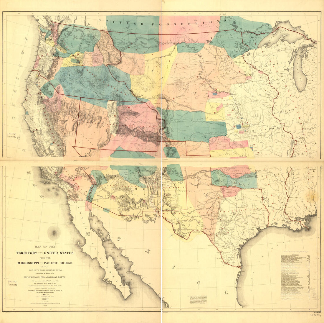 Map of the Territory of the United States From the Mississippi to the Pacific Ocean; Ordered by Jeff'n Davis, Secretary of War to Accompany the Reports of the Explorations for a Railroad Route in 1858
- Regular price
-
From
$34.95 - Regular price
-
$49.99 - Sale price
-
From
$34.95
-
Map of the United States, Territory of Oregon, West of the Rocky Mountains, Exhibiting the Various Trading Depots Or Forts Occupied by the British Hudson Bay Company, Connected With the Western and Northwestern Fur Trade 1838
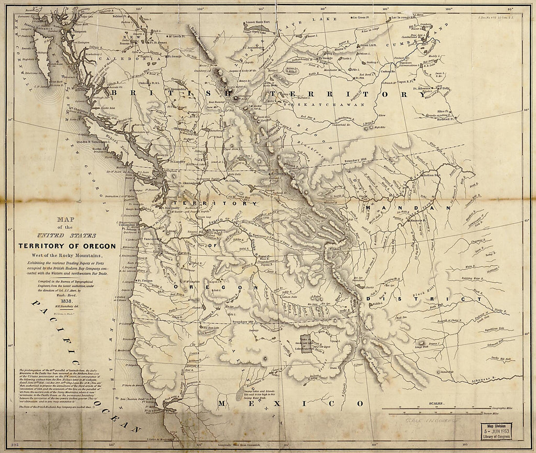 Map of the United States, Territory of Oregon, West of the Rocky Mountains, Exhibiting the Various Trading Depots Or Forts Occupied by the British Hudson Bay Company, Connected With the Western and Northwestern Fur Trade 1838
- Regular price
-
From
$34.95 - Regular price
-
$49.99 - Sale price
-
From
$34.95
-
National Political Map of the United States 1856
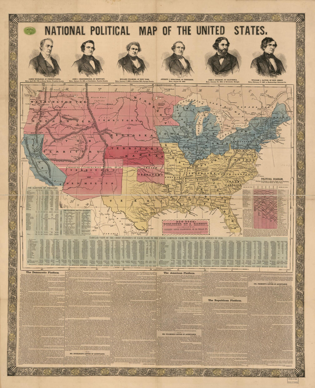 National Political Map of the United States 1856
- Regular price
-
From
$34.95 - Regular price
-
$49.99 - Sale price
-
From
$34.95
-
Map Showing Indian Reservations Within the Limits of the United States 1892
 Map Showing Indian Reservations Within the Limits of the United States 1892
- Regular price
-
From
$41.95 - Regular price
-
$66.99 - Sale price
-
From
$41.95
-
The Coast of the United States : Sheet No. 2 From Cape Lookout to Cape Carnaveral i.e. Canaveral From the U.S. Coast Surveys in 1865
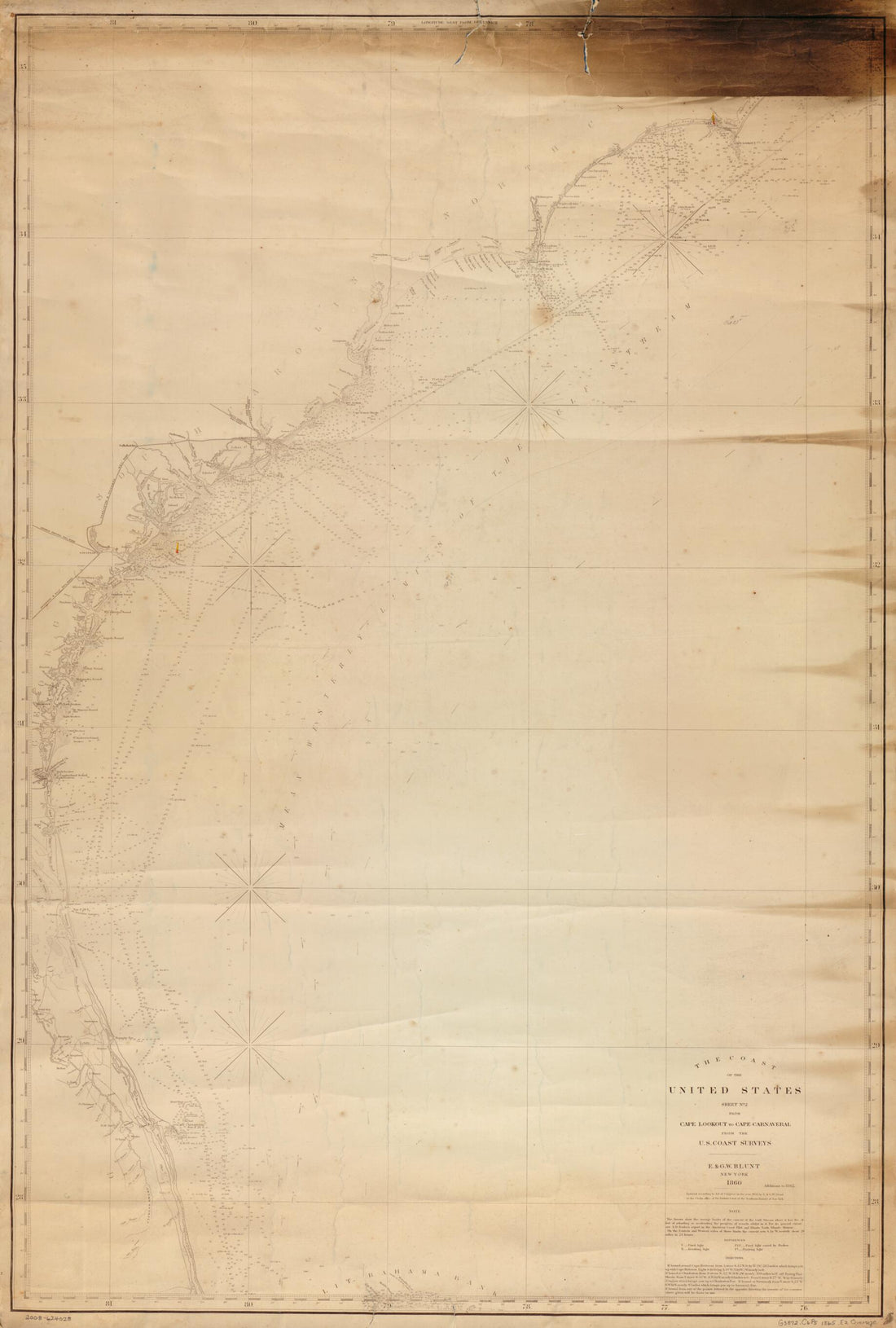 The Coast of the United States : Sheet No. 2 From Cape Lookout to Cape Carnaveral i.e. Canaveral From the U.S. Coast Surveys in 1865
- Regular price
-
From
$41.95 - Regular price
-
$66.99 - Sale price
-
From
$41.95
-
Lloyd's New County Map of the United States and Canadas Showing Battle Fields, Railroads, &c., Compiled from the Latest Government Surveys & Other Reliable & Official Sources, Drawn and Engraved by Schơnberg & County, New York 1863
 Lloyd's New County Map of the United States and Canadas Showing Battle Fields, Railroads, &c., Compiled from the Latest Government Surveys & Other Reliable & Official Sources, Drawn and Engraved by Schơnberg & County, New York 1863
- Regular price
-
From
$32.95 - Regular price
-
$51.99 - Sale price
-
From
$32.95
-
Interesting Bird's Eye View of the Seat of War. Showing Parts of the States of Maryland, Delaware, Virginia, and North Carolina; and Also the Coast Line from Cape Henry to Fort Pickens, With the United States Blockading Fleet 1861
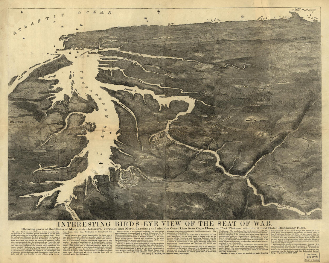 Interesting Bird's Eye View of the Seat of War. Showing Parts of the States of Maryland, Delaware, Virginia, and North Carolina; and Also the Coast Line from Cape Henry to Fort Pickens, With the United States Blockading Fleet 1861
- Regular price
-
From
$34.95 - Regular price
-
$49.99 - Sale price
-
From
$34.95
-
The Upper Territories of the United States 1814
 The Upper Territories of the United States 1814
- Regular price
-
From
$32.95 - Regular price
-
$51.99 - Sale price
-
From
$32.95
-
Plan of the City of Washington : the Capitol sic of the United States of America 1874
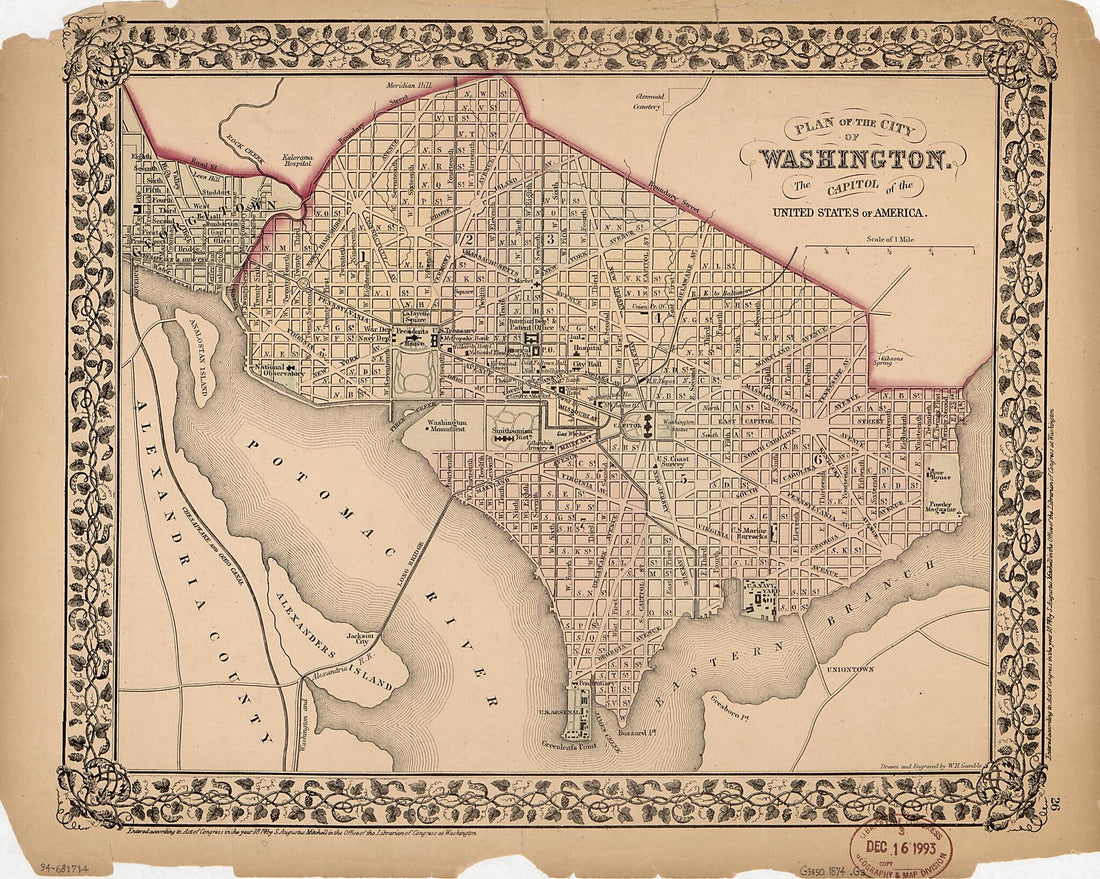 Plan of the City of Washington : the Capitol sic of the United States of America 1874
- Regular price
-
From
$19.95 - Regular price
-
$29.95 - Sale price
-
From
$19.95
-
Map of the Parish of Avoyelles and Part of Rapides, Louisiana : From the United States Survey in 1860
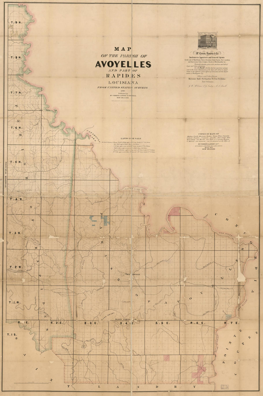 Map of the Parish of Avoyelles and Part of Rapides, Louisiana : From the United States Survey in 1860
- Regular price
-
From
$41.95 - Regular price
-
$66.99 - Sale price
-
From
$41.95
-
Sectional Map of the State of Iowa, Compiled from the United States Surveys Also Exhibiting the Internal Improvements, Distances Between Towns & Villages, Lines of Projected Rail Roads &c. &c.; Drawn and Published by Guy H. Carleton, Dep. Sur. U.S 1850
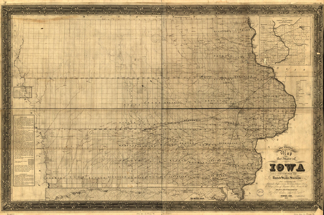 Sectional Map of the State of Iowa, Compiled from the United States Surveys Also Exhibiting the Internal Improvements, Distances Between Towns & Villages, Lines of Projected Rail Roads &c. &c.; Drawn and Published by Guy H. Carleton, Dep. Sur. U.S 1850
- Regular price
-
From
$41.95 - Regular price
-
$66.99 - Sale price
-
From
$41.95


