Quick links
13434 products
-
Lewis and Clark Map, With Annotations In Brown Ink by Meriwether Lewis, Tracing Showing the Mississippi, the Missouri for a Short Distance Above Kansas, Lakes Michigan, Superior, and Winnipeg, and the Country Onwards to the Pacific 1803
 Lewis and Clark Map, With Annotations In Brown Ink by Meriwether Lewis, Tracing Showing the Mississippi, the Missouri for a Short Distance Above Kansas, Lakes Michigan, Superior, and Winnipeg, and the Country Onwards to the Pacific 1803
- Regular price
-
From
$41.95 - Regular price
-
$66.99 - Sale price
-
From
$41.95
-
A Chart of New York Island & North River: East River, Passage Through Hell Gate, Flushing Bay, Hampstead Bay, Oyster, Huntington Bay, Cow Harbour, East Chester Inlet, Rochell, Rye, Patrick Islands, Ec 1770
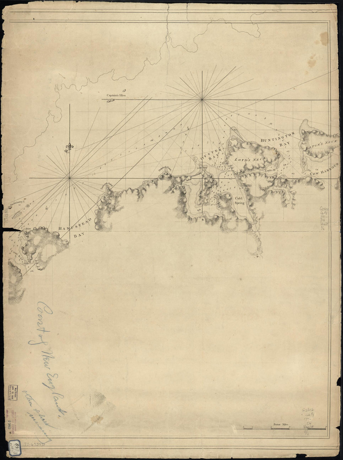 A Chart of New York Island & North River: East River, Passage Through Hell Gate, Flushing Bay, Hampstead Bay, Oyster, Huntington Bay, Cow Harbour, East Chester Inlet, Rochell, Rye, Patrick Islands, Ec 1770
- Regular price
-
From
$32.95 - Regular price
-
$51.99 - Sale price
-
From
$32.95
-
Chart Showing the Depth of the James and York Rivers As They Enter Chesapeake Bay, With Towns Adjacent 1781
 Chart Showing the Depth of the James and York Rivers As They Enter Chesapeake Bay, With Towns Adjacent 1781
- Regular price
-
From
$29.95 - Regular price
-
$46.95 - Sale price
-
From
$29.95
-
Map Showing the Location of Battle Fields of Virginia (Battle Fields of Virginia, Battlefields of Virginia) 1892
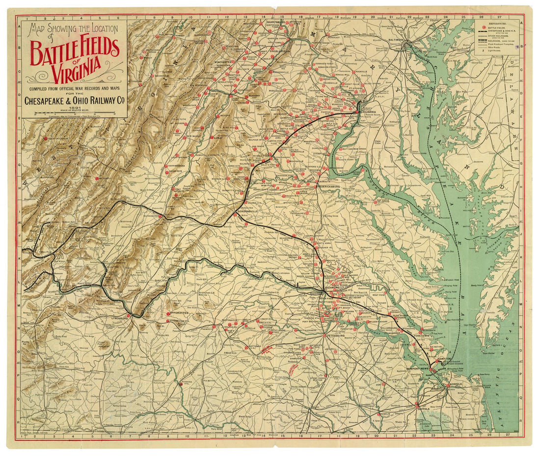 Map Showing the Location of Battle Fields of Virginia (Battle Fields of Virginia, Battlefields of Virginia) 1892
- Regular price
-
From
$34.95 - Regular price
-
$49.99 - Sale price
-
From
$34.95
-
Bacon's Topographical Map of the Seat of War In Virginia, Maryland and Pennsylvania 1863
 Bacon's Topographical Map of the Seat of War In Virginia, Maryland and Pennsylvania 1863
- Regular price
-
From
$32.95 - Regular price
-
$51.99 - Sale price
-
From
$32.95
-
Ft. Fisher Shewing sic Union Attack, Jany 15th 1865 from Survey Made After Surrender by U.S. Engineers 01-15
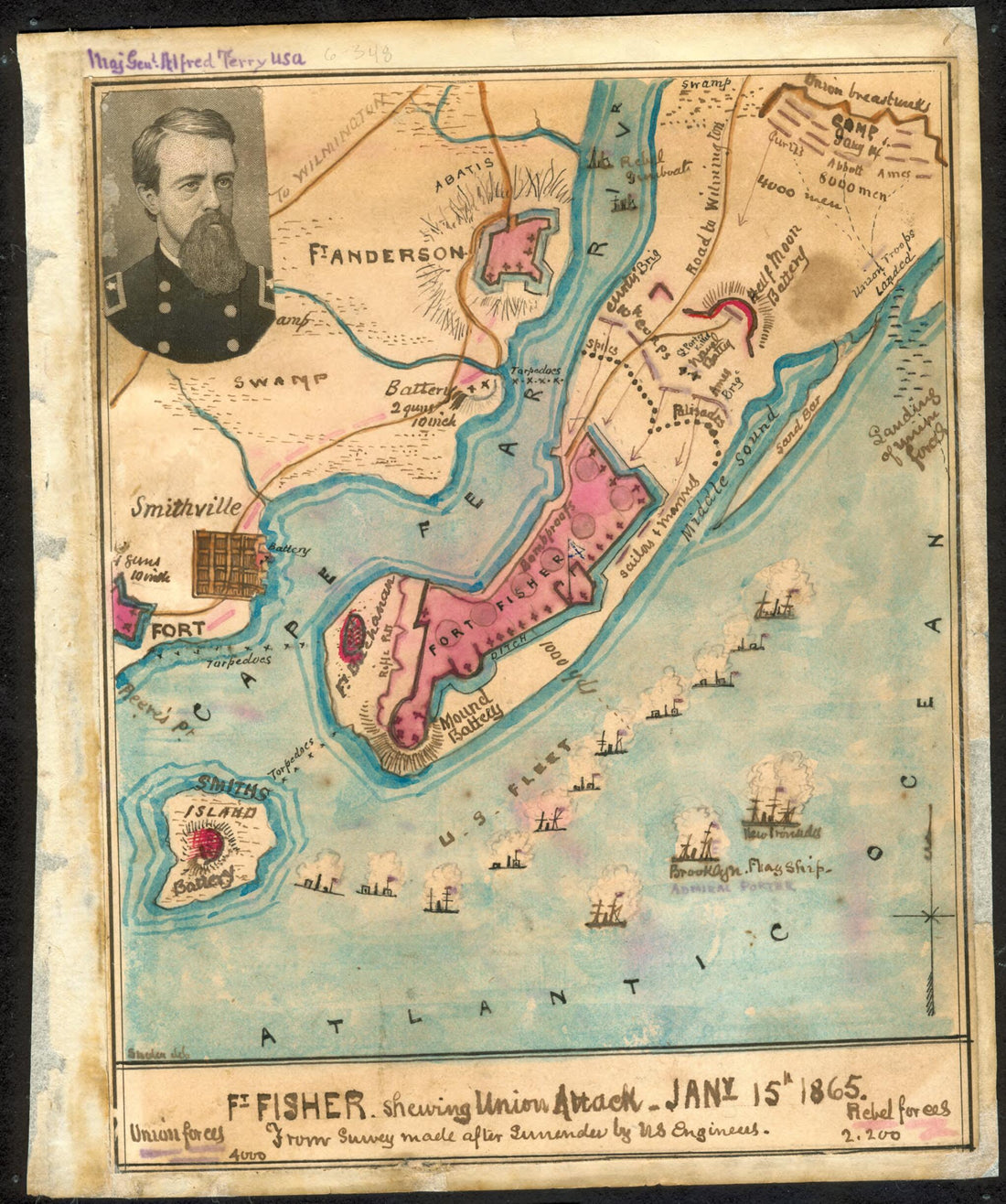 Ft. Fisher Shewing sic Union Attack, Jany 15th 1865 from Survey Made After Surrender by U.S. Engineers 01-15
- Regular price
-
From
$19.95 - Regular price
-
$29.95 - Sale price
-
From
$19.95
-
Plan of Fort Mifflin On Mud Island, With the Batteries On Province Island 1778
 Plan of Fort Mifflin On Mud Island, With the Batteries On Province Island 1778
- Regular price
-
From
$19.95 - Regular price
-
$29.95 - Sale price
-
From
$19.95
-
A New Map of the United States. Upon Which Are Delineated Its Vast Works of Internal Communication, Routes Across the Continent &c. Showing Also Canada and the Island of Cuba 1851
 A New Map of the United States. Upon Which Are Delineated Its Vast Works of Internal Communication, Routes Across the Continent &c. Showing Also Canada and the Island of Cuba 1851
- Regular price
-
From
$34.95 - Regular price
-
$49.99 - Sale price
-
From
$34.95
-
Connecticut With Portions of New York & Rhode Island 1859
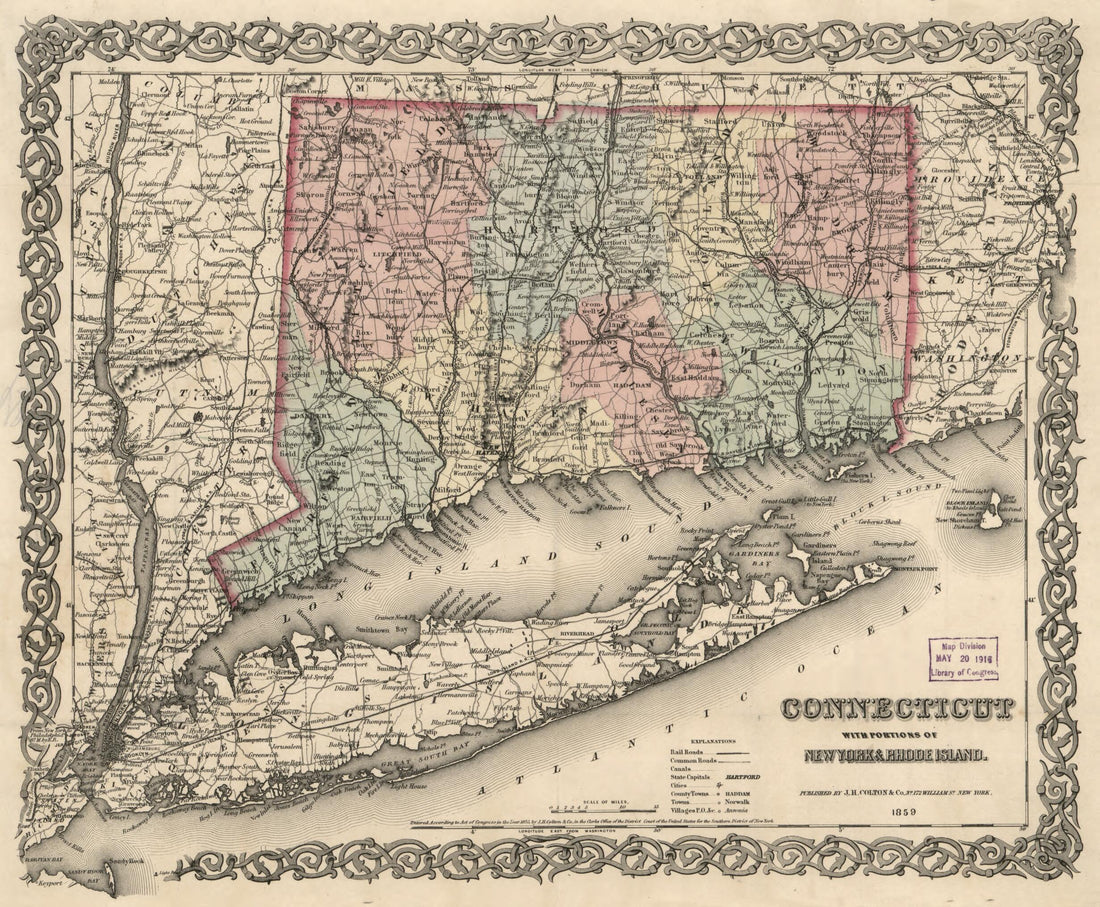 Connecticut With Portions of New York & Rhode Island 1859
- Regular price
-
From
$23.95 - Regular price
-
$36.95 - Sale price
-
From
$23.95
-
Map of Hickory Co., Mo. (Map of Hickory County, Missouri, Hickory County, Missouri) 1880
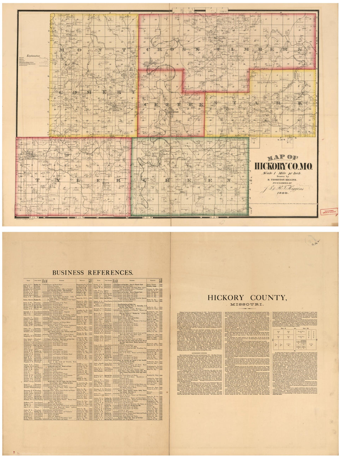 Map of Hickory Co., Mo. (Map of Hickory County, Missouri, Hickory County, Missouri) 1880
- Regular price
-
From
$32.95 - Regular price
-
$51.99 - Sale price
-
From
$32.95
-
Map of a Portion of Kern County, California. : Showing Ranches, Lakes, Rivers, Canals, Sloughs, and Artesian Wells 1888
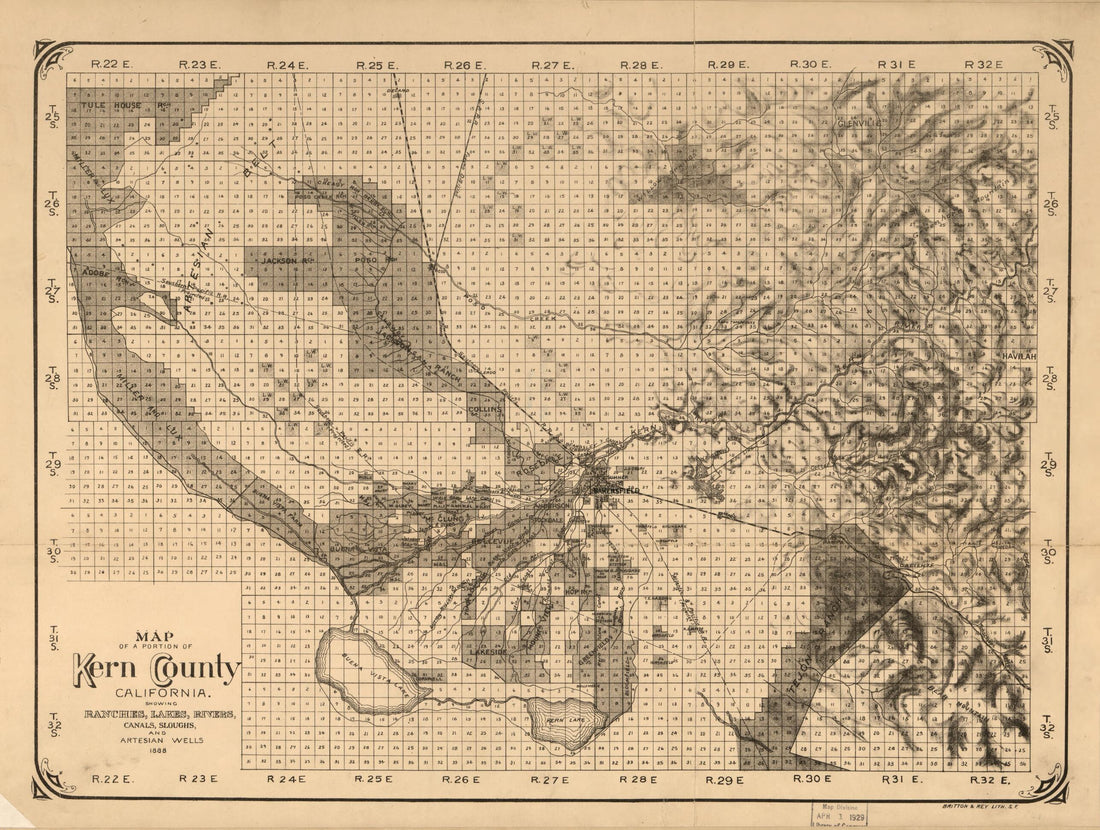 Map of a Portion of Kern County, California. : Showing Ranches, Lakes, Rivers, Canals, Sloughs, and Artesian Wells 1888
- Regular price
-
From
$32.95 - Regular price
-
$51.95 - Sale price
-
From
$32.95
-
Map of Kaufman & Rockwall Counties,Texas 1878
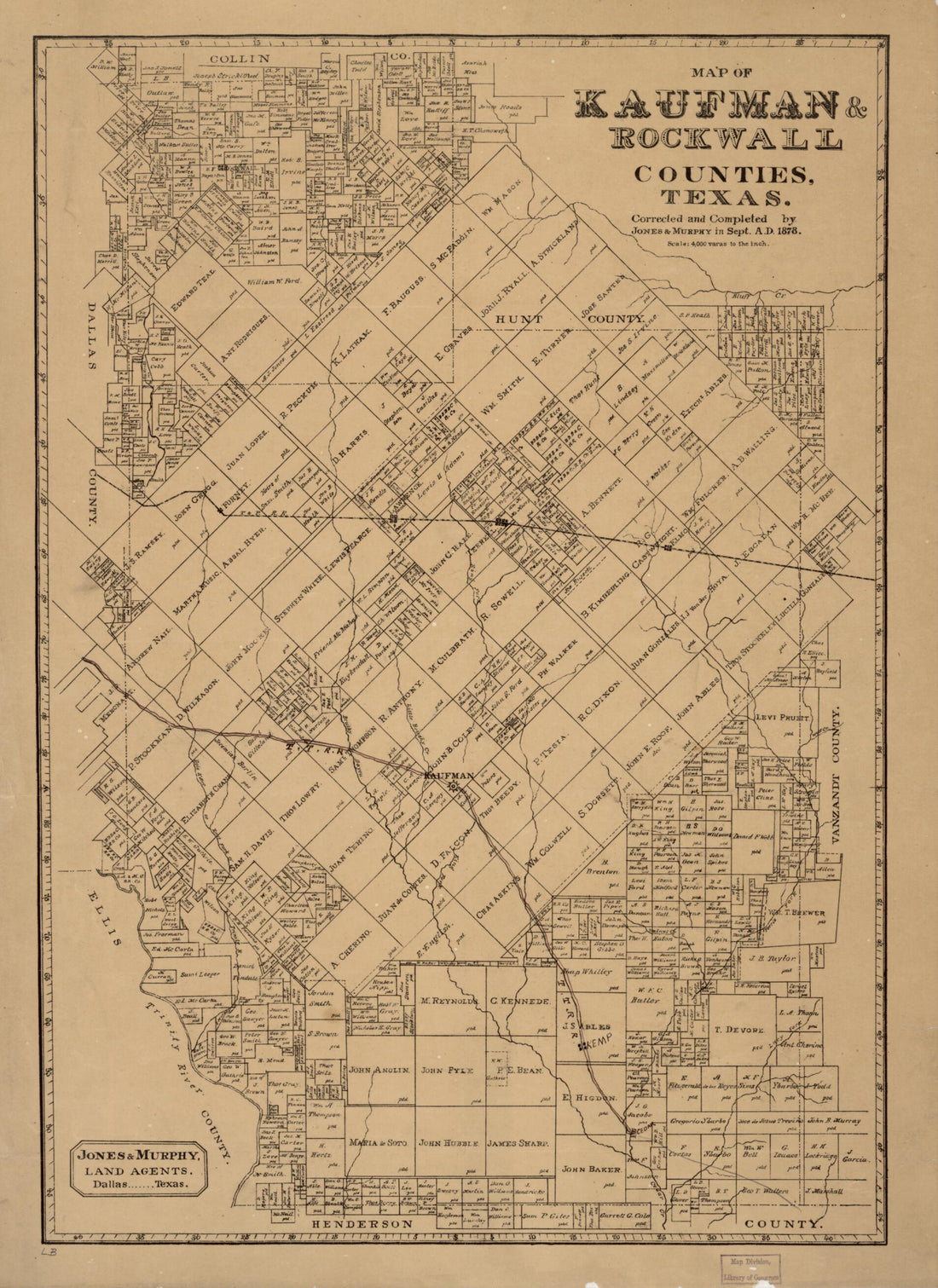 Map of Kaufman & Rockwall Counties,Texas 1878
- Regular price
-
From
$32.95 - Regular price
-
$51.99 - Sale price
-
From
$32.95


