Quick links
13434 products
-
Preliminary Chart of North Landing River (head of Currituck Sound), Virginia & N. Carolina 1861
 Preliminary Chart of North Landing River (head of Currituck Sound), Virginia & N. Carolina 1861
- Regular price
-
From
$34.95 - Regular price
-
$49.99 - Sale price
-
From
$34.95
-
Map of the Richmond and Louisville R.R. Connecting the Railroads of Virginia With the Railroads of Kentucky On the Shortest Route East and West of the Mississippi Valley to the Atlantic Ocean 1882
 Map of the Richmond and Louisville R.R. Connecting the Railroads of Virginia With the Railroads of Kentucky On the Shortest Route East and West of the Mississippi Valley to the Atlantic Ocean 1882
- Regular price
-
From
$41.95 - Regular price
-
$66.99 - Sale price
-
From
$41.95
-
Map Showing Location of Lands Belonging to the Iowa Rail Road Land Company Iowa Falls, and Sioux City R.R. Land Company Sioux City, and Pacific Land Company & Elkhorn Land Company, J. T. McAlvin, Del. I.R.R. Land Department, Cedar Rapids, Iowa, 1871
 Map Showing Location of Lands Belonging to the Iowa Rail Road Land Company Iowa Falls, and Sioux City R.R. Land Company Sioux City, and Pacific Land Company & Elkhorn Land Company, J. T. McAlvin, Del. I.R.R. Land Department, Cedar Rapids, Iowa, 1871
- Regular price
-
From
$41.95 - Regular price
-
$66.99 - Sale price
-
From
$41.95
-
Map of Trinidad, Washington, D.C. : 1888
 Map of Trinidad, Washington, D.C. : 1888
- Regular price
-
From
$34.95 - Regular price
-
$49.99 - Sale price
-
From
$34.95
-
Todd & Brown's Subdivision of Part of Pleasant Plains and Mt. Pleasant, Washington County, D.C 1887
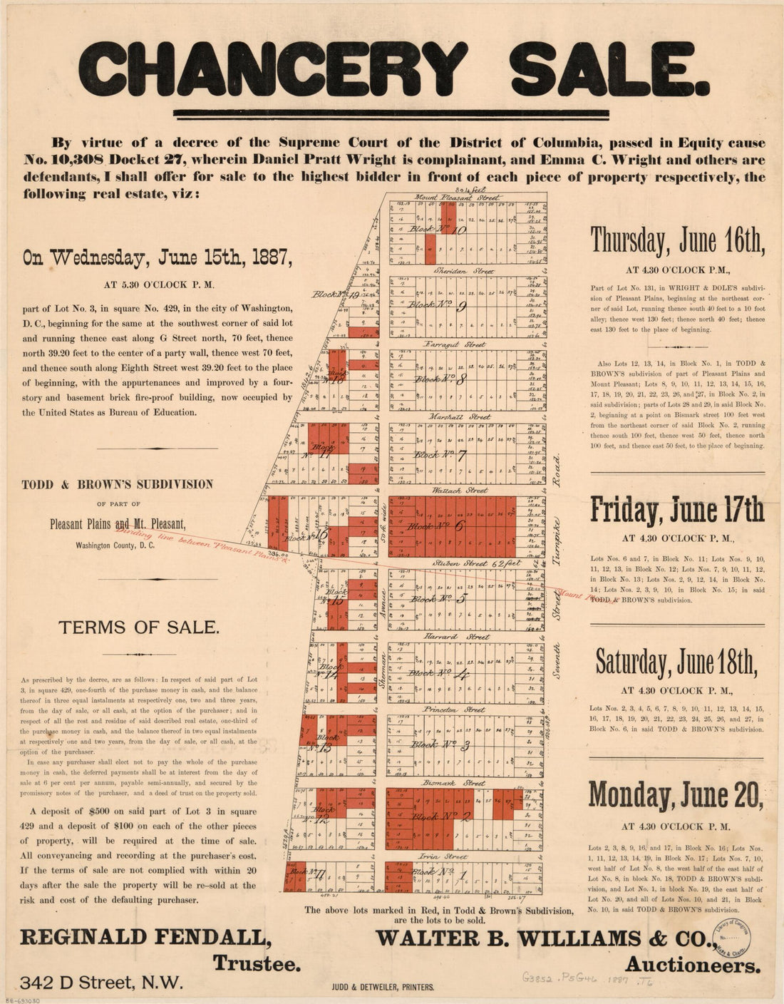 Todd & Brown's Subdivision of Part of Pleasant Plains and Mt. Pleasant, Washington County, D.C 1887
- Regular price
-
From
$34.95 - Regular price
-
$49.99 - Sale price
-
From
$34.95
-
A Map of the Most Inhabited Part of Virginia Containing the Whole Province of Maryland With Part of Pensilvania, New Jersey and North Carolina 1775
 A Map of the Most Inhabited Part of Virginia Containing the Whole Province of Maryland With Part of Pensilvania, New Jersey and North Carolina 1775
- Regular price
-
From
$41.95 - Regular price
-
$66.99 - Sale price
-
From
$41.95
-
Bahia De Tampa 1809
 Bahia De Tampa 1809
- Regular price
-
From
$19.95 - Regular price
-
$29.95 - Sale price
-
From
$19.95
-
Plan, Lake Champlain from Fort St. John's to Ticonderoga, With the Soundings, Rocks, Shoals, and Sands, Surveyed In the Years 1778, 1779
 Plan, Lake Champlain from Fort St. John's to Ticonderoga, With the Soundings, Rocks, Shoals, and Sands, Surveyed In the Years 1778, 1779
- Regular price
-
From
$41.95 - Regular price
-
$66.99 - Sale price
-
From
$41.95
-
Plan of Fort William Henry and Camp at Lake George 1755
 Plan of Fort William Henry and Camp at Lake George 1755
- Regular price
-
From
$20.95 - Regular price
-
$32.95 - Sale price
-
From
$20.95
-
Map of McCook County, South Dakota : Compiled and Drawn from a Special Survey and Official Records 1900
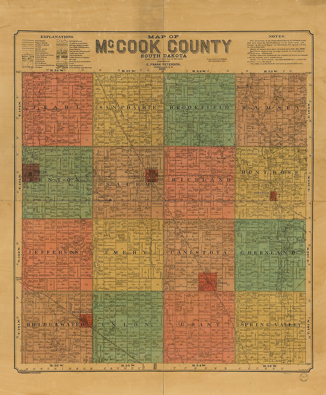 Map of McCook County, South Dakota : Compiled and Drawn from a Special Survey and Official Records 1900
- Regular price
-
From
$34.95 - Regular price
-
$49.99 - Sale price
-
From
$34.95
-
Map of Marion and Washington Counties, Ky : from Actual Surveys and Official Records (Map of Marion and Washington Counties, Kentucky) 1877
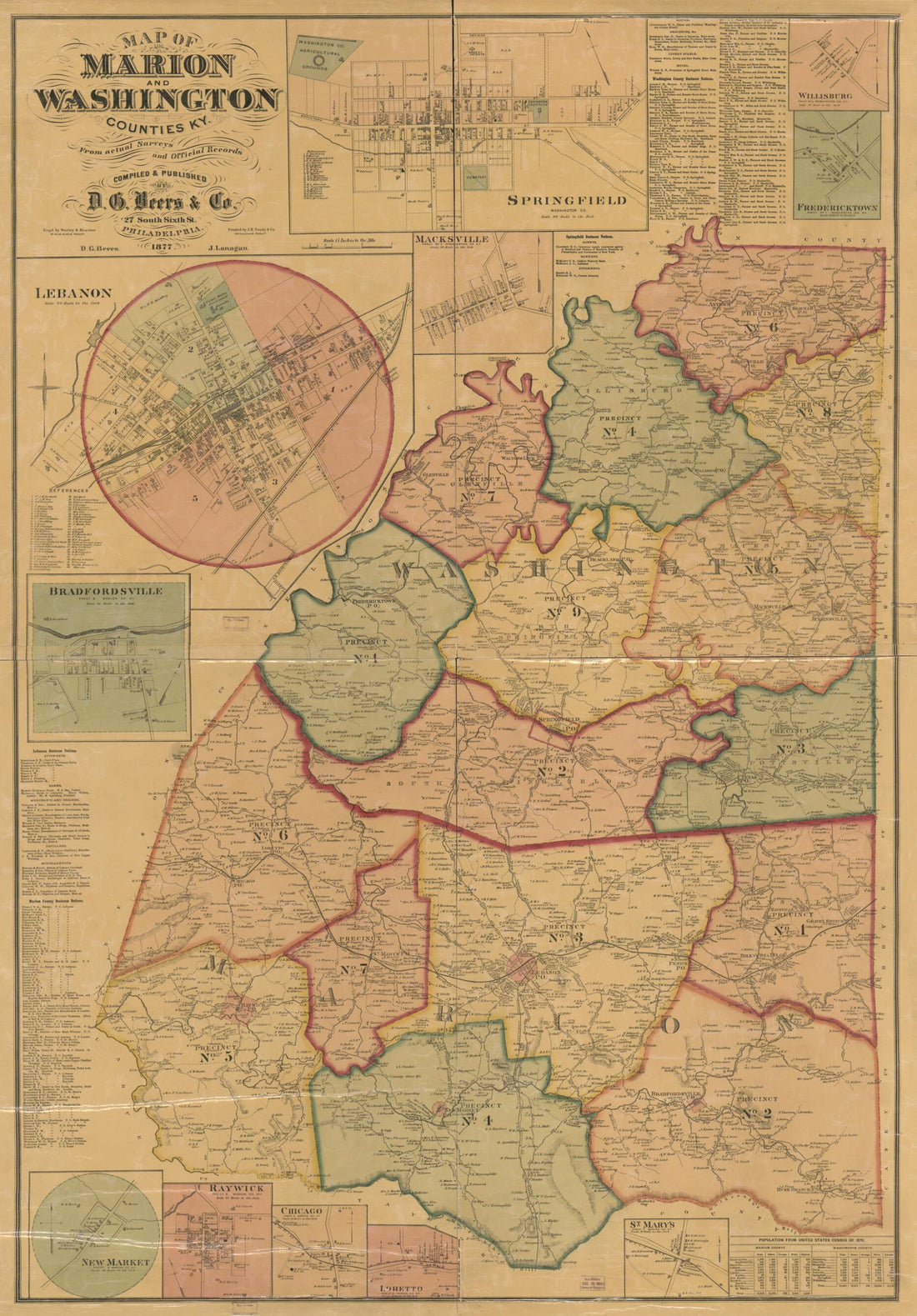 Map of Marion and Washington Counties, Ky : from Actual Surveys and Official Records (Map of Marion and Washington Counties, Kentucky) 1877
- Regular price
-
From
$41.95 - Regular price
-
$66.99 - Sale price
-
From
$41.95
-
A New Map of Virginia With Maryland, Delaware & V 1814
 A New Map of Virginia With Maryland, Delaware & V 1814
- Regular price
-
From
$32.95 - Regular price
-
$51.99 - Sale price
-
From
$32.95


