
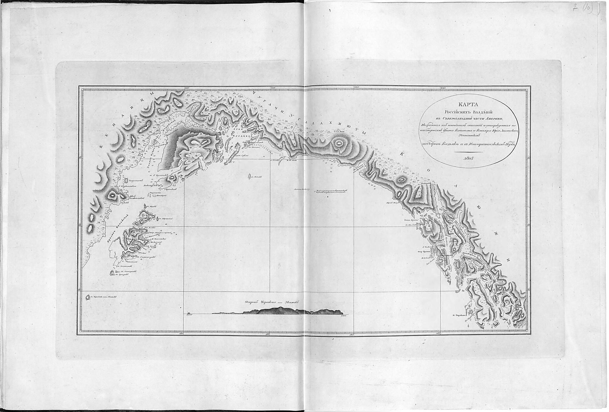
Zapadnoĭ Chasti Ameriki, Vybrannai︠a︡ Iz Noveĭshikh Opisaniĭ I Utverzhdennai︠a︡ Po Nabli︠u︡denii︠a︡m Flota Kapitana I Kavalera I︠U︡rii︠a︡ Lisi︠a︡nskogo, Uchinennym Na Ostrove Kad'i︠a︡ke V Novoarkhangel'skom Porte. 18...
- Regular price
-
$62.95 - Regular price
-
$44.95 - Sale price
-
$62.95
Buy one map, get any other map in our collection for 50% OFF! Add to cart to see discount.
Couldn't load pickup availability
About This Map
Discover the timeless beauty of our fine art quality printed reproduction of this antique map. Perfect for history enthusiasts, collectors, and interior decorators.
Restored with meticulous attention to detail by our team with over a decade of experience, this stunning reproduction captures the intricate artistry and historical significance of the original map.
Whether you're a collector or seeking a unique decor piece, this archival-quality map reproduction is a timeless addition to any space. Order now to bring history to life!
Old map of Alaska, Kenai Peninsula, Kodiak Island, United States.Created by I︠u︡ri Lisi︠a︡nskiĭ in 1812.
- [5] Iz izdanii︠a︡: Sobranie kart i risunkov, prinadlezhashchikh k puteshestvii︠u︡ flota kapitana 1-go ranga i Kavalera I︠U︡rii︠a︡ Lisi︠a︡nskogo na korable Neve. Kartograficheskai︠a︡ setka cherez 5°.
- Pokazano: naselennye punkty, rasselenie narodnosteĭ; otmetki glubin, podvodnye kamni, meli, rastitel'nost', rel'ef shtrikhami. Vid berega: Ostrov Chirikova ili Ukamok.
- Original map at: National Library of Russia
- From the atlas "Собрание карт и рисунков, принадлежащих к Путешествию флота капитана 1-го ранга и Кавалера Юрия Лисянского, на корабле Нева."
- [5] Из издания: Собрание карт и рисунков, принадлежащих к путешествию флота капитана 1-го ранга и Кавалера Юрия Лисянского на корабле Неве. Картографическая сетка через 5°.
- Показано: населенные пункты, расселение народностей; отметки глубин, подводные камни, мели, растительность, рельеф штрихами. Вид берега: Остров Чирикова или Укамок.
Map Subjects
Alaska
Kenai Peninsula
Kodiak Island
United States Of America
United States
I︠u︡ri Lisi︠a︡nskiĭ
1812
- For the best legibility, order your map in the original size or larger. Most maps have intricate detail and small text that is best appreciated when the print size hasn't been reduced.
- Sizes labeled "Fits a Standard Frame" will drop right into any frame that you purchase in that size. The sizes that we offer are commonly available online and at most retail stores.
- Our standard sizes are recommendations based on the aspect ratio of the original map, but still may require some added "white space" in one dimension to fit.
- Non-standard sizes will require custom framing, and we suggest taking your print to the frame shop of your choice after you receive it for the best results.
- Custom sizes are available, simply contact us for a quote.
Below is an approximation of the scale of a few standard sizes, and how they might appear in your space.
