
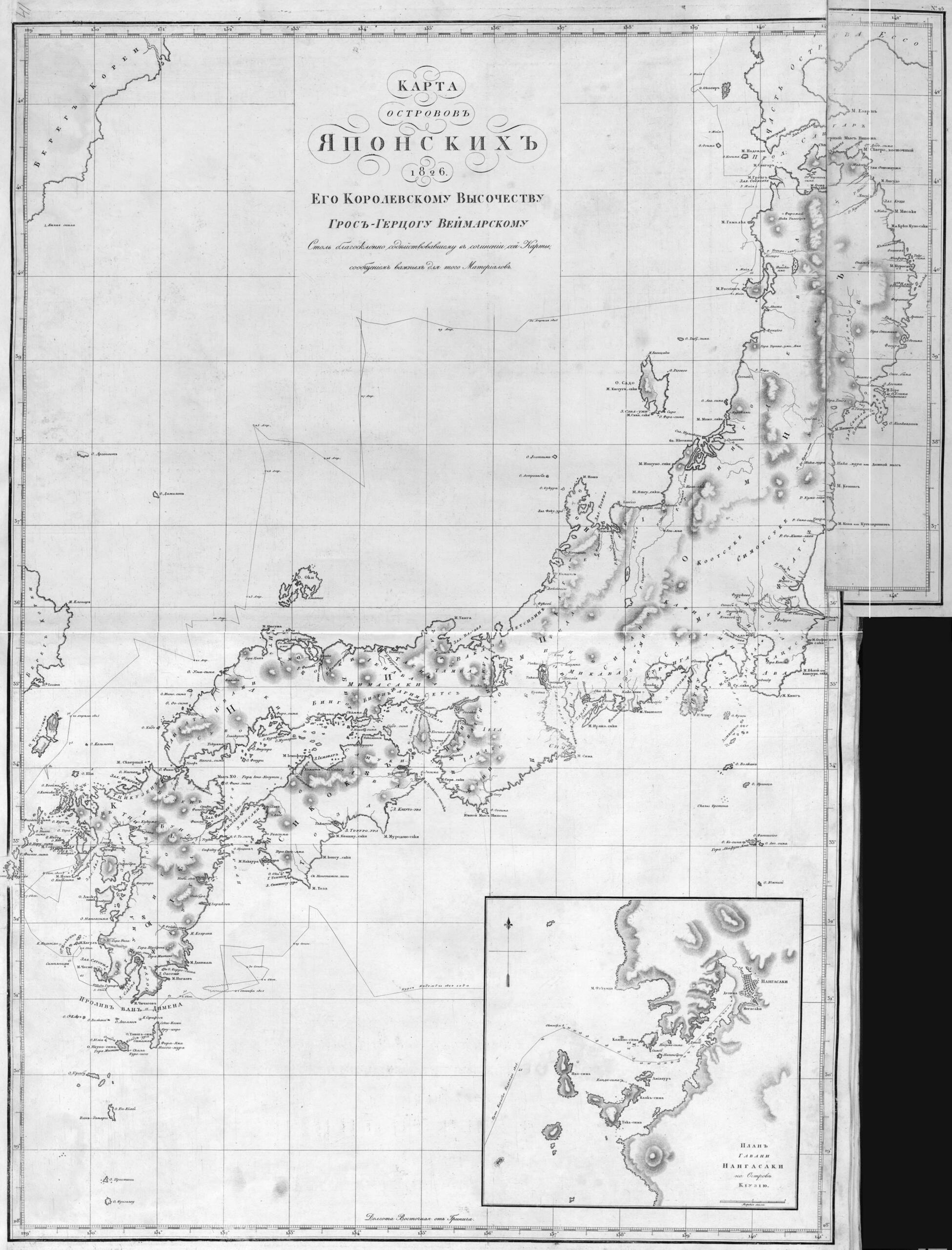
Карта островов Японских. in 1826
- Regular price
-
$101.95 - Regular price
-
$96.95 - Sale price
-
$101.95
Shipping calculated at checkout.
Buy one map, get any other map in our collection for 50% OFF! Add to cart to see discount.
Couldn't load pickup availability
About This Map
Old map of Japan.
Created by Ivan Fedorovich Kruzenshtern in 1826.
Created by Ivan Fedorovich Kruzenshtern in 1826.
- Dopolnitel'nai︠a︡ karta: Plan gavani Nagasaki na ostrove Kiuzii︠u︡.- 1:80 500.
- Na karte posvi︠a︡shchenie: Ego Korolevskomu Vysochestvu Gross-Gert︠s︡ogu Veĭmarskomu stol' blagosklonno sodeĭstvovavshemu v sochinenii seĭ karty soobshcheniem vazhnykh dli︠a︡ togo materialov.
- Original map at: National Library of Russia
- From the atlas "Атлас Южного моря сочиненный флота капитан командором Крузенштерном."
- Дополнительная карта: План гавани Нагасаки на острове Киузию.- 1:80 500.
- На карте посвящение: Его Королевскому Высочеству Гросс-Герцогу Веймарскому столь благосклонно содействовавшему в сочинении сей карты сообщением важных для того материалов.
Map Sizing Information
- For the best legibility, order your map in the original size or larger. Most maps have intricate detail and small text that is best appreciated when the print size hasn't been reduced.
- Sizes labeled "Fits a Standard Frame" will drop right into any frame that you purchase in that size. The sizes that we offer are commonly available online and at most retail stores.
- Our standard sizes are recommendations based on the aspect ratio of the original map, but still may require some added "white space" in one dimension to fit.
- Non-standard sizes will require custom framing, and we suggest taking your print to the frame shop of your choice after you receive it for the best results.
- Custom sizes are available, simply contact us for a quote.
Below is an approximation of the scale of a few standard sizes, and how they might appear in your space.

