
Portsmouth Region, Virginia 1885
- Regular price
-
$49.95 - Regular price
-
$29.95 - Sale price
-
$49.95
Shipping calculated at checkout.
Buy one map, get any other map in our collection for 50% OFF! Add to cart to see discount.
Couldn't load pickup availability
About This Map
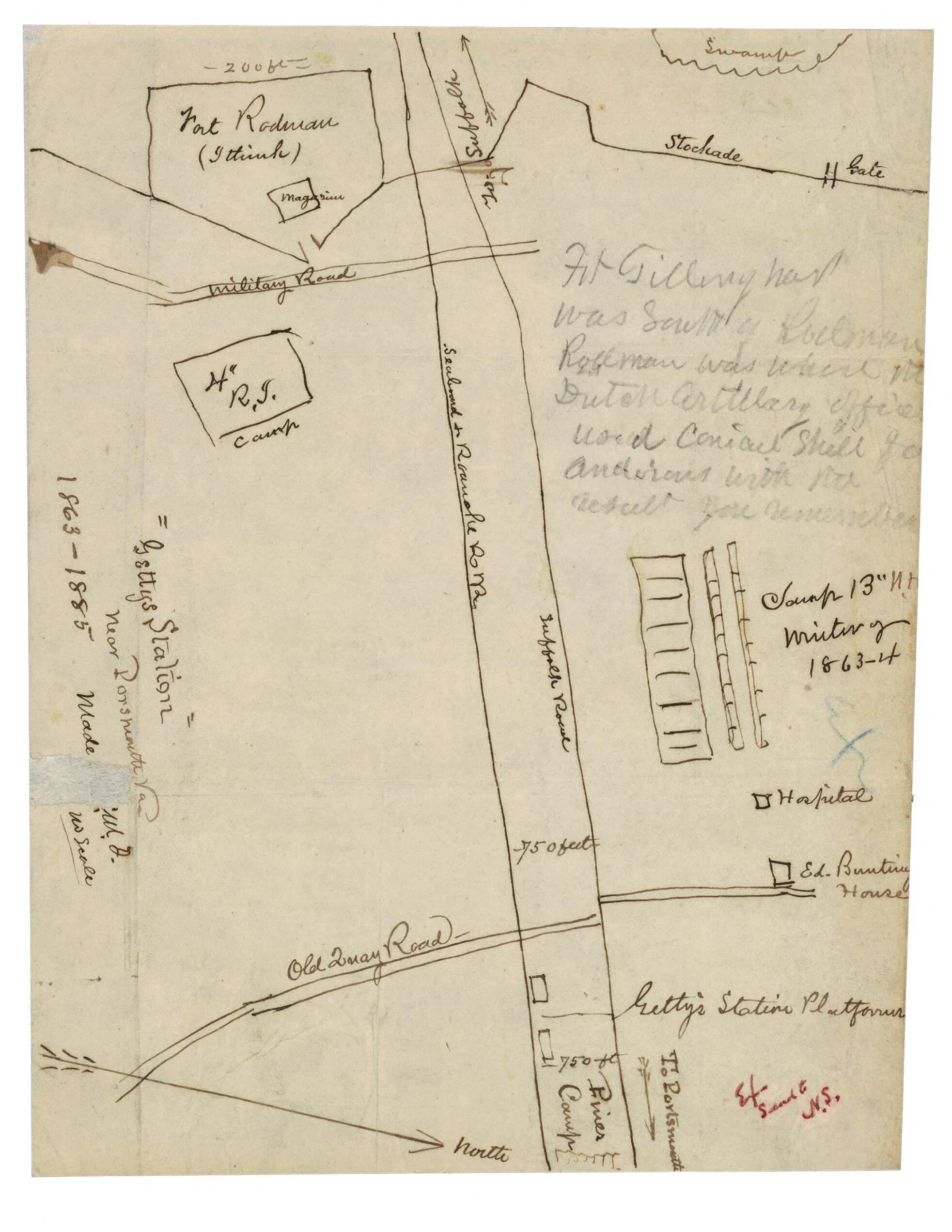
Old map of Portsmouth Region, United States, Virginia.
Created by Normand Smith in 1885.
Created by Normand Smith in 1885.
- Additional annotations made in pencil.
- One of a series of five maps drawn by Col. Normand Smith showing battle lines. Original maps are included in Personal Papers Collection, accession 24417, Gaines Family Papers, 1776-1905.
- Oriented with north toward the lower right.
- Part of text: "Made C.N.G."? missing.
- This item is in the Map Collection of the Library of Virginia; please contact the Library's Archives Research Services department for more information.
- C. 1 1956, photocopy, LVA; c. 2 Dec. 2003, color ink jet print, LVA (original in Archives, Mrs. Ormonde Smith, 1956, gift); Map Cataloging Team.
- Archives original conserved by the Etherington Conservation Center, May 2002.
- Civil War Map Proj. no.: LVA00061
- Copy filed as: 755.514 M6 1861-1865 1885?.
- Digital image available: 7 x 9 in.
Map Sizing Information
- For the best legibility, order your map in the original size or larger. Most maps have intricate detail and small text that is best appreciated when the print size hasn't been reduced.
- Sizes labeled "Fits a Standard Frame" will drop right into any frame that you purchase in that size. The sizes that we offer are commonly available online and at most retail stores.
- Our standard sizes are recommendations based on the aspect ratio of the original map, but still may require some added "white space" in one dimension to fit.
- Non-standard sizes will require custom framing, and we suggest taking your print to the frame shop of your choice after you receive it for the best results.
- Custom sizes are available, simply contact us for a quote.
Below is an approximation of the scale of a few standard sizes, and how they might appear in your space.

