
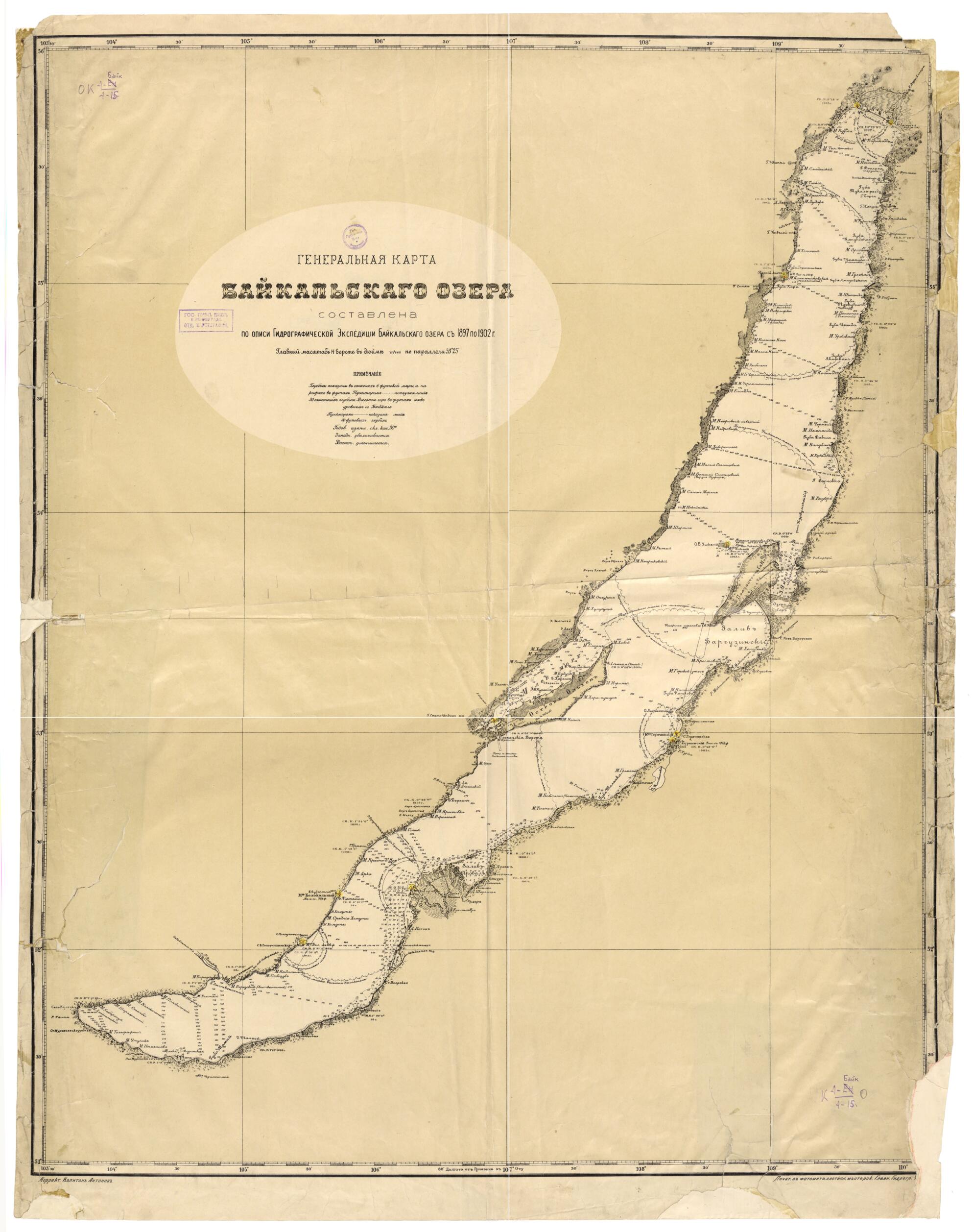
General'nai︠a︡ Karta Baĭkal'skogo Ozera Sostavlena Po Opisi Gidrograficheskoĭ Ėkspedit︠s︡ii Baĭkal'skogo Ozera S 1897 Po 1902 G. (Генеральная карта Байкальского озера Составлена по описи Г...
- Regular price
-
$130.95 - Regular price
-
$125.95 - Sale price
-
$130.95
Buy one map, get any other map in our collection for 50% OFF! Add to cart to see discount.
Couldn't load pickup availability
About This Map
Discover the timeless beauty of our fine art quality printed reproduction of this antique map. Perfect for history enthusiasts, collectors, and interior decorators.
Restored with meticulous attention to detail by our team with over a decade of experience, this stunning reproduction captures the intricate artistry and historical significance of the original map.
Whether you're a collector or seeking a unique decor piece, this archival-quality map reproduction is a timeless addition to any space. Order now to bring history to life!
Old map of Russian Federation.Created by Antonov, Gidrograficheskai︠a︡ Ėkspedit︠s︡ii︠a in 1924.
- T︠S︡vetnai︠a︡. Kartograficheskai︠a︡ setka po dolgote cherez 1°, po shirote cherez 2°; schet dolgot ot Grinvicha.
- Otmecheny: naselennye punkty po poberezh'i︠u︡ Baĭkala (4 gruppy), stant︠s︡ii na Zabaĭkal'skoĭ zheleznoĭ doroge, monastyri, mai︠a︡ki s ukazaniem dal'nosti ikh vidimosti, banki ėkspedit︠s︡ii; rastitel'nost', bolota, rel'ef sushi shtrikhami s otmetkami vysot v futakh, kompasnye.
- Original map at: National Library of Russia
- Цветная. Картографическая сетка по долготе через 1°, по широте через 2°; счет долгот от Гринвича.
- Отмечены: населенные пункты по побережью Байкала (4 группы), станции на Забайкальской железной дороге, монастыри, маяки с указанием дальности их видимости, банки экспедиции; растительность, болота, рельеф суши штрихами с отметками высот в футах, компасные.
- For the best legibility, order your map in the original size or larger. Most maps have intricate detail and small text that is best appreciated when the print size hasn't been reduced.
- Sizes labeled "Fits a Standard Frame" will drop right into any frame that you purchase in that size. The sizes that we offer are commonly available online and at most retail stores.
- Our standard sizes are recommendations based on the aspect ratio of the original map, but still may require some added "white space" in one dimension to fit.
- Non-standard sizes will require custom framing, and we suggest taking your print to the frame shop of your choice after you receive it for the best results.
- Custom sizes are available, simply contact us for a quote.
Below is an approximation of the scale of a few standard sizes, and how they might appear in your space.

