


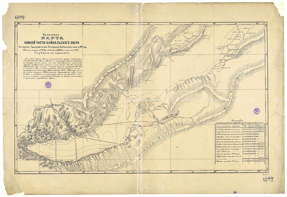
Vremennai︠a︡ Karta I︠u︡zhnoĭ Chasti Baĭkal'skago Ozera. Sostavlena Gidrograficheskoi︠u︡ Ėkspedit︠s︡iei︠u︡ Baĭkal'skago Ozera V 1897 Godu. (Временная карта южной части Байкальскаго озера....
- Regular price
-
$123.95 - Regular price
-
$118.95 - Sale price
-
$123.95
Couldn't load pickup availability
Archival Quality Reproduction
We print on archival quality paper similar to heavy cardstock (used in greeting cards or invitations). The refined matte finish creates a premium look and feel that elevates presentation quality. Our paper delivers results suitable for display in your home, office or gallery.
Meticulously Restored
All maps undergo a careful digital restoration before printing. We strive for the highest quality presentation while maintaining the original integrity of the map.
About This Map
Discover the timeless beauty of our fine art quality printed reproduction of this antique map. Perfect for history enthusiasts, collectors, and interior decorators.
Restored with meticulous attention to detail by our team with over a decade of experience, this stunning reproduction captures the intricate artistry and historical significance of the original map.
Whether you're a collector or seeking a unique decor piece, this archival-quality map reproduction is a timeless addition to any space. Order now to bring history to life!
Old map of Russian Federation.Created by Gidrograficheskai︠a︡ Ėkspedit︠s︡ii︠a in 1897.
- Cherno-belai︠a︡. Kartograficheskai︠a︡ setka po dolgote cherez 30', po shirote cherez 1°, vykhod koordinat cherez 30'; schet dolgot ot Grinvicha.
- Otmecheny: naselennye punkty po poberezh'i︠u︡ Baĭkala (4 gruppy), stant︠s︡ii na Zabaĭkal'skoĭ zheleznoĭ doroge, monastyr', Turkinskie mineral'nye vody, astropunkty; mysy, ust'i︠a︡ rek, kompasnye sklonenii︠a︡, rel'ef sushi gorizontali︠a︡mi, otmetki vysot v futakh, rel'ef oze.
- Original map at: National Library of Russia
- Черно-белая. Картографическая сетка по долготе через 30', по широте через 1°, выход координат через 30'; счет долгот от Гринвича.
- Отмечены: населенные пункты по побережью Байкала (4 группы), станции на Забайкальской железной дороге, монастырь, Туркинские минеральные воды, астропункты; мысы, устья рек, компасные склонения, рельеф суши горизонталями, отметки высот в футах, рельеф озе.
Map Subjects
Gidrografii︠a
Russian Federation
Siberia
Gidrograficheskai︠a︡ Ėkspedit︠s︡ii︠a
1897
- For the best legibility, order your map in the original size or larger. Most maps have intricate detail and small text that is best appreciated when the print size hasn't been reduced.
- Sizes labeled "Fits a Standard Frame" will drop right into any frame that you purchase in that size. The sizes that we offer are commonly available online and at most retail stores.
- Our standard sizes are recommendations based on the aspect ratio of the original map, but still may require some added "white space" in one dimension to fit.
- Non-standard sizes will require custom framing, and we suggest taking your print to the frame shop of your choice after you receive it for the best results.
- Custom sizes are available, simply contact us for a quote.
Below is an approximation of the scale of a few standard sizes, and how they might appear in your space.
