
18th Century Map Including the Headwaters of the Big Cole River 03-30
- Regular price
-
$49.95 - Regular price
-
$34.95 - Sale price
-
$49.95
Shipping calculated at checkout.
Buy one map, get any other map in our collection for 50% OFF! Add to cart to see discount.
Couldn't load pickup availability
About This Map
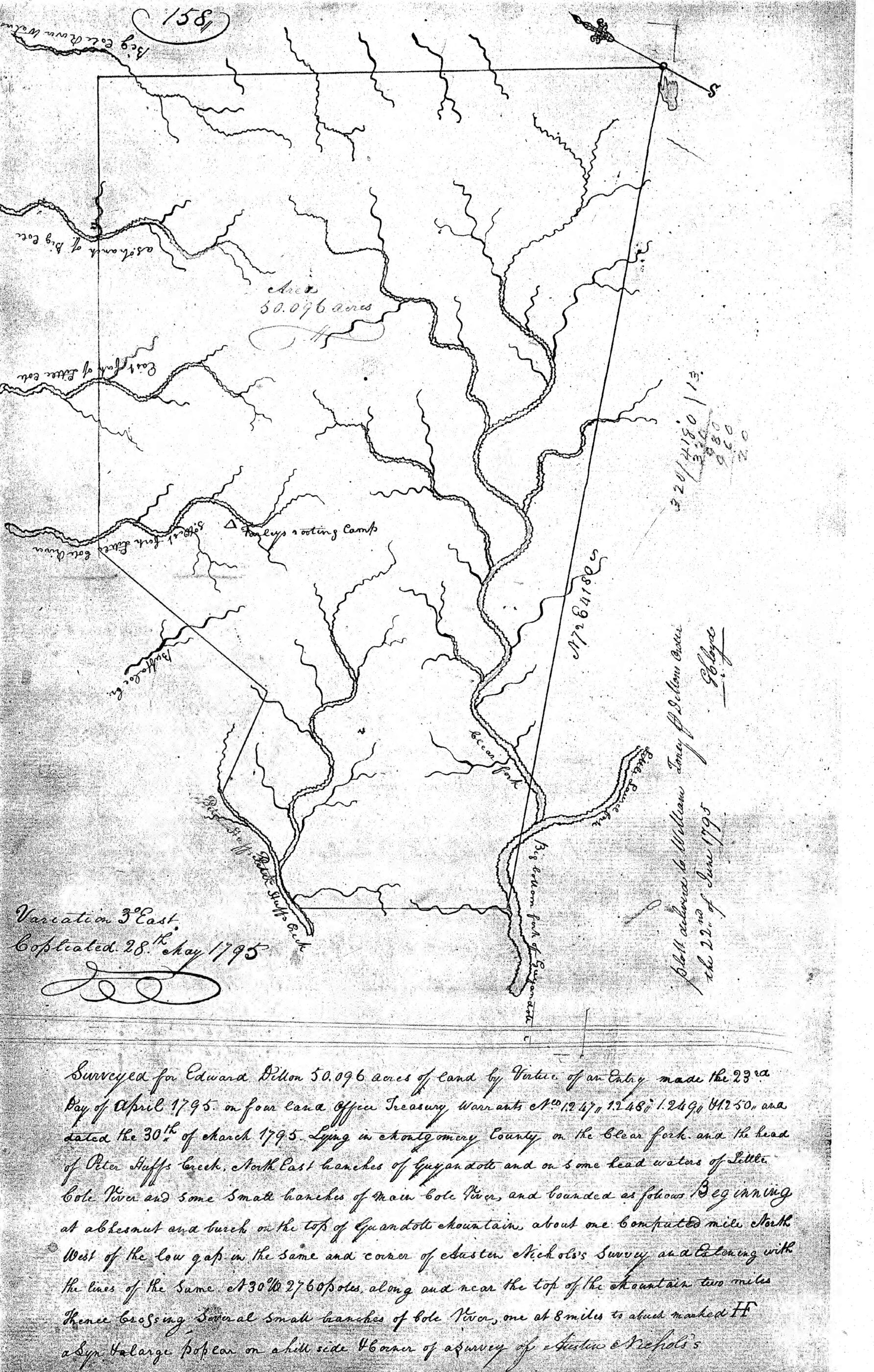
- This representation of 50,096 acres surveyed for Edward Dillon was entered in Montgomery County Deed Book E, page 158, in the spring of 1795. It includes the headwaters of the "Big Cole" River, as well as the headwaters of Buffalo Creek. At the head of the West Fork of the Little Cole River is "Farley's Rooting Camp," presumably a site where men camped while hunting, trapping, and digging for ginseng. Specifically excluded from the 50,096 acres are 2,500 acres within, which were previously claimed. Appalachian historians term the speculative frenzy of land acquisition during this period "the engrossment." Between the years 1790 and 1810, residents of West Virginia established claim to 324,388 acres, nearly seven percent, while absentee owners claimed 4,525,153, more than ninety-three percent (Dunaway, 1996:57). Dillon's property is adjacent to 272,000 acres deeded at that time to Dewitt Clinton, a lawmaker from New York.
- Montgomery County Deedbook E, Montgomery County, Virginia.
Map Sizing Information
- For the best legibility, order your map in the original size or larger. Most maps have intricate detail and small text that is best appreciated when the print size hasn't been reduced.
- Sizes labeled "Fits a Standard Frame" will drop right into any frame that you purchase in that size. The sizes that we offer are commonly available online and at most retail stores.
- Our standard sizes are recommendations based on the aspect ratio of the original map, but still may require some added "white space" in one dimension to fit.
- Non-standard sizes will require custom framing, and we suggest taking your print to the frame shop of your choice after you receive it for the best results.
- Custom sizes are available, simply contact us for a quote.
Below is an approximation of the scale of a few standard sizes, and how they might appear in your space.

