
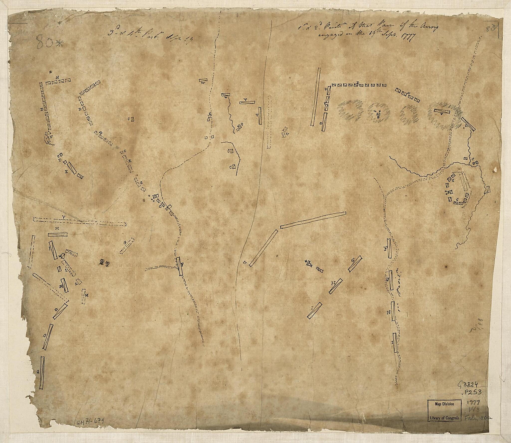
1st. & 2d. Position of That Part of the Army Engaged On the 19th Sept. in 1777. 3d & 4th Postn. Sept. 19
- Regular price
-
$59.95 - Regular price
-
$42.95 - Sale price
-
$59.95
Shipping calculated at checkout.
Buy one map, get any other map in our collection for 50% OFF! Add to cart to see discount.
Couldn't load pickup availability
About This Map
Old early map / manuscript map of New York, New York (State), Saratoga Springs, Saratoga Springs Region, United States.
Created by Friedrich Adam Julius Von Wangenheim in 1777.
Created by Friedrich Adam Julius Von Wangenheim in 1777.
- Scale not given.
- Manuscript, pen-and-ink and lead-pencil on tracing paper.
- The maps show the Battle of Freeman's Farm on 19 September 1777--an action undertaken during the Saratoga Campaign (N.Y.).
- Map sheet mounted on cloth backing.
- Includes notes in ink handwriting at upper edge.
Map Subjects
Early Maps
Early Works To 1800
Manuscript Maps
New York (State)
Saratoga Campaign N.Y.
Saratoga Springs
Saratoga Springs Region (N.Y.)
United States
New York
Saratoga Springs Region
Friedrich Adam Julius Von Wangenheim
1777
Map Sizing Information
- For the best legibility, order your map in the original size or larger. Most maps have intricate detail and small text that is best appreciated when the print size hasn't been reduced.
- Sizes labeled "Fits a Standard Frame" will drop right into any frame that you purchase in that size. The sizes that we offer are commonly available online and at most retail stores.
- Our standard sizes are recommendations based on the aspect ratio of the original map, but still may require some added "white space" in one dimension to fit.
- Non-standard sizes will require custom framing, and we suggest taking your print to the frame shop of your choice after you receive it for the best results.
- Custom sizes are available, simply contact us for a quote.
Below is an approximation of the scale of a few standard sizes, and how they might appear in your space.

