
United States, West 1844
- Regular price
-
$176.95 - Regular price
-
$171.95 - Sale price
-
$176.95
Buy one map, get any other map in our collection for 50% OFF! Add to cart to see discount.
Couldn't load pickup availability
About This Map
Discover the timeless beauty of our fine art quality printed reproduction of this antique map. Perfect for history enthusiasts, collectors, and interior decorators.
Restored with meticulous attention to detail by our team with over a decade of experience, this stunning reproduction captures the intricate artistry and historical significance of the original map.
Whether you're a collector or seeking a unique decor piece, this archival-quality map reproduction is a timeless addition to any space. Order now to bring history to life!
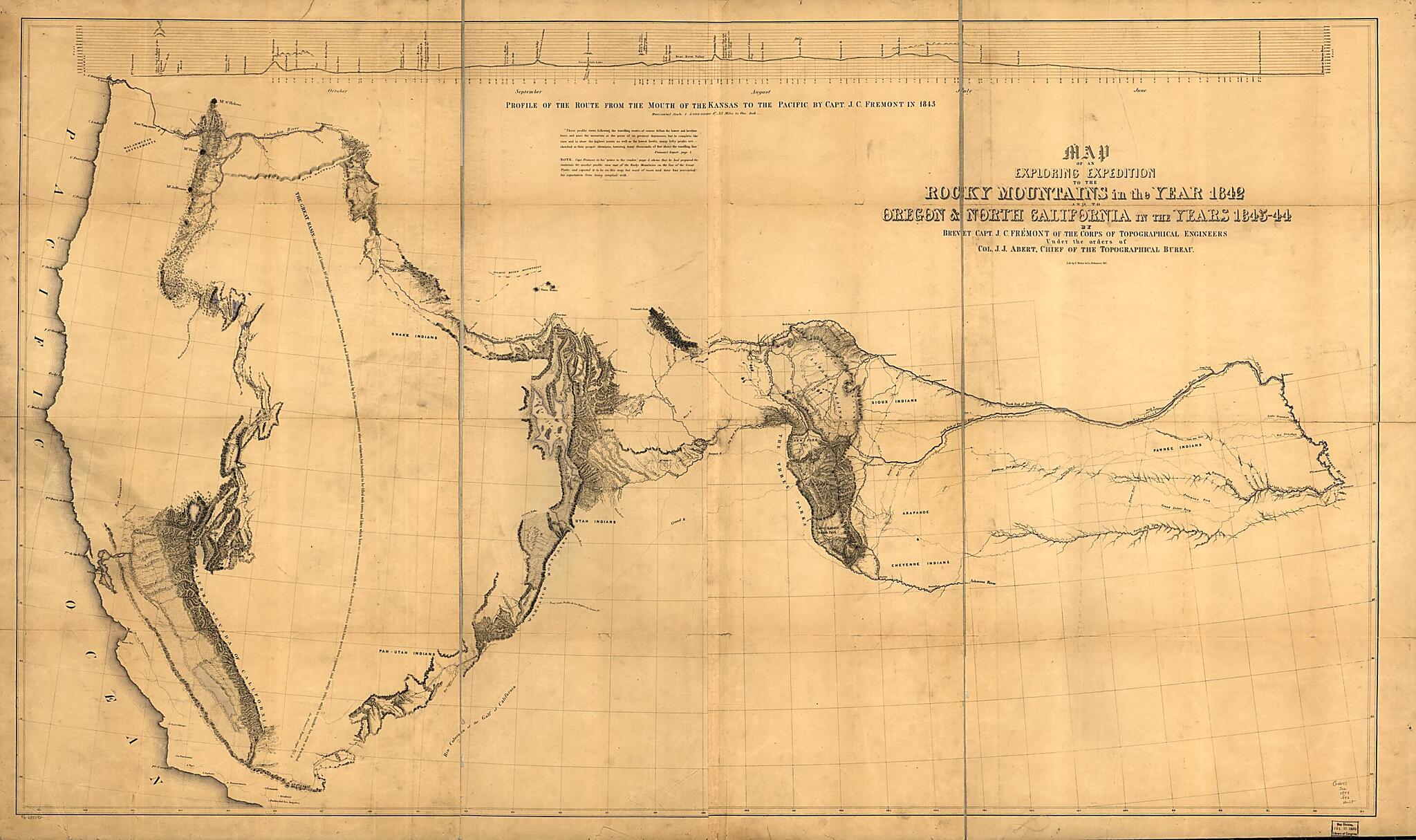
Old map of United States, West.Created by John James Abert, Edward Weber & Co, John Charles Frémont, United States. Congress. Senate in 1844.
- Relief shown by hachures.
- State 3: Includes notes, Great Basin statement, and place name South Park below Bayou Salade; some place names differ from other states.
- "Published in Report of the exploring expedition to the Rocky Mountains in the year 1842 and to Oregon and north California in the years 1843-44. By Brevet Captain J. C. Fremont ... Printed by order of the Senate of the United States. Washington ... 1845 (28th Cong., 2nd Sess., Sen. Ex. Doc. 174, Serial 461)."
- Includes "Profile of the route from the mouth of the Kansas to the Pacific by Capt. J.C. Fremont in 1843."
- 3 copies. Copy 2 has 39A stamped in lower left corner
Map Subjects
Discovery And Exploration
United States
West
West (U.S.)
John James Abert
Edward Weber & Co
John Charles Frémont
United States. Congress. Senate
1844
- For the best legibility, order your map in the original size or larger. Most maps have intricate detail and small text that is best appreciated when the print size hasn't been reduced.
- Sizes labeled "Fits a Standard Frame" will drop right into any frame that you purchase in that size. The sizes that we offer are commonly available online and at most retail stores.
- Our standard sizes are recommendations based on the aspect ratio of the original map, but still may require some added "white space" in one dimension to fit.
- Non-standard sizes will require custom framing, and we suggest taking your print to the frame shop of your choice after you receive it for the best results.
- Custom sizes are available, simply contact us for a quote.
Below is an approximation of the scale of a few standard sizes, and how they might appear in your space.
