
Petersburg, Virginia 1865
- Regular price
-
$71.95 - Regular price
-
$66.95 - Sale price
-
$71.95
Shipping calculated at checkout.
Buy one map, get any other map in our collection for 50% OFF! Add to cart to see discount.
Couldn't load pickup availability
About This Map
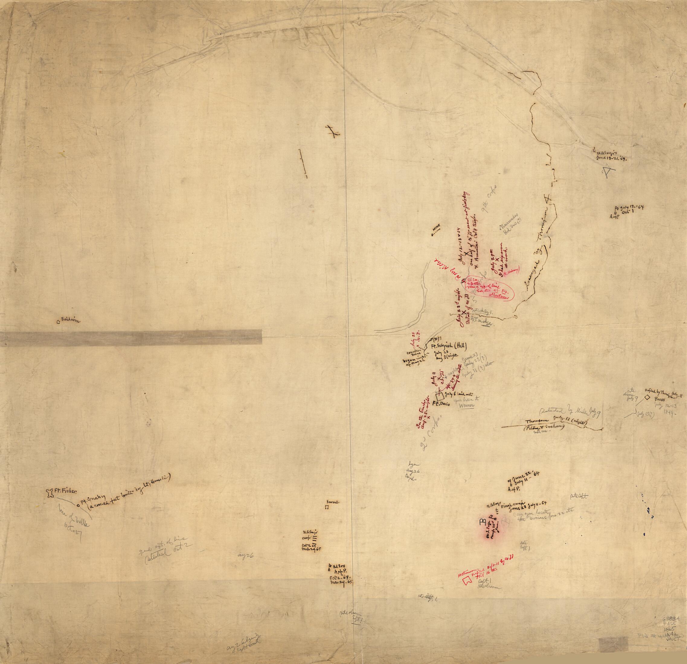
Old map of Petersburg, United States, Virginia.
Created by J. E. Weyss in 1865.
Created by J. E. Weyss in 1865.
- This is an overlay designed to be used with the map of the siege of Petersburg by J.E. Weyss.
- Title derived from Stephenson's Civil War maps, 1989.
- Civil War Map
- Includes brief field notes in pencil, red ink, and black ink, probably written by Federal engineers, and shows the location of several camps of the U.S. Engineers and the headquarters of the Army of the Potomac on June 22 to July 11, 1864, July 12 to Oct. 1, 1864, and Oct. 2, 1864, to Mar. 29, 1865.
Map Sizing Information
- For the best legibility, order your map in the original size or larger. Most maps have intricate detail and small text that is best appreciated when the print size hasn't been reduced.
- Sizes labeled "Fits a Standard Frame" will drop right into any frame that you purchase in that size. The sizes that we offer are commonly available online and at most retail stores.
- Our standard sizes are recommendations based on the aspect ratio of the original map, but still may require some added "white space" in one dimension to fit.
- Non-standard sizes will require custom framing, and we suggest taking your print to the frame shop of your choice after you receive it for the best results.
- Custom sizes are available, simply contact us for a quote.
Below is an approximation of the scale of a few standard sizes, and how they might appear in your space.

