
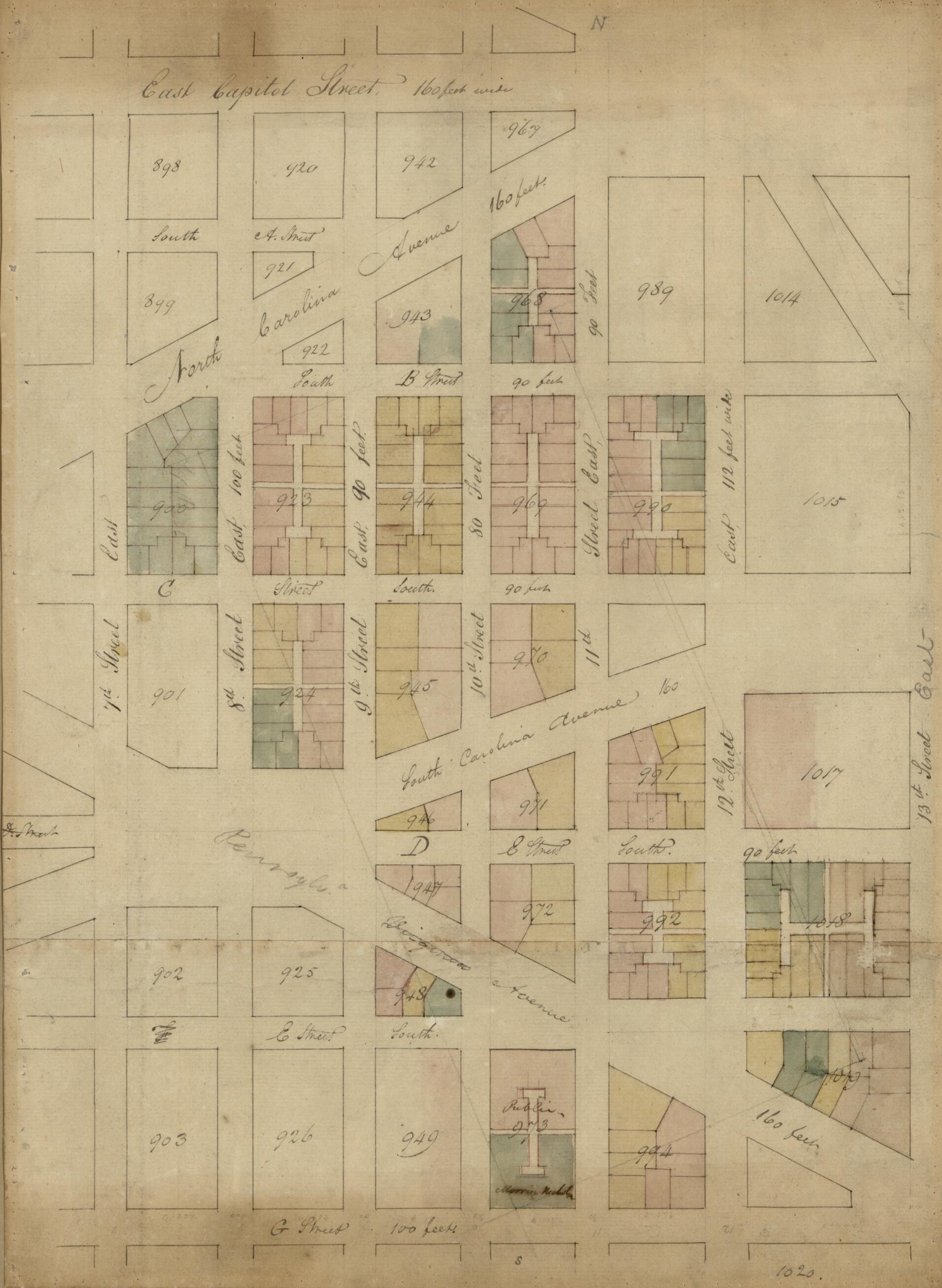
5th Plan, from 7th East to 13th Street and G Street South to East Capitol Street : S.E. Washington D.C. 1794
- Regular price
-
$49.95 - Regular price
-
$34.95 - Sale price
-
$49.95
Shipping calculated at checkout.
Buy one map, get any other map in our collection for 50% OFF! Add to cart to see discount.
Couldn't load pickup availability
About This Map
Old map of District of Columbia, United States, Washington, Washington D.C..
Created by Association of the Oldest Inhabitants of the District of Columbia, Henry C. Gauss, Rt. (Robert) King in 1794.
Created by Association of the Oldest Inhabitants of the District of Columbia, Henry C. Gauss, Rt. (Robert) King in 1794.
- Partial cadastral map showing block numbers, outline of pre-existing landholding, and lots tinted in different colors.
- Covers area bounded by East Capitol, 13th, G, and 7th streets S.E.
- Title from handwritten (ink) label affixed to cloth backing.
- Pen-and-ink, watercolors, and lead pencil.
- Watermark: L Munn 1794.
- Edged in green cloth stripping, mounted on cloth backing, and annotated in lead pencil on cloth backing: From the files of the Society of Oldest Inhabitants. Deposited by Henry C. Gauss in 1920's (?). One of 12 maps.
Map Sizing Information
- For the best legibility, order your map in the original size or larger. Most maps have intricate detail and small text that is best appreciated when the print size hasn't been reduced.
- Sizes labeled "Fits a Standard Frame" will drop right into any frame that you purchase in that size. The sizes that we offer are commonly available online and at most retail stores.
- Our standard sizes are recommendations based on the aspect ratio of the original map, but still may require some added "white space" in one dimension to fit.
- Non-standard sizes will require custom framing, and we suggest taking your print to the frame shop of your choice after you receive it for the best results.
- Custom sizes are available, simply contact us for a quote.
Below is an approximation of the scale of a few standard sizes, and how they might appear in your space.

