
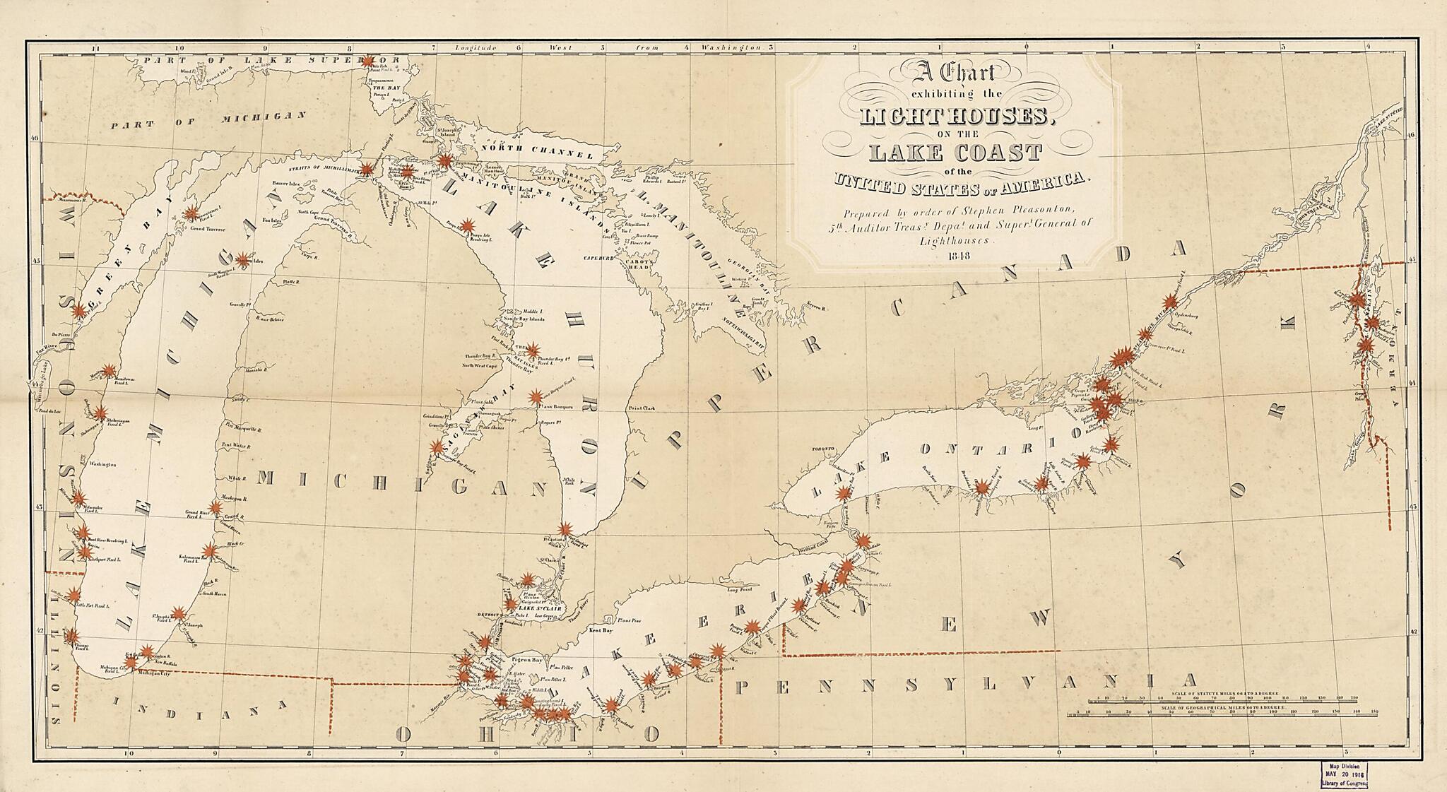
A Chart Exhibiting the Lighthouses of the Lake Coast of the United States of America 1848
- Regular price
-
$64.95 - Regular price
-
$59.95 - Sale price
-
$64.95
Buy one map, get any other map in our collection for 50% OFF! Add to cart to see discount.
Couldn't load pickup availability
About This Map
Discover the timeless beauty of our fine art quality printed reproduction of this antique map. Perfect for history enthusiasts, collectors, and interior decorators.
Restored with meticulous attention to detail by our team with over a decade of experience, this stunning reproduction captures the intricate artistry and historical significance of the original map.
Whether you're a collector or seeking a unique decor piece, this archival-quality map reproduction is a timeless addition to any space. Order now to bring history to life!
Old nautical chart of Champlain, Champlain, Lake, Great Lakes, Great Lakes Region, Lake, North America, Saint Lawrence River.Created by Millard Fillmore, Stephen Pleasonton, United States. Department of the Treasury. Office of the Fifth Auditor in 1848.
- Map of lighthouse locations in the Great Lakes region of the U.S. using red overprint symbols to indicate the locations and to emphasize state boundaries.
- Lighthouse locations also shown along the upper St. Lawrence River (Canada) and around Lake Champlain.
- Prime meridian: Washington D.C.
- This map has some imperfections: use-darkened along fold lines on verso. We'll do our best to restore the image before printing.
- Includes 2 bar scales--1 in statute miles, the other in geographical (nautical) miles.
- Handwritten (cursive script) inked identification statement on verso panel: Chart of light houses on the U.S. lake coasts, 1848, M. Fillmore.
- Another exemplar (without signature) in single map file.
Map Subjects
Champlain Lake
Great Lakes
Great Lakes (North America)
Great Lakes Region
Great Lakes Region (North America)
Lighthouses
Nautical Charts
North America
Saint Lawrence River
Champlain
Lake
Millard Fillmore
Stephen Pleasonton
United States. Department Of The Treasury. Office Of The Fifth Auditor
1848
- For the best legibility, order your map in the original size or larger. Most maps have intricate detail and small text that is best appreciated when the print size hasn't been reduced.
- Sizes labeled "Fits a Standard Frame" will drop right into any frame that you purchase in that size. The sizes that we offer are commonly available online and at most retail stores.
- Our standard sizes are recommendations based on the aspect ratio of the original map, but still may require some added "white space" in one dimension to fit.
- Non-standard sizes will require custom framing, and we suggest taking your print to the frame shop of your choice after you receive it for the best results.
- Custom sizes are available, simply contact us for a quote.
Below is an approximation of the scale of a few standard sizes, and how they might appear in your space.
