
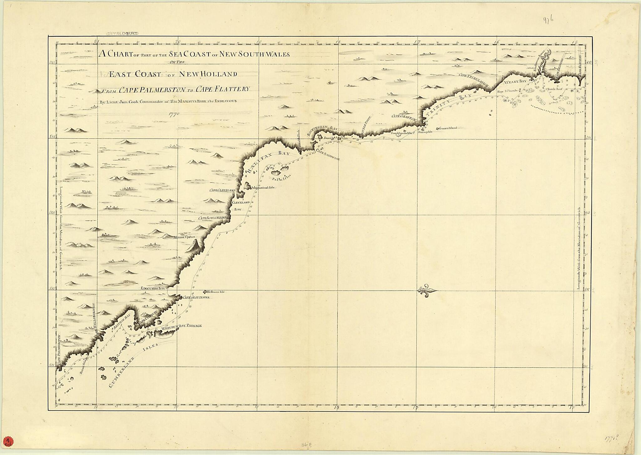
A Chart of Part of the Sea Coast of New South Wales On the East Coast of New Holland from Cape Palmerston to Cape Flattery 1771
- Regular price
-
$85.95 - Regular price
-
$80.95 - Sale price
-
$85.95
Buy one map, get any other map in our collection for 50% OFF! Add to cart to see discount.
Couldn't load pickup availability
About This Map
Discover the timeless beauty of our fine art quality printed reproduction of this antique map. Perfect for history enthusiasts, collectors, and interior decorators.
Restored with meticulous attention to detail by our team with over a decade of experience, this stunning reproduction captures the intricate artistry and historical significance of the original map.
Whether you're a collector or seeking a unique decor piece, this archival-quality map reproduction is a timeless addition to any space. Order now to bring history to life!
Old map of Australia, Cape Flattery, Cape Palmerston, New South Wales, Queensland.This map is one of four manuscript charts from the first great voyage of exploration by Captain James Cook, which in April 1770 made the first clear delineation of the east coast of Australia. Sponsored by the Royal Society and the Royal Navy, the expedition had several objectives. Cook was to observe and describe the transit of Venus, chart the coastlines of places he visited in the South Pacific, and record details of the peoples, flora, and fauna he saw. The expedition sponsors also hoped Cook would find and claim for Britain the land then known as terra incognita australis. Cook did not sail close to shore, except in a few places, so the amount of detail shown in the map varied with his ship's distance from the coast.
Created by James Cook in 1771.
- Title devised, in English, by Library staff.
- "Relief shown by landform drawings. Depths shown by soundings. North oriented to the right. Longitude given as "Longitude west from the meridian of Greenwich." Scale 1:890,000"--Note extracted from World Digital Library.
- Original resource extent: 1 map : manuscript ; 47 x 73 centimeters.
- Original resource at: University of Wisconsin-Milwaukee Libraries.
- Content in English.
- Description based on data extracted from World Digital Library, which may be extracted from partner institutions.
Map Subjects
Australia
Cape Flattery
Cape Palmerston
Exploration And Encounters
New South Wales
Queensland
James Cook
1771
- For the best legibility, order your map in the original size or larger. Most maps have intricate detail and small text that is best appreciated when the print size hasn't been reduced.
- Sizes labeled "Fits a Standard Frame" will drop right into any frame that you purchase in that size. The sizes that we offer are commonly available online and at most retail stores.
- Our standard sizes are recommendations based on the aspect ratio of the original map, but still may require some added "white space" in one dimension to fit.
- Non-standard sizes will require custom framing, and we suggest taking your print to the frame shop of your choice after you receive it for the best results.
- Custom sizes are available, simply contact us for a quote.
Below is an approximation of the scale of a few standard sizes, and how they might appear in your space.

