
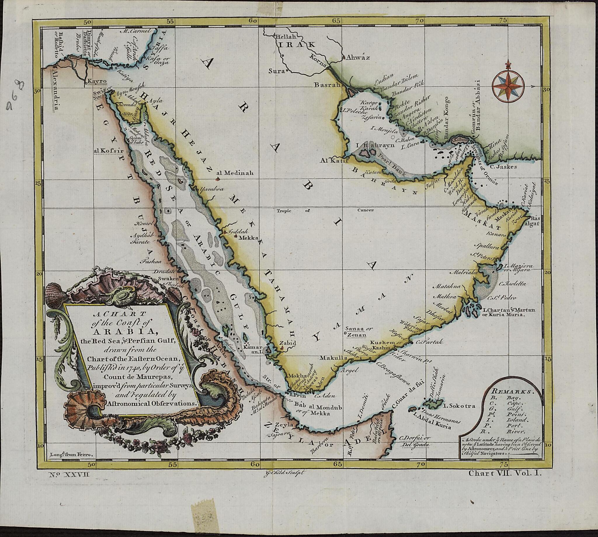
A Chart of the Coast of Arabia, the Red Sea and Persian Gulf, Drawn from the Chart of the Eastern Ocean 1740
- Regular price
-
$49.95 - Regular price
-
$34.95 - Sale price
-
$49.95
Buy one map, get any other map in our collection for 50% OFF! Add to cart to see discount.
Couldn't load pickup availability
About This Map
Discover the timeless beauty of our fine art quality printed reproduction of this antique map. Perfect for history enthusiasts, collectors, and interior decorators.
Restored with meticulous attention to detail by our team with over a decade of experience, this stunning reproduction captures the intricate artistry and historical significance of the original map.
Whether you're a collector or seeking a unique decor piece, this archival-quality map reproduction is a timeless addition to any space. Order now to bring history to life!
Old map of Iraq, Kuwait, Oman, Qatar, Saudi Arabia, United Arab Emirates, Yemen.Frédéric Phélypeaux, Count de Maurepas (1701-81), secretary of state under King Louis XV. The map was drawn from an earlier chart of the Eastern Ocean, "improv'd from particular surveys and regulated by astronomical observations." This English edition of the de Maurepas map has a different title cartouche. The "Remarks" section at the lower right gives abbreviations for physical features on the map, and notes: " A Stroke under ye Name of a Place denotes ye Latitude having been Observed by Astronomers, and a Prict [sic] Line by skilful Navigators." Longitude is measured in degrees east of the "Isle de Fer" (Ferro, in the Canary Islands). Town names are as they appeared on the earlier French map. The Red Sea is listed as the "Red Sea or Arabic Gulf."
Created by G. Child in 1740.
- Title devised, in English, by Library staff.
- Original resource extent: 1 map; color; 22 x 24 centimeters.
- Original resource at: Qatar National Library.
- Content in English.
- Description based on data extracted from World Digital Library, which may be extracted from partner institutions.
Map Subjects
Arabian Gulf
Arabian Peninsula
Iraq
Kuwait
Oman
Persian Gulf
Qatar
Saudi Arabia
United Arab Emirates
Yemen
G. Child
1740
- For the best legibility, order your map in the original size or larger. Most maps have intricate detail and small text that is best appreciated when the print size hasn't been reduced.
- Sizes labeled "Fits a Standard Frame" will drop right into any frame that you purchase in that size. The sizes that we offer are commonly available online and at most retail stores.
- Our standard sizes are recommendations based on the aspect ratio of the original map, but still may require some added "white space" in one dimension to fit.
- Non-standard sizes will require custom framing, and we suggest taking your print to the frame shop of your choice after you receive it for the best results.
- Custom sizes are available, simply contact us for a quote.
Below is an approximation of the scale of a few standard sizes, and how they might appear in your space.

