
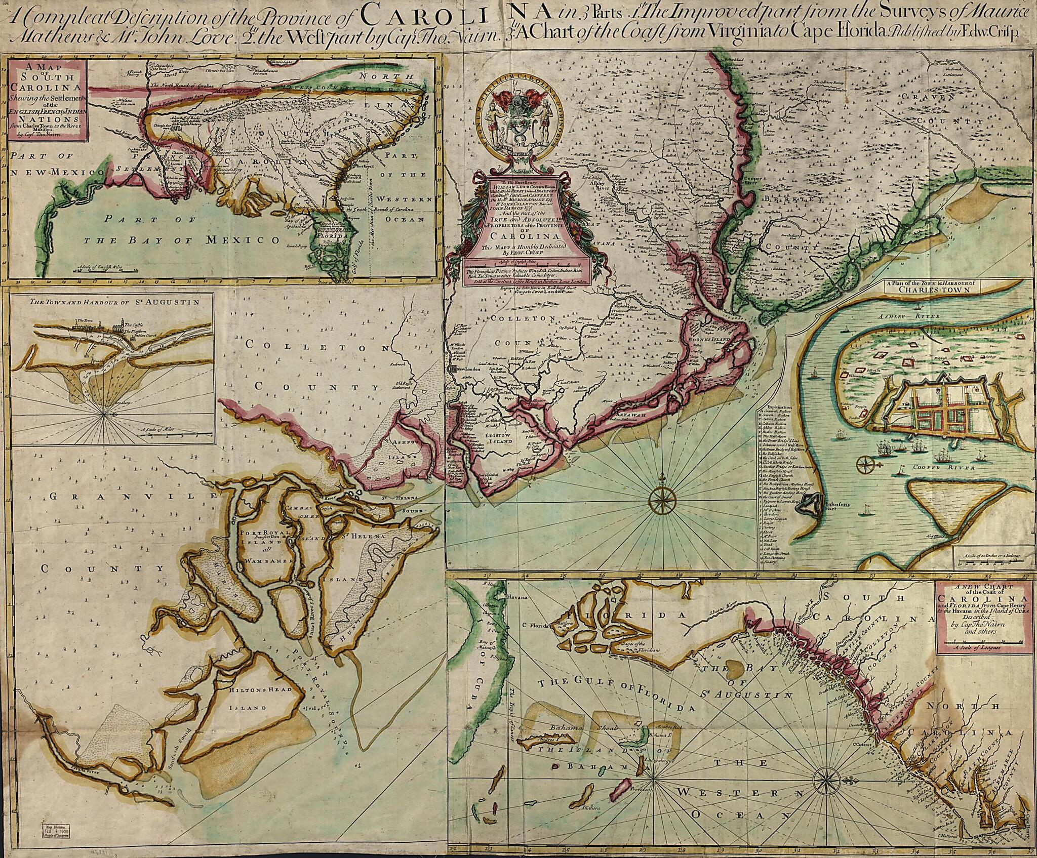
A Compleat Description of the Province of Carolina In 3 Parts : 1st, the Improved Part from the Surveys of Maurice Mathews & Mr. John Love : 2ly, the West Part by Capt. Tho. Nairn : 3ly, a Chart of the Coast from Virginia to Cape Florida (Complete Des...
- Regular price
-
$128.95 - Regular price
-
$123.95 - Sale price
-
$128.95
Buy one map, get any other map in our collection for 50% OFF! Add to cart to see discount.
Couldn't load pickup availability
About This Map
Discover the timeless beauty of our fine art quality printed reproduction of this antique map. Perfect for history enthusiasts, collectors, and interior decorators.
Restored with meticulous attention to detail by our team with over a decade of experience, this stunning reproduction captures the intricate artistry and historical significance of the original map.
Whether you're a collector or seeking a unique decor piece, this archival-quality map reproduction is a timeless addition to any space. Order now to bring history to life!
Old map of Charleston, Florida, Saint Augustine, South Atlantic States, South Carolina, United States.Created by Edw. (Edward) Crisp, John Harris, John Love, Maurice Mathews, Thomas Nairne in 1711.
- Shows coastal area from North Carolina to Florida.
- Relief shown pictorially. Depth shown by soundings.
- Prime meridian: Charles Town.
- Mounted on cloth.
- Includes indexed inset of "A plan of the town & harbour of Charles Town," and inset "The town and harbour of St Augustin," and col. ill.
- Copy This map has some imperfections: discoloration along folds. We'll do our best to restore the image before printing.
Map Subjects
Charleston
Charleston (S.C.)
Early Works To 1800
Florida
Saint Augustine
Saint Augustine (Fla.)
South Atlantic States
South Carolina
United States
Edw. (Edward) Crisp
John Harris
John Love
Maurice Mathews
Thomas Nairne
1711
- For the best legibility, order your map in the original size or larger. Most maps have intricate detail and small text that is best appreciated when the print size hasn't been reduced.
- Sizes labeled "Fits a Standard Frame" will drop right into any frame that you purchase in that size. The sizes that we offer are commonly available online and at most retail stores.
- Our standard sizes are recommendations based on the aspect ratio of the original map, but still may require some added "white space" in one dimension to fit.
- Non-standard sizes will require custom framing, and we suggest taking your print to the frame shop of your choice after you receive it for the best results.
- Custom sizes are available, simply contact us for a quote.
Below is an approximation of the scale of a few standard sizes, and how they might appear in your space.

