

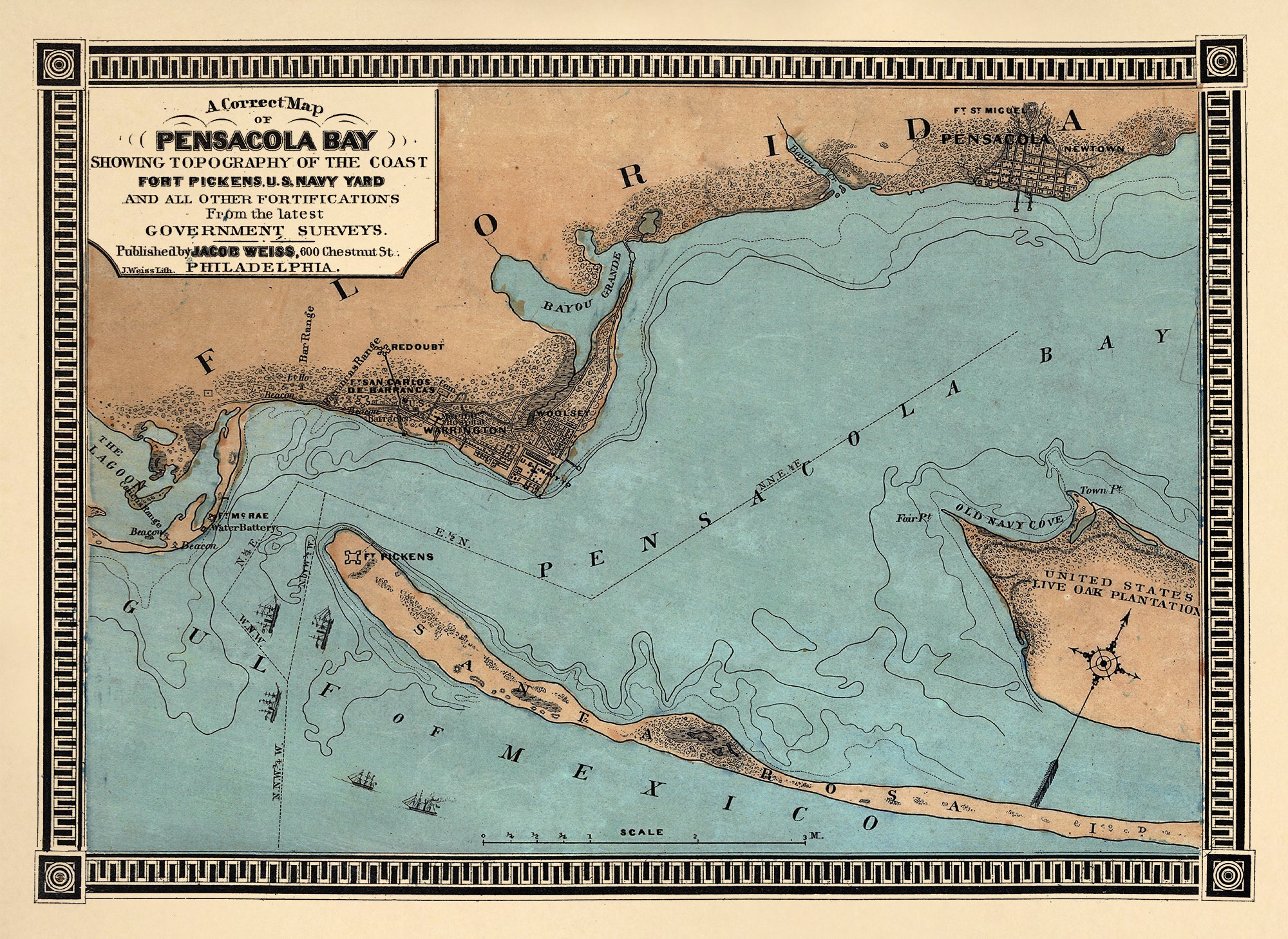
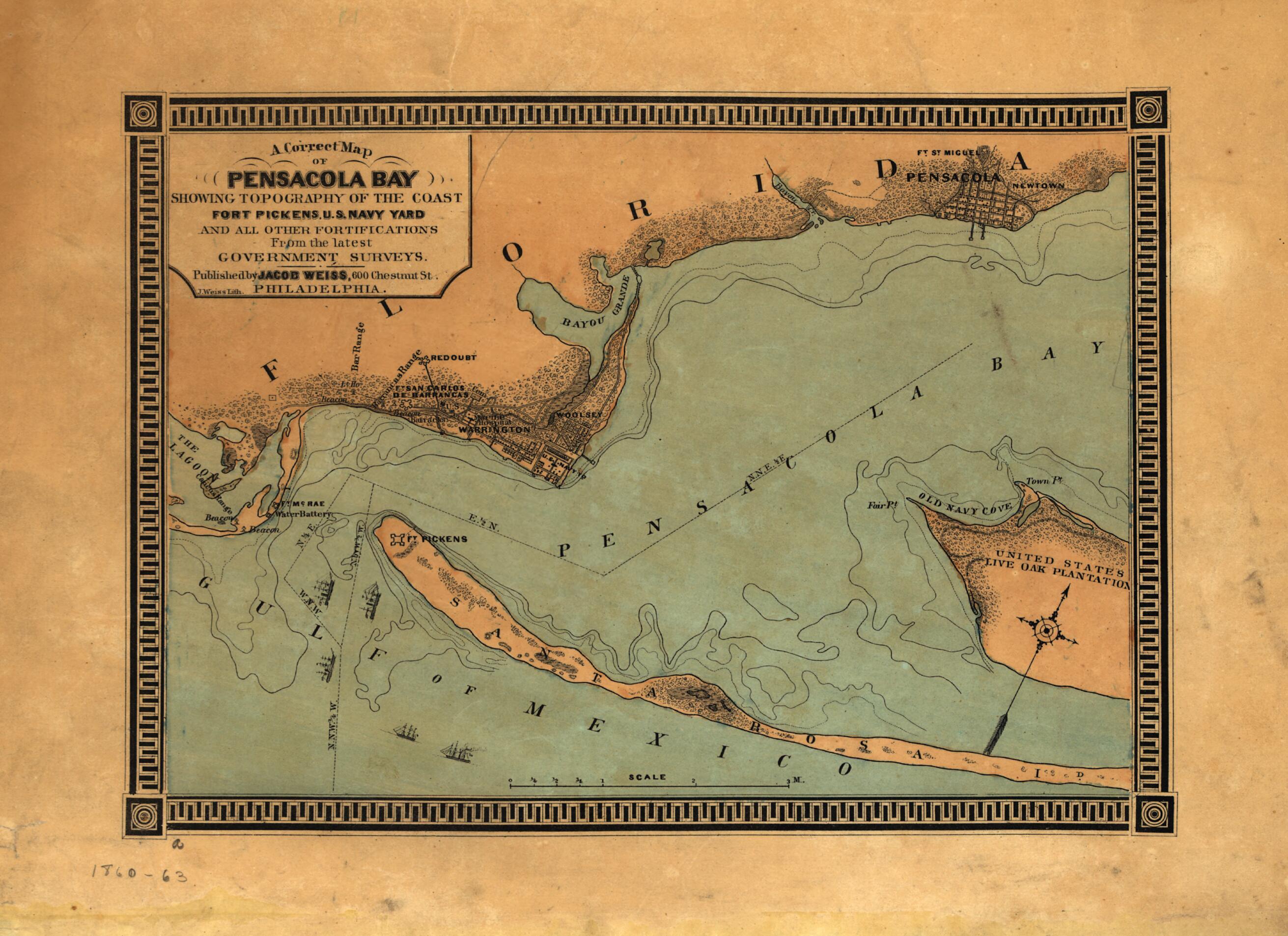
A Correct Map of Pensacola Bay Showing Topography of the Coast, Fort Pickens, U.S. Navy Yard, and All Other Fortifications from the Latest Government Surveys 1860
- Regular price
-
$49.95 - Regular price
-
$34.95 - Sale price
-
$49.95
Buy one map, get any other map in our collection for 50% OFF! Add to cart to see discount.
Couldn't load pickup availability
About This Map
This archival-quality print reproduces the antique map titled A Correct Map of Pensacola Bay Showing Topography of the Coast, Fort Pickens, U.S. Navy Yard, and All Other Fortifications from the Latest Government Surveys 1860. Created by Jacob Weiss in 1860, the map documents Pensacola Bay, the coastal topography, Fort Pickens and the U.S. Navy Yard with surrounding fortifications.
Restored by a team with over ten years of experience, this piece preserves historical engravings while delivering a clean, archival-quality print suitable for display and study.
Ideal for history buffs, map collectors, and interior decorators, it adds a touch of Civil War era realism to libraries, offices, or living spaces. Use it as a focal point in a study nook, or pair it with a period frame to highlight vintage cartography.
Key details: subject Pensacola Bay, topography, Fort Pickens, U.S. Navy Yard; scale ca. 1:62,000; creation credit Jacob Weiss (1860); archival-quality reproduction.
- For the best legibility, order your map in the original size or larger. Most maps have intricate detail and small text that is best appreciated when the print size hasn't been reduced.
- Sizes labeled "Fits a Standard Frame" will drop right into any frame that you purchase in that size. The sizes that we offer are commonly available online and at most retail stores.
- Our standard sizes are recommendations based on the aspect ratio of the original map, but still may require some added "white space" in one dimension to fit.
- Non-standard sizes will require custom framing, and we suggest taking your print to the frame shop of your choice after you receive it for the best results.
- Custom sizes are available, simply contact us for a quote.
Below is an approximation of the scale of a few standard sizes, and how they might appear in your space.

