
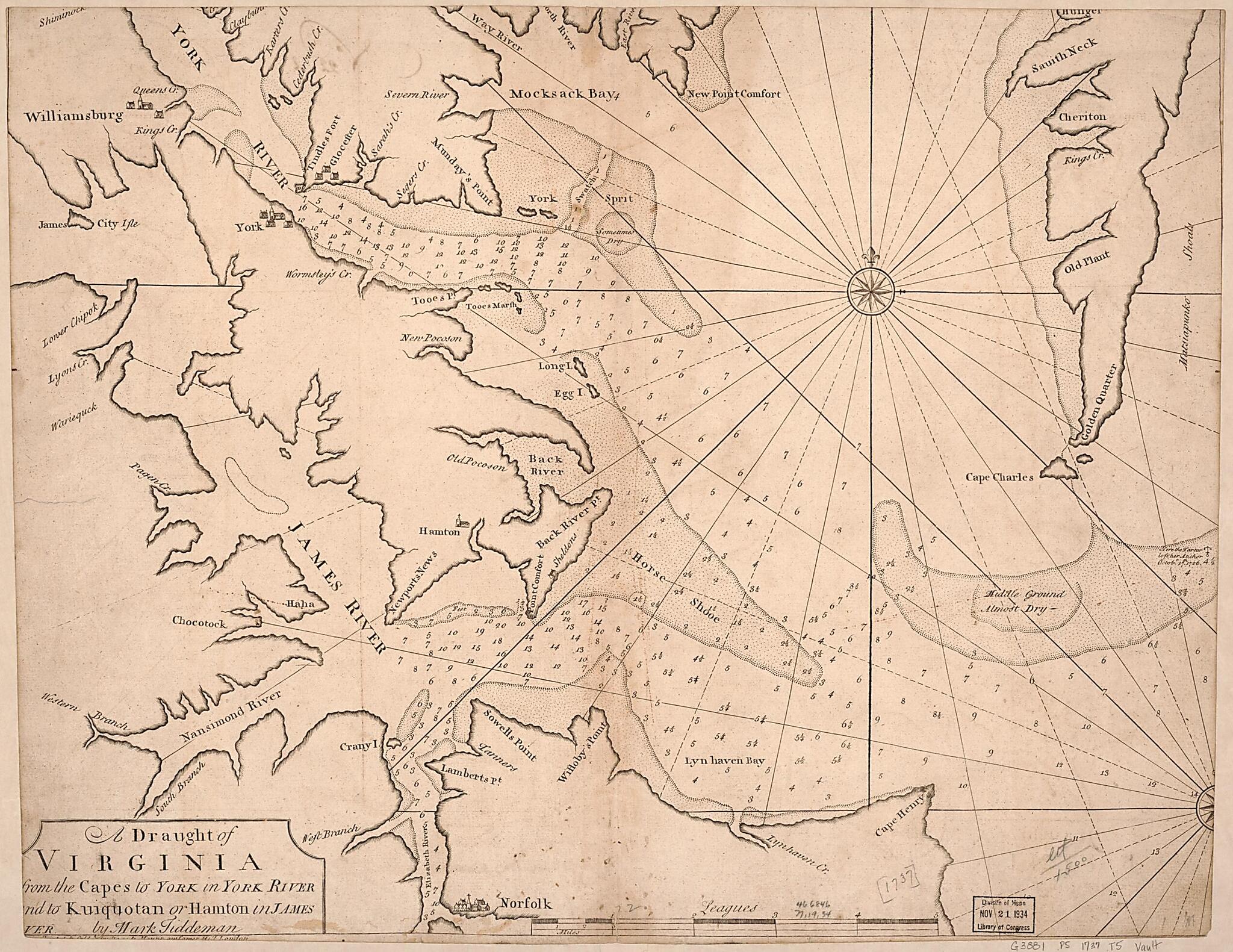
A Draught of Virginia from the Capes to York In York River and to Kuiquotan Or Hamton In James River 1737
- Regular price
-
$50.95 - Regular price
-
$45.95 - Sale price
-
$50.95
Buy one map, get any other map in our collection for 50% OFF! Add to cart to see discount.
Couldn't load pickup availability
About This Map
Discover the timeless beauty of our fine art quality printed reproduction of this antique map. Perfect for history enthusiasts, collectors, and interior decorators.
Restored with meticulous attention to detail by our team with over a decade of experience, this stunning reproduction captures the intricate artistry and historical significance of the original map.
Whether you're a collector or seeking a unique decor piece, this archival-quality map reproduction is a timeless addition to any space. Order now to bring history to life!
Old nautical chart / early map of Chesapeake Bay, Maryland, United States, Virginia.Created by Mark Tiddeman, W. Mount and T. Page in 1737.
- Depths shown by soundings.
- Imprint: London : Printed & sold by Page & Mount on Tower Hill.
- Taken from: The English Pilot (Fourth book). London : for William Mount and Thomas Page, 1737 (G1106.P5E5 1737 Vault). Swem No. 154.
- Copy This map has some imperfections: trimmed to neat line, losses along edges. We'll do our best to restore the image before printing.
Map Subjects
Chesapeake Bay
Chesapeake Bay (Md. And Va.)
Coasts
Early Maps
Early Works To 1800
Maryland
Nautical Charts
United States
Virginia
Nautical Charts
Early Maps
Mark Tiddeman
W. Mount And T. Page
1737
- For the best legibility, order your map in the original size or larger. Most maps have intricate detail and small text that is best appreciated when the print size hasn't been reduced.
- Sizes labeled "Fits a Standard Frame" will drop right into any frame that you purchase in that size. The sizes that we offer are commonly available online and at most retail stores.
- Our standard sizes are recommendations based on the aspect ratio of the original map, but still may require some added "white space" in one dimension to fit.
- Non-standard sizes will require custom framing, and we suggest taking your print to the frame shop of your choice after you receive it for the best results.
- Custom sizes are available, simply contact us for a quote.
Below is an approximation of the scale of a few standard sizes, and how they might appear in your space.

