
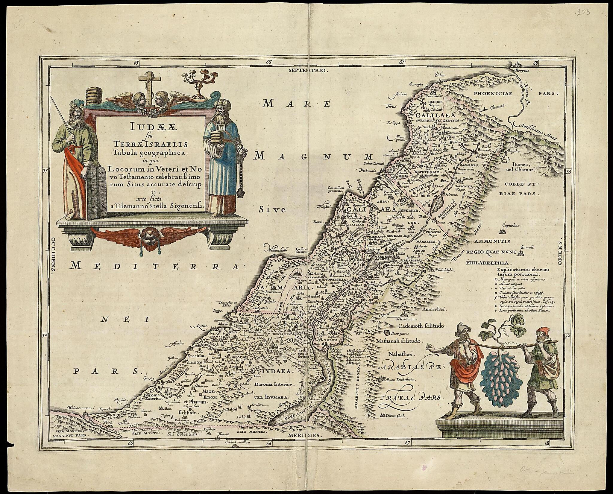
A Geographical Rendering of Judaea, Or the Land of Israel, In Which the Positions of the Most Famous Places In the Old and New Testament Are Precisely Depicted. (Iudaeae Seu Terrae Israelis Tabula Geographica; In Qua Locorum In Veteri Et Novo Testamen...
- Regular price
-
$73.95 - Regular price
-
$68.95 - Sale price
-
$73.95
Buy one map, get any other map in our collection for 50% OFF! Add to cart to see discount.
Couldn't load pickup availability
About This Map
Discover the timeless beauty of our fine art quality printed reproduction of this antique map. Perfect for history enthusiasts, collectors, and interior decorators.
Restored with meticulous attention to detail by our team with over a decade of experience, this stunning reproduction captures the intricate artistry and historical significance of the original map.
Whether you're a collector or seeking a unique decor piece, this archival-quality map reproduction is a timeless addition to any space. Order now to bring history to life!
Old map of Israel.colored copperplate map of the Holy Land, featuring notable cities from the Bible, appeared in Le theatre du monde ou nouvel atlas (Theater of the world, or new atlas), a work by Jan Jansson (1588-1664) that was published in Amsterdam circa 1658. It depicts the kingdoms of Judea and Israel, along with territory stretching north to present-day Beirut and land on both sides of the Jordan River as far south as the Dead Sea. It also includes a key to major cities, priestly towns, and towns belonging to the Philistines. The map is an exact copy of the "Typus chorographicus" of Abraham Ortelius (1527-98), which was adapted from a map by the German cartographer, geographer, and mathematician Tilemann Stella (circa 1525-89). This map was first published by Jansson in 1652 in his Accuratissima orbis antiqui delineation (Atlas of the ancient world).
Created by Georg Horn, Jan Jansson, Abraham Ortelius, Tilemannus Stella in 1658.
- Title devised, in English, by Library staff.
- Original resource extent: Copperplate; 257 x 483 millimeters.
- Original resource at: National Library of Israel.
- Content in Latin.
- Description based on data extracted from World Digital Library, which may be extracted from partner institutions.
Map Subjects
Israel
Georg Horn
Jan Jansson
Abraham Ortelius
Tilemannus Stella
1658
- For the best legibility, order your map in the original size or larger. Most maps have intricate detail and small text that is best appreciated when the print size hasn't been reduced.
- Sizes labeled "Fits a Standard Frame" will drop right into any frame that you purchase in that size. The sizes that we offer are commonly available online and at most retail stores.
- Our standard sizes are recommendations based on the aspect ratio of the original map, but still may require some added "white space" in one dimension to fit.
- Non-standard sizes will require custom framing, and we suggest taking your print to the frame shop of your choice after you receive it for the best results.
- Custom sizes are available, simply contact us for a quote.
Below is an approximation of the scale of a few standard sizes, and how they might appear in your space.

