
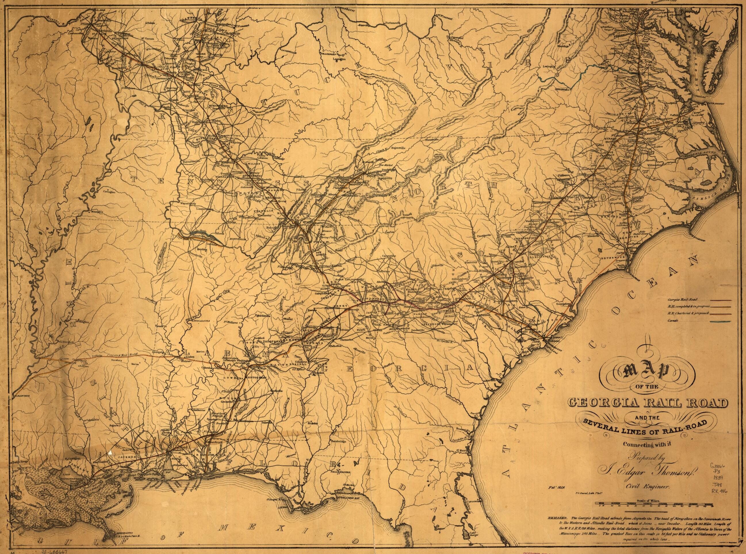
A Map of the Georgia Rail Road and the Several Lines of Railroad Connecting With It, Febr. 1839
- Regular price
-
$75.95 - Regular price
-
$70.95 - Sale price
-
$75.95
Buy one map, get any other map in our collection for 50% OFF! Add to cart to see discount.
Couldn't load pickup availability
About This Map
Discover the timeless beauty of our fine art quality printed reproduction of this antique map. Perfect for history enthusiasts, collectors, and interior decorators.
Restored with meticulous attention to detail by our team with over a decade of experience, this stunning reproduction captures the intricate artistry and historical significance of the original map.
Whether you're a collector or seeking a unique decor piece, this archival-quality map reproduction is a timeless addition to any space. Order now to bring history to life!
Old map of Southern States, United States.Map of the southeastern United States indicating drainage, relief by hachures, place names, roads, canals in blue, Georgia Railroad in red, "R.R. completed & in progress" in yellow. "R.R. chartered & proposed" in brown. Probably made to accompany his Report of the Engineer in Chief, May 13, 1839. Created by Act of December 21, 1836. See also items 613 and 614.
Created by Georgia Rail Road Company, J. Edgar (John Edgar) Thomson in 1839.
- Scale 1:2,000,000.
- "The Georgia Rail-Road extends from Augusta Geo. The head of navigation on the Savannah River to the Western and Atlantic Rail-Road-which it joins--near Decatur. Length 165 miles. Length of W & A R.R. 130 miles-making the total distance from the navigable waters of the Atlantic to those of the Mississippi 295 miles.- The greatest rise on this route is 36 feet per mile and no satisfactory power required on the whole line."
- Description derived from published bibliography.
- For the best legibility, order your map in the original size or larger. Most maps have intricate detail and small text that is best appreciated when the print size hasn't been reduced.
- Sizes labeled "Fits a Standard Frame" will drop right into any frame that you purchase in that size. The sizes that we offer are commonly available online and at most retail stores.
- Our standard sizes are recommendations based on the aspect ratio of the original map, but still may require some added "white space" in one dimension to fit.
- Non-standard sizes will require custom framing, and we suggest taking your print to the frame shop of your choice after you receive it for the best results.
- Custom sizes are available, simply contact us for a quote.
Below is an approximation of the scale of a few standard sizes, and how they might appear in your space.

