Skip to product information
1 of 1

A Map of Township (No. 14) In the 7th Range of Townships, In the County of Ontario, and State of New York : Situate & Bounded Westerly On the Geneseo River, Northwardly On Lake Ontario, Easterly On the Gerundigut Bay, & South On the North Line of Town...

Regular price
$23.95
Regular price
$36.95
Sale price
$23.95
Map Description
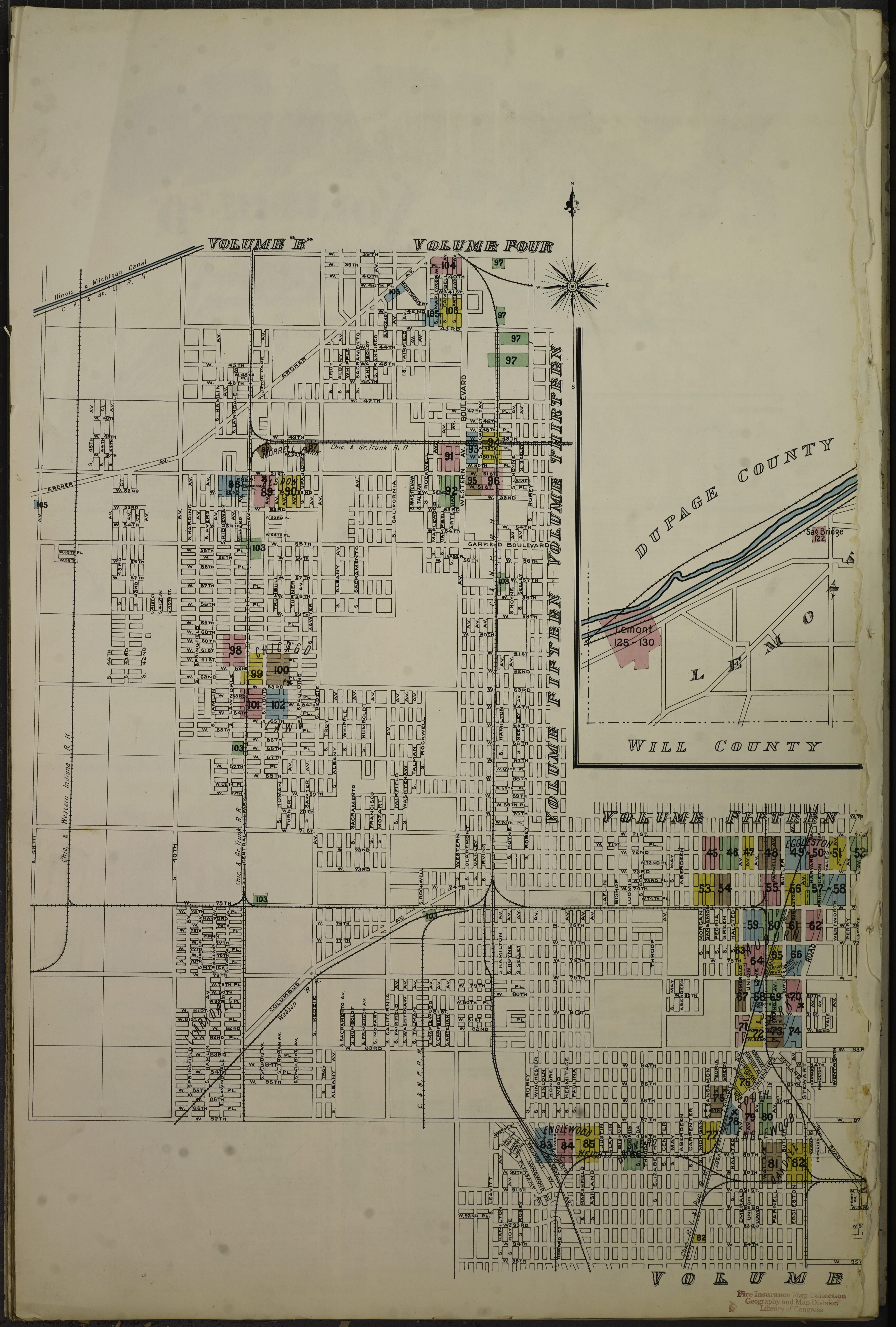
Old map of Auburn Park, Brainerd, Brookline, Burnside, Chicago, Chicago Lawn, Cook County, Dauphine Park, Eggleston, Elsdon, Englewood Heights, Evergreen Park, Forest Hill Elevator, Grand Crossing, Hayford Elevator, Illinois, Lemont, Morrell Park, Mount Forest, Oakdale, Penn. Transfer Elevator, Sag Bridge, South Englewood, Stony Island, Summit, Willow Springs.

  • Vol. D, 1897.
  • 127.
  • Auburn Park, Brainerd, Brookline, Burnside, Chicago Lawn, Dauphine Park, Eggleston, Elsdon, Englewood Heights, Evergreen Park, Grand Crossing, Hayford Elevator, Forest Hill Elevator, Lemont, Morrell Park, Mount Forest, Oakdale,penn. Transfer Elevator, Sag Bridge, South Englewood, Stony Island, Summit, Willow Springs.
  • Bound.

Map Tags

1897

Auburn Park

Brainerd

Brookline

Burnside

Chicago

Chicago Lawn

Cook County

Dauphine Park

Eggleston

Elsdon

Englewood Heights

Evergreen Park

Forest Hill Elevator

Grand Crossing

Hayford Elevator

Illinois

Lemont

Map

Morrell Park

Mount Forest

Oakdale

Penn. Transfer Elevator

Sag Bridge

South Englewood

Stony Island

Summit

Willow Springs

Fine Art Quality Printed on heavyweight (230 gsm) archival paper with a classic matte finish
Professionally Restored For the best presentation, your map will be carefully retouched by our experienced team
Free Shipping Orders of $75 or more ship for free and arrive in 3-5 business days
Proudly Made in the USA All of our maps are custom printed to order in Portland, Maine
Help with Choosing a Map Size
Secure Checkout
Lifetime Warranty
Money-Back Guarantee
This old map of Sanborn Fire Insurance Map from Chicago, Cook County, Illinois from 1897 was created by  in 1897