
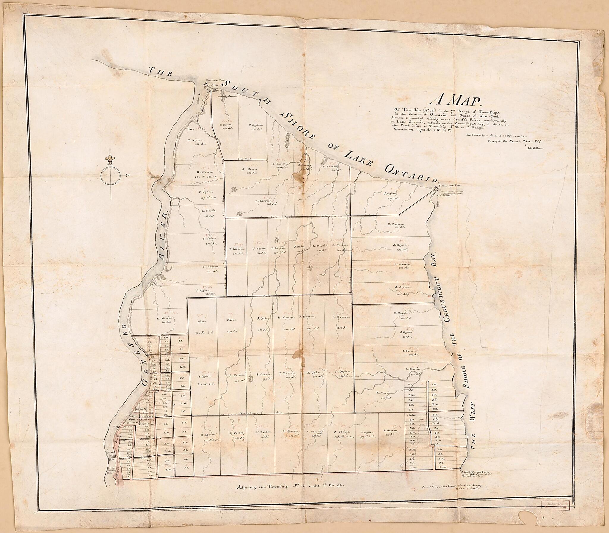
A Map of Township (No. 14) In the 7th Range of Townships, In the County of Ontario, and State of New York : Situate & Bounded Westerly On the Geneseo River, Northwardly On Lake Ontario, Easterly On the Gerundigut Bay, & South On the North Line of Town...
- Regular price
-
$97.95 - Regular price
-
$92.95 - Sale price
-
$97.95
Buy one map, get any other map in our collection for 50% OFF! Add to cart to see discount.
Couldn't load pickup availability
About This Map
Discover the timeless beauty of our fine art quality printed reproduction of this antique map. Perfect for history enthusiasts, collectors, and interior decorators.
Restored with meticulous attention to detail by our team with over a decade of experience, this stunning reproduction captures the intricate artistry and historical significance of the original map.
Whether you're a collector or seeking a unique decor piece, this archival-quality map reproduction is a timeless addition to any space. Order now to bring history to life!
Old cadastral map / manuscript map / early map of Irondequoit, New York, New York (State), Rochester, United States.Created by Charles De Krafft, Job Gilbert, Samuel Street in 1792.
- Cadastral survey map of original landholdings in what is now the northern part of the city of Rochester (N.Y.) and the town (township) of Irondequoit in the present-day Monroe County (N.Y.).
- Shows acreages, landholders' names for the larger holdings, and plan for a new town at lower left.
- Relief shown by hachures.
- Manuscript: Black pen-and-ink for property lines, acreages, personal names, place-names; faint red ink for tract numbers; pink wash (watercolor) for roads.
- The sheet has old folds, minor wrinkling, small water stains at fold-line crossings.
- Accompanied by fact sheets from Boston Rare Maps (Firm). [3] sheets : photocopies ; 28 x 22 cm.
- Includes notes.
Map Subjects
18th Century
Cadastral Maps
Early Maps
Early Works To 1800
Irondequoit
Landowners
Manuscript Maps
New York (State)
Real Property
Rochester
Surveys
United States
New York
Cadastral Maps
Manuscript Maps
Early Maps
Charles De Krafft
Job Gilbert
Samuel Street
1792
- For the best legibility, order your map in the original size or larger. Most maps have intricate detail and small text that is best appreciated when the print size hasn't been reduced.
- Sizes labeled "Fits a Standard Frame" will drop right into any frame that you purchase in that size. The sizes that we offer are commonly available online and at most retail stores.
- Our standard sizes are recommendations based on the aspect ratio of the original map, but still may require some added "white space" in one dimension to fit.
- Non-standard sizes will require custom framing, and we suggest taking your print to the frame shop of your choice after you receive it for the best results.
- Custom sizes are available, simply contact us for a quote.
Below is an approximation of the scale of a few standard sizes, and how they might appear in your space.

