
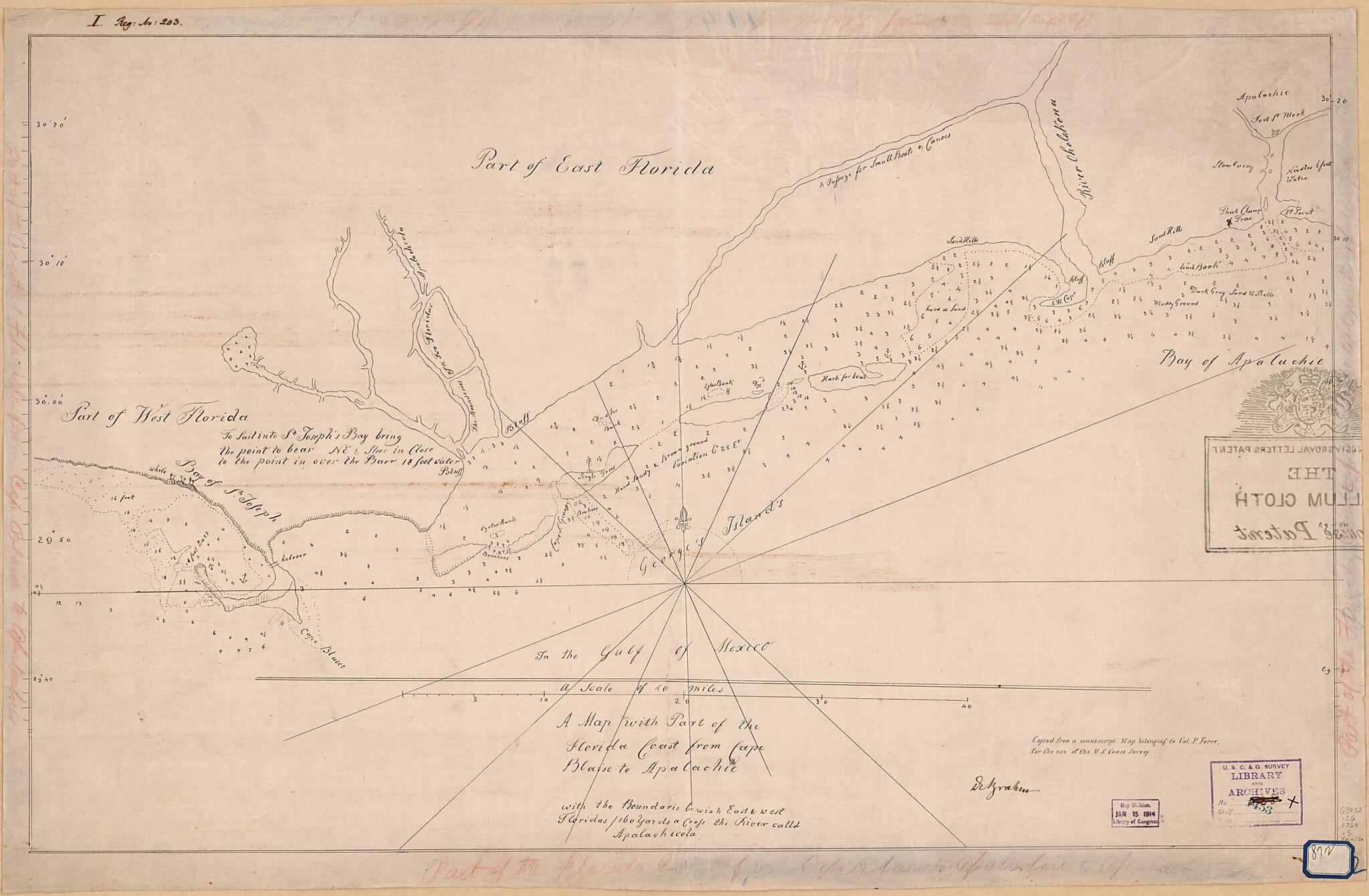
A Map With Part of the Florida Coast from Cape Blaise to Apalachie : With the Boundaries Bewixh East & West Floridas : 160 Yards Across the River Calld Apalachicola. (Florida Coast from Cape Blaise to Apalachie) 1769
- Regular price
-
$68.95 - Regular price
-
$63.95 - Sale price
-
$68.95
Buy one map, get any other map in our collection for 50% OFF! Add to cart to see discount.
Couldn't load pickup availability
About This Map
Discover the timeless beauty of our fine art quality printed reproduction of this antique map. Perfect for history enthusiasts, collectors, and interior decorators.
Restored with meticulous attention to detail by our team with over a decade of experience, this stunning reproduction captures the intricate artistry and historical significance of the original map.
Whether you're a collector or seeking a unique decor piece, this archival-quality map reproduction is a timeless addition to any space. Order now to bring history to life!
Old manuscript map / early map / nautical chart of Florida, United States.Created by John Gerar William De Brahm, Robert Slowley in 1769.
- Depths shown by soundings.
- Pen-and-ink on vellum cloth. A manuscript copy of a manuscript original.
- Autographed by "DeBrahm."
- "Copied from a manuscript map belongng to Col. P. Force for the use of the U.S. Coast Survey."
- The original manuscript from which this tracing was made is in vault collection, G&M by [Robert Slowley]. It is no. 51 in the Peter Force Map collection. See G3932.C6 1769 .S5.
- Includes coat-of-arms.
- In pen and ink in top left margin: I. Reg. No. : 203.
- In pen and ink on octagonal blue bordered label in lower right corner: 872.
Map Subjects
Coasts
Early Maps
Early Works To 1800
Florida
Manuscript Maps
Nautical Charts
United States
Manuscript Maps
Early Maps
Nautical Charts
John Gerar William De Brahm
Robert Slowley
1769
- For the best legibility, order your map in the original size or larger. Most maps have intricate detail and small text that is best appreciated when the print size hasn't been reduced.
- Sizes labeled "Fits a Standard Frame" will drop right into any frame that you purchase in that size. The sizes that we offer are commonly available online and at most retail stores.
- Our standard sizes are recommendations based on the aspect ratio of the original map, but still may require some added "white space" in one dimension to fit.
- Non-standard sizes will require custom framing, and we suggest taking your print to the frame shop of your choice after you receive it for the best results.
- Custom sizes are available, simply contact us for a quote.
Below is an approximation of the scale of a few standard sizes, and how they might appear in your space.
