
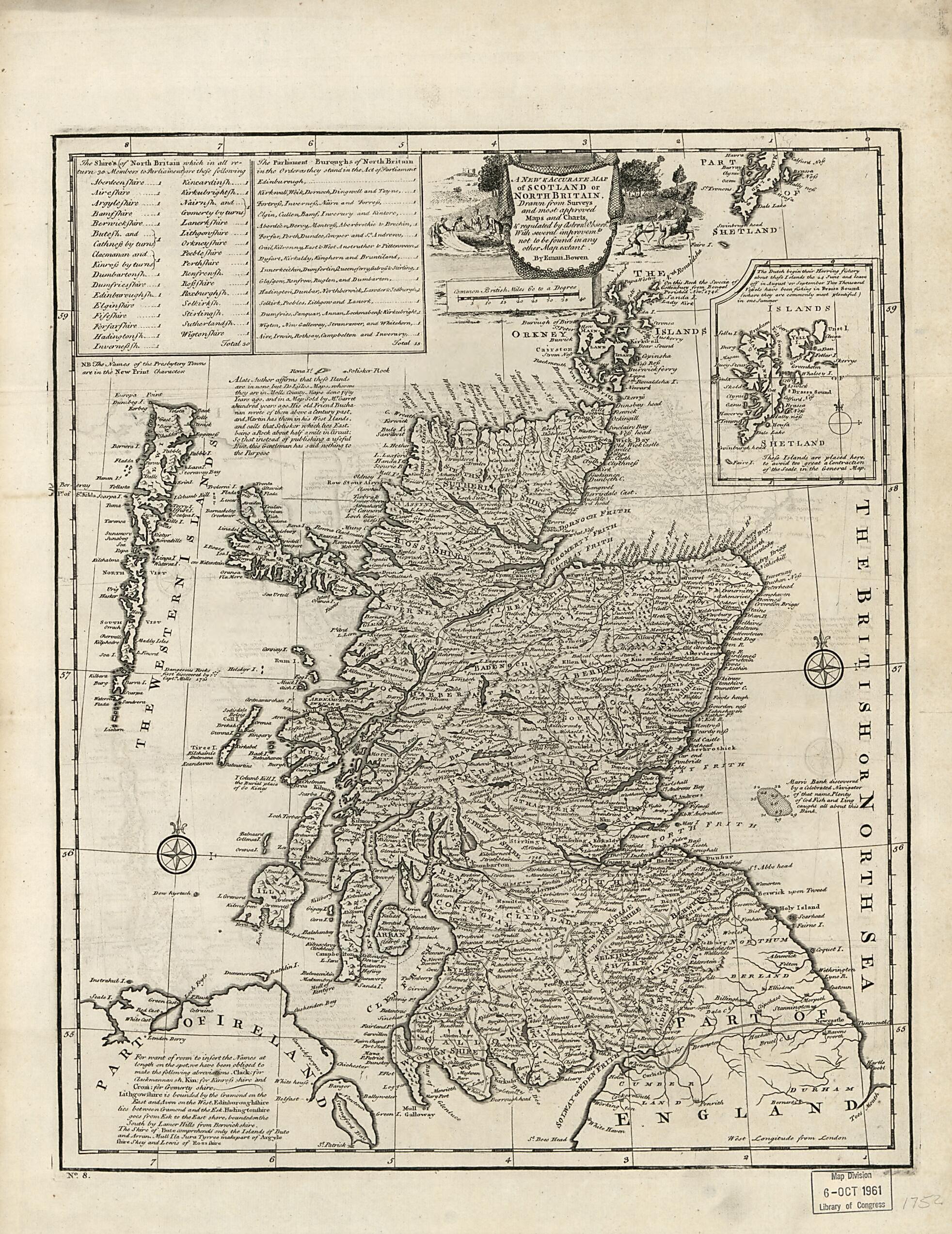
A New & Accurate Map of Scotland Or North Britain : Drawn from Surveys and Most Approved Maps and Charts & Regulated by Astronom'l Observ's : With Several Improvm'ts Not to Be Found In Any Other Map Extant (New and Accurate Map of Scotland Or North Br...
- Regular price
-
$54.95 - Regular price
-
$33.95 - Sale price
-
$54.95
Buy one map, get any other map in our collection for 50% OFF! Add to cart to see discount.
Couldn't load pickup availability
About This Map
Discover the timeless beauty of our fine art quality printed reproduction of this antique map. Perfect for history enthusiasts, collectors, and interior decorators.
Restored with meticulous attention to detail by our team with over a decade of experience, this stunning reproduction captures the intricate artistry and historical significance of the original map.
Whether you're a collector or seeking a unique decor piece, this archival-quality map reproduction is a timeless addition to any space. Order now to bring history to life!
Old early map of Scotland.Created by Emanuel Bowen in 1752.
- Relief shown pictorially. Depths shown by soundings in local area.
- Hand col. to emphasize shire boundaries.
- Watermark indecipherable.
- Plate removed from Bowen's Complete atlas, or, distinct view of the known world. London, 1752.
- Phillips 614, no. 6
- Includes text, notes, Shetland Islands inset, tabular directory of shires, directory of parliamentary boroughs, and embellished title cartouche.
- In lower margin: No. 8.
- 2 copies
Map Subjects
Early Maps
Early Works To 1800
Scotland
Early Maps
Emanuel Bowen
1752
- For the best legibility, order your map in the original size or larger. Most maps have intricate detail and small text that is best appreciated when the print size hasn't been reduced.
- Sizes labeled "Fits a Standard Frame" will drop right into any frame that you purchase in that size. The sizes that we offer are commonly available online and at most retail stores.
- Our standard sizes are recommendations based on the aspect ratio of the original map, but still may require some added "white space" in one dimension to fit.
- Non-standard sizes will require custom framing, and we suggest taking your print to the frame shop of your choice after you receive it for the best results.
- Custom sizes are available, simply contact us for a quote.
Below is an approximation of the scale of a few standard sizes, and how they might appear in your space.

