
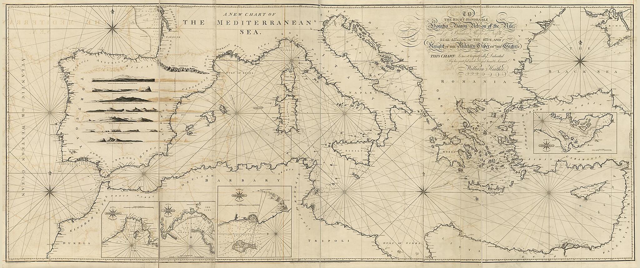
A New Chart of the Mediterranean Sea in 1797
- Regular price
-
$221.95 - Regular price
-
$216.95 - Sale price
-
$221.95
Buy one map, get any other map in our collection for 50% OFF! Add to cart to see discount.
Couldn't load pickup availability
About This Map
Discover the timeless beauty of our fine art quality printed reproduction of this antique map. Perfect for history enthusiasts, collectors, and interior decorators.
Restored with meticulous attention to detail by our team with over a decade of experience, this stunning reproduction captures the intricate artistry and historical significance of the original map.
Whether you're a collector or seeking a unique decor piece, this archival-quality map reproduction is a timeless addition to any space. Order now to bring history to life!
Old nautical chart / early map of France, Genoa, Gulf of Izmir, Italy, Izmir, Gulf Of., Livorno Region, Marseille Region, Mediterranean Sea, Turkey.Created by William Heather, Henri Michelot, J. W. (John William) Norie, John Stephenson, W. Heather & Co in 1797.
- Depths shown by soundings in selected areas.
- Statement of dedication: To the Right Honorable Horatio Baron Nelson of the Nile and of Burnham Thorpe in Norfolk, Rear Admiral of the Blue, and Knight of the Military Order of the Garter, this chart is most repectfully dedicated by his grateful much obliged humble servant, William Heather.
- "Published as the Act directs, July 12th 1797, by W. Heather & Co. at the Navigation Warehouse, No. 157 Leadenhall Street, London."
- Originally printed on 3 sheets (later conjoined, still later quartered and mounted on cloth backing to enable folding).
- Includes notes, 7 landscape panoramas, and 11 compass stars.
- Inset charts: The Gulf of Marseilles / by Henry Michelott -- The port of Genoa / by Captain Dupré -- The harbor of Leghorn / by William Heather -- The Gulf of Smyrna / by Henry Michod.
Map Subjects
Early Maps
Early Works To 1800
France
Genoa
Harbors
Italy
Izmir Gulf Of
Izmir Gulf Of (Turkey)
Livorno Region
Livorno Region (Italy)
Marseille Region
Marseille Region (France)
Mediterranean Sea
Nautical Charts
Turkey
Gulf Of Izmir
Izmir Gulf Of.
William Heather
Henri Michelot
J. W. (John William) Norie
John Stephenson
W. Heather & Co
1797
- For the best legibility, order your map in the original size or larger. Most maps have intricate detail and small text that is best appreciated when the print size hasn't been reduced.
- Sizes labeled "Fits a Standard Frame" will drop right into any frame that you purchase in that size. The sizes that we offer are commonly available online and at most retail stores.
- Our standard sizes are recommendations based on the aspect ratio of the original map, but still may require some added "white space" in one dimension to fit.
- Non-standard sizes will require custom framing, and we suggest taking your print to the frame shop of your choice after you receive it for the best results.
- Custom sizes are available, simply contact us for a quote.
Below is an approximation of the scale of a few standard sizes, and how they might appear in your space.
