
A New Depiction of the Whole of Hungary. (Nova Totius Ungariae) 1567
- Regular price
-
$87.95 - Regular price
-
$82.95 - Sale price
-
$87.95
Buy one map, get any other map in our collection for 50% OFF! Add to cart to see discount.
Couldn't load pickup availability
About This Map
Discover the timeless beauty of our fine art quality printed reproduction of this antique map. Perfect for history enthusiasts, collectors, and interior decorators.
Restored with meticulous attention to detail by our team with over a decade of experience, this stunning reproduction captures the intricate artistry and historical significance of the original map.
Whether you're a collector or seeking a unique decor piece, this archival-quality map reproduction is a timeless addition to any space. Order now to bring history to life!
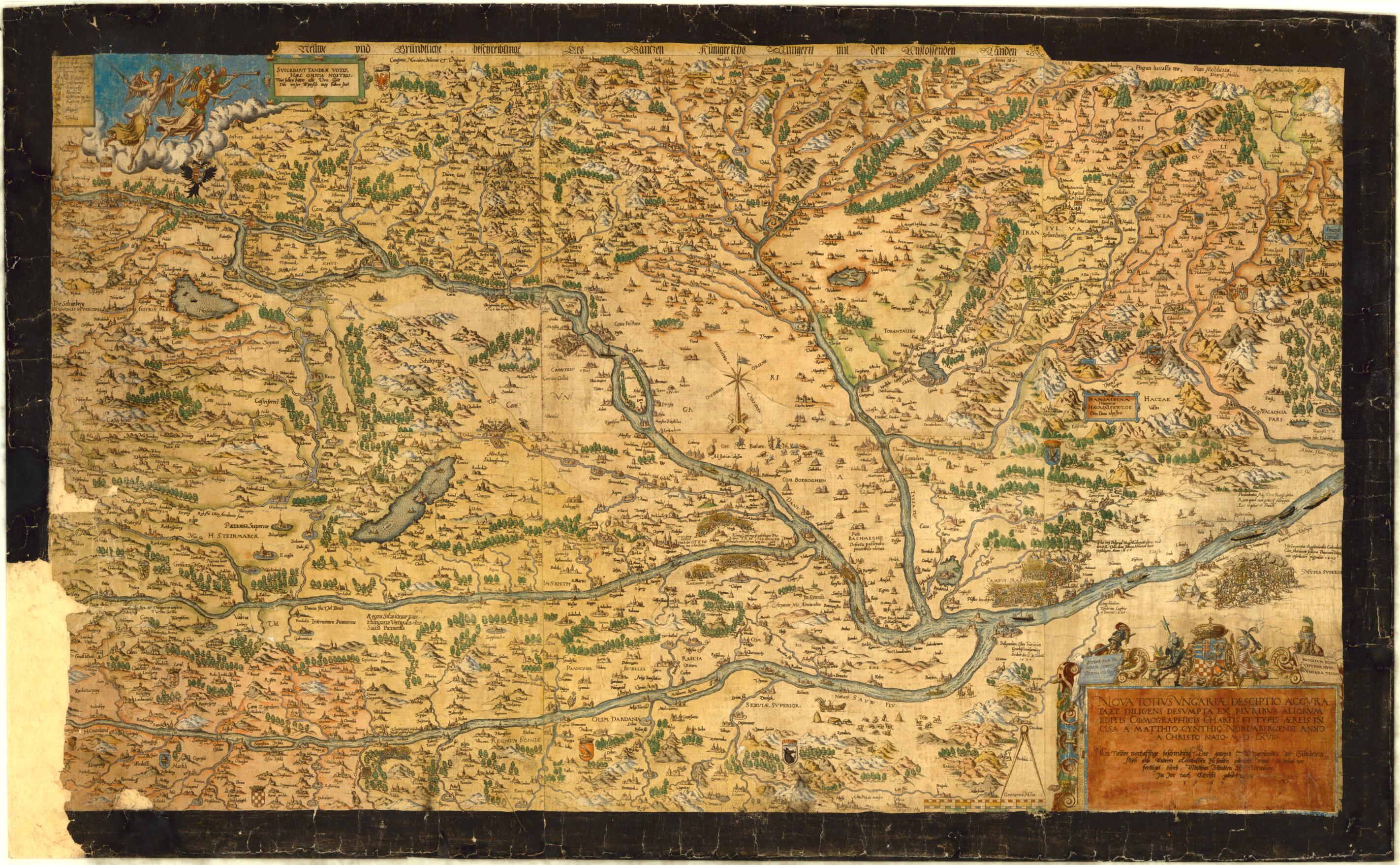
Old map of Hungary.-1572) was an engraver, sculptor, and goldsmith from Nuremberg who produced 13 copper-plate engraved maps and views between 1565 and 1571. The map originally appeared in six sheets arranged together. It shows colorful views of important cities, kingdoms, provinces, and bordering countries. Episcopal churches and Turkish religious buildings are shown, reflecting the fact that at the time one-third of the country was ruled by the Turks. Pastoral life is depicted through illustrations of cattle, shepherds, dogs, rustic houses, cabins, horsemen, and animals. Mines and mountains as well as important 16th-century military events such as battles, sieges, and encampments also are depicted. Place-names are primarily in Latin with some in Hungarian and German. Zündt's map was used as a source in 16th-century atlases such as Ortelius's 1573 Theatrum Orbis Terrarum and Gerard de Jode's Speculum Orbis Terrae, published in 1584 and 1593.
Created by Matthias Zündt in 1567.
- Title devised, in English, by Library staff.
- "scale 1:1,700,000"--Note extracted from World Digital Library.
- Original resource extent: 1 map : color ; 52 x 86 centimeters, on sheet 57 x 93 centimeters.
- Original resource at: University of Wisconsin-Milwaukee Libraries.
- Content in German and Hungarian and Latin.
- Description based on data extracted from World Digital Library, which may be extracted from partner institutions.
- For the best legibility, order your map in the original size or larger. Most maps have intricate detail and small text that is best appreciated when the print size hasn't been reduced.
- Sizes labeled "Fits a Standard Frame" will drop right into any frame that you purchase in that size. The sizes that we offer are commonly available online and at most retail stores.
- Our standard sizes are recommendations based on the aspect ratio of the original map, but still may require some added "white space" in one dimension to fit.
- Non-standard sizes will require custom framing, and we suggest taking your print to the frame shop of your choice after you receive it for the best results.
- Custom sizes are available, simply contact us for a quote.
Below is an approximation of the scale of a few standard sizes, and how they might appear in your space.
