
A New Description of Asia. (Asiae Nova Descriptio) 1579
- Regular price
-
$74.95 - Regular price
-
$69.95 - Sale price
-
$74.95
Buy one map, get any other map in our collection for 50% OFF! Add to cart to see discount.
Couldn't load pickup availability
About This Map
Discover the timeless beauty of our fine art quality printed reproduction of this antique map. Perfect for history enthusiasts, collectors, and interior decorators.
Restored with meticulous attention to detail by our team with over a decade of experience, this stunning reproduction captures the intricate artistry and historical significance of the original map.
Whether you're a collector or seeking a unique decor piece, this archival-quality map reproduction is a timeless addition to any space. Order now to bring history to life!
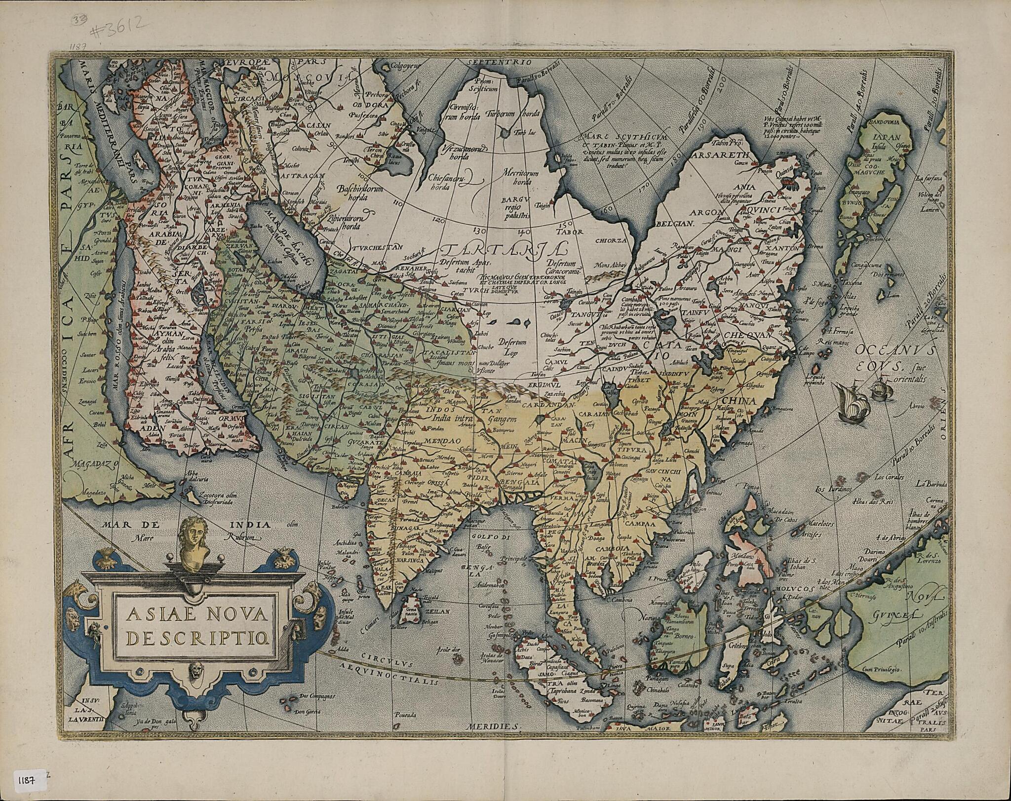
98) published the first edition of his Theatrum orbis terrarum (Theater of the world) in 1570. It contained 53 maps, each with a detailed commentary. It was the first true atlas in the modern sense: a bound book of map plates and accompanying text specifically produced to give a uniform, complete presentation. More than 7,300 copies of the atlas appeared in 31 editions between 1570 and 1612 in various languages, including French, Dutch, English, German, Italian, Latin, and Spanish. Ortelius began to produce his own maps from about 1560, and the map presented here derives from his own 1567 wall map of Asia. It is widely considered more accurate and complete than earlier maps of Asia, as it was informed by the travels of Marco Polo, in particular the account of these travels that appeared in Giovanni Battista Ramusio's Navigationi et Viaggi (Travels and voyages), published in 1550-59. This map depicts all of Asia and was the standard map of the continent for at least 40 years. Nevertheless, Asia is still shown extending farther to the east than it should, the shape of Japan is distorted, and Luzon is missing from the Philippines. New Guinea is enlarged, and a putative Australia is indicated in the bottom right-hand corner. The Red Sea is given the alternative name of Arabian Gulf, and the Gulf is given the alternative name of Mar Mesendin (Sea of Mesendin), derived from present-day Musandam, the northernmost governorate of Oman.Created by Abraham Ortelius in 1579.
- Title devised, in English, by Library staff.
- "This is a new plate of the 1570 map, meticulously copied. In the Arabian Peninsula the name Ara, a city at the mouth of the Red Sea, has been omitted, while Medina Tallnabi becomes Medina, the word Tallnabi being moved to the left to cover a formerly nameless town south of Ianbut (present-day Yanbu').|Map scale approximately 1:28,000,000"--Note extracted from World Digital Library.
- Original resource extent: 1 map ; 37 x 48 centimeters.
- Original resource at: Qatar National Library.
- Content in Latin.
- Description based on data extracted from World Digital Library, which may be extracted from partner institutions.
Map Subjects
Abraham Ortelius
1579
- For the best legibility, order your map in the original size or larger. Most maps have intricate detail and small text that is best appreciated when the print size hasn't been reduced.
- Sizes labeled "Fits a Standard Frame" will drop right into any frame that you purchase in that size. The sizes that we offer are commonly available online and at most retail stores.
- Our standard sizes are recommendations based on the aspect ratio of the original map, but still may require some added "white space" in one dimension to fit.
- Non-standard sizes will require custom framing, and we suggest taking your print to the frame shop of your choice after you receive it for the best results.
- Custom sizes are available, simply contact us for a quote.
Below is an approximation of the scale of a few standard sizes, and how they might appear in your space.

