
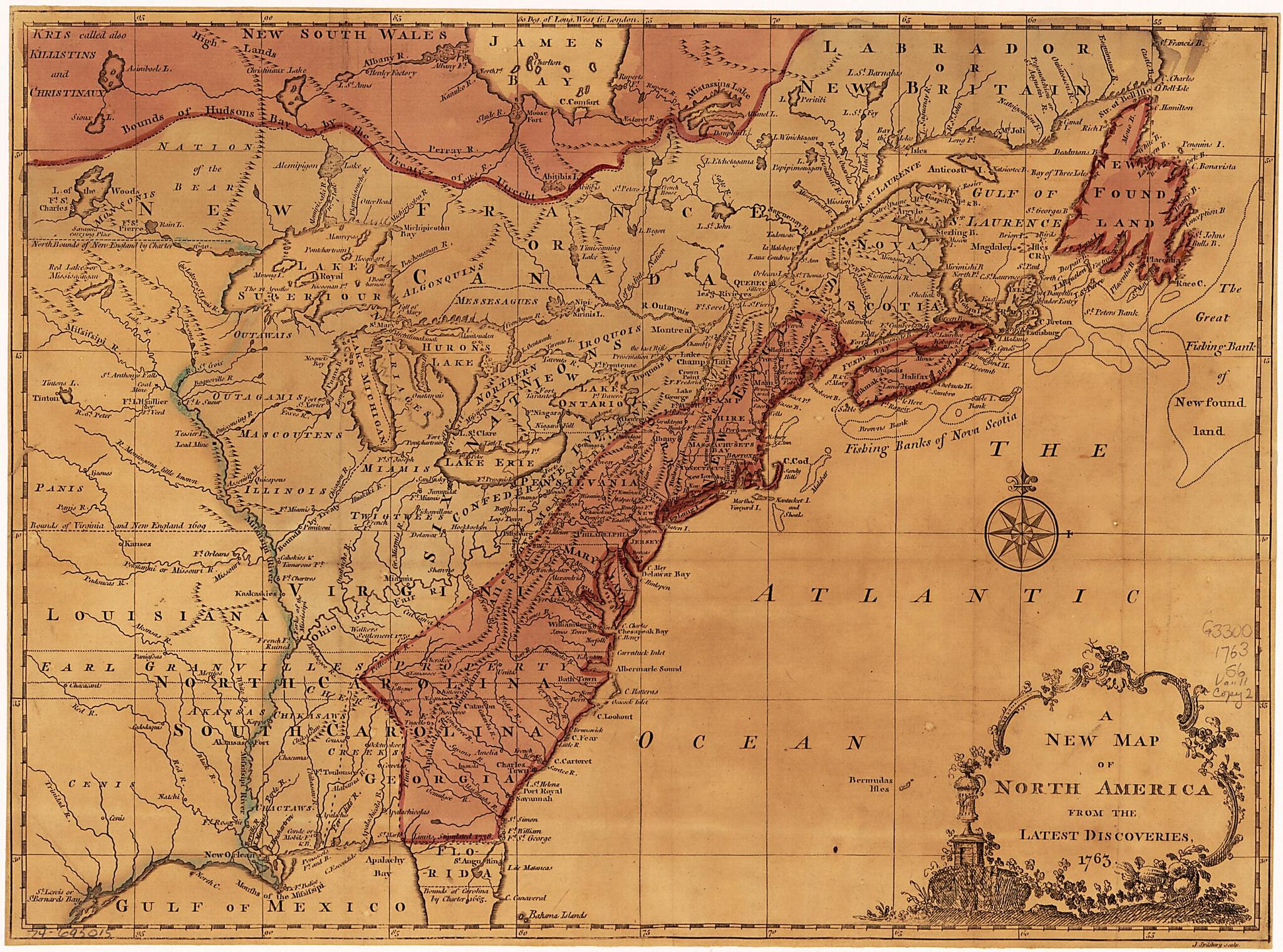
A New Map of North America from the Latest Discoveries 1763
- Regular price
-
$49.95 - Regular price
-
$29.95 - Sale price
-
$49.95
Buy one map, get any other map in our collection for 50% OFF! Add to cart to see discount.
Couldn't load pickup availability
About This Map
Discover the timeless beauty of our fine art quality printed reproduction of this antique map. Perfect for history enthusiasts, collectors, and interior decorators.
Restored with meticulous attention to detail by our team with over a decade of experience, this stunning reproduction captures the intricate artistry and historical significance of the original map.
Whether you're a collector or seeking a unique decor piece, this archival-quality map reproduction is a timeless addition to any space. Order now to bring history to life!
Old map of North America.Created by American Imprint Collection (Library of Congress), Miscellaneous Pamphlet Collection (Library of Congress), John Spilsbury in 1763.
- Scale ca. 1:12,000,000.
- Hand colored.
- Relief shown pictorially.
- Vault.
- LAC scc 2019-04-12 no edits (3 cards)
- Additional info on card : Contents : The proceedings of the North American colonies in consequence of the Stamp-act. 18 pages-Virginia charters: No. I. King James I.'s letters patent to Sir Thomas Gates, Sir George Somers, and others, for two several colonies and plantations, to be made in Virginia, and other parts and territories of America. Dated April 10, 1606; no. II. King James the I.'s second charter, to the treasurer and company for Virginia, erecting them into a corporation and body politic ... Dated March 23, 1609; no. III. A third charter of King James I. to the treasurer and company for Virginia. Dated March 12, 1611-2. 15p. -Maryland charter, granted by King Charles the First, to Caecilius, Lord Baron of Baltimore. Translated from the Latin original. 5 p.-Connecticut charter, granted by King Charles II. in the fourteenth year of his reign. 4 p.-Rhode-Island charter, granted by King Charles II. in the fourteenth year of his reign. 6 p.-Pennsylvania charter, granted by King Charles II. in the fourteenth year of his reign. 5 p.-Massachusetts Bay charter, granted by King William and Queen Mary, in the third year of their reign. 9 p.-Georgia charter, granted by King George the Second, in the fifth year of his reign. 7p. LAC scc 2019-04-12
Map Subjects
Early Works To 1800
North America
American Imprint Collection (Library Of Congress)
Miscellaneous Pamphlet Collection (Library Of Congress)
John Spilsbury
1763
- For the best legibility, order your map in the original size or larger. Most maps have intricate detail and small text that is best appreciated when the print size hasn't been reduced.
- Sizes labeled "Fits a Standard Frame" will drop right into any frame that you purchase in that size. The sizes that we offer are commonly available online and at most retail stores.
- Our standard sizes are recommendations based on the aspect ratio of the original map, but still may require some added "white space" in one dimension to fit.
- Non-standard sizes will require custom framing, and we suggest taking your print to the frame shop of your choice after you receive it for the best results.
- Custom sizes are available, simply contact us for a quote.
Below is an approximation of the scale of a few standard sizes, and how they might appear in your space.

